Tips nearby


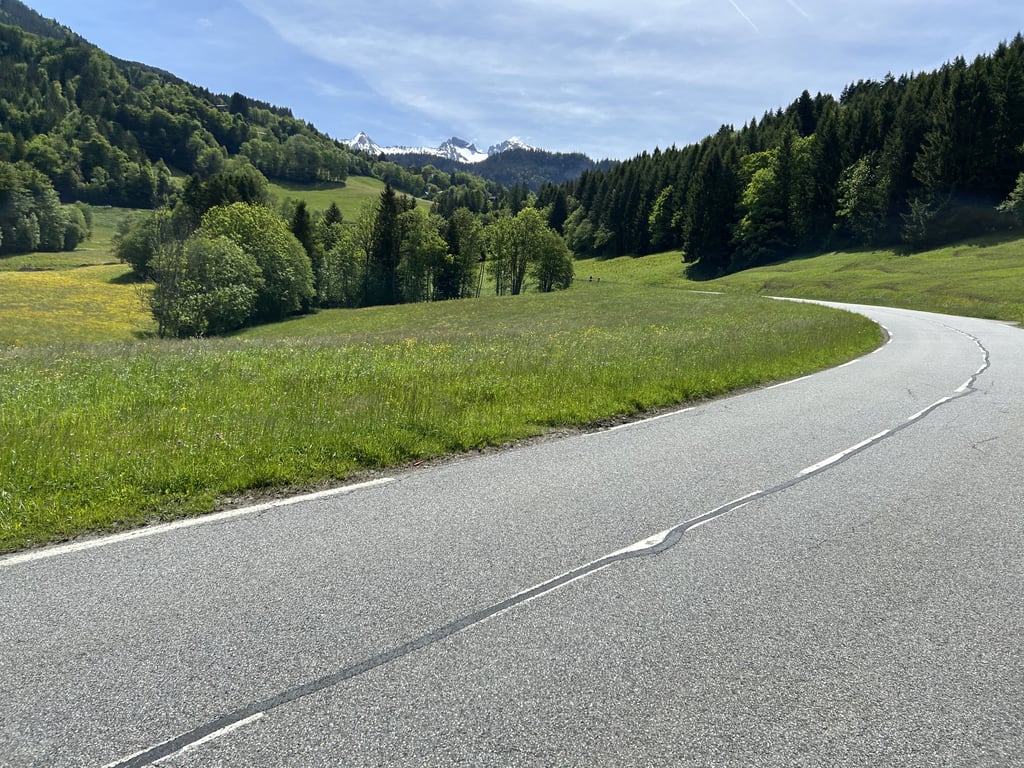
Les Confins from La Clusaz is a climb in the region Annecy. It is 5.6 km long and bridges 377 m of vertical ascent with an average gradient of 6.7%, resulting in a difficulty score of 287. The top of the ascent is located at 1438 m above sea level. Climbfinder users shared 3 reviews of this climb and uploaded 11 photos.
Road names: Montée du Bossonet & Route des Confins
3.0 by hardloper_marcoThis is an automatic translation, the original language is: Dutch.Climb is beautiful and reasonably quiet even on Ascension Day. Pretty good tarmac up to the top at the goat farm. Plenty of places with terraces to eat or drink something along the way.... read more

Welcome! Please activate your account if you would like to share something. Look for the verification email in your inbox.
If you want to upload your photos, you need to create an account. It only takes 1 minute and it's completely free.
Climb is beautiful and reasonably quiet even on Ascension Day. Pretty good tarmac up to the top at the goat farm. Plenty of places with terraces to eat or drink something along the way.
Klim is mooi en zelfs op Hemelvaartsdag nog redelijk rustig. Behoorlijk goed asfalt tot boven aan bij de geitenboerderij. Genoeg plekken met terras om iets te eten of drinken onderweg.
Done on 31 August 2023.
This is the end of the Rte de La Clusaz, not a pass but a short climb with some fairly steep sections.
For practical reasons and to warm up, it's better to park at St Jean de Sixt a few kilometres below La Clusaz, but the downside is that there's a lot of traffic, even after La Clusaz in the direction of Les Confins.
I understood why further up, there's a golf course, a restaurant, chalets to rent and also lots of picnic tables and hiking trails.
Otherwise it's worth the diversions as the scenery is magnificent.
The finish is on a large car park with a mountain goat farm at the end.
Fait le 31 août 2023.
C'est la fin de la Rte de La Clusaz, ce n'est pas un col mais une petite ascension avec quelques passages assez pentus.
Pour le côté pratique et l'échauffement mieux vaut se garer à St Jean de Sixt quelques kilomètres sous la Clusaz, par contre le côté négatif c'est que ça circule énormément , même après la Clusaz en direction des Confins beaucoup de véhicules.
J'ai compris pourquoi plus haut, Golf, Restaurant, des chalets de locations et aussi beaucoup de tables pique-niques et de chemins de randonnées .
Sinon ça vaut le détour car les paysages sont magnifiques.
Le final est sur un grand parking avec au bout une Chèvrerie de montagne.
Ascent made in August 2021.
A pass accessible from La Clusaz, unfortunately overshadowed by its colleagues the pass of the Aravis and the cross fry. The pass itself is located at the last bend but the road continues to rise until the end of it, a little further on, at the level of a gîte. The climb has 1 kilometer at 10, 5 % although it is not listed as such. The pavement is not the best in some places but does the job largely. Be careful though, as it can sometimes get crowded at the top to enjoy the various activities (there is even a golf course). There is another variant from the rue de plattuy, a little less steep but longer, almost a kilometer according to alpes4ever.
Montée effectuée en août 2021.
Un col accessible depuis La Clusaz ,éclipsé malheureusement par ses confrères le col des aravis et de la croix fry. Le col à proprement parlé se situe au dernier virage mais la route continue à s'élever jusqu'au terminus de celle-ci, un peu plus loin, au niveau d'un gîte. La montée possède 1 kilomètre à 10, 5 % bien que ce ne soit pas répertorié comme tel. Le revêtement n'est pas des meilleurs à certains endroits mais fait largement l'affaire. Attention tout de même car il peut parfois y avoir du monde au sommet venu profiter des différentes activités (il y a même un golf). Il y a une autre variante depuis la rue de plattuy, un peu moins raide mais plus longue, de presque un kilomètre selon alpes4ever.
| 7 km/h | 00:48:13 |
| 11 km/h | 00:30:41 |
| 15 km/h | 00:22:30 |
| 19 km/h | 00:17:45 |
This page is better in the app