View on map
© MapLibre | OpenStreetMap contributors
1%
2%
4%
6%
8%
10%
12%
15%
20%

Le Mont from Le Pohets

3.5
2 reviews | Elevation profile | 3 photos
Tips nearby
Le Mont from Le Pohets
transparant thumb
transparant thumb
transparant thumb
transparant thumb
transparant thumb
Your achievable time
Calculating based on your best performances...
Relaxed
Maximum
W/kg
W/kg
W/kg
Analyse your climbing performance
Detailed insight into your climbing performance & automatically check off climbs
Based on your best performances.
Your best attempt:
Number of attempts:
Elevation profile Le Mont from Le Pohets

Statistics

Difficulty points 486
Length 3.2 km
Average gradient 12.3%
Steepest 100 metres 18.5%
Total ascent 387 m

Short recap

6 hairpin turns
#86 toughest climb of Haute Savoie
#90 most elevation gain of Annecy
#45 average steepest climb of Auvergne-Rhône-Alpes
Feedback about this climb?
Show climbs nearby Export to GPS device

Le Mont from Le Pohets is a climb in the region Annecy. It is 3.2 km long and bridges 387 m of vertical ascent with an average gradient of 12.3%, resulting in a difficulty score of 486. The top of the ascent is located at 1127 m above sea level. Climbfinder users shared 2 reviews of this climb and uploaded 3 photos.

Road name: Route des Pohets

4.0 by gusvelo
This is an automatic translation, the original language is: French.
It's not a very long climb, but it's a tough one! The slope is very regular but also very steep.... read more

Photos (3)

Le Mont from Le Pohets
transparant thumb
transparant thumb
transparant thumb

Your uploads (max 4)

Welcome! Please activate your account if you would like to share something. Look for the verification email in your inbox.

If you want to upload your photos, you need to create an account. It only takes 1 minute and it's completely free.

  • Receive free climbfinder goodies for your reviews & photos.
  • Create a bucket list and check off conquered climbs.
  • Add missing climbs.
Continue with GoogleContinue with Google Continue with FacebookContinue with Facebook Continue with AppleContinue with Apple Sign up with email
By signing up you agree to our terms of service and confirm that you have read our privacy & content policy.

Reviews (2)

5.0
4.0
3.0
2.0
1.0
sergenavetat
1 Mo 3.0
This is an automatic translation, the original language is: French. Show original

Leaving the heart of Thônes the climb is slightly tougher, as you have to tackle the first slopes of the Col de la Croix Fry, which are not to be overlooked, but that's just the beginning as the real menu begins once you leave this Rte for the Rte des Pohets where the steep slopes begin.
3.2km at an average of 12.2%, on the whole the gradient is steady and only passages at 10-11 "allow" to recover.
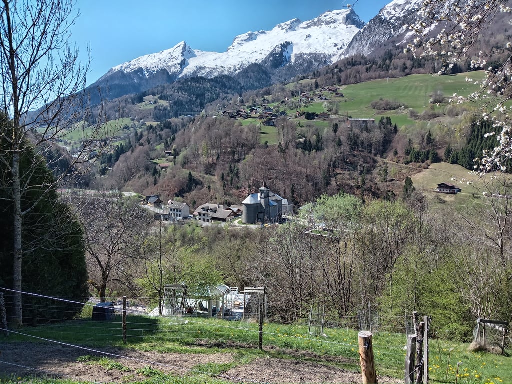
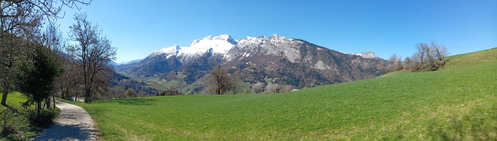
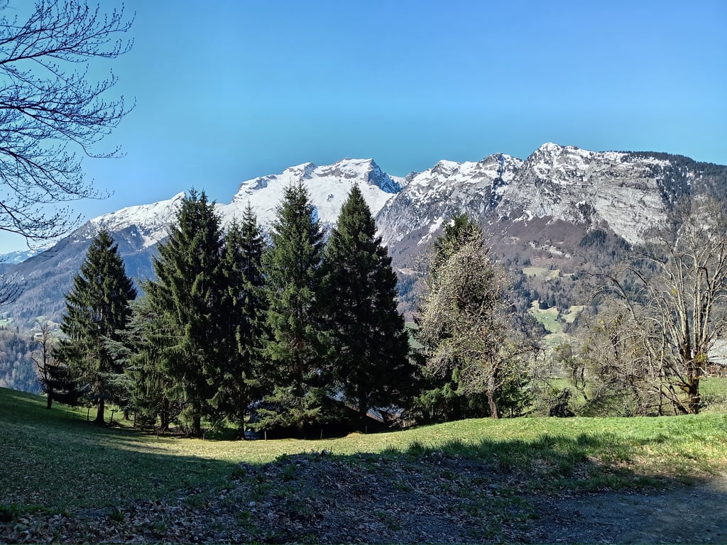
The start is in full sunshine and the finish more in the shade of trees, the traffic is modest, the tarmac good and once at the top the scenery magnificent.
For the icing on the cake, you have to finish the short concrete section of around 150M to the chalet (gradient between 15 and 18%), which hurts!
You'll have understood, the use of very small developments is essential to tackle this place.

En partant du cœur de Thônes l'ascension est légèrement plus corsée, car il faudra affronter les premières pentes du col de la Croix Fry qui ne sont pas à négliger, mais ce n'est que le début car le véritable menu commence une fois quitté cette Rte pour celle des Pohets que les pentes abruptes commencent.
3,2km à 12,2% moyenne, dans l'ensemble la pente est régulière et seulement des passages à 10-11 "permettent" de récupérer.
Le début est en plein soleil et le final plutôt à l'ombre des arbres, la circulation est modeste, le bitume bon et une fois au sommet les paysages magnifiques.
Pour la cerise sur le gâteau il faut finir la petite portion en béton environ 150M jusqu'au chalet ( pente entre 15 et 18% ) ça fait mal!
Vous l'aurez compris , l'usage de très petits développements s'impose pour affronter ce lieu.

Le Mont from Le Pohets
Dashboard
gusvelo
1 y 4.0
This is an automatic translation, the original language is: French. Show original

It's not a very long climb, but it's a tough one! The slope is very regular but also very steep.

La monté n'est, certes, pas très longue mais ô combien difficile ! La pente est très régulière mais aussi très forte.

Dashboard

Climbing times

7 km/h 00:27:00
11 km/h 00:17:11
15 km/h 00:12:36
19 km/h 00:09:57

Road surface condition

0% 100% 0%
Based on 1 vote
Share your knowledge. What was the road condition during your ascent?

Traffic

0% 100% 0%
Based on 1 vote
Your experience counts. How much traffic did you encounter during the climb?

Frequently Asked Questions

Le Mont from Le Pohets is a challenging ascent. For this type of climbing, we recommend mountain gearing, specifically a compact system. This means a small front chainring of 34 teeth, combined with a rear cassette where, depending on your level, strength, and experience, you choose a sprocket with 30, 32, or even 34 teeth. Remember that a smooth cadence is always more efficient!

Le Mont from Le Pohets is a serious climb and falls into the 2nd category. With a good basic fitness level, even without much cycling experience, you can complete this climb just fine. However, a bike with climbing gears is a must. Without experience or training, it will be really tough – but that’s part of the challenge!

Le Mont from Le Pohets is 3.2 km long.

The average gradient of Le Mont from Le Pohets is 12.3%.

Le Mont from Le Pohets has a steepest segment with an average gradient of 18.5%.

The summit of Le Mont from Le Pohets is at 1127 m.

At a slow pace of 7 km/h, it takes about 00:27:00 to climb Le Mont from Le Pohets. At 11 km/h the time is 00:17:11, and at 15 km/h 00:12:36. For the fastest cyclists, 00:09:57 is an achievable time.

Le Mont from Le Pohets is located in the region Haute Savoie in France.

This page is better in the app

Climbfinder app
Climbfinder
(Free)
Open