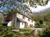
| Beautiful scenery |
| 1 hairpin turn |
| #94 most elevation gain of Pyrénées-Atlantiques |
Le Gave de Bious from Gabas is a climb in the region Pyrénées-Atlantiques. It is 4.1 km long and bridges 348 m of vertical ascent with an average gradient of 8.5%, resulting in a difficulty score of 333. The top of the ascent is located at 1416 m above sea level. Climbfinder users shared 2 reviews of this climb and uploaded 7 photos.
Road names: D 231 & Piste Pastorale de Bious
3.0 by __paskal__This is an automatic translation, the original language is: Dutch.Spicy climb through the forest. Road of very good tarmac runs along stream giving very nice views.... read more
Welcome! Please activate your account if you would like to share something. Look for the verification email in your inbox.
If you want to upload your photos, you need to create an account. It only takes 1 minute and it's completely free.
Spicy climb through the forest. Road of very good tarmac runs along stream giving very nice views.
Pittige klim door het bos. Weg van zeer goed asfalt loopt langs beekje wat zeer mooie uitzichten geeft.
Heerlijk rustig vergeleken met de weg naar Portalet
Ridden this climb in June 2022 after not having been there for some'50 years. Memories of wild camping with an Eriba on the edge of a small lake. We started from Laruns (good campsite) and go up part of the Col de Pourtalet first. Somewhat busier narrow road with traffic to and from Spain. After the turn-off to the lake it becomes quiet. The road surface is not asphalted everywhere and in the shade of the trees also damp and slippery. The slope is very uneven with sometimes steep gradients. But a very nice quiet road below the Pic du Midi d'Osseau. At the end, you come out of the trees and into mountain meadows. The last stretch along the lake dam is very steep. At the top is a cafe/terrace where you can sit and rave (do pay cash). You are then in a beautiful mountain landscape.
This is a very unfamiliar climb, but I found it very rewarding. (Time includes a lot of photo stops). I found it a "hidden gem".
Also less known in the Netherlands is the Col du Portalet which is on the border if you go from Laruns to Spain. This one is in the cyclo Quebrantehuesos, a household name in that area. (Haven't ridden the bike myself yet, we have to go back)
In juni 2022 deze klim gereden na er zo'n 50 jaar niet meer geweest te zijn. Herinneringen aan wildkamperen met een Eriba aan de rand van een meertje. Wij begonnen vanuit Laruns (goede camping) en gaan eerst een deel van de Col de Pourtalet op. Wat drukkere smalle weg met verkeer van en naar Spanje. Na de afslag naar het meer wordt het stil. Het wegdek is niet overal even geasfalteerd en in de schaduw van de bomen ook vochtig en glad. De helling is zeer onregelmatig met soms flinke stijgingspercentages. Maar een heel leuke rustige weg onder de Pic du Midi d'Osseau. Aan het eind kom je uit de bomen en in bergweides. Het laatste stuk langs de stuwdam van het meer is zeer steil. Boven is een cafe/terras waar je kunt zitten en ravitailleren (wel contant betalen). Je zit dan in een prachtig berglandschap.
Dit is een erg onbekende klim, maar ik vond hem zeer de moeite waard. (tijd is inclusief een hoop fotostops). Ik vond het een "verborgen juweeltje".
In Nederland ook minder bekend is de Col du Portalet die op de grens ligt als je vanuit Laruns naar Spanje gaat. Deze zit in de cyclo Quebrantehuesos, een begrip in die omgeving. (zelf nog niet op de fiets gereden, we moeten terug)
| 7 km/h | 00:35:01 |
| 11 km/h | 00:22:17 |
| 15 km/h | 00:16:20 |
| 19 km/h | 00:12:54 |
This page is better in the app