View on map
© MapLibre | OpenStreetMap contributors
1%
2%
4%
6%
8%
10%
12%
15%
20%

Langmatt from Buhl via Belchenthal

3.5
2 reviews | Elevation profile | 2 photos
Tips nearby
Langmatt from Buhl via Belchenthal
transparant thumb
transparant thumb
transparant thumb
transparant thumb
transparant thumb
transparant thumb
Your achievable time
Calculating based on your best performances...
Relaxed
Maximum
W/kg
W/kg
W/kg
Analyse your climbing performance
Detailed insight into your climbing performance & automatically check off climbs
Based on your best performances.
Your best attempt:
Number of attempts:
Elevation profile Langmatt from Buhl via Belchenthal

Statistics

Difficulty points 300
Length 4.7 km
Average gradient 7%
Steepest 100 metres 16%
Total ascent 328 m

Short recap

1 hairpin turn
#66 toughest climb of Upper Rhine
#86 most elevation gain of Upper Rhine
#88 longest climb of Upper Rhine
#61 average steepest climb of Upper Rhine
Feedback about this climb?
Show climbs nearby Export to GPS device

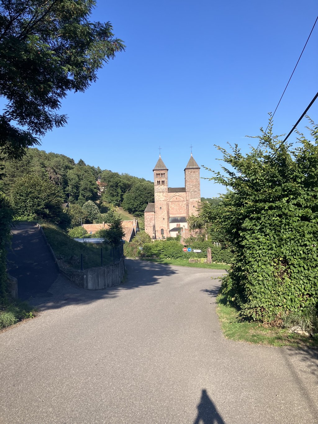
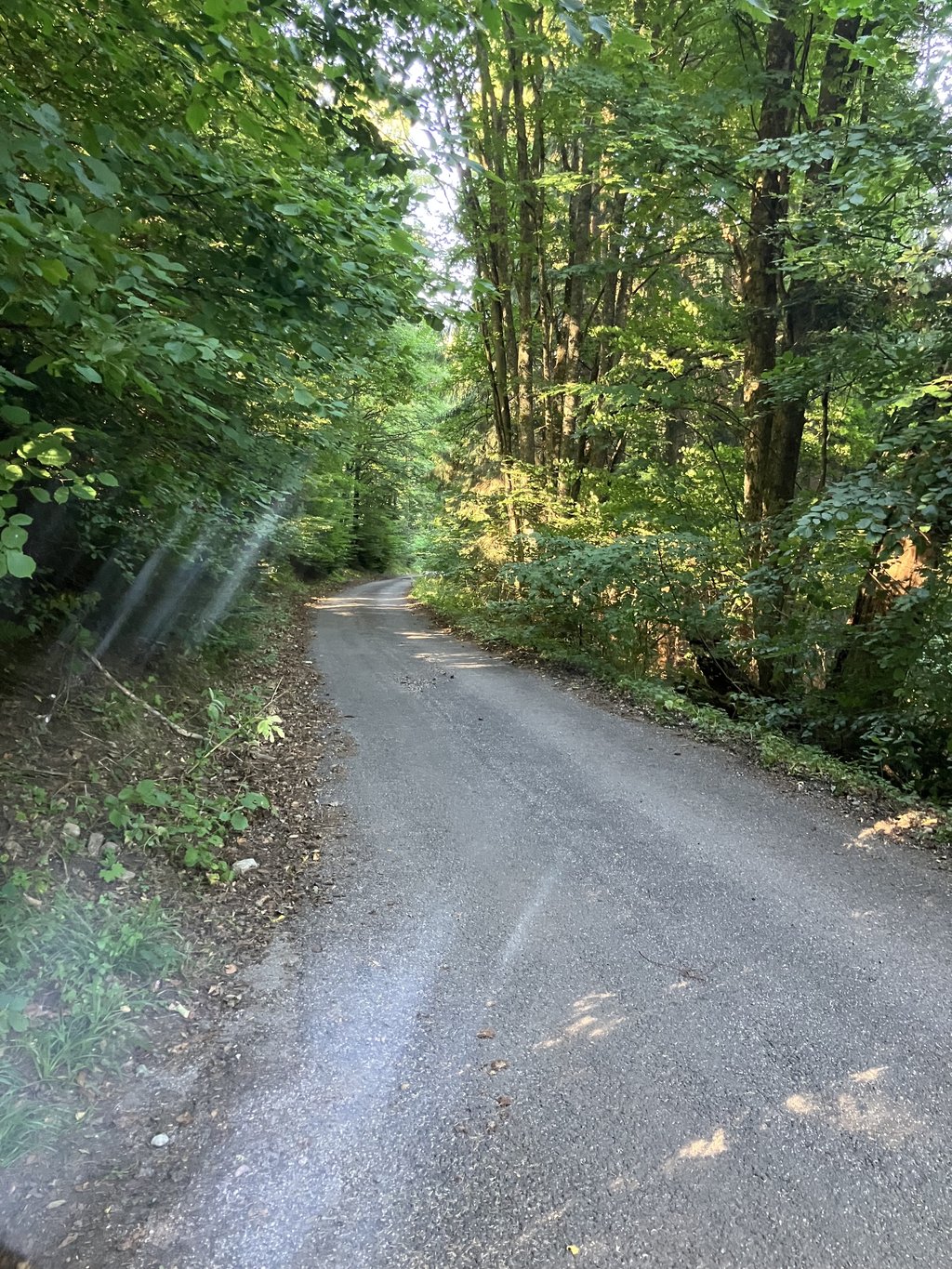
Langmatt from Buhl via Belchenthal is a climb in the region Upper Rhine. It is 4.7 km long and bridges 328 m of vertical ascent with an average gradient of 7%, resulting in a difficulty score of 300. The top of the ascent is located at 670 m above sea level. Climbfinder users shared 2 reviews of this climb and uploaded 2 photos.

Road names: Rue de Murbach & Rue du Belchental

3.0 by Walput
This is an automatic translation, the original language is: Dutch.
Steep climb starts mainly when you pass the beautiful abbey of murbach. Then it is really scrambling to the top. For those who like this steep grade, definitely do it. The end point of the climb is in the forest. A little further you can drive on to hotel but this is private property. Climb is fun but no nice views attached.... read more

Photos (2)

Langmatt from Buhl via Belchenthal
transparant thumb
transparant thumb
transparant thumb
transparant thumb

Your uploads (max 4)

Welcome! Please activate your account if you would like to share something. Look for the verification email in your inbox.

If you want to upload your photos, you need to create an account. It only takes 1 minute and it's completely free.

  • Receive free climbfinder goodies for your reviews & photos.
  • Create a bucket list and check off conquered climbs.
  • Add missing climbs.
Continue with GoogleContinue with Google Continue with FacebookContinue with Facebook Continue with AppleContinue with Apple Sign up with email
By signing up you agree to our terms of service and confirm that you have read our privacy & content policy.

Reviews (2)

5.0
4.0
3.0
2.0
1.0
Walput
9 Mo 3.0 via the Climbfinder app
This is an automatic translation, the original language is: Dutch. Show original

Steep climb starts mainly when you pass the beautiful abbey of murbach. Then it is really scrambling to the top. For those who like this steep grade, definitely do it. The end point of the climb is in the forest. A little further you can drive on to hotel but this is private property. Climb is fun but no nice views attached.

Steile klim begint voornamelijk wanneer je de mooie abdij van murbach passeert. Dan is het wel echt klauteren naar boven. Voor wie van deze steilte graad houdt, zeker doen. Het eindpunt van de klim is in het bos. Een beetje verder kan je naar hotel doorrijden maar dit is privé terrein. Klim is leuk maar geen mooie uitzichten die eraan gekoppeld zijn.

Langmatt from Buhl via Belchenthal
Dashboard
N_M
1 y 4.0 via the Climbfinder app
This is an automatic translation, the original language is: Dutch. Show original

Ascent that gets steep through Murbach and past Murbach Abbey and gets much steeper towards the end. The road ends at hotel/restaurant Langmatt. A very beautiful, varied and challenging climb.

Beklimming die door Murbach en langs de abdij van Murbach steil wordt en naar het einde toe nog veel steiler wordt. De weg eindigt aan hotel/restaurant Langmatt. Een hele mooie, gevarieerde en uitdagende klim.

Dashboard

Climbing times

7 km/h 00:40:08
11 km/h 00:25:32
15 km/h 00:18:44
19 km/h 00:14:47

Road surface condition

0% 100% 0%
Based on 1 vote
Share your knowledge. What was the road condition during your ascent?

Traffic

100% 0% 0%
Based on 1 vote
Your experience counts. How much traffic did you encounter during the climb?

Frequently Asked Questions

Langmatt from Buhl via Belchenthal is a challenging ascent. For this type of climbing, we recommend mountain gearing, specifically a compact system. This means a small front chainring of 34 teeth, combined with a rear cassette where, depending on your level, strength, and experience, you choose a sprocket with 30, 32, or even 34 teeth. Remember that a smooth cadence is always more efficient!

Langmatt from Buhl via Belchenthal is a serious climb and falls into the 2nd category. With a good basic fitness level, even without much cycling experience, you can complete this climb just fine. However, a bike with climbing gears is a must. Without experience or training, it will be really tough – but that’s part of the challenge!

Langmatt from Buhl via Belchenthal is 4.7 km long.

The average gradient of Langmatt from Buhl via Belchenthal is 7%.

Langmatt from Buhl via Belchenthal has a steepest segment with an average gradient of 16%.

The summit of Langmatt from Buhl via Belchenthal is at 670 m.

At a slow pace of 7 km/h, it takes about 00:40:08 to climb Langmatt from Buhl via Belchenthal. At 11 km/h the time is 00:25:32, and at 15 km/h 00:18:44. For the fastest cyclists, 00:14:47 is an achievable time.

Langmatt from Buhl via Belchenthal is located in the region Upper Rhine in France.

This page is better in the app

Climbfinder app
Climbfinder
(Free)
Open