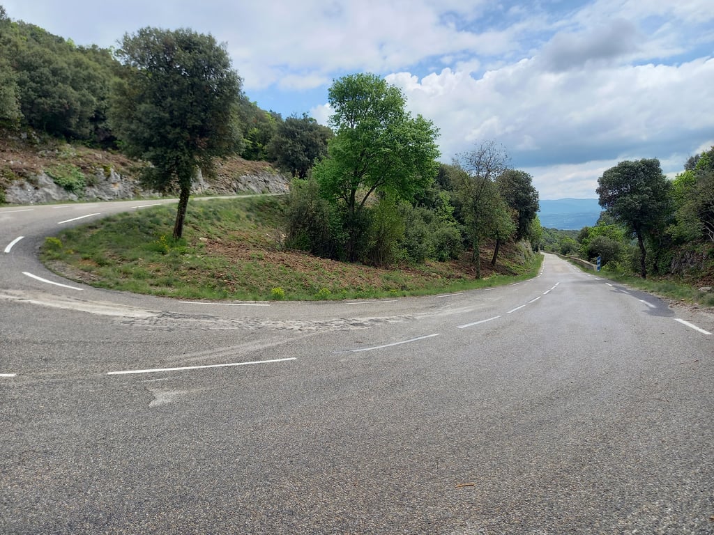
| 8 hairpin turns |
| #77 toughest climb of Provence |
| #80 most elevation gain of Provence-Alpes-Côte d'Azur |
| #13 longest climb of Vaucluse |
| #33 average steepest climb of Vaucluse |
Lagarde d'Apt from Rustrel is a climb in the region Vaucluse. It is 11.3 km long and bridges 769 m of vertical ascent with an average gradient of 6.8%, resulting in a difficulty score of 535. The top of the ascent is located at 1104 m above sea level. Climbfinder users shared 6 reviews of this climb and uploaded 6 photos.
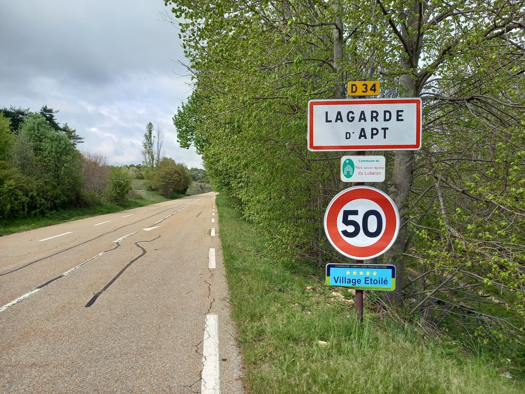
Road name: D34
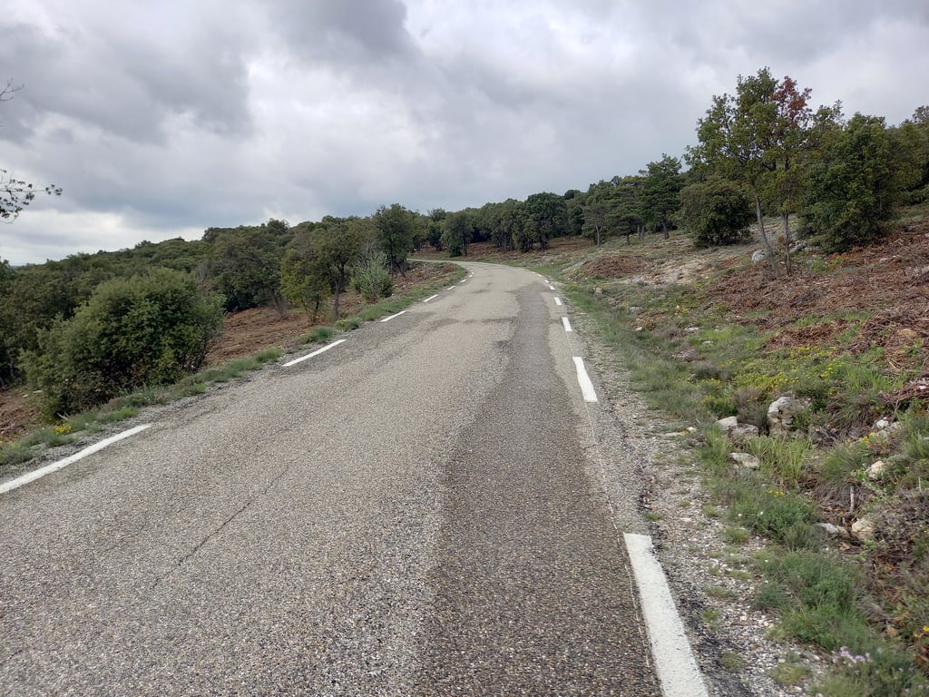
4.0 by RuudJThis is an automatic translation, the original language is: Dutch.A steady steady climb, beautiful through nature. Occasional views over the valley. Good road surface, though of the rough tarmac variety. Very little traffic indeed. A car once every 10 minutes.... read more
Welcome! Please activate your account if you would like to share something. Look for the verification email in your inbox.
If you want to upload your photos, you need to create an account. It only takes 1 minute and it's completely free.
A steady steady climb, beautiful through nature. Occasional views over the valley. Good road surface, though of the rough tarmac variety. Very little traffic indeed. A car once every 10 minutes.
Een gestage gelijkmatige klim, mooi door de natuur. Af en toe uitzicht over de vallei. Goed wegdek, maar wel van het ruwe asfalt. Inderdaad heel weinig verkeer. Eens in de 10 minuten een auto.
Ridden today after a ride from Bédoin. Nice, even climb and very quiet (2 cars and 3 cyclists in opposite direction at an hour's ride). Not to be underestimated as there are few rest points.
Vandaag gereden na een ritje vanuit Bédoin. Mooie, gelijkmatige klim en zéér rustig (2 auto’s en 3 fietsers in tegenovergestelde richting op een uurtje fietsen). Niet te onderschatten aangezien er weinig rustpunten zijn.
Pleasant, steady climb. Done in the cool, with very little traffic if you're in the area!
Montée agréable, régulière. Effectué à la fraîche très peu de circulation à faire si vous êtes dans le coin !
Good 10k steady climb, not too steep. Good place for training, if you are looking for that. Otherwise just a way to get where you want to be :-)
Today I did a round trip from Apt up via Lagarde d'Apt. This climb is nice and steady but not very special in terms of views, although you can enjoy the shade of the trees along the way. At the top is a dead plateau... I descended towards Sault and that goes up and down until you turn left on the D243 where the party really starts. An empty wide road where you can safely hard to go down 😍.... Before Sault, turn left again towards Apt and then you drive up the Col de la Liquiere at the back where the next downhill party can start again! +/- 60 km and 1200hm
Vandaag een rondje vanaf Apt gedaan omhoog via Lagarde d’Apt. Deze klim is mooi constant maar verder niet bijzonder qua uitzichten wel kun je regelmatig genieten van de schaduw die de bomen langs de kant geven.. boven is een doods plateau.. ik ben afgedaald richting Sault en dat gaat vooral op en af tot je links af slaat de D243 op daar begint het feest past echt.. Een lege brede weg waar je veilig hard naar beneden kan 😍.. voor Sault weer links en richting Apt en dan rij je de Col de la Liquiere op aan de achterkant waarna het volgende afdaalfeest weer kan beginnen! +/- 60 km en 1200hm
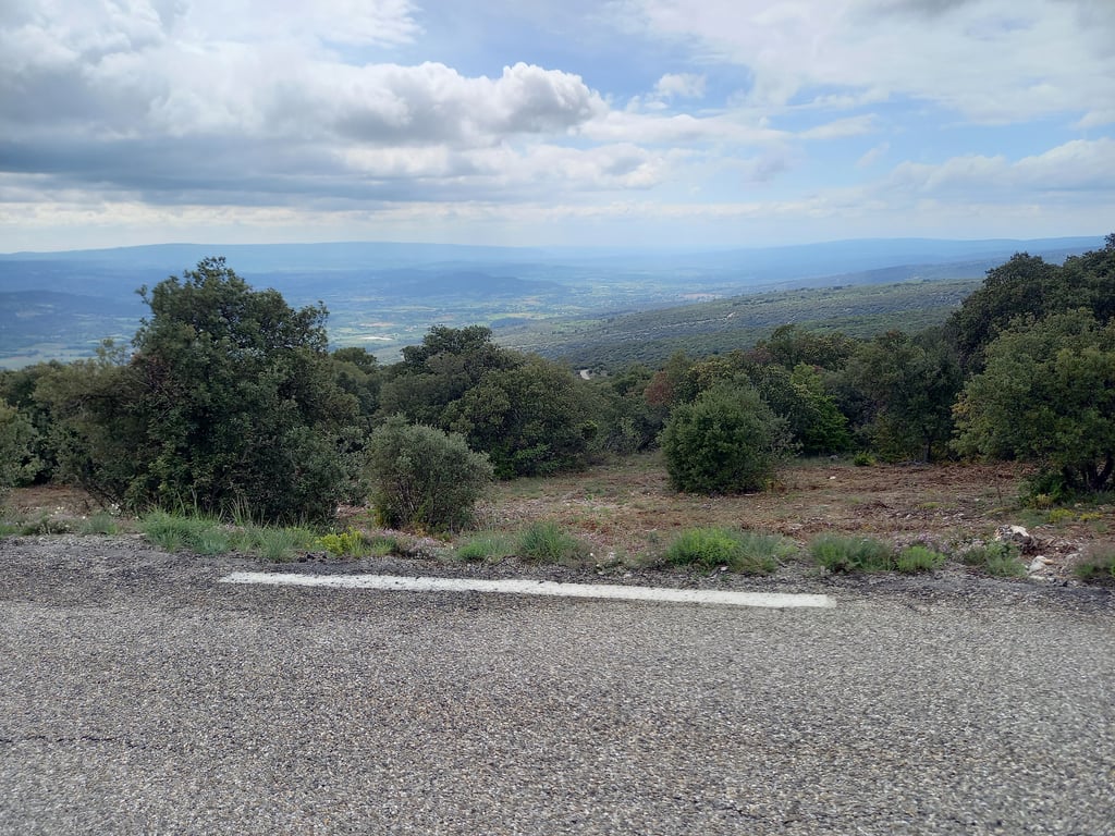
Very nice steady climb. From Rustrel is recommended instead of Saint-Christiol D'Albiol. Climb consists of a nice, narrow and well driveable road between the woods with occasional beautiful views. Descent to Saint-Christiol D'Albion goes over broader but quiet roads with a beautiful view of the Mont Ventoux.
Zeer mooie gelijkmatige klim. Vanuit Rustrel is aan te raden ipv. Saint-Christiol D'Albiol. Klim bestaat uit een mooi, smal en goed berijdbaar wegje tussen de bossen met af en toe een mooi uitzicht. Afdaling naar Saint-Christiol D'Albion gaat over bredere maar rustige wegen met een prachtig uitzicht op de Mont Ventoux.
| 7 km/h | 01:36:46 |
| 11 km/h | 01:01:35 |
| 15 km/h | 00:45:09 |
| 19 km/h | 00:35:39 |
This page is better in the app