Tips nearby


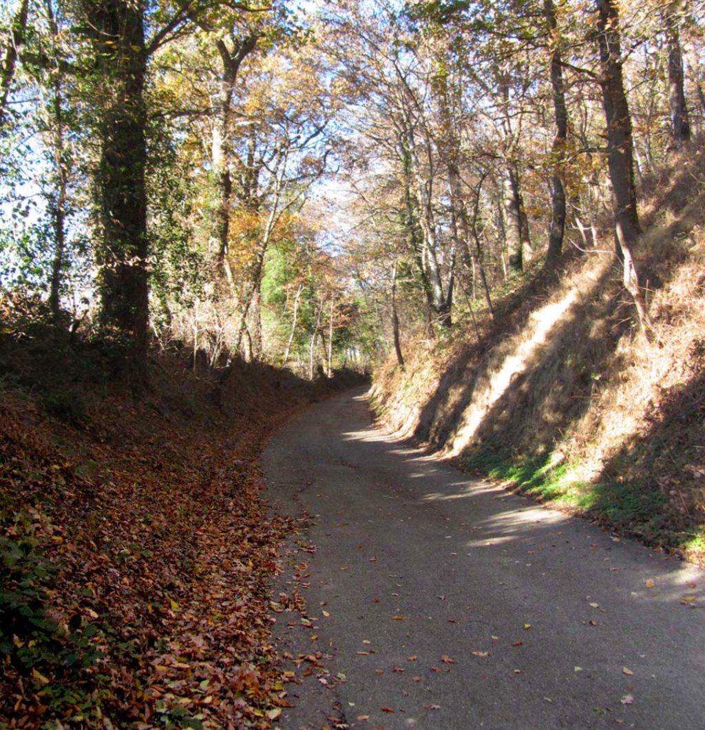
La Pépinière from Granges sur Vologne is a climb in the region Vosges. It is 5.9 km long and bridges 384 m of vertical ascent with an average gradient of 6.5%, resulting in a difficulty score of 379. The top of the ascent is located at 905 m above sea level. Climbfinder users shared 3 reviews of this climb and uploaded 5 photos.
Road name: Route Forestière de Neuves Granges
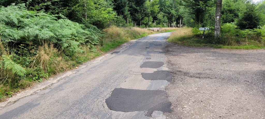
3.0 by TiesW45This is an automatic translation, the original language is: Dutch.After a nice drive in the area, you still have to drive up this steep rocky thing to the campsite, which is a bad road deck, especially if you drive it downhill, you have to be careful what climbfinder says about how steep it is is not entirely correct because the first two kilometres are well over 12 per cent.... read more
Welcome! Please activate your account if you would like to share something. Look for the verification email in your inbox.
If you want to upload your photos, you need to create an account. It only takes 1 minute and it's completely free.
After a nice drive in the area, you still have to drive up this steep rocky thing to the campsite, which is a bad road deck, especially if you drive it downhill, you have to be careful what climbfinder says about how steep it is is not entirely correct because the first two kilometres are well over 12 per cent.
Na een mooie rit in de omgeving moet je dit steile rot ding nog omhoog naar de camping wel een slecht weg dek zeker als je hem naar beneden rijd is het flink op passen wat op climbfinder staat van hoe stijl hij is klopt niet helemaal want de eerste twee kilometer is dik boven de 12 procent daarna vlakt het wel aanzienlijk af ondanks de minpunten is het het zeker waard om er op te rijden want je word beloond met een prachtig uitzicht
I did this climb because I was staying on the camping halfways. Om the first part of the road the asphalt is in bad condition, mainly patches on patches, after the camping the road is somewhat better but near the top there is also a couple hundred meters of gravel. I would not recommend to put this climb in your route but when you need to be there (for example when you stay on that camping) it is a nice climb to challenge yourself.
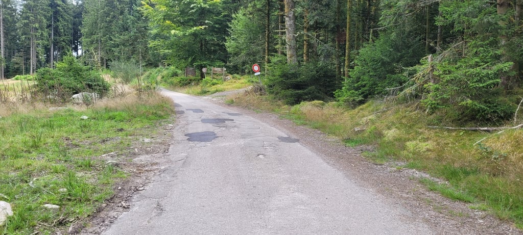
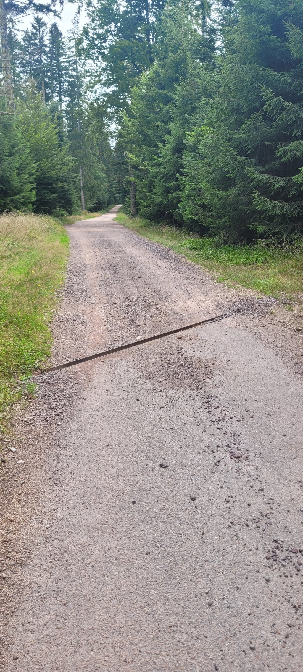
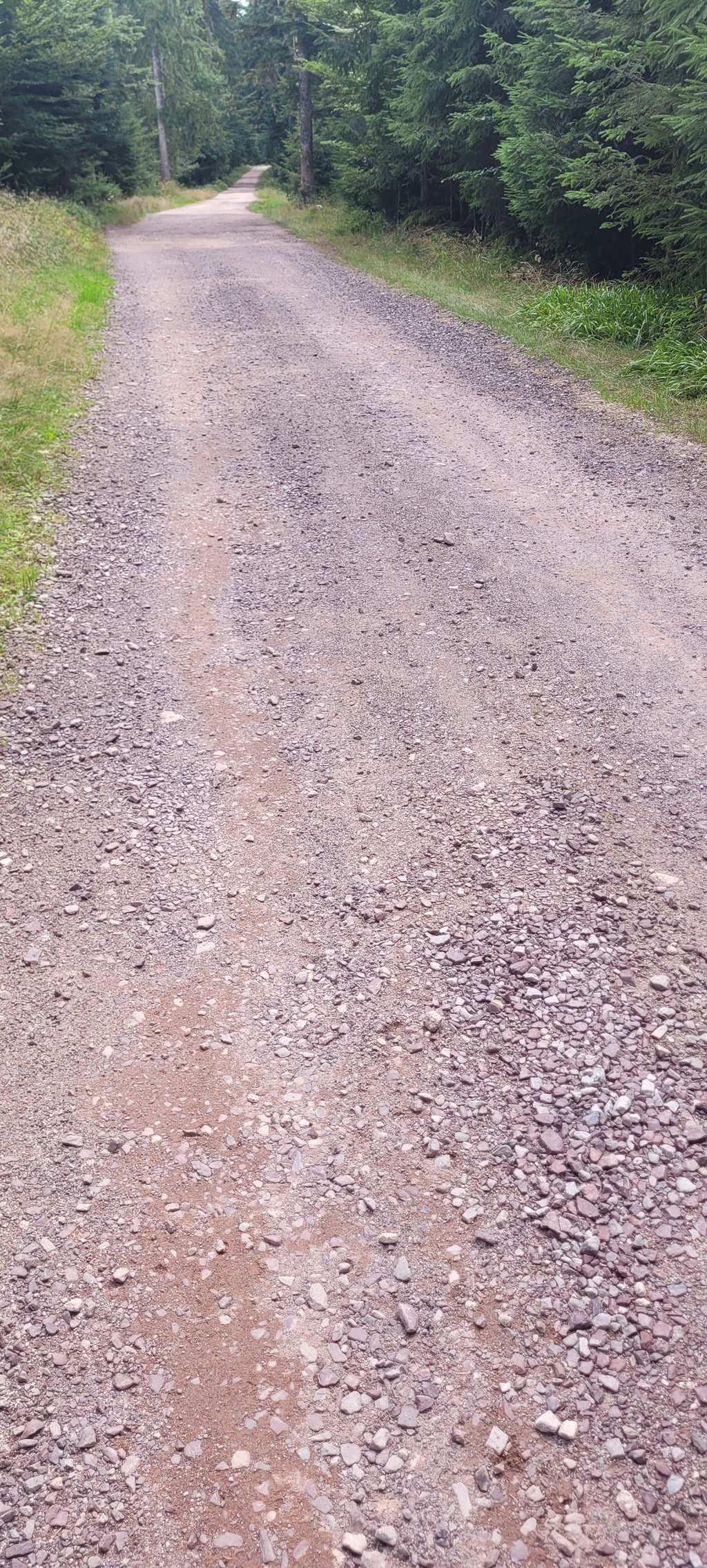
Immediately be careful as you turn up this climb. There are lots of pebbles in that bend. Int beginning it is very steep (10 to 16 per cent) in full sun. Then it starts to level off more and more. Up to and including these stretches it is also busy due to a campsite located on the climb. Once you pass this campsite, it is first some flat stretches of tarmac and then suddenly gravel. Very bad gravel with also needles from the trees lying on the track. Luckily I had tubeless tyres, otherwise it would have been a case of putting another tyre on. After the gravel back asphalt , full of potholes. Not up for a second time.
Direct oppassen geblazen als je deze klim opdraait. In die bocht liggen er veel steentjes. Int begin is het zeer steil (10 tot 16 procent) in de volle zon. Daarna begin het steeds meer af te vlakken. Tot en met deze stukken is het ook druk door een camping die op de beklimming ligt. Als je deze camping gepasseerd bent, is het eerst wat vlakke stukken asfalt en dan plots gravel. Zeer slechte gravel met ook naalden van de bomen die op de baan liggen. Gelukkig had ik tubeless banden , anders was het een ander bandje op leggen. Na de gravel terug asfalt , vol met putten. Niet voor een tweede keer vatbaar.
| 7 km/h | 00:50:18 |
| 11 km/h | 00:32:01 |
| 15 km/h | 00:23:28 |
| 19 km/h | 00:18:32 |
This page is better in the app