View on map
© MapLibre | OpenStreetMap contributors
1%
2%
4%
6%
8%
10%
12%
15%
20%

La Haute Cluse

2.0
1 review/story | Elevation profile | 3 photos
Tips nearby
La Haute Cluse
La Haute Cluse
La Haute Cluse
transparant thumb
transparant thumb
transparant thumb
transparant thumb
transparant thumb
Your achievable time
Calculating based on your best performances...
Relaxed
Maximum
W/kg
W/kg
W/kg
Analyse your climbing performance
Detailed insight into your climbing performance & automatically check off climbs
Based on your best performances.
Your best attempt:
Number of attempts:
Elevation profile La Haute Cluse

Statistics

Difficulty points 22
Length 0.9 km
Average gradient 4.2%
Steepest 100 metres 9.6%
Total ascent 37 m
Feedback about this climb?
Show climbs nearby Export to GPS device

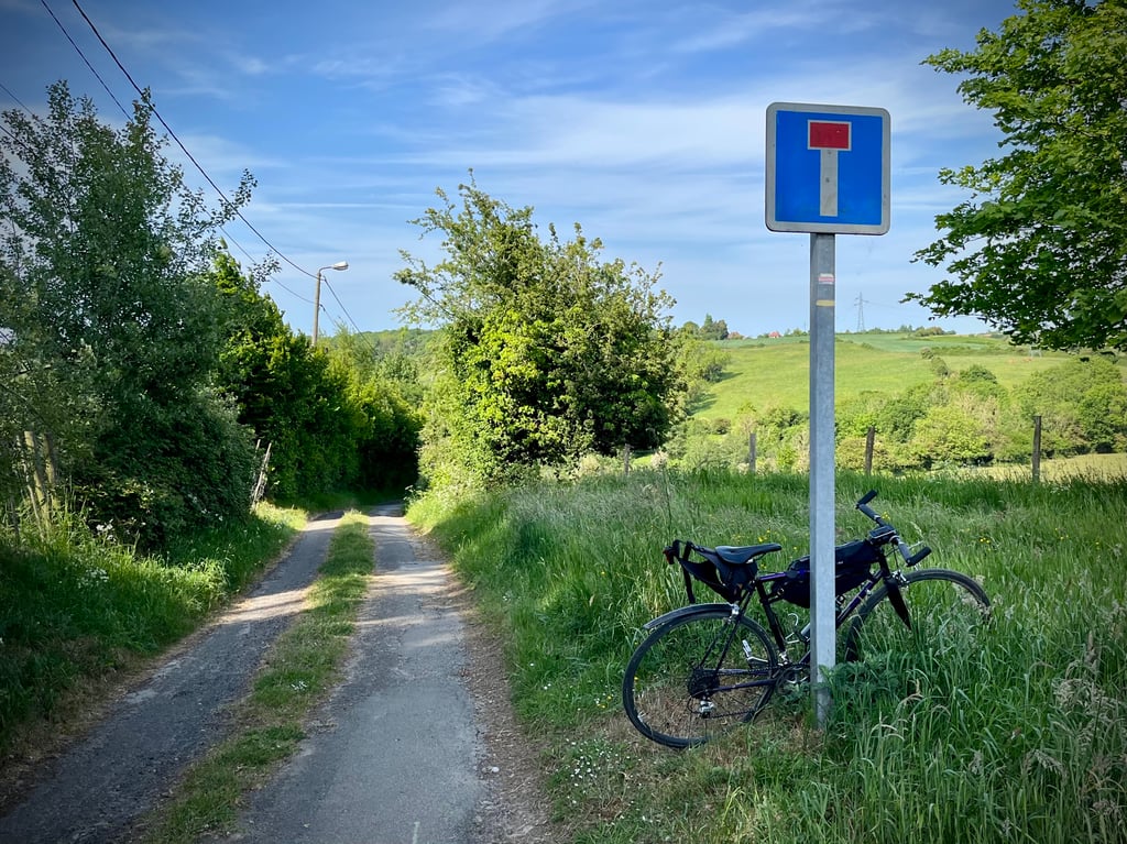
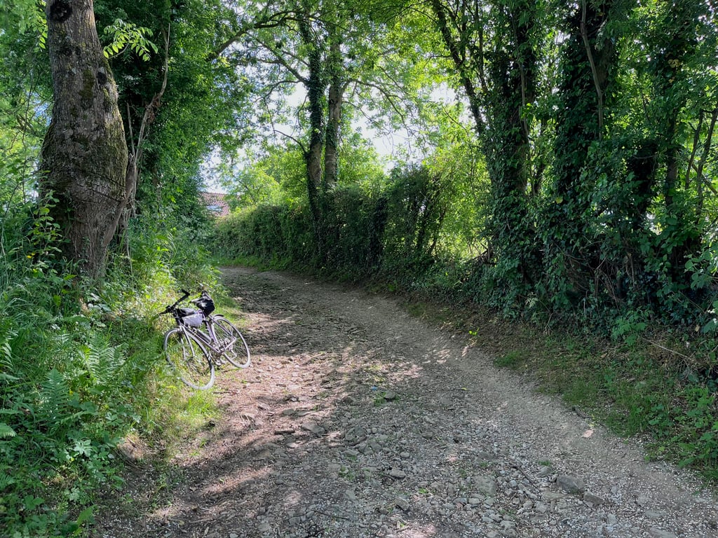
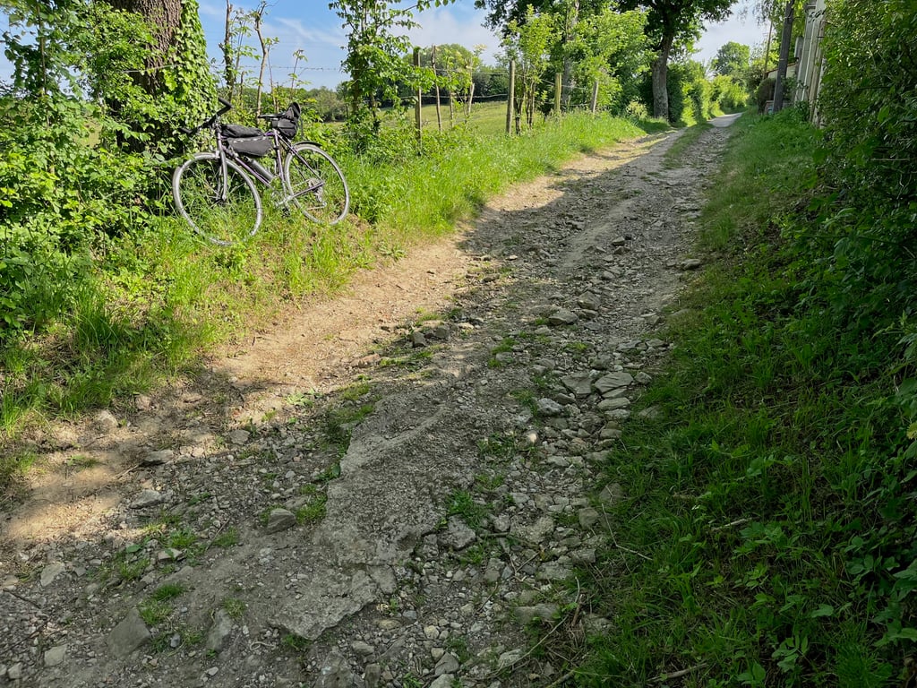
La Haute Cluse is a climb in the region Caps et Marais d'Opale. It is 0.9 km long and bridges 37 m of vertical ascent with an average gradient of 4.2%, resulting in a difficulty score of 22. The top of the ascent is located at 105 m above sea level. Climbfinder users shared 1 review/story of this climb and uploaded 3 photos.

Road name: Chemin de la Cluse

2.0 by Cromagnon
This is an automatic translation, the original language is: French.
A tiny path which, if you go down a little further into the forest, becomes a really fun little gravel course. In any case, the path is well degraded. This little path is not unforgettable.... read more

Photos (3)

La Haute Cluse
La Haute Cluse
La Haute Cluse
transparant thumb
transparant thumb
transparant thumb

Your uploads (max 4)

Welcome! Please activate your account if you would like to share something. Look for the verification email in your inbox.

If you want to upload your photos, you need to create an account. It only takes 1 minute and it's completely free.

  • Receive free climbfinder goodies for your reviews & photos.
  • Create a bucket list and check off conquered climbs.
  • Add missing climbs.
Continue with GoogleContinue with Google Continue with FacebookContinue with Facebook Continue with AppleContinue with Apple Sign up with email
By signing up you agree to our terms of service and confirm that you have read our privacy & content policy.

Reviews (1)

5.0
4.0
3.0
2.0
1.0
Cromagnon
1 y 2.0
This is an automatic translation, the original language is: French. Show original

A tiny path which, if you go down a little further into the forest, becomes a really fun little gravel course. In any case, the path is well degraded.
This little path is not unforgettable.

Un minuscule chemin qui, si l’on descend un peu plus bas dans la forêt devient un vrai petit parcours gravel très marrant. Dans tous les cas, le chemin est bien dégradé.
Ce petit chemin n’est pas inoubliable.

La Haute Cluse
La Haute Cluse
La Haute Cluse
Dashboard

Climbing times

7 km/h 00:07:34
11 km/h 00:04:49
15 km/h 00:03:32
19 km/h 00:02:47

Road surface condition

0% 0% 100%
Based on 1 vote
Share your knowledge. What was the road condition during your ascent?

Traffic

100% 0% 0%
Based on 1 vote
Your experience counts. How much traffic did you encounter during the climb?

Frequently Asked Questions

You don't need special gearing for La Haute Cluse. The slope isn't long or steep enough to require much shifting down. You can conquer this climb on power alone. However, a compact gearing system with a smallest front chainring of 34 and largest rear sprocket of 28 or 30 is always nice if you enjoy cycling uphill. This helps maintain a smooth cadence.

La Haute Cluse is not tough enough to be assigned a mountain category. This means that even untrained cyclists can reach the top without any problems on this climb.

La Haute Cluse is 0.9 km long.

The average gradient of La Haute Cluse is 4.2%.

La Haute Cluse has a steepest segment with an average gradient of 9.6%.

The summit of La Haute Cluse is at 105 m.

At a slow pace of 7 km/h, it takes about 00:07:34 to climb La Haute Cluse. At 11 km/h the time is 00:04:49, and at 15 km/h 00:03:32. For the fastest cyclists, 00:02:47 is an achievable time.

La Haute Cluse is located in the region Caps et Marais d'Opale in France.

This page is better in the app

Climbfinder app
Climbfinder
(Free)
Open