Tips nearby


La Fruitière de Montgirod is a climb in the region Savoie. It is 14.9 km long and bridges 1279 m of vertical ascent with an average gradient of 8.6%, resulting in a difficulty score of 1185. The top of the ascent is located at 1915 m above sea level. Climbfinder users shared 3 reviews of this climb and uploaded 10 photos.
Road names: D 85B & Route Pastorale
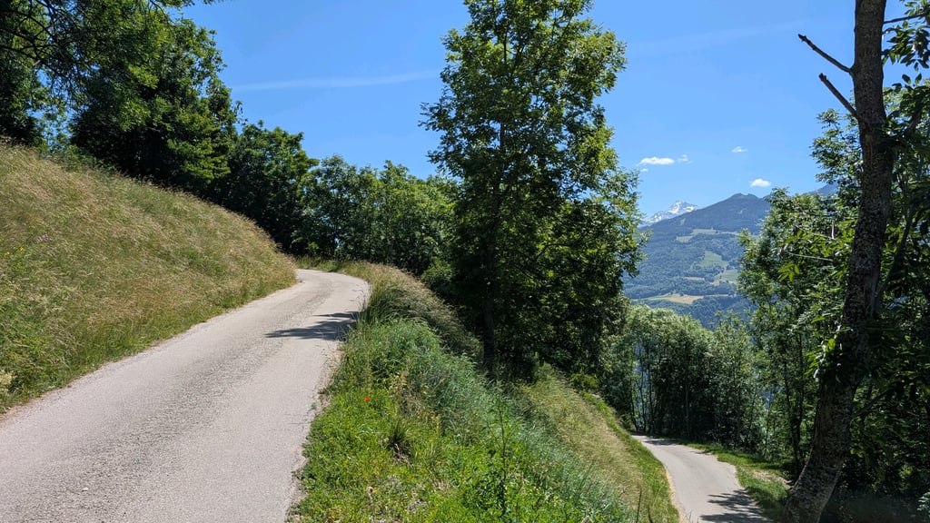
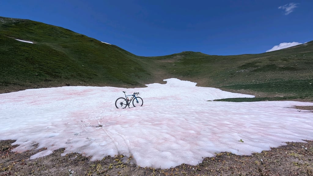
4.0 by JohanC11This is an automatic translation, the original language is: Dutch.A lovely, little-known climb, which you can extend quite a bit further on a gravel bike or MTB all the way to La Combe (a climb a little further on). You can take the lower route (1,950 m) or the higher route (2,200 m). Up to Montgirod, it’s not too difficult, but that’s when it really gets going. Steeper, but also quieter and more scenic. However, if you really want to enjoy the peace and quiet, I’d recommend taking a gravel bike or MTB and adding a few more kilometres at the top.... read more

Welcome! Please activate your account if you would like to share something. Look for the verification email in your inbox.
If you want to upload your photos, you need to create an account. It only takes 1 minute and it's completely free.
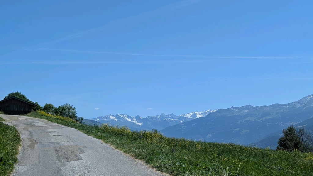
A lovely, little-known climb, which you can extend quite a bit further on a gravel bike or MTB all the way to La Combe (a climb a little further on). You can take the lower route (1,950 m) or the higher route (2,200 m). Up to Montgirod, it’s not too difficult, but that’s when it really gets going. Steeper, but also quieter and more scenic. However, if you really want to enjoy the peace and quiet, I’d recommend taking a gravel bike or MTB and adding a few more kilometres at the top.
Mooie onbekende klim, die je op de gravelbike of mtb nog een stuk verder door kan trekken tot aan La Combe (klim wat verderop). Dat kan onderlangs (1.950m) of bovenlangs (2.200m). Tot Montgirod is het allemaal niet al te lastig, maar daarna begint het pas echt. Steiler maar ook rustiger en mooier. Maar als je echt wil genieten van de rust dan zou ik op de gravelbike of mtb gaan en er bovenaan nog wat kilometers aan vast plakken.
Rerely climbed (just 47 times on Strava) but I was very satisfied.
Once I finished the tarmac at la fruitière and I continued 1km further on gravel (walk if not the appropriate tires), to get to the beautiful green plateau.
Only a litthe further and I arrived at the top of La Combe for the descent.
Contrary to the description, the road surface is fine until the last 5 km.
Like most steep back climbs, the road surface always gets worse as the climb progresses.
Very fine climb up to and past Montgirod.
Fairly regular climb but past the town the percentages start to go up.
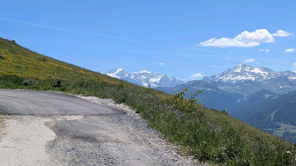
Beautiful views of the valley and mountain peaks.
The climb alternates between steep and less steep so you get a break.
Suddenly you're on an open stretch and then you're already there!
Definitely do it!
In tegenstelling tot de omschrijving is het wegdek prima tot de laatste 5 km.
Zoals de meeste steile achteraf klimmen word het wegdek altijd slechter naarmate de klim vordert.
Hele fijne klim tot en voorbij Montgirod.
Vrij regelmatige klim maar voorbij het plaatsje beginnen de percentages omhoog te gaan.
Mooie uitzichten op de vallei en op bergtoppen.
De klim wisselt af met steil en minder steil zodat je even rust krijgt.
Plots zit je op een open stuk en dan ben je er al!
Zeker doen!
| 7 km/h | 02:07:57 |
| 11 km/h | 01:21:25 |
| 15 km/h | 00:59:42 |
| 19 km/h | 00:47:08 |
This page is better in the app