View on map
© MapLibre | OpenStreetMap contributors
1%
2%
4%
6%
8%
10%
12%
15%
20%

Haut du Tôt from Vagney

3.7
3 reviews | Elevation profile | 4 photos
Tips nearby
Haut du Tôt from Vagney
transparant thumb
transparant thumb
transparant thumb
transparant thumb
Your achievable time
Calculating based on your best performances...
Relaxed
Maximum
W/kg
W/kg
W/kg
Analyse your climbing performance
Detailed insight into your climbing performance & automatically check off climbs
Based on your best performances.
Your best attempt:
Number of attempts:
Elevation profile Haut du Tôt from Vagney

Statistics

Difficulty points 385
Length 7.3 km
Average gradient 6.7%
Steepest 100 metres 13%
Total ascent 489 m

Short recap

Beautiful scenery
Hidden gem
2 hairpin turns
#58 toughest climb of Grand Est
#76 most elevation gain of Grand Est
#46 longest climb of Vosges
#80 average steepest climb of Vosges
Feedback about this climb?
Show climbs nearby Export to GPS device

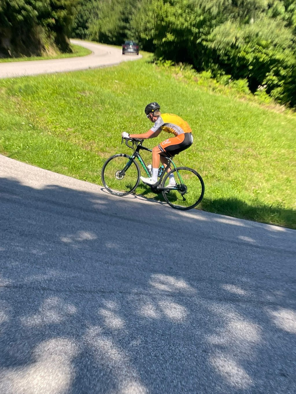
Haut du Tôt from Vagney is a climb in the region Vosges. It is 7.3 km long and bridges 489 m of vertical ascent with an average gradient of 6.7%, resulting in a difficulty score of 385. The top of the ascent is located at 866 m above sea level. Climbfinder users shared 3 reviews of this climb and uploaded 4 photos.

Road name: Route du Haut du Tôt

4.0 by RobinDonot
This is an automatic translation, the original language is: French.
A very unfamiliar but fairly difficult climb. The descent is a little narrow... read more

Photos (4)

Haut du Tôt from Vagney
transparant thumb
transparant thumb

Your uploads (max 4)

Welcome! Please activate your account if you would like to share something. Look for the verification email in your inbox.

If you want to upload your photos, you need to create an account. It only takes 1 minute and it's completely free.

  • Receive free climbfinder goodies for your reviews & photos.
  • Create a bucket list and check off conquered climbs.
  • Add missing climbs.
Continue with GoogleContinue with Google Continue with FacebookContinue with Facebook Continue with AppleContinue with Apple Sign up with email
By signing up you agree to our terms of service and confirm that you have read our privacy & content policy.

Reviews (3)

5.0
4.0
3.0
2.0
1.0
RobinDonot
10 Mo 4.0 via the Climbfinder app
This is an automatic translation, the original language is: French. Show original

A very unfamiliar but fairly difficult climb. The descent is a little narrow

Montée très peu connue mais assez difficile. La descente est un peu étroite

Dashboard
JulienFelix
3 y 4.0 00:25:36 (17.2 km/h)
This is an automatic translation, the original language is: French. Show original

Very pleasant but uneven climb. Several ramps over 10%. Out of the peak tourist season the climb is little used.

Montée très agréable mais irrégulière. Plusieurs rampes à plus de 10%. Hors pic de saison touristique la montée est peu fréquentée.

Dashboard
Jeroen
4 y 3.0
This is an automatic translation, the original language is: Dutch. Show original

Nice climb on a good road to a small village on a hill. On top there is not much to do, it is mainly a climb to enjoy the quiet and the altimeters. Very quiet with at the beginning also some bumps up to 13%.

Mooie klim over een goed wegdek naar een klein dorpje op een heuvel. Bovenop is niet veel te doen, het is vooral een klim om te genieten van de rust en de hoogtemeters. Heerlijk rustig met aan het begin ook hobbels tot een procent of 13. Deze klim past goed in elk rondje.

Haut du Tôt from Vagney
Dashboard

Climbing times

7 km/h 01:02:49
11 km/h 00:39:58
15 km/h 00:29:18
19 km/h 00:23:08

Road surface condition

89% 11% 0%
Based on 9 votes
Share your knowledge. What was the road condition during your ascent?

Traffic

56% 44% 0%
Based on 9 votes
Your experience counts. How much traffic did you encounter during the climb?

Frequently Asked Questions

Haut du Tôt can be cycled from 3 sides. Haut du Tôt from Vagney is the most popular side, but the summit can also be reached via Haut du Tôt from Le Tholy & Haut du Tôt from Sapois.

Haut du Tôt from Vagney is a challenging ascent. For this type of climbing, we recommend mountain gearing, specifically a compact system. This means a small front chainring of 34 teeth, combined with a rear cassette where, depending on your level, strength, and experience, you choose a sprocket with 30, 32, or even 34 teeth. Remember that a smooth cadence is always more efficient!

Haut du Tôt from Vagney is a serious climb and falls into the 2nd category. With a good basic fitness level, even without much cycling experience, you can complete this climb just fine. However, a bike with climbing gears is a must. Without experience or training, it will be really tough – but that’s part of the challenge!

Haut du Tôt from Vagney is 7.3 km long.

The average gradient of Haut du Tôt from Vagney is 6.7%.

Haut du Tôt from Vagney has a steepest segment with an average gradient of 13%.

The summit of Haut du Tôt from Vagney is at 866 m.

At a slow pace of 7 km/h, it takes about 01:02:49 to climb Haut du Tôt from Vagney. At 11 km/h the time is 00:39:58, and at 15 km/h 00:29:18. For the fastest cyclists, 00:23:08 is an achievable time.

Haut du Tôt from Vagney is located in the region Vosges in France.

This page is better in the app

Climbfinder app
Climbfinder
(Free)
Open