Grosssee / Zirknitztal from Grosskirchheim is a climb in the region Carinthia. It is 14.9 km long and bridges 1370 m of vertical ascent with an average gradient of 9.2%, resulting in a difficulty score of 1538. The top of the ascent is located at 2378 m above sea level. Climbfinder users shared 5 reviews of this climb and uploaded 9 photos.
Road names: Apriacher Landstraße & Zirknitz
4.0 by WernerVanSteenThis is an automatic translation, the original language is: Dutch.Drove on 04/07/2026 If you want to avoid the crowds (and hordes of motorbikes!) on the Grossglockner Hochalpenstrasse during a holiday weekend, this is the ideal choice. The route starts in Grosskirchheim, the village just before Heiligenblut. This road is closed to traffic from km 8 onwards, as it belongs to the energy company that has built a small dam on the Grosssee – the little lake that marks the end of this climb. The first 8 km are also quiet and climb steeply right from the start on ... read more
Welcome! Please activate your account if you would like to share something. Look for the verification email in your inbox.
If you want to upload your photos, you need to create an account. It only takes 1 minute and it's completely free.
Drove on 04/07/2026
If you want to avoid the crowds (and hordes of motorbikes!) on the Grossglockner Hochalpenstrasse during a holiday weekend, this is the ideal choice. The route starts in Grosskirchheim, the village just before Heiligenblut. This road is closed to traffic from km 8 onwards, as it belongs to the energy company that has built a small dam on the Grosssee – the little lake that marks the end of this climb.
The first 8 km are also quiet and climb steeply right from the start on good tarmac. Between km 6 and km 7 there are sections of poor tarmac, and you hope the rest of the route will improve again – which it does.
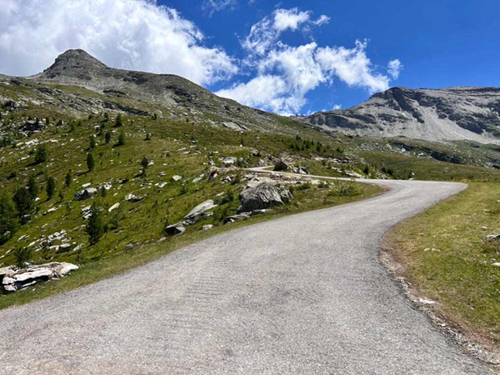
After the little bridge over the stream, you’ll encounter the steepest section of the route: about 100 metres at a 16 per cent gradient. You pass through the gates and from there it only gets more beautiful; above all, you can enjoy the immense tranquillity – it’s lovely to climb without cars or revving engines!
The road is steep, regularly around 10–13 per cent, but there are also flatter sections where you can recover a bit.
A little later, you’ll reach the first small lake, and the road curves sharply to the right into the valley, eventually ending at the gates of the Grosssee. You can then look back with satisfaction on 1,400 metres of challenging climbing.
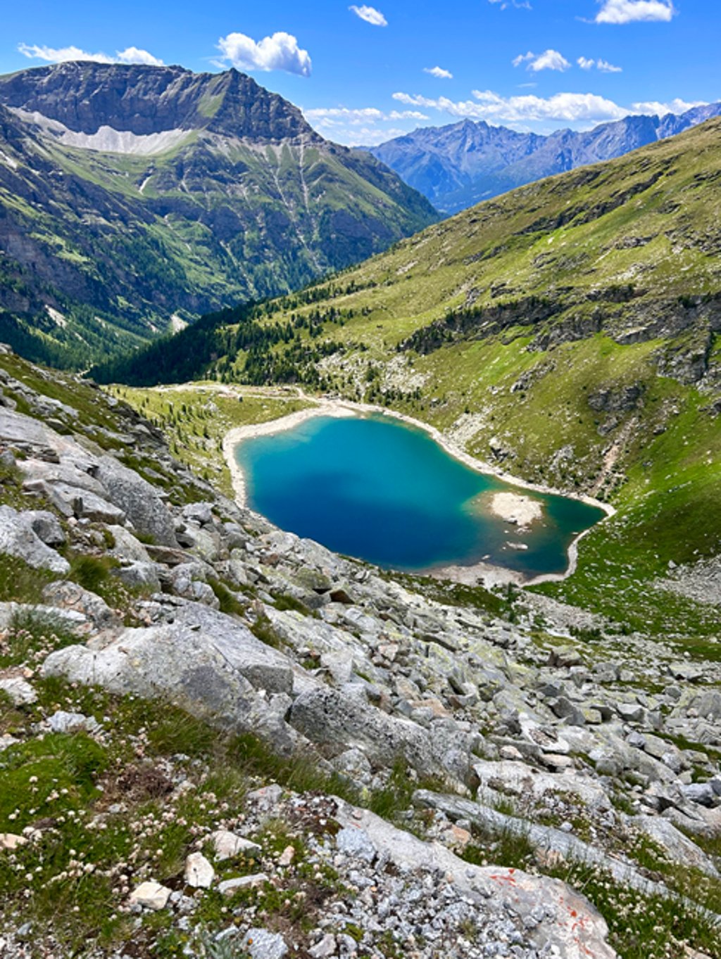
During the descent, at one point you’ll have a lovely view of the lowest lake (see attached photo), but watch out for the many, sometimes treacherous, water-filled ruts – I actually got a puncture on one of them. This applies to the entire descent, with the exception of the last 6 km.
A TOP climb!
Gereden op 04/07/2026
Wil je de drukte (en massa’s motoren !) op de Grossglockner Hochalpenstrasse vermijden in een vakantie-weekend, dan is dit dé ideale keuze. De start ligt in Grosskirchheim ; het dorp net voor Heiligenblut. Deze weg is voor verkeer afgesloten vanaf km 8 want het is een weg die behoort aan de energie maatschappij die een kleine stuwdam hebben gebouwd aan de Grosssee ; het meertje dat het einde vormt van deze beklimming.
Ook de eerste 8km zijn verkeersluw en gaan van in het begin stevig naar boven over mooi asfalt. Tussen km 6 en km 7 zijn er stroken met slecht asfalt en hoop je dat de rest van de route opnieuw beter wordt ; wat het ook is.
Na het bruggetje over het riviertje kom je de steilste strook van de route tegen ; een 100 tal meter aan een 16%. Je gaat door het hekken en vanaf daar wordt het alleen maar mooier en wordt het vooral genieten van de immense rust ; heerlijk om zonder auto’s en gierende motoren te klimmen !
De weg is steil en regelmatig rond de 10-13% maar er zijn ook vlakkere stroken waar je wat kan herstellen.
Even later kom je aan het eerste meertje en draait de weg een eind rechts de vallei in om uiteindelijk te eindigen aan de het hekken van de Grosssee. Je kan dan met voldoening terug blikken op 1400m stevig klimwerk.
Tijdens de afdaling heb je op een gegeven moment een mooi zicht op het laagste meertje (zie foto in bijlage) maar kijk uit voor de vele soms aggressieve water geulen waarop ik overigens lek reed. Dat geldt overigens voor de hele afdaling met uitzondering van de laatste 6km.
TOP-beklimming !
Heavy but very beautiful
Gets tough from the barriers.
Car-free climb is always nice. Seen a few marmotte in this marmotte paradise.
The Hochwurtenspeicher descent is much worse than this descent.
Zwaar maar heel mooi
Wordt zwaar vanaf de slagbomen.
Autovrije klim is altijd leuk. Paar marmotte gezien in dit marmotte paradijs.
De Hochwurtenspeicher afdaling is veeeel slechter dan deze afdaling.
Hard but grandiose climb, which except for one flat kilometre gives almost constant double gradients. It is well worth the effort, however, because almost the entire route you are treated to beautiful views. From the Barrier you cycle into the Kleine Zirknitztal and the scenery actually becomes fairytale-like (except for some construction traffic). The final kilometres from the Kegelesee are downright stunning. During these kilometres, you are also accompanied by an army of marmots, which makes the climb all the more exceptional.
F A N T A S T I C S !
Loodzware, doch grandioze beklimming, die uitgezonderd één vlakke kilometer vrijwel constant dubbele stijgingpercentages geeft. Het is het afzien echter meer dan waard, want vrijwel de hele route word je getrakteerd op prachtige vergezichten. Vanaf de barriëre fiets je het Kleine Zirknitztal in en wordt de omgeving zowaar sprookjesachtig (met uitzondering van wat bouwverkeer). De slotkilometers vanaf de Kegelesee zijn ronduit verbluffend. Tijdens deze kilometers word je bovendien vergezeld door een leger van marmotten, wat de klim helemaal uitzonderlijk maakt.
F A N T A S T I S C H !
I myself stayed in this valley at the campsite in Lassach. I don't know why, but I missed this climb.
In this valley you can do several climbs, for example from Sagritz to the Sadnighaus - 10 km of buffeting with mostly double percentages. Road surface is fair to good.
Or to Rettenbach - 6 km climb from the valley. Also tough percentages with varying road surface.
The roads from the valley are here almost all with double percentages. Some stop soon and turn into gravel roads - to be able to ride a 'round' a MTB is more suitable.
Ik heb zelf in dit dal op de camping in Lassach gestaan. Ik weet niet waarom maar deze beklimming heb ik gemist..
In dit dal kan je verschillende beklimming doen, bijvoorbeeld vanuit Sagritz naar het Sadnighaus - 10 km buffelen met veelal dubbele percentages. Wegdek is redelijk tot goed.
Of naar Rettenbach - 6km klimmen vanuit het dal. Ook pittige percentages met wisselend wegdek.
De weggetjes die vanuit het dal zijn hier vrijwel allemaal met dubbele percentages. Sommige houden al snel op en gaan over in grintwegen - om hier een 'rondje' te kunnen rijden is een MTB wat geschikter.
Nature is great and you get to almost 2400m high. Car-free and you only see some cows on the road. Road surface is fair to good.
Natuur is geweldig en je komt op bijna 2400m hoog. Autovrij en je ziet alleen wat koeien op de weg. Wegdek is redelijk tot goed.
| 7 km/h | 02:07:30 |
| 11 km/h | 01:21:08 |
| 15 km/h | 00:59:30 |
| 19 km/h | 00:46:58 |
This page is better in the app