Gries from Längenfeld is a climb in the region Tyrol. It is 6.8 km long and bridges 525 m of vertical ascent with an average gradient of 7.7%, resulting in a difficulty score of 492. The top of the ascent is located at 1699 m above sea level. Climbfinder users shared 3 reviews of this climb and uploaded 34 photos.
This is an automatic translation, the original language is: Dutch.
Show original
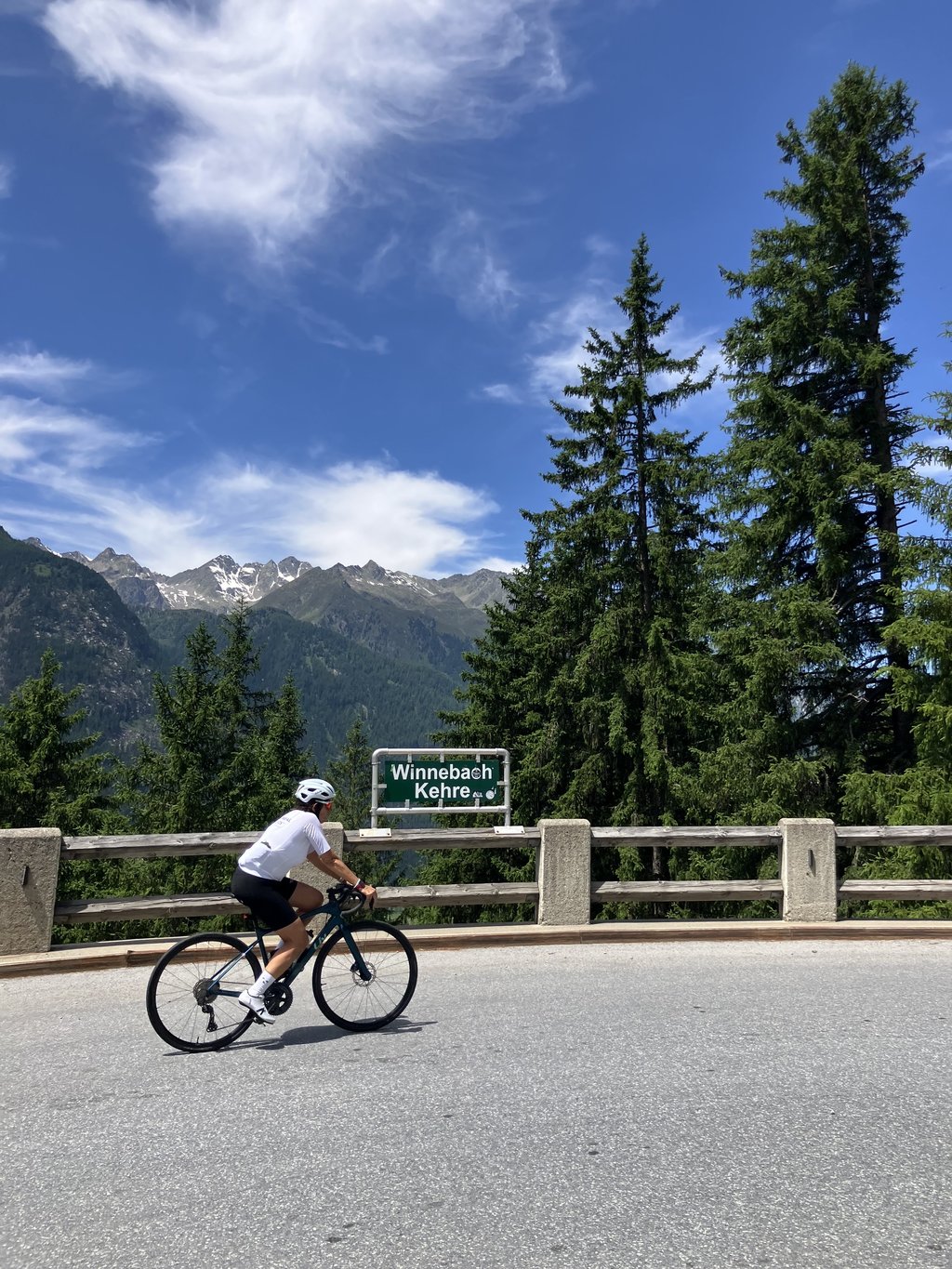
Thanks to Climbfinder.nl I have discovered this little gem. Starts beautifully with some very short hairpin bends which each have a name (I specially stopped in the descent to take pictures so you have a clear picture).
The percentages are whimsical, from steep to recovery parts, after the bends you get beautiful images of a mountain river. At the top you have a nice bonus if you climb the climbfinder segment all the way to the top.
You can mount lights, because you have to go through two tunnels. It is not really necessary, because the first tunnel consists mainly of a gallery so there is enough light and the second tunnel is really short.
You should really not miss this one if you are in the area for the bigger stuff like the Rettenbachferner or the Timmelsjoch.
Dankzij Climbfinder.nl heb ik dit pareltje ontdekt. Begint prachtig met enkele zeer korte haarspeldbochtjes die elk een naam hebben gekregen (ben speciaal gestopt in de afdaling om fotootjes te trekken zodat jullie een duidelijk beeld de hebben).
De percentages zijn grillig van pittig tot recuperatie-stukken, na de bochtjes krijg je prachtige beelden van een bergriviertje. Op de top heb je nog een mooi uitsmijter als je het climbfinder-segment helemaal tot boven klimt.
Je kan lichtjes monteren, want je moet door twee tunneltjes. Het hoeft niet echt, want de eerste tunnel bestaat grotendeels uit een galerij waardoor er voldoende lichtinval is en de tweede tunnel is hartstikke kort.
Deze moet je echt niet laten liggen als je in de buurt bent voor het groter werk zoals de Rettenbachferner of de Timmelsjoch.
This is an automatic translation, the original language is: Dutch.
Show original
This is a nice climb (tough but still doable). Especially the first kilometers are quite tough. These first kilometers consist of fairly short straight stretches (100-200m), followed by a sharp curve (13 curves at a distance of 2 km).
After 2,5 kilometers you have to go through a longer tunnel (partly open). The gradients then level off for a while. After passing the hamlet Unterlehn (this is basically just a single farm) you will have to finish one more hard kilometer (8-9%) and one easier kilometer (2-3%). In these kilometers you have to pass through a short (±200m) closed tunnel. You will have a fairly good view in these tunnels. However, it is advisable to install a rear light before the start of the climb so that you are clearly visible to traffic coming from behind.
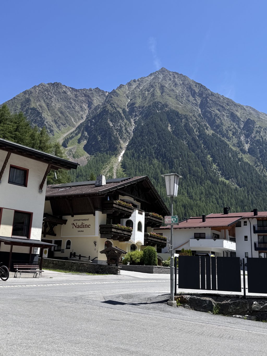
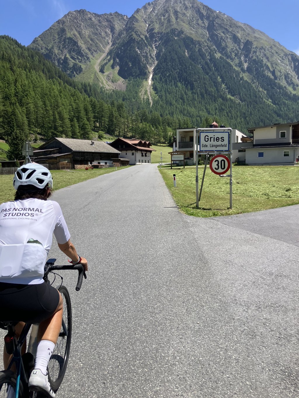
After 5.5 km climbing you will see the first houses of Gries. We cycle another 500 m and arrive at the end of the village. Here we turn right to Winnebach (this is another kilometre of climbing at 11-12%). And this kilometre can be hard if you have used a lot of energy in the first few kilometres.
We only climb to Winnebach for sportive reasons, because this hamlet doesn't represent much (one hotel and 1 or 2 houses).
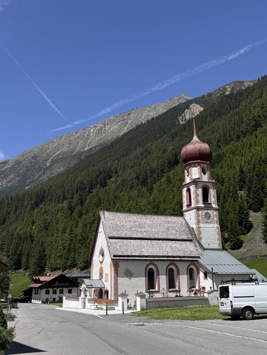
This was a rather pleasant climb - good road surface and little car traffic (this road is mainly used by tourists who come to hike in this beautiful valley).
Dit is een mooie beklimming (zwaar maar nog goed doenbaar). Vooral de eerste kilometers zijn vrij pittig. Deze eerste kilometers bestaan uit vrij korte rechte stukken (100-200m) rechtdoor, gevolgd door een scherpe bocht (13 bochten op een afstand van 2 km).
Na 2,5 kilometers moet je door een langere tunnel (deels open). De stijgingspercentages vlakken dan even af. Na het passeren van het gehucht Unterlehn (dit is in wezen slechts één enkele boerderij) moet je nog één zwaardere kilometer (8-9%) en een gemakkelijkere kilometer (2-3%) afwerken. In deze kilometers moet je door een korte (±200m) gesloten tunnel. Je hebt een vrij goed zicht in deze tunnels. Maar het is toch raadzaam om voor de aanvang van de beklimming een achterlichtje te monteren, zodat je ook goed zichtbaar bent voor het achteropkomend verkeer.
Na 5,5km klimmen zie je de eerste huizen van Gries. We fietsen nog 500 m verder en komen dan aan het einde van het dorp. Hier slaan we rechtsaf naar Winnebach (dit is nog een kleine kilometer klimmen aan 11-12%). En deze kilometer kan nog zwaar vallen als je in de eerste kilometers wat veel energie hebt verbruikt.
Klimmen naar Winnebach doen we enkel uit sportieve overwegingen want veel stelt dit gehucht niet voor (één hotel en nog 1 of 2 woningen).
Dit was een vrij aangename beklimming - een goed wegdek en weinig autoverkeer (deze weg wordt vnl. gebruikt door toeristen die in deze mooie vallei komen wandelen).
Share your knowledge. What was the road condition during your ascent?
Traffic
100% 0% 0%
Based on 2 votes
Your experience counts. How much traffic did you encounter during the climb?
Frequently Asked Questions
Gries from Längenfeld is a challenging ascent. For this type of climbing, we recommend mountain gearing, specifically a compact system. This means a small front chainring of 34 teeth, combined with a rear cassette where, depending on your level, strength, and experience, you choose a sprocket with 30, 32, or even 34 teeth. Remember that a smooth cadence is always more efficient!
Gries from Längenfeld is a serious climb and falls into the 2nd category. With a good basic fitness level, even without much cycling experience, you can complete this climb just fine. However, a bike with climbing gears is a must. Without experience or training, it will be really tough – but that’s part of the challenge!
Gries from Längenfeld is 6.8 km long.
The average gradient of Gries from Längenfeld is 7.7%.
Gries from Längenfeld has a steepest segment with an average gradient of 14.7%.
The summit of Gries from Längenfeld is at 1699 m.
At a slow pace of 7 km/h, it takes about 00:58:13 to climb Gries from Längenfeld. At 11 km/h the time is 00:37:02, and at 15 km/h 00:27:10. For the fastest cyclists, 00:21:26 is an achievable time.
Gries from Längenfeld is located in the region Tyrol in Austria.