Forcella di Ranzanico via Peia is a climb in the region Bergamo. It is 5.3 km long and bridges 480 m of vertical ascent with an average gradient of 9%, resulting in a difficulty score of 642. The top of the ascent is located at 962 m above sea level. Climbfinder users shared 4 reviews of this climb and uploaded 9 photos.
Road names: Via Antonio Locatelli, Via Provinciale & Via Ca' Zenucchi
3.0 by MauroBrescianiThis is an automatic translation, the original language is: Italian.The climb is really very hard, from where the sign "Malga Lunga" appears there are decisive climbs, in particular the really hard part goes to 23% with a concrete road surface with 4-5cm steps to allow the few cars to grip. With the road bike it is not really the best. On the edge there's a concrete surface that isn't very wide but sufficient for pedalling except for a segment with roadworks. I can assume that descending from this side becomes dangerous because of these majo... read more

Welcome! Please activate your account if you would like to share something. Look for the verification email in your inbox.
If you want to upload your photos, you need to create an account. It only takes 1 minute and it's completely free.
An impossible climb on road bikes: 500 metres of concrete with extremely narrow channels.
Salita infattibile con BDC: 500m in cemento con canaline strettissime.
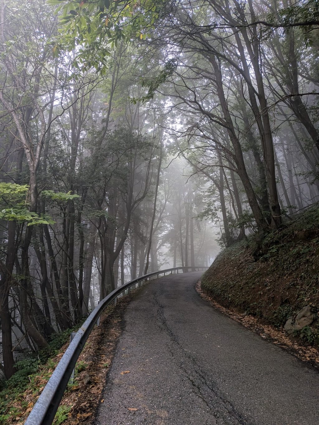
The hard section is just after the village of Peia after entering the forest. There'is a concrete ramp with a gradient of more than 17%, very tiring with the Gravel. Then up to the top the slopes are steep but doable. The road surface is good, I don't know if the concrete ramp is doable by BDC (about 400 m).
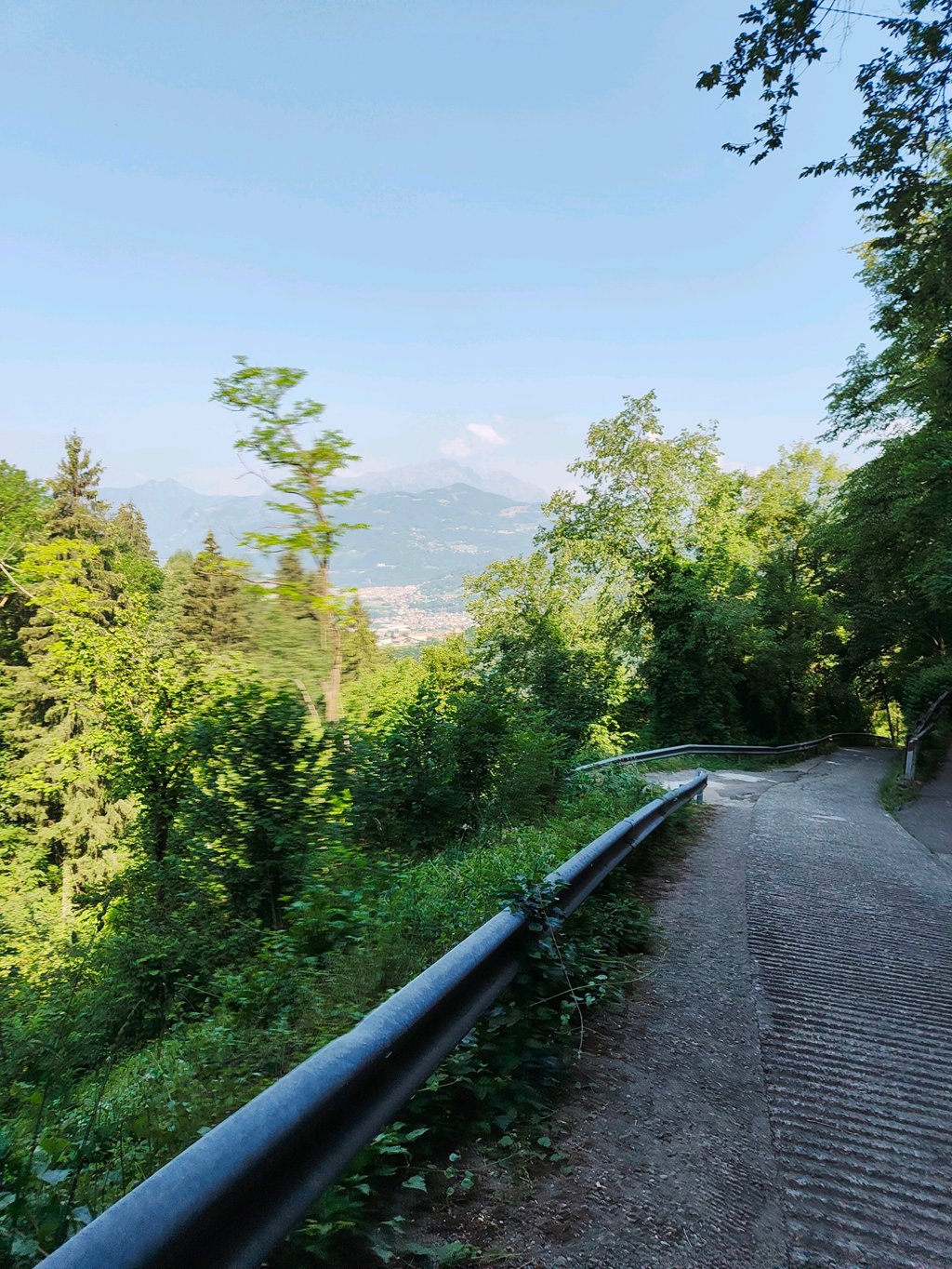
Descent towards Ranzanico with a fairly bumpy road surface. Excellent view of the lake.
Il Tratto duro è appena dopo il paese di Peia dopo essere entrati nel bosco. C'è una rampa in cemento con una pendenza superiore al 17%, faticosissima con la Gravel. Poi fino la cima le pendenze sono importanti ma fattibili. Manto stradale buono, non so se fattibile in BDC la rampa in cemento (Circa 400 m).
Discesa verso Ranzanico con manto stradale abbastranza sconnesso. Ottima la vista sul lago.
The climb was at the end of a big lap. Then it is really very difficult. Already in Peia, there are steep sections but at the top almost impossible to do. There are all ridges in the concrete to give cars grip... I was so tired I didn't take any more photos. Better get more of a 34 resistance or MTB
De klim was aan het einde van een grote ronde. Dan is het echt heel moeilijk. Al in Peia zijn er stijle stukken maar boven in bijna niet te doen. Er zitten allemaal ribbels in het beton om auto’s grip te geven.. ik was zo moe dat ik geen foto’s meer gemaakt heb. Beter meer een 34 verzet of een MTB
The climb is really very hard, from where the sign "Malga Lunga" appears there are decisive climbs, in particular the really hard part goes to 23% with a concrete road surface with 4-5cm steps to allow the few cars to grip. With the road bike it is not really the best. On the edge there's a concrete surface that isn't very wide but sufficient for pedalling except for a segment with roadworks. I can assume that descending from this side becomes dangerous because of these major steps. The descent to Ranzanico has an acceptable asphalt surface with frequent pasture droppings. The view of the lake is priceless. I strongly suggest mtb
La salita è davvero molto dura, da dove compare il cartello "Malga Lunga" ci sono strappi decisi, in particolare la parte davvero dura va al 23% con fondo stradale in cemento con gradini di 4-5cm per permettere il grip alle poche auto. Con la bici da corsa non è proprio il massimo. A bordo c'è un fondo sempre in cemento non molto largo ma sufficiente per pedalare ad eccezione di un segmento con lavori in corso. Posso supporre che scendere da questo lato diventi pericoloso per questi gradini importanti. La discesa verso Ranzanico ha un asfalto accettabile con frequenti escrementi di pascolo. La vista sul lago impagabile. Suggerisco caldamente mtb
| 7 km/h | 00:45:49 |
| 11 km/h | 00:29:09 |
| 15 km/h | 00:21:23 |
| 19 km/h | 00:16:53 |
This page is better in the app