View on map
© MapLibre | OpenStreetMap contributors
1%
2%
4%
6%
8%
10%
12%
15%
20%

Col le Viarès from Rasteau

3.0
1 review/story | Elevation profile | 1 photo
Tips nearby
Col le Viarès from Rasteau
transparant thumb
transparant thumb
transparant thumb
transparant thumb
transparant thumb
transparant thumb
transparant thumb
Your achievable time
Calculating based on your best performances...
Relaxed
Maximum
W/kg
W/kg
W/kg
Analyse your climbing performance
Detailed insight into your climbing performance & automatically check off climbs
Based on your best performances.
Your best attempt:
Number of attempts:
Elevation profile Col le Viarès from Rasteau

Statistics

Difficulty points 43
Length 2.4 km
Average gradient 3.9%
Steepest 100 metres 7.1%
Total ascent 95 m

Short recap

Beautiful scenery
Feedback about this climb?
Show climbs nearby Export to GPS device

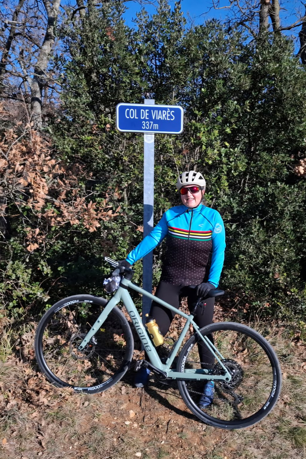
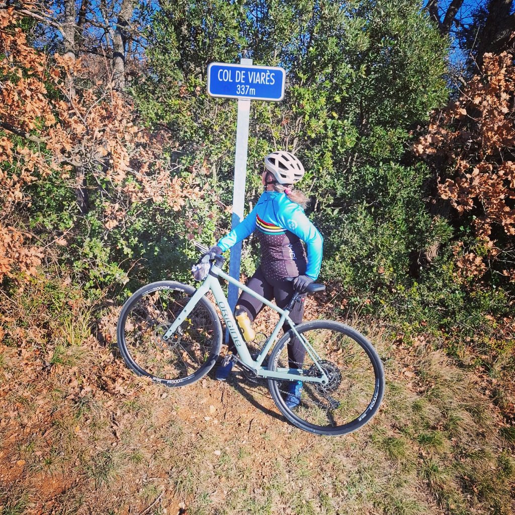
Col le Viarès from Rasteau is a climb in the region Vaucluse. It is 2.4 km long and bridges 95 m of vertical ascent with an average gradient of 3.9%, resulting in a difficulty score of 43. The top of the ascent is located at 337 m above sea level. Climbfinder users shared 1 review/story of this climb and uploaded 1 photo.

Road name: Route de Rasteau

This is an automatic translation, the original language is: French.
A pleasant little road through vineyards and woods. Typical southern landscapes. The road is not very busy, but be careful on the bends as you approach Saint Roman De Malegarde.... read more

Photos (1)

Col le Viarès from Rasteau
transparant thumb
transparant thumb
transparant thumb
transparant thumb
transparant thumb

Your uploads (max 4)

Welcome! Please activate your account if you would like to share something. Look for the verification email in your inbox.

If you want to upload your photos, you need to create an account. It only takes 1 minute and it's completely free.

  • Receive free climbfinder goodies for your reviews & photos.
  • Create a bucket list and check off conquered climbs.
  • Add missing climbs.
Continue with GoogleContinue with Google Continue with FacebookContinue with Facebook Continue with AppleContinue with Apple Sign up with email
By signing up you agree to our terms of service and confirm that you have read our privacy & content policy.

Reviews (1)

5.0
4.0
3.0
2.0
1.0
SansLesRoulettes84
1 y 3.0 via the Climbfinder app
This is an automatic translation, the original language is: French. Show original

A pleasant little road through vineyards and woods. Typical southern landscapes. The road is not very busy, but be careful on the bends as you approach Saint Roman De Malegarde.

Petite route bien agréable qui passe dans les vignes et dans les bois. Paysages typiques du sud. La route est peu fréquentée mais attention dans les virages en arrivant sur Saint Roman De Malegarde.

Col le Viarès from Rasteau
Dashboard

Climbing times

7 km/h 00:20:57
11 km/h 00:13:20
15 km/h 00:09:47
19 km/h 00:07:43

Road surface condition

0% 0% 0%
Based on 0 votes
Share your knowledge. What was the road condition during your ascent?

Traffic

0% 0% 0%
Based on 0 votes
Your experience counts. How much traffic did you encounter during the climb?

Frequently Asked Questions

Col le Viarès can be cycled from 2 sides. Col le Viarès from Saint Roman de Malegarde is the most popular side, but the summit can also be reached via Col le Viarès from Rasteau.

You don't need special gearing for Col le Viarès from Rasteau. The slope isn't long or steep enough to require much shifting down. You can conquer this climb on power alone. However, a compact gearing system with a smallest front chainring of 34 and largest rear sprocket of 28 or 30 is always nice if you enjoy cycling uphill. This helps maintain a smooth cadence.

Col le Viarès from Rasteau falls into the 5th category. With good fitness, you can ride it up with speed and power. If you have less training, shift down and climb smoothly.

Col le Viarès from Rasteau is 2.4 km long.

The average gradient of Col le Viarès from Rasteau is 3.9%.

Col le Viarès from Rasteau has a steepest segment with an average gradient of 7.1%.

The summit of Col le Viarès from Rasteau is at 337 m.

At a slow pace of 7 km/h, it takes about 00:20:57 to climb Col le Viarès from Rasteau. At 11 km/h the time is 00:13:20, and at 15 km/h 00:09:47. For the fastest cyclists, 00:07:43 is an achievable time.

Col le Viarès from Rasteau is located in the region Vaucluse in France.

This page is better in the app

Climbfinder app
Climbfinder
(Free)
Open