Tips nearby


Col des Hayes from Saulxures sur Moselotte via Route du droit du Rupt de Bâmont is a climb in the region Vosges. It is 6.3 km long and bridges 437 m of vertical ascent with an average gradient of 6.9%, resulting in a difficulty score of 366. The top of the ascent is located at 889 m above sea level. Climbfinder users shared 3 reviews of this climb and uploaded 3 photos.
Road name: Route du droit du Rupt de Bâmont
3.0 by Ivo17This is an automatic translation, the original language is: Dutch.If you arrive at the Col de Hayes by MTB, continue to the Haut du Roc via a path with larger boulders for a nice view (and visit the table de Charlemagne). With the Planche des belles filles, this is the highest point in the Western Vosges (1012m).... read more
Welcome! Please activate your account if you would like to share something. Look for the verification email in your inbox.
If you want to upload your photos, you need to create an account. It only takes 1 minute and it's completely free.
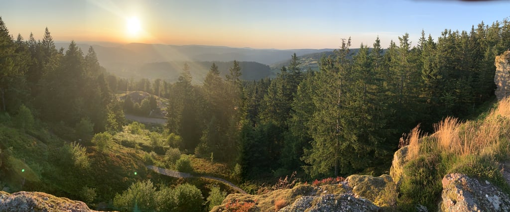
If you arrive at the Col de Hayes by MTB, continue to the Haut du Roc via a path with larger boulders for a nice view (and visit the table de Charlemagne). With the Planche des belles filles, this is the highest point in the Western Vosges (1012m).
Als je op de Col de Hayes aankomt per MTB, rijd door naar de Haut du Roc via een pad met grotere keien voor een mooi uitzicht (en bezoekje aan de table de Charlemagne). Dit is met de Planche des belles filles het hoogste punt van de Westelijke Vogezen (1012 m).
Surely the climb feels tackier than indicated in the percentages here. There are sections up to 16.7%, which make the climb very tiring. This also makes it difficult to find a pace.
De klim voelt toch pakken zwaarder aan dan aangegeven in de percentages hier. Er zitten stukken in tot 16,7%, die de klim zeer vermoeiend maken. Dit maakt het ook moeilijk om een tempo te vinden.
Typical climb for this part of the Vosges: you start between houses with then more and more open landscape and old meadows, interspersed with streams and stretches of forest. It is very quiet and green. On this ascent, I understood a little what is meant by 'French life'. Living in quiet, green surroundings at a calm pace.
Typische klim voor dit deel van de Vogezen: je start tussen de huizen met daarna steeds meer open landschap en oude weilanden, afgewisseld met beekjes en stukken bos. Het is er heel erg rustig en groen. Op deze beklimming begreep ik een beetje wat er wordt bedoeld met 'het Franse leven'. Wonen in een rustige, groene omgeving in een kalm tempo.
| 7 km/h | 00:54:19 |
| 11 km/h | 00:34:33 |
| 15 km/h | 00:25:20 |
| 19 km/h | 00:20:00 |
This page is better in the app