View on map
© MapLibre | OpenStreetMap contributors
1%
2%
4%
6%
8%
10%
12%
15%
20%

Col des Cyclotouristes from Bonnecine

2.7
3 reviews | Elevation profile | 4 photos
Tips nearby
Col des Cyclotouristes from Bonnecine
transparant thumb
transparant thumb
transparant thumb
transparant thumb
Your achievable time
Calculating based on your best performances...
Relaxed
Maximum
W/kg
W/kg
W/kg
Analyse your climbing performance
Detailed insight into your climbing performance & automatically check off climbs
Based on your best performances.
Your best attempt:
Number of attempts:
Elevation profile Col des Cyclotouristes from Bonnecine

Statistics

Difficulty points 566
Length 11.8 km
Average gradient 6.4%
Steepest 100 metres 10.1%
Total ascent 751 m

Short recap

Beautiful scenery
Hidden gem
13 hairpin turns
#42 toughest climb of Annecy
#32 most elevation gain of Annecy
#28 longest climb of Annecy
#99 average steepest climb of Annecy
Feedback about this climb?
Show climbs nearby Export to GPS device

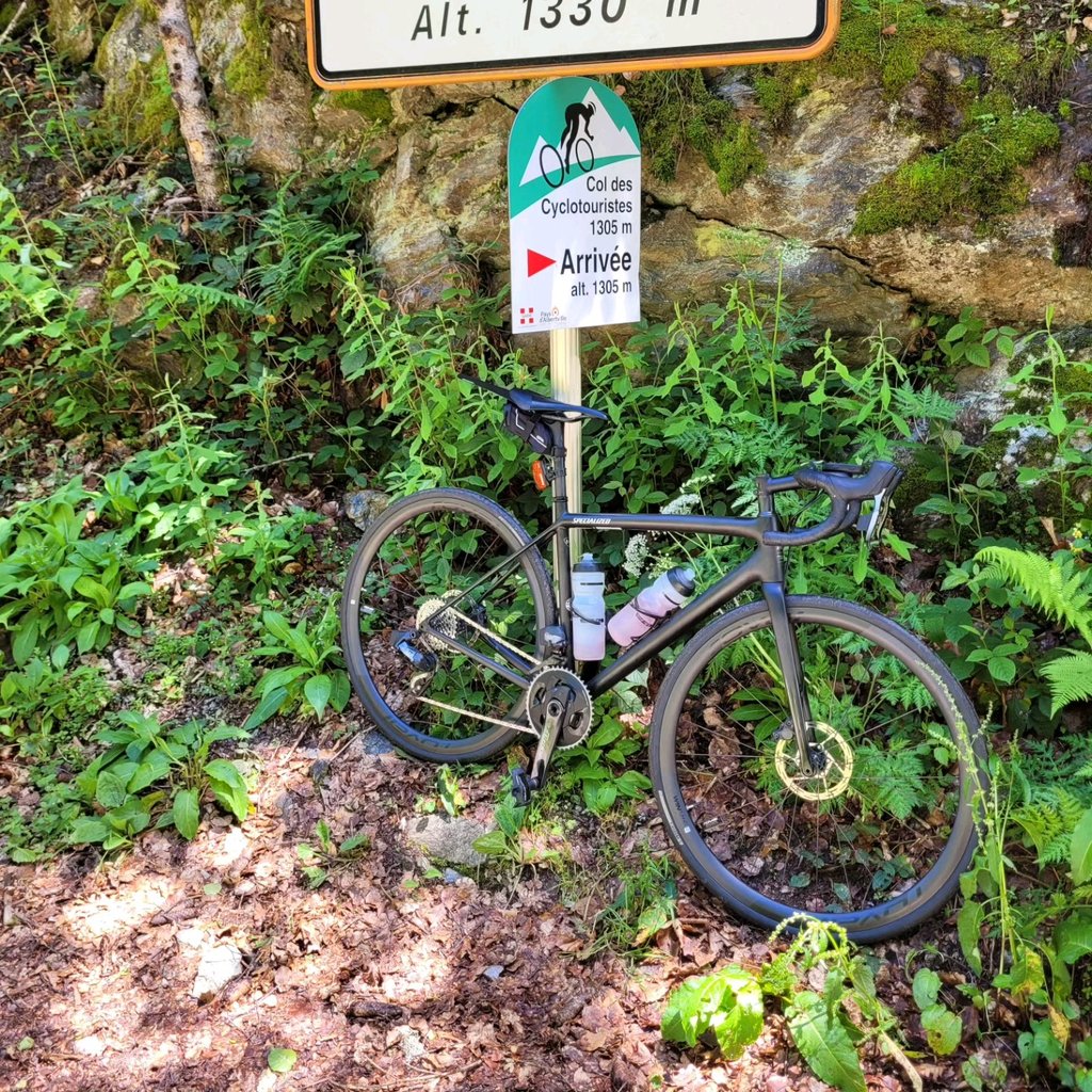
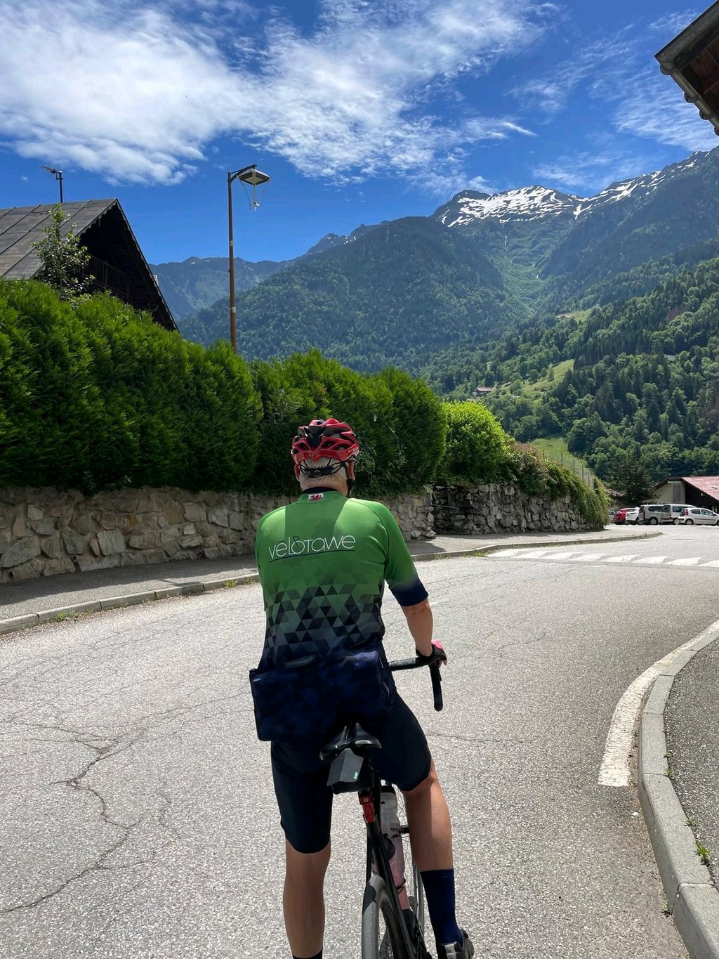
Col des Cyclotouristes from Bonnecine is a climb in the region Annecy. It is 11.8 km long and bridges 751 m of vertical ascent with an average gradient of 6.4%, resulting in a difficulty score of 566. The top of the ascent is located at 1300 m above sea level. Climbfinder users shared 3 reviews of this climb and uploaded 4 photos.

Road names: Route de Molliessoulaz, Pont Couvert & Route du Fort du Mont

3.0 by VincentM
This is an automatic translation, the original language is: French.
Two gravel climbs in 2024. No problem. Note that the "col" is never signposted from this side. Follow the signs for "les croix" at Miollessoulaz. It's not very good at the top but you can climb it on a road bike. Loop possible via Les Pointieres and Les Roengers for a nice loop at 900 D+ in 30 kms. ... read more

Photos (4)

Col des Cyclotouristes from Bonnecine
transparant thumb
transparant thumb

Your uploads (max 4)

Welcome! Please activate your account if you would like to share something. Look for the verification email in your inbox.

If you want to upload your photos, you need to create an account. It only takes 1 minute and it's completely free.

  • Receive free climbfinder goodies for your reviews & photos.
  • Create a bucket list and check off conquered climbs.
  • Add missing climbs.
Continue with GoogleContinue with Google Continue with FacebookContinue with Facebook Continue with AppleContinue with Apple Sign up with email
By signing up you agree to our terms of service and confirm that you have read our privacy & content policy.

Reviews (3)

5.0
4.0
3.0
2.0
1.0
VincentM
1 y 3.0
This is an automatic translation, the original language is: French. Show original

Two gravel climbs in 2024.
No problem. Note that the "col" is never signposted from this side.
Follow the signs for "les croix" at Miollessoulaz.
It's not very good at the top but you can climb it on a road bike.

Loop possible via Les Pointieres and Les Roengers for a nice loop at 900 D+ in 30 kms.

Deux montées avec un gravel en 2024.
Pas de problème. Attention le "col" n'est jamais indiqué par ce côté là.
Suivre le lieux dit "les croix" au niveau de Miollessoulaz.
État moyen en haut mais ça passe en montée en vélo de route.
La montée est plus difficile que le profil ne le montre, avec des kilomètres en descente / montée à la fin. La dernière rampe est courte mais sévère

Boucle possible par les Pointieres et les Roengers pour une belle boucle à 900 D+ en 30 kms

Dashboard
Cyclopaat
1 y 2.0

You can probably ride the last stretch if you have gravel tyres. If not, you may end up with punctures as there hardly is a road to speak of. Only the final kilometers, but the rest is okay-ish...

Col des Cyclotouristes from Bonnecine
Dashboard
Mark1991
1 y 3.0
This is an automatic translation, the original language is: Dutch. Show original

Nice alternative climb.
As it is not a through road, you hardly encounter any traffic.
The condition of the road is bad the last stretch though. But you can climb over it just fine.

Leuke alternatieve klim.
Doordat het geen doorgaande weg is kom je bijna geen verkeer tegen.
De staat van de weg is het laatste stuk wel slecht. Maar je kunt er prima overheen klimmen.

Dashboard

Climbing times

7 km/h 01:41:09
11 km/h 01:04:22
15 km/h 00:47:12
19 km/h 00:37:16

Road surface condition

0% 0% 0%
Based on 0 votes
Share your knowledge. What was the road condition during your ascent?

Traffic

0% 0% 0%
Based on 0 votes
Your experience counts. How much traffic did you encounter during the climb?

Frequently Asked Questions

Col des Cyclotouristes can be cycled from 3 sides. Col des Cyclotouristes from Albertville is the most popular side, but the summit can also be reached via Col des Cyclotouristes from Bonnecine & Col des Cyclotouristes from Albertville via Marolland.

Col des Cyclotouristes from Bonnecine is a challenging ascent. For this type of climbing, we recommend mountain gearing, specifically a compact system. This means a small front chainring of 34 teeth, combined with a rear cassette where, depending on your level, strength, and experience, you choose a sprocket with 30, 32, or even 34 teeth. Remember that a smooth cadence is always more efficient!

Col des Cyclotouristes from Bonnecine is a serious climb and falls into the 2nd category. With a good basic fitness level, even without much cycling experience, you can complete this climb just fine. However, a bike with climbing gears is a must. Without experience or training, it will be really tough – but that’s part of the challenge!

Col des Cyclotouristes from Bonnecine is 11.8 km long.

The average gradient of Col des Cyclotouristes from Bonnecine is 6.4%.

Col des Cyclotouristes from Bonnecine has a steepest segment with an average gradient of 10.1%.

The summit of Col des Cyclotouristes from Bonnecine is at 1300 m.

At a slow pace of 7 km/h, it takes about 01:41:09 to climb Col des Cyclotouristes from Bonnecine. At 11 km/h the time is 01:04:22, and at 15 km/h 00:47:12. For the fastest cyclists, 00:37:16 is an achievable time.

Col des Cyclotouristes from Bonnecine is located in the region Savoie in France.

This page is better in the app

Climbfinder app
Climbfinder
(Free)
Open