View on map
© MapLibre | OpenStreetMap contributors
1%
2%
4%
6%
8%
10%
12%
15%
20%

Col de Propiac from Propiac

3.5
4 reviews | Elevation profile | 6 photos
Tips nearby
Col de Propiac from Propiac
transparant thumb
transparant thumb
Your achievable time
Calculating based on your best performances...
Relaxed
Maximum
W/kg
W/kg
W/kg
Analyse your climbing performance
Detailed insight into your climbing performance & automatically check off climbs
Based on your best performances.
Your best attempt:
Number of attempts:
Elevation profile Col de Propiac from Propiac

Statistics

Difficulty points 112
Length 2.6 km
Average gradient 6.4%
Steepest 100 metres 9%
Total ascent 167 m

Short recap

10 hairpin turns
#84 average steepest climb of Drôme
Feedback about this climb?
Show climbs nearby Export to GPS device

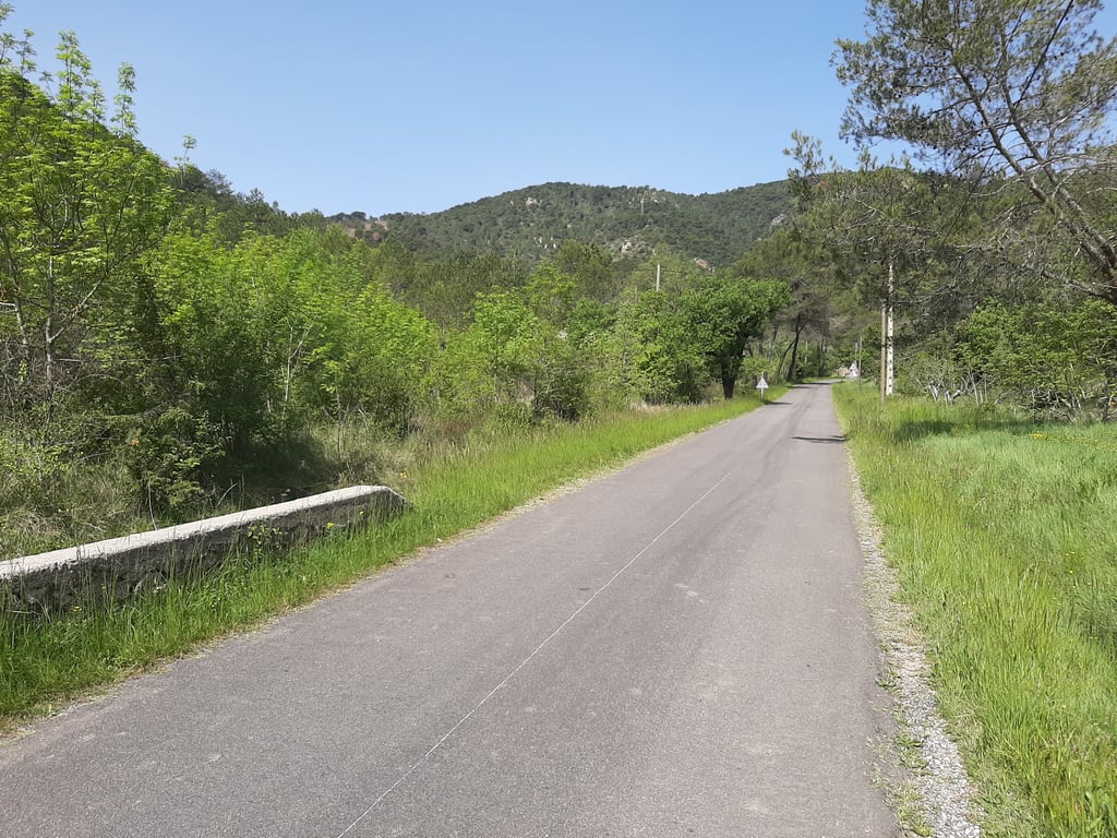
Col de Propiac from Propiac is a climb in the region Drôme. It is 2.6 km long and bridges 167 m of vertical ascent with an average gradient of 6.4%, resulting in a difficulty score of 112. The top of the ascent is located at 526 m above sea level. Climbfinder users shared 4 reviews of this climb and uploaded 6 photos.

Road name: D 147

This is an automatic translation, the original language is: French.
Don't look for the "Col de Propiac" sign because it hasn't been there for a while. Kilometre markers with percentage gradient... It's motivating... Or not 😂 the last 5 tight bends... Don't give up!... read more

Photos (6)

Col de Propiac from Propiac

Your uploads (max 4)

Welcome! Please activate your account if you would like to share something. Look for the verification email in your inbox.

If you want to upload your photos, you need to create an account. It only takes 1 minute and it's completely free.

  • Receive free climbfinder goodies for your reviews & photos.
  • Create a bucket list and check off conquered climbs.
  • Add missing climbs.
Continue with GoogleContinue with Google Continue with FacebookContinue with Facebook Continue with AppleContinue with Apple Sign up with email
By signing up you agree to our terms of service and confirm that you have read our privacy & content policy.

Reviews (4)

5.0
4.0
3.0
2.0
1.0
JY88
1 y 4.0
This is an automatic translation, the original language is: Dutch. Show original

The most beautiful of the several variants. Relative to Mt. Ventoux a sneeze, relative to say, the Netherlands, a serious climb. Above all, very beautiful and quiet. Would you descend it along this side, choose right at the bottom, the road leads along the river and past olive fields.

De mooiste van de verscheidene varianten. In verhouding tot de Mt. Ventoux een niemendalletje, in verhouding tot pakweg Nederland, een serieuze klim. Bovenal erg fraai en rustig. Zou je hem afdalen langs deze zijde, kies dan onderaan rechts, de weg voert langs de rivier en langs olijvenvelden.

Col de Propiac from Propiac
Dashboard
SansLesRoulettes84
1 y 4.0 via the Climbfinder app
This is an automatic translation, the original language is: French. Show original

Don't look for the "Col de Propiac" sign because it hasn't been there for a while. Kilometre markers with percentage gradient... It's motivating... Or not 😂 the last 5 tight bends... Don't give up!

Ne cherchez pas le panneau "Col de Propiac" parce que ça fait un bout de temps qu'elle n'est plus là. Bornes kilométriques avec le pourcentage de dénivelé... Ça motive... Ou pas 😂 les 5 derniers virages bien serrés... Ne rien lâcher!

Col de Propiac from Propiac
Dashboard
LucJansen
2 y 3.0 00:10:38 (14.6 km/h)
This is an automatic translation, the original language is: Dutch. Show original

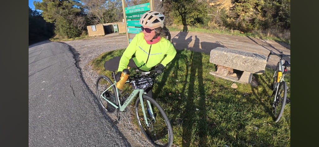
Climbed on 2 July 2021. Especially at the end of a good tour, this is a treacherous climb that takes energy (especially in summer). Nice hairpin turns and good views. Last bit with 8% a gut bite. Didn't see a real sign on the col, but managed to photograph the name Propiac anyway.

Beklommen op 2 juli 2021. Zeker aan het eind van een goede toertocht is dit een verradelijk klimmetje die energie kost (zeker in de zomer). Mooie haarspeldbochten en goed uitzicht. Laatste stukje met 8% een kuitenbijter. Op de col geen echt bord gezien, maar de naam Propiac toch kunnen fotograferen.

Col de Propiac from Propiac
Dashboard
LouisB
3 y 3.0
This is an automatic translation, the original language is: Dutch. Show original

The connection between Buis-les-Barronies and Vaison-la-Romaine along Propiac is a nice alternative.Short in both directions and sometimes snappy.

De verbinding tussen Buis-les-Baronies en Vaison-la-Romaine is langs Propiac een mooi alternatief.In beide richtingen kort en soms pittig.

Col de Propiac from Propiac
Dashboard

Climbing times

7 km/h 00:22:15
11 km/h 00:14:09
15 km/h 00:10:23
19 km/h 00:08:11

Road surface condition

50% 50% 0%
Based on 2 votes
Share your knowledge. What was the road condition during your ascent?

Traffic

50% 50% 0%
Based on 2 votes
Your experience counts. How much traffic did you encounter during the climb?

Frequently Asked Questions

Col de Propiac can be cycled from 3 sides. Col de Propiac from Propiac is the most popular side, but the summit can also be reached via Col de Propiac from Faucon via Mérindol les Oliviers & Col de Propiac via Aiguillon.

You don't need special gearing for Col de Propiac from Propiac. The slope isn't long or steep enough to require much shifting down. You can conquer this climb on power alone. However, a compact gearing system with a smallest front chainring of 34 and largest rear sprocket of 28 or 30 is always nice if you enjoy cycling uphill. This helps maintain a smooth cadence.

Col de Propiac from Propiac is a 4th-category climb. A sprint to the top is usually not an option, and untrained riders will definitely feel it in their legs. For trained cyclists, it is a great training climb.

Col de Propiac from Propiac is 2.6 km long.

The average gradient of Col de Propiac from Propiac is 6.4%.

Col de Propiac from Propiac has a steepest segment with an average gradient of 9%.

The summit of Col de Propiac from Propiac is at 526 m.

At a slow pace of 7 km/h, it takes about 00:22:15 to climb Col de Propiac from Propiac. At 11 km/h the time is 00:14:09, and at 15 km/h 00:10:23. For the fastest cyclists, 00:08:11 is an achievable time.

Col de Propiac from Propiac is located in the region Drôme in France.

This page is better in the app

Climbfinder app
Climbfinder
(Free)
Open