Tips nearby


Col de Morbieux from Ramonchamp is a climb in the region Vosges. It is 5.4 km long and bridges 330 m of vertical ascent with an average gradient of 6.1%, resulting in a difficulty score of 266. The top of the ascent is located at 793 m above sea level. Climbfinder users shared 5 reviews of this climb and uploaded 15 photos.
Road name: Route de Morbieux
5.0 by EjprinsThis is an automatic translation, the original language is: Dutch.Very nice climb in the beginning you think I'm right here up and down but once you get to the forest part you know you're right. Just a few km through and you're up. Do not underestimate this is the steep side of the morbieux. The street name is called rue de morbieux. But a small gem!... read more

Welcome! Please activate your account if you would like to share something. Look for the verification email in your inbox.
If you want to upload your photos, you need to create an account. It only takes 1 minute and it's completely free.
 Continue with Google
 Continue with Facebook
 Continue with Apple
Sign up with email
Continue with Apple
Sign up with email
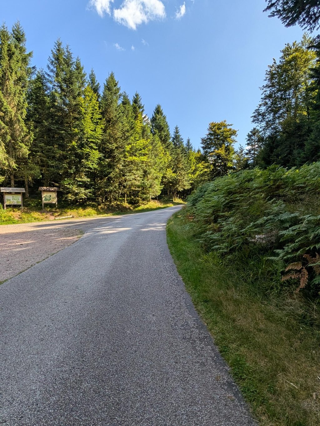
The road surface is good, with very little traffic. It’s a narrow road, mostly through the woods, particularly the second and steepest section. It starts off very pleasantly, but after 2.5 km, you’ll be flirting with the 10 per cent gradient for about 2 km, with short peaks of up to 14 per cent. The climb was surprisingly tougher than expected but certainly manageable for someone with a bit of a fitness base. The descent to Saulxures-sur-Moselotte was entirely through the woods. It’s a narrow road that starts and ends with decent road surface quality, but after picking up some speed at the start, you suddenly find yourself on much rougher tarmac, so you need to be careful.
Ok wegdek met bijzonder weinig verkeer. Smalle weg, grotendeels in het bos, zeker het 2e en steilste deel. Begint heel aangenaam, maar na 2,5 km flirt je een 2-tal km met de 10%-grens met korte pieken tot 14%. Klim was verassend zwaarder dan gedacht maar zeker te doen voor iemand met wat basis. De afdaling naar Saulxures-sur-Moselotte lag volledig in het bos. Smalle weg die begint en eindigt met degelijke wegkwaliteit maar na wat snelheid te winnen in het begin kom je opeens in veel ruigere asfalt terecht terecht, dus oplettendheid geboden.
Good to ride with a racing bike. The road surface is quite OK, despite what was written in a review below. Little traffic. Quirky gradient. Well, I did it once along the other side and wasn't sold then. Now I am, nice climb on the edge of the 'secret Vosges' and the 'high Vosges'.
Goed te berijden met een koersfiets. Het wegdek is best OK, ondanks wat hier onder in een review geschreven is. Weinig verkeer. Grillig verloop. Tja, ik heb hem eens langs de andere kant gedaan en toen was ik niet verkocht. Nu wel, mooie klim op de rand van de 'geheime Vogezen' en de 'hoge Vogezen'.
Nice walk up from Le Thillot..very quiet..good view up to the Auberge de Morbieux..more difficult up to the pass..no special view at the pass..sustained effort for experienced walkers given the profile.
Belle montée pédestre depuis Le Thillot..très calme.. belle vue jusqu'à l'auberge de Morbieux..plus difficile jusqu'au col pas de vue particulière au col..effort soutenu pour marcheur confirmé vu le profil
Very nice climb in the beginning you think I'm right here up and down but once you get to the forest part you know you're right. Just a few km through and you're up. Do not underestimate this is the steep side of the morbieux. The street name is called rue de morbieux. But a small gem!
Heel mooie klim in het begin denk je zit ik hier wel goed op en neer maar zodra je in het bos gedeelte komt weet je dat je goed zit. Even een paar km doorbijten en je bent boven. Onderschat het niet dit is de steile kant van de morbieux. De straatnaam heet trouwens rue de morbieux. Maar wel een klein pareltje!
| 7 km/h | 00:46:24 |
| 11 km/h | 00:29:32 |
| 15 km/h | 00:21:39 |
| 19 km/h | 00:17:05 |
This page is better in the app