View on map
© MapLibre | OpenStreetMap contributors
1%
2%
4%
6%
8%
10%
12%
15%
20%

Col de Moissière from Chorges

4.0
2 reviews | Elevation profile | 2 photos
Tips nearby
Col de Moissière from Chorges
transparant thumb
transparant thumb
transparant thumb
transparant thumb
transparant thumb
transparant thumb
Your achievable time
Calculating based on your best performances...
Relaxed
Maximum
W/kg
W/kg
W/kg
Analyse your climbing performance
Detailed insight into your climbing performance & automatically check off climbs
Based on your best performances.
Your best attempt:
Number of attempts:
Elevation profile Col de Moissière from Chorges

Statistics

Difficulty points 608
Length 12.4 km
Average gradient 6.1%
Steepest 100 metres 12.8%
Total ascent 754 m
Feedback about this climb?
Show climbs nearby Export to GPS device

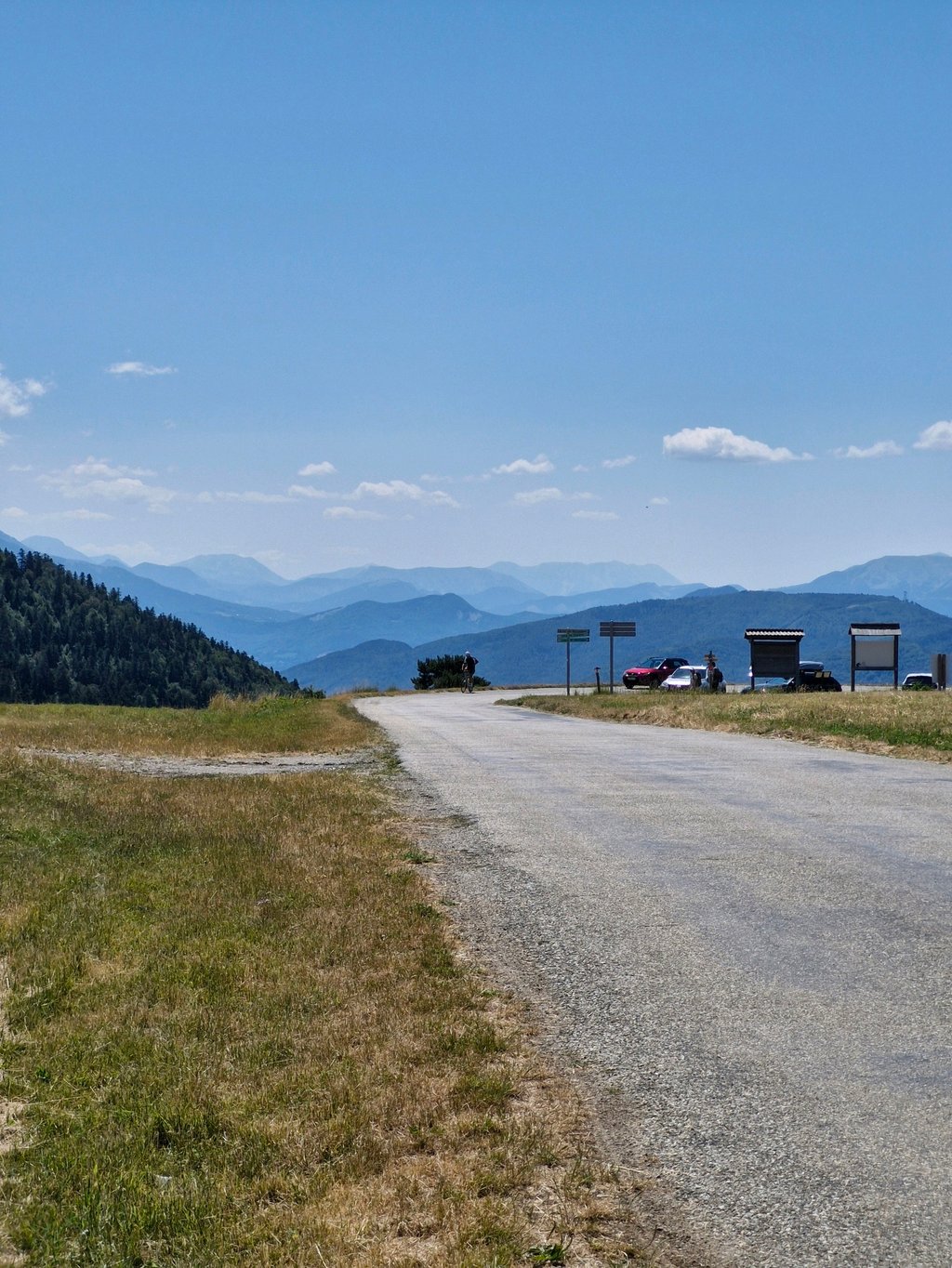
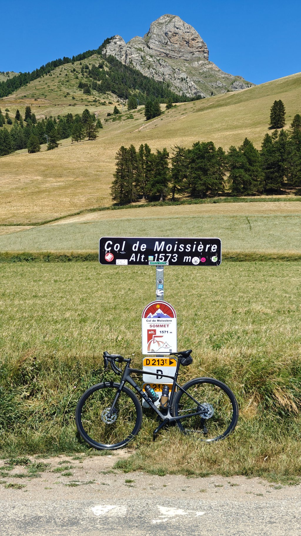
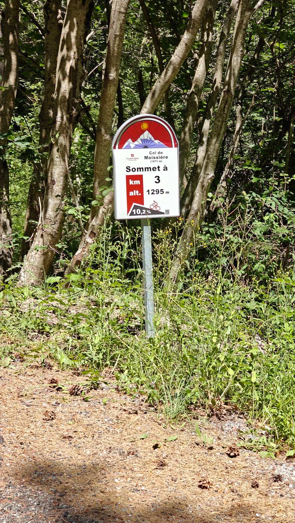
Col de Moissière from Chorges is a climb in the region Serre Ponçon. It is 12.4 km long and bridges 754 m of vertical ascent with an average gradient of 6.1%, resulting in a difficulty score of 608. The top of the ascent is located at 1573 m above sea level. Climbfinder users shared 2 reviews of this climb and uploaded 2 photos.

Road names: Rue du Pré de Lobre & Route du Sapet

This is an automatic translation, the original language is: French.
Nice effort , first regular climb with. A 4km block at 7.5% followed by 2km of steep, uneven sections at around 10.5% .... read more

Photos (2)

Col de Moissière from Chorges
transparant thumb
transparant thumb
transparant thumb
transparant thumb

Your uploads (max 4)

Welcome! Please activate your account if you would like to share something. Look for the verification email in your inbox.

If you want to upload your photos, you need to create an account. It only takes 1 minute and it's completely free.

  • Receive free climbfinder goodies for your reviews & photos.
  • Create a bucket list and check off conquered climbs.
  • Add missing climbs.
Continue with GoogleContinue with Google Continue with FacebookContinue with Facebook Continue with AppleContinue with Apple Sign up with email
By signing up you agree to our terms of service and confirm that you have read our privacy & content policy.

Reviews (2)

5.0
4.0
3.0
2.0
1.0
GuillaumeP37
9 Mo 4.0 via the Climbfinder app
This is an automatic translation, the original language is: French. Show original

Nice effort , first regular climb with. A 4km block at 7.5% followed by 2km of steep, uneven sections at around 10.5% .

Bel effort , montée d abord régulière avec. Un bloc de 4km a 7,5% qui enchaîne avec 2 km raide est irrégulier vers 10,5% .en descente la qualité du revêtement est un peu pénible

Dashboard
WimP19
10 Mo 4.0 via the Climbfinder app
This is an automatic translation, the original language is: Dutch. Show original

Nice climb, but not to be underestimated. There are some tough sections in the forest

Mooie klim, maar niet te onderschatten. In het bos zijn enkele zware stukken

Dashboard

Climbing times

7 km/h 01:46:10
11 km/h 01:07:33
15 km/h 00:49:32
19 km/h 00:39:07

Road surface condition

100% 0% 0%
Based on 1 vote
Share your knowledge. What was the road condition during your ascent?

Traffic

0% 100% 0%
Based on 1 vote
Your experience counts. How much traffic did you encounter during the climb?

Frequently Asked Questions

Col de Moissière can be cycled from 4 sides. Col de Moissière from La Bâtie Neuve is the most popular side, but the summit can also be reached via Col de Moissière from Forest Saint Julien, Col de Moissière from Ancelle & Col de Moissière from Chorges.

Col de Moissière from Chorges is a challenging ascent. For this type of climbing, we recommend mountain gearing, specifically a compact system. This means a small front chainring of 34 teeth, combined with a rear cassette where, depending on your level, strength, and experience, you choose a sprocket with 30, 32, or even 34 teeth. Remember that a smooth cadence is always more efficient!

Col de Moissière from Chorges is a first-category climb: long and tough. Do not underestimate this climb. Many famous Tour de France cols fall into this category. Prepare for a long, challenging ride. Only well-trained riders will reach the top smoothly. Make sure you have a road bike with climbing gears and enough training; otherwise, it will be a struggle.

Col de Moissière from Chorges is 12.4 km long.

The average gradient of Col de Moissière from Chorges is 6.1%.

Col de Moissière from Chorges has a steepest segment with an average gradient of 12.8%.

The summit of Col de Moissière from Chorges is at 1573 m.

At a slow pace of 7 km/h, it takes about 01:46:10 to climb Col de Moissière from Chorges. At 11 km/h the time is 01:07:33, and at 15 km/h 00:49:32. For the fastest cyclists, 00:39:07 is an achievable time.

Col de Moissière from Chorges is located in the region Hautes Alpes in France.

This page is better in the app

Climbfinder app
Climbfinder
(Free)
Open