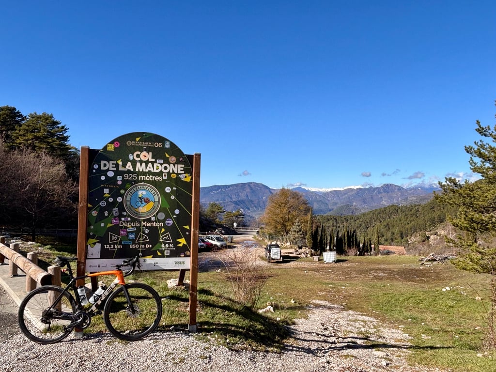
1 y 5.0 01:33:07 (9.3 km/h)
This is an automatic translation, the original language is: Dutch.
Show original
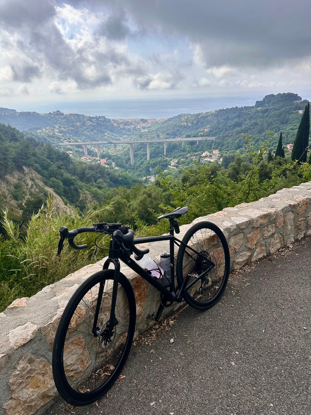
Wonderful climb. I started at the car park in front of the Hotel Riva in Menton, right by the sea, and from there rode up the Corniche des Serres de la Madone, so not quite the route I tick here, but still climbed 936 m at an average of 7.2%.
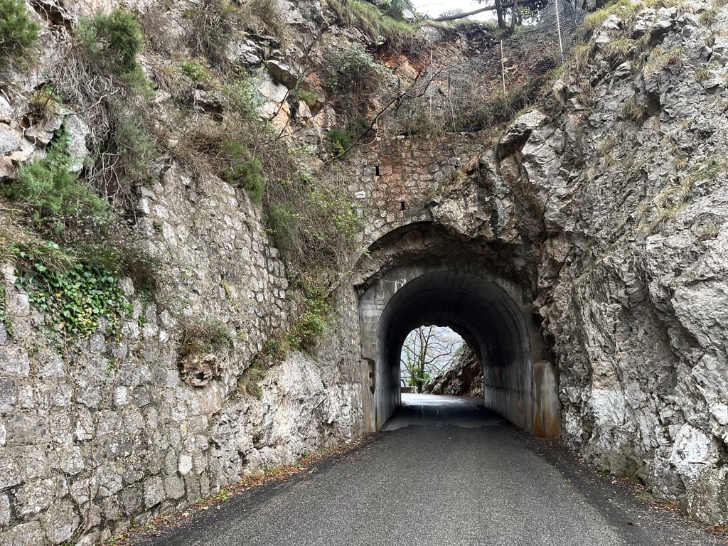
The advantage of this route is that you are immediately out of town and can start climbing through a quiet residential area. After about three kilometres you pass under the A8 viaduct, which reminded me very much of the Ponte Morandi near Genoa that collapsed in 2018, but this one fortunately stayed put. There the city ends and the climbing and scrambling begins.
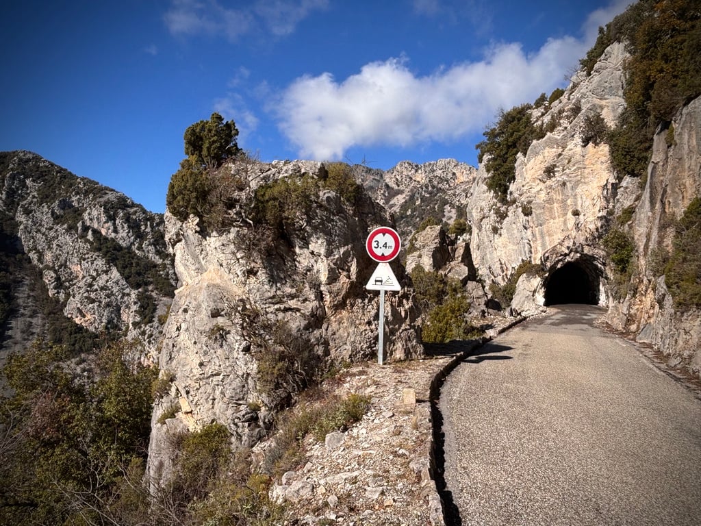
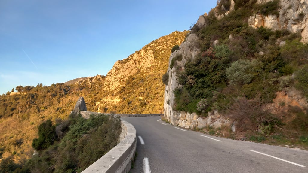
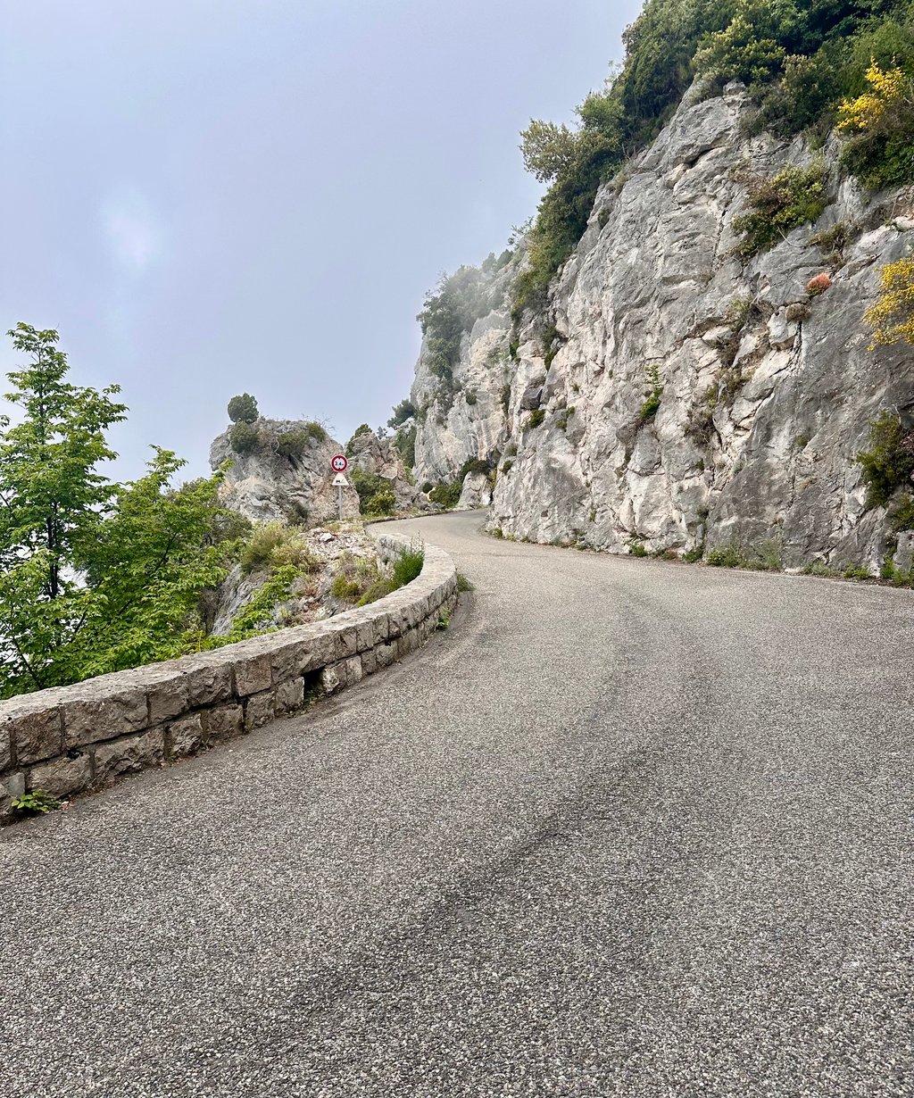
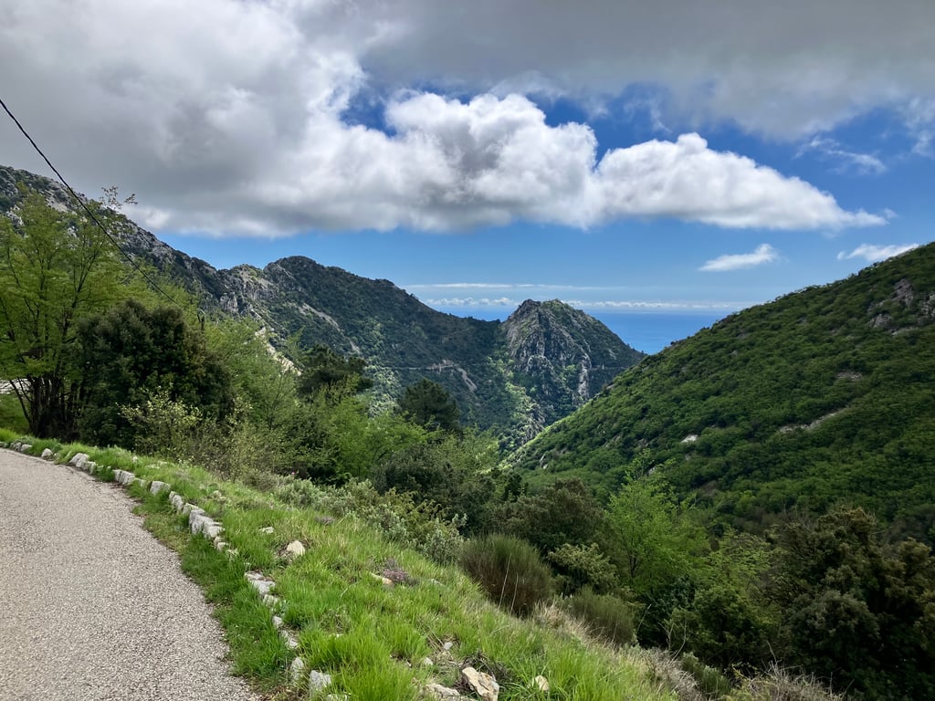
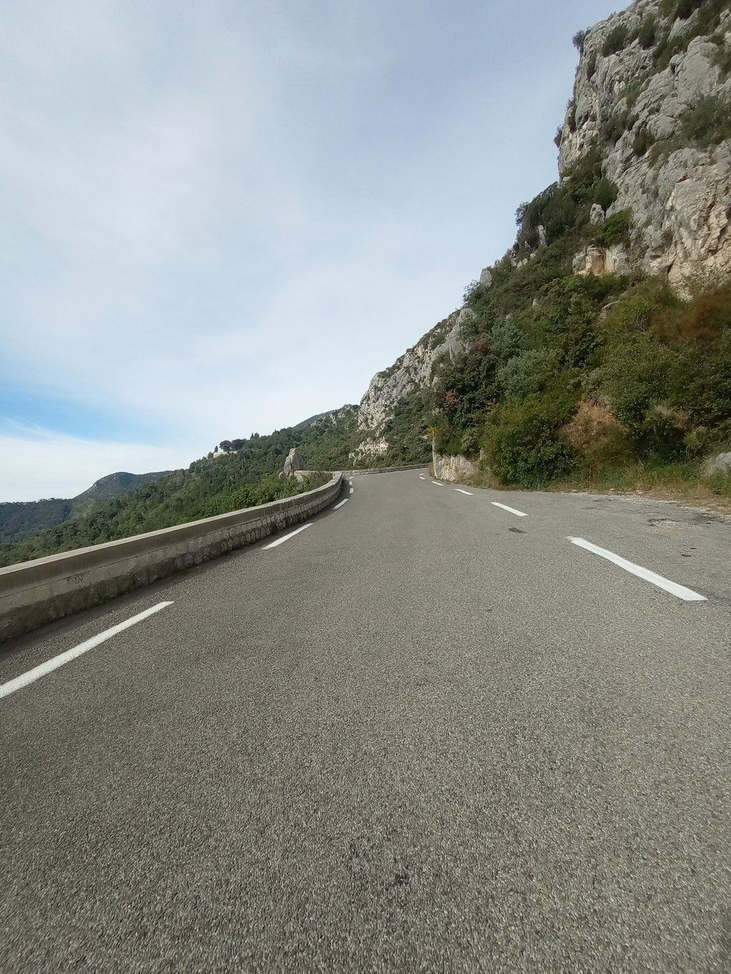
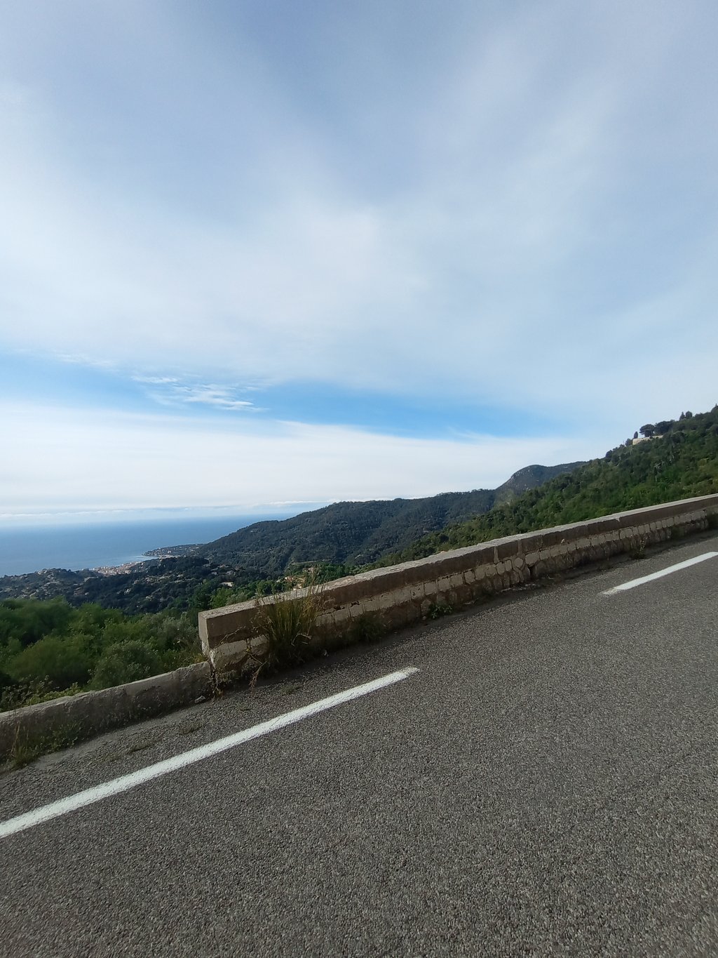
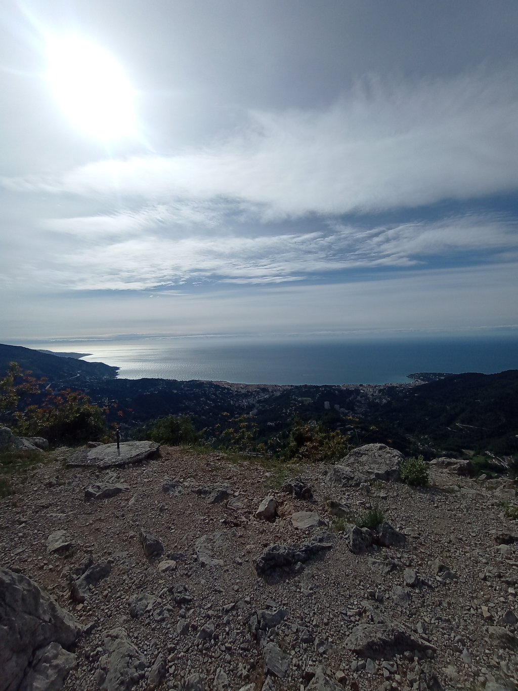
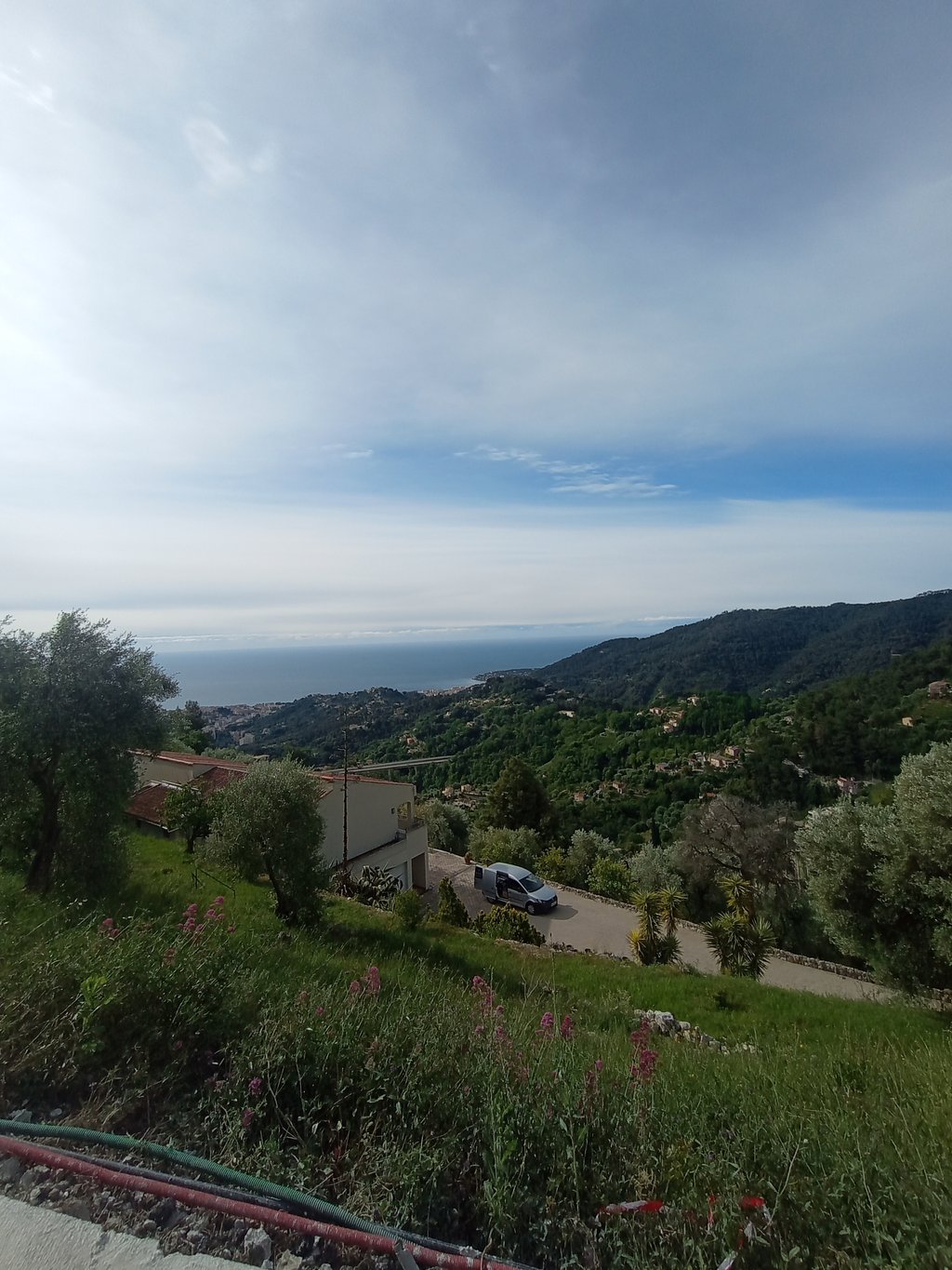
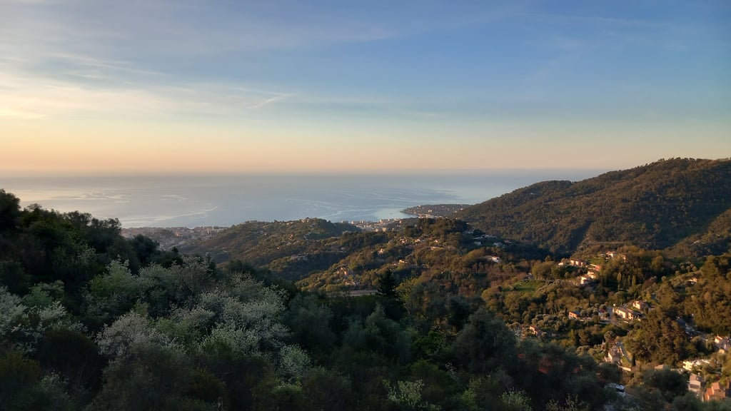
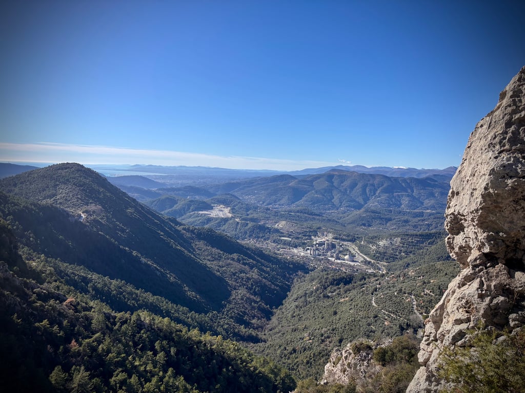
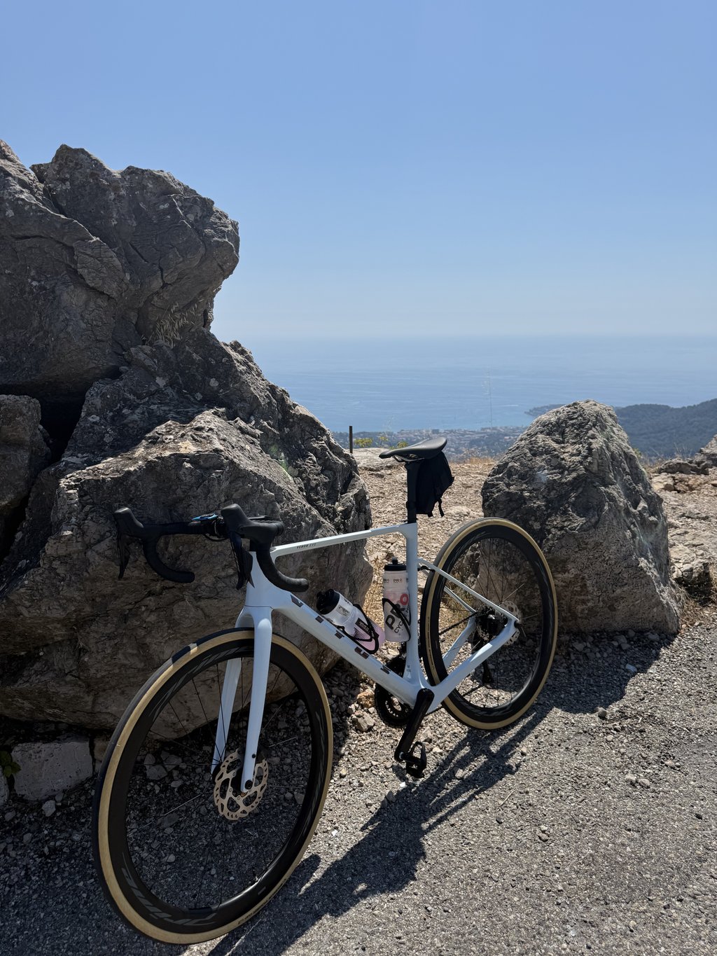
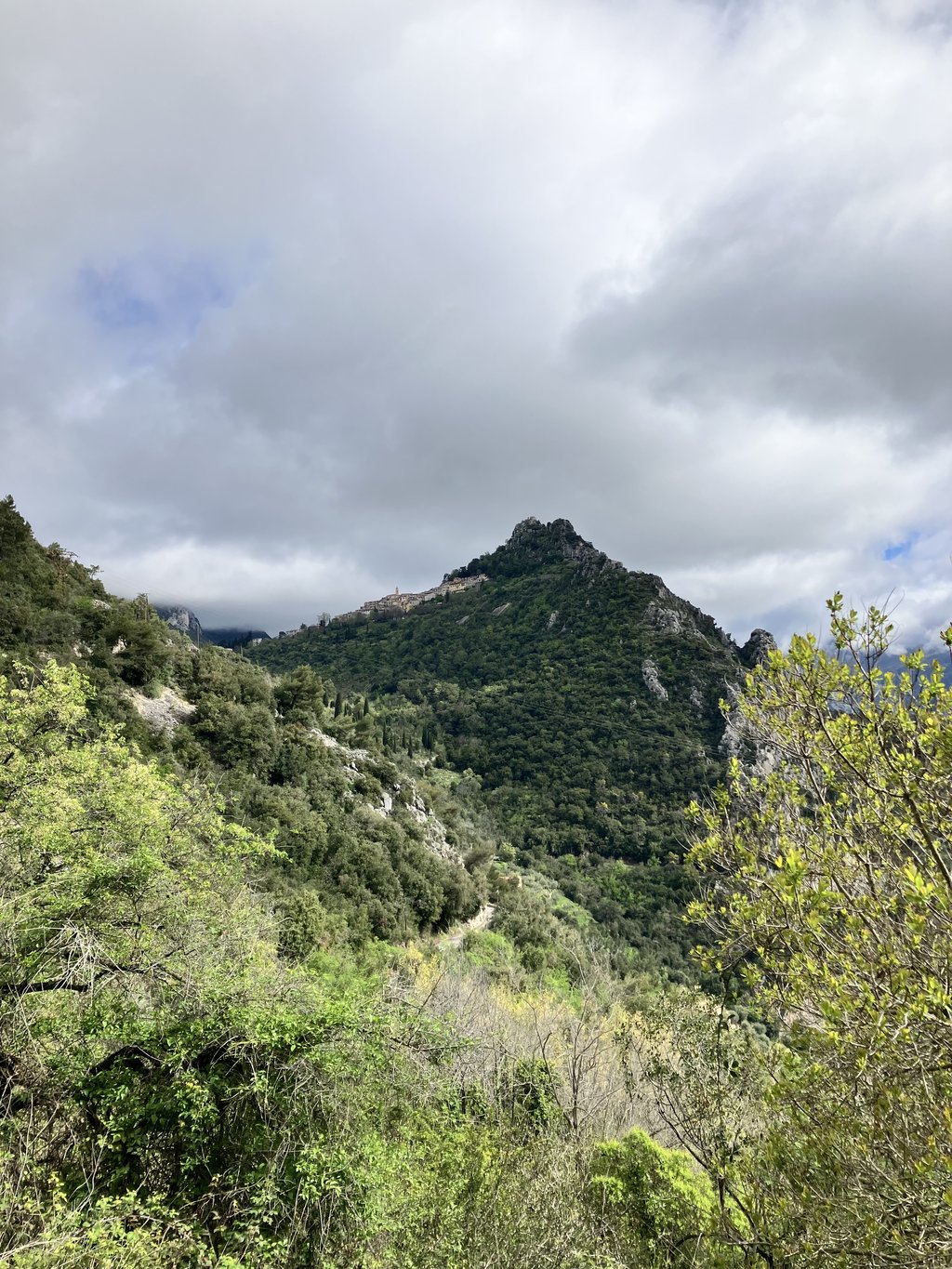
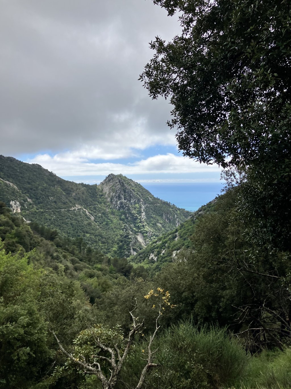
At one point you look out on Sainte-Agnès, which is gracefully plastered there against a mountain peak. Before the village, you then turn left and can suddenly see the sea in the depths, as you are already at 600 metres. After that, spin around between the mountains with occasional (spectacular) views of the sea and occasional glances up, to see when that pass will finally come into sight.
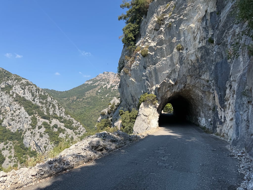
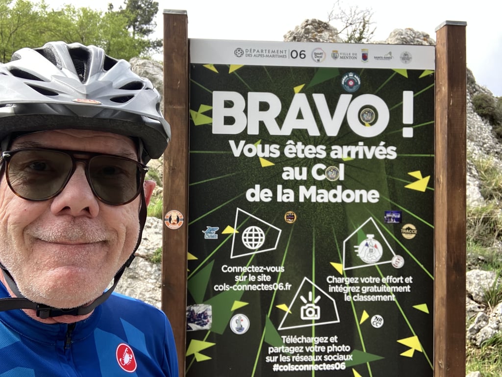
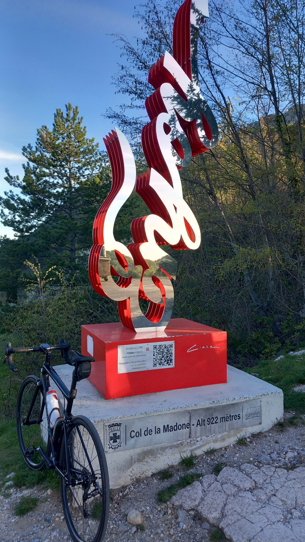
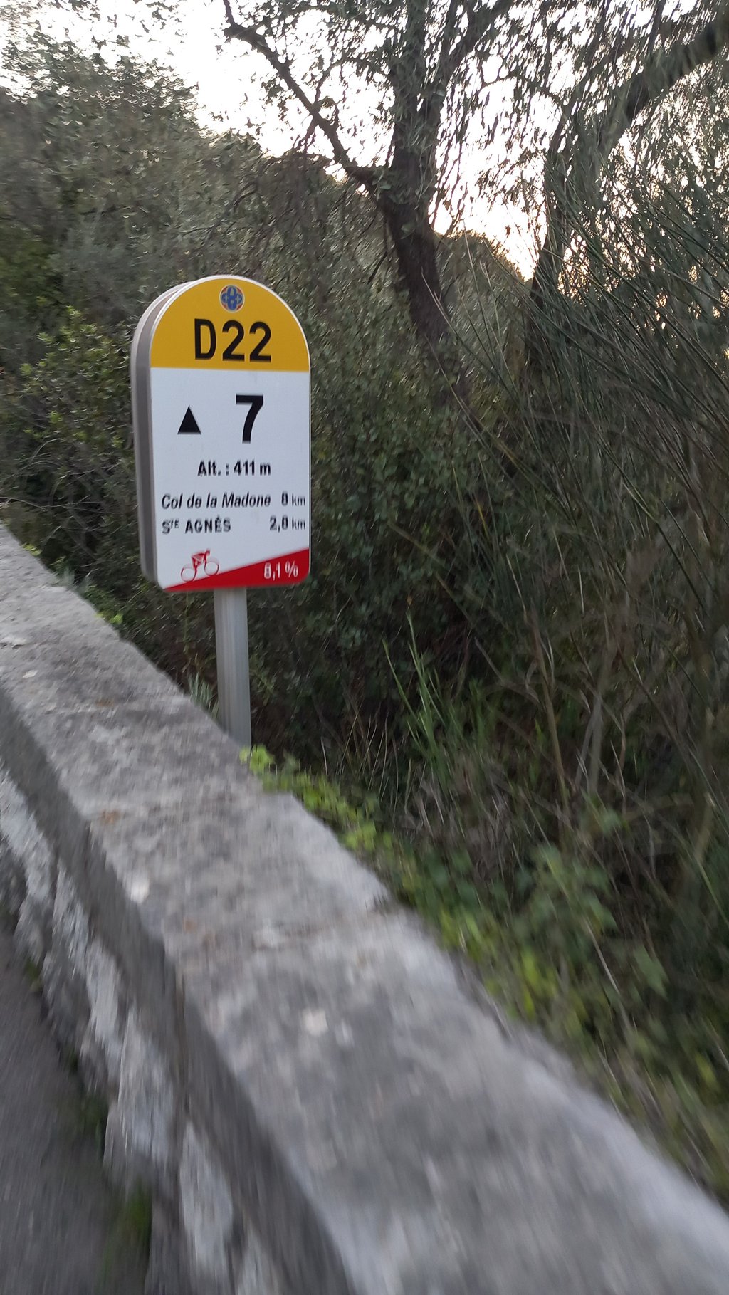
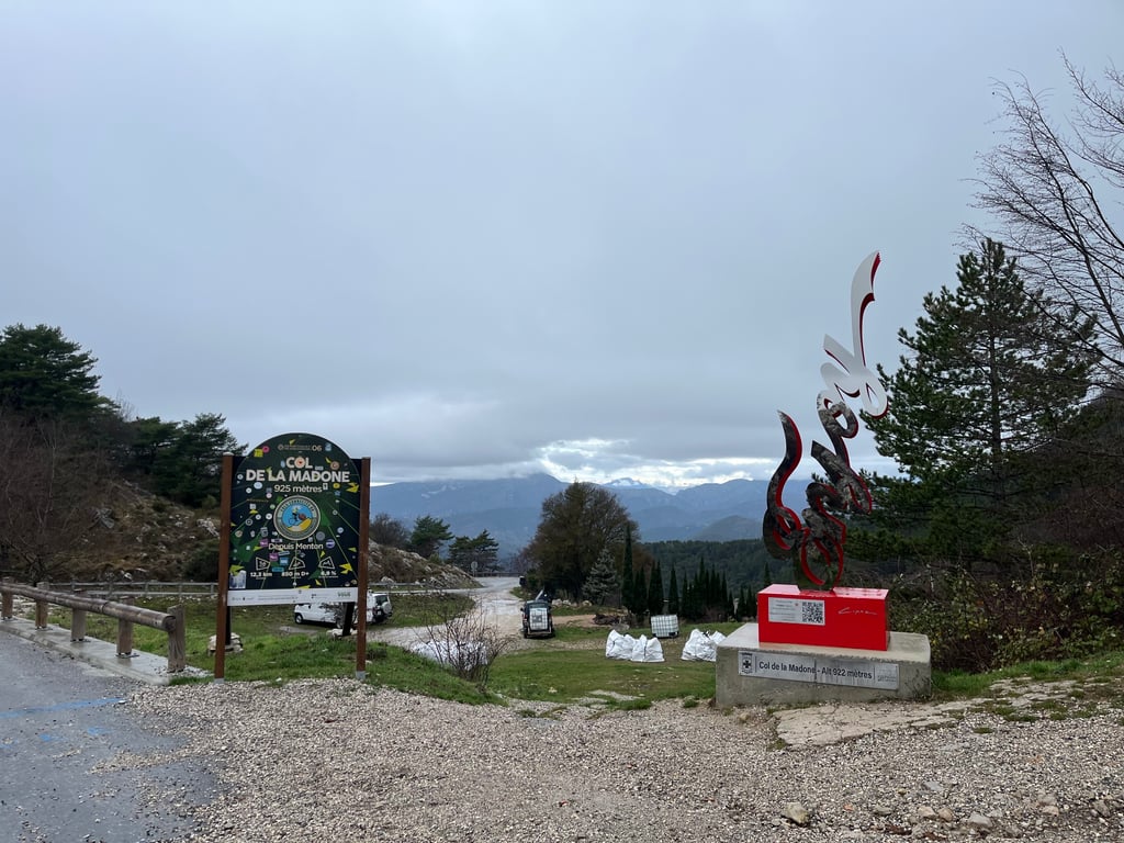
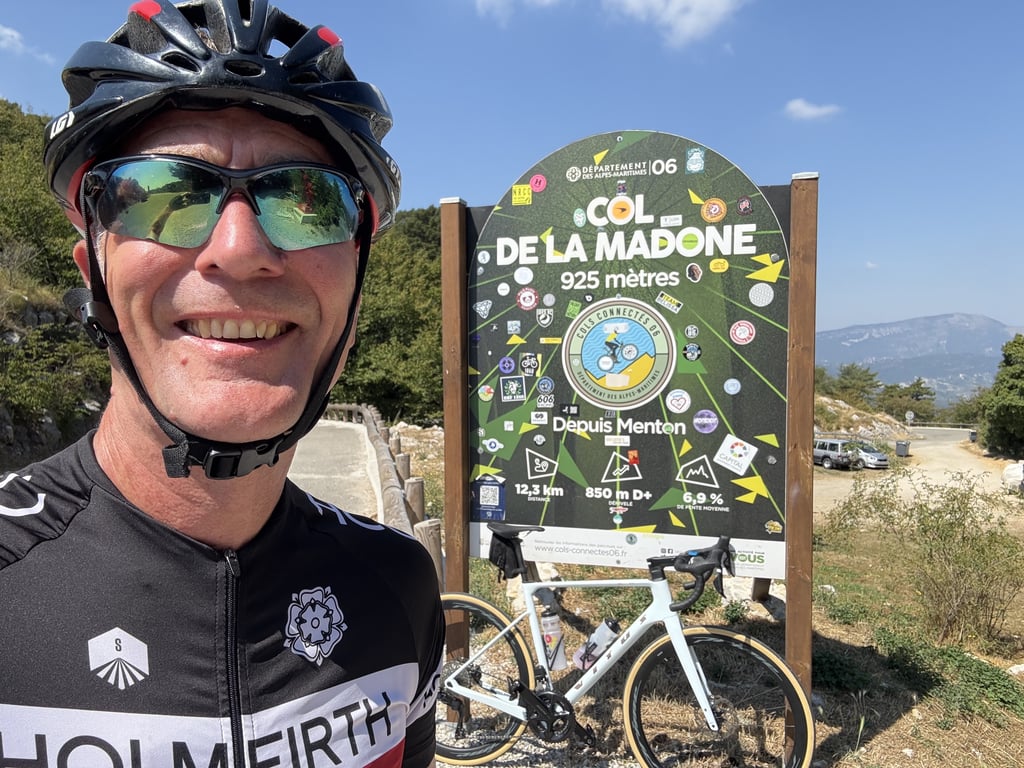
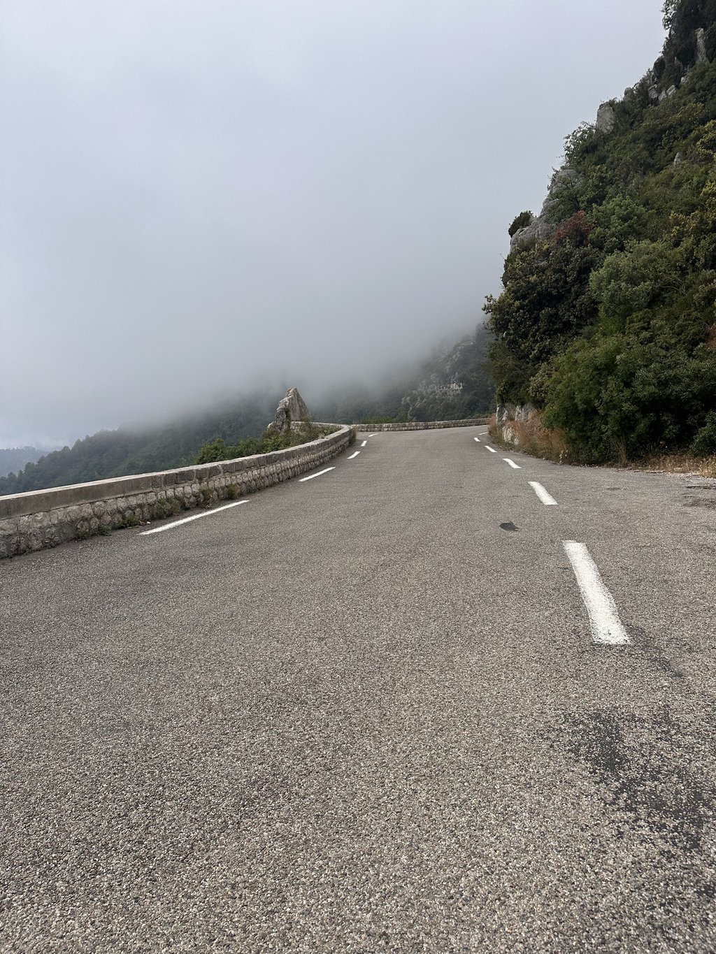
The gradients between the viaduct and Sainte-Agnès are between 7 and 8%, but a couple of kilometres below the col you drive a kilometre or two below 3%, which is not bad at all. By the way, there is a sign every kilometre with the average gradient until the next one. And at some point you're there!
All in all, a hefty climb, but doable if you are not in a hurry (I was overtaken by all but one other cyclist). In the week before Easter it is quiet there, around noon I did see more and more cyclists, but this is also a popular climb. The road surface is fine.
In the section, don't forget to get off now and then to look out over Menton and the sea, because it is very beautiful. And you also immediately understand why it is called Côte d'Azure here, as the sea is very blue.
Prachtklim. Ik ben begonnen op de parkeerplaats voor hotel Riva in Menton, pal aan zee, en vandaar de Corniche des Serres de la Madone opgereden, dus niet helemaal de route die ik hier aankruis, maar toch 936 m geklommen tegen gemiddeld 7,2%.
Het voordeel van deze route is dat je meteen de stad uit bent en kunt gaan klimmen door een rustige woonbuurt. Na een kilometer of drie kom je onder het A8-viaduct door, dat me erg deed denken aan de Ponte Morandi bij Genua die in 2018 is ingestort, maar deze bleef gelukkig staan. Daar houd de stad op en begint het geklim en geslinger.
Op een gegeven moment kijk je uit op Sainte-Agnès, dat daar sierlijk tegen een bergtop is aangeplakt. Vóór het dorp ga je dan naar links en kun je ineens de zee in de diepte zien liggen, want je zit dan al op 600 meter. Daarna draai wat tussen de bergen rond met af en toe een (spectaculaire) blik op zee en af en toe een blik omhoog, om te kijken wanneer die pas nou eindelijk eens in zicht komt.
De hellingspercentages tussen het viaduct en Sainte-Agnès liggen tussen de 7 en 8%, maar een paar kilometer onder de col rijd je een of twee keer een kilometer onder de 3%, wat helemaal niet erg is. Er staat trouwens om de kilometer een bord met het gemiddelde stijgingspercentage tot het volgende. En op een gegeven moment ben je er dan!
Al met al een flinke klim, maar goed te doen als je geen haast hebt (ik werd door alle andere fietsers, op één na, ingehaald). In de week voor Pasen is het er rustig, rond de middag zag ik wel steeds meer fieters, maar dit is ook een populaire klim. Het wegdek is prima.
Vergeet in de afdeling niet af en toe af te stappen om over Menton en de zee uit te kijken, want het is er heel erg mooi. En je snapt ook meteen waarom het hier Côte d'Azure heet, want de zee is erg blauw.