Tips nearby


| Beautiful scenery |
| 40 hairpin turns |
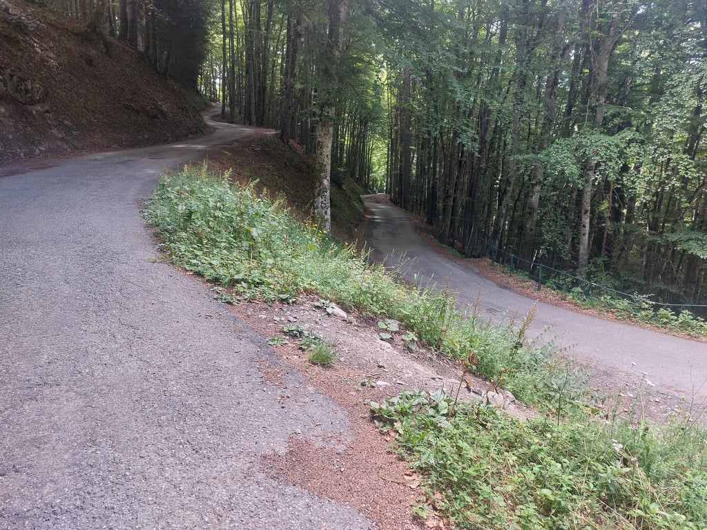
| Bad road |
| #75 toughest climb of Auvergne-Rhône-Alpes |
| #92 most elevation gain of Auvergne-Rhône-Alpes |
| #86 longest climb of Savoie |
| #54 average steepest climb of Annecy |
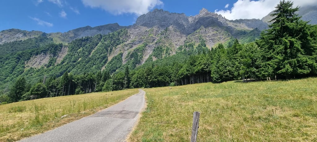
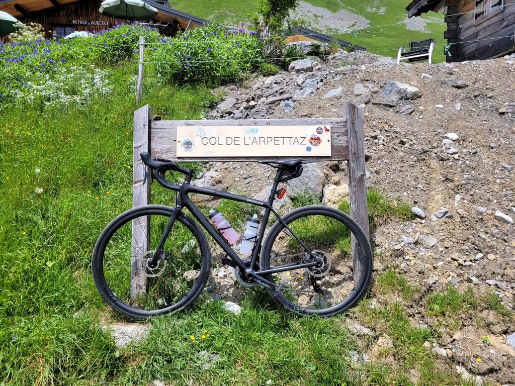
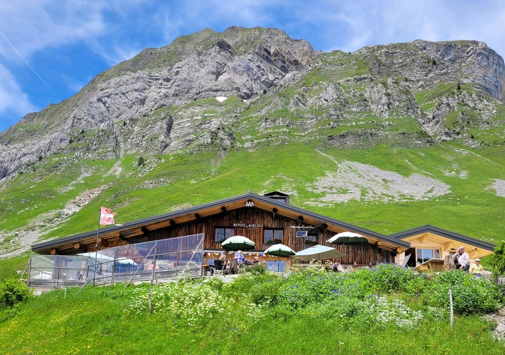
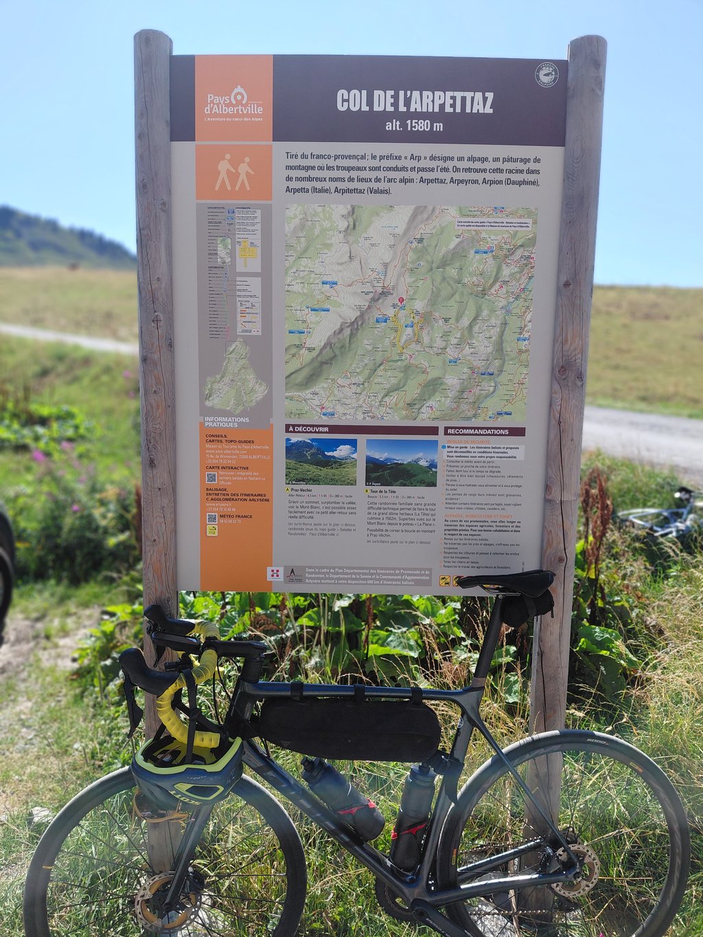
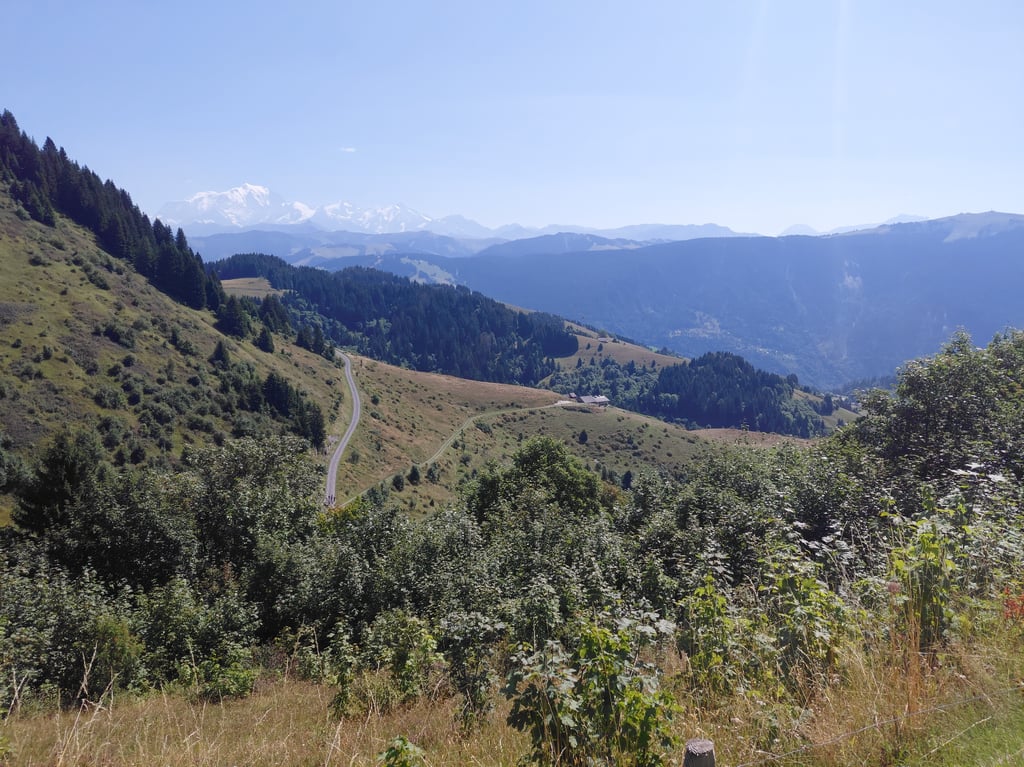
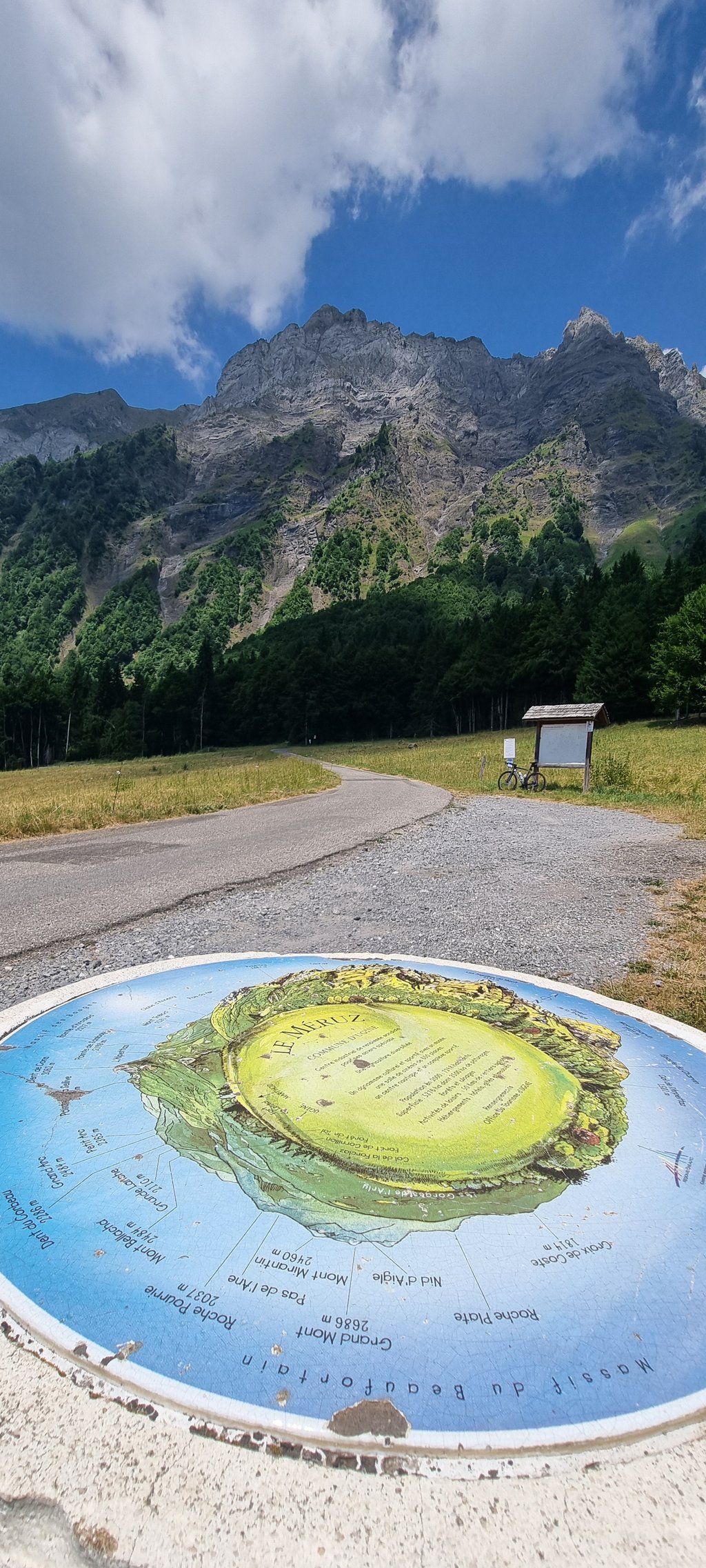
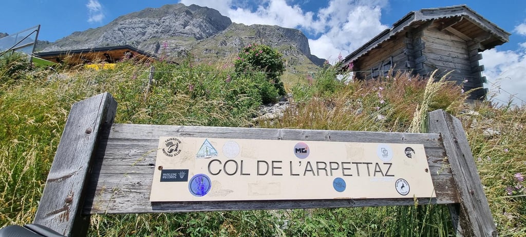
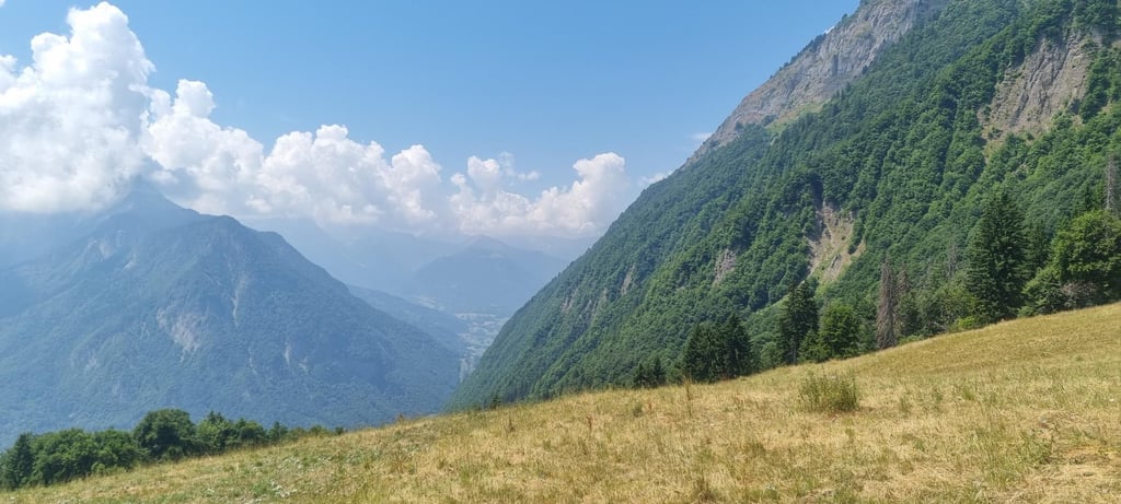
Col de l'Arpettaz from La Foliette is a climb in the region Annecy. It is 15 km long and bridges 1159 m of vertical ascent with an average gradient of 7.7%, resulting in a difficulty score of 985. The top of the ascent is located at 1582 m above sea level. Climbfinder users shared 8 reviews of this climb and uploaded 12 photos.
Road name: Route des Montagnes
5.0 by Epsilonn29This is an automatic translation, the original language is: French.I'd wanted to do this climb for a long time, I was able to do it on 01/06/2024 and it's without a doubt one of my favourite climbs. No traffic (I passed no more than 2 cars on the road), the state of the road is a little damaged in places but it passes without a problem on a road bike, the first two thirds of the climb are in the forest, sometimes you have a view over the valley, then the last third of the climb is in the mountain pastures, it's really very pretty. Don't be f... read more
Welcome! Please activate your account if you would like to share something. Look for the verification email in your inbox.
If you want to upload your photos, you need to create an account. It only takes 1 minute and it's completely free.
A truly spectacular climb through forest and alpine pastures. The state of the road leaves something to be desired, so it's better to go down the other side where it's a little less bad. You'll be alone on this very quiet road, with magnificent scenery at the top. A must-do, much more beautiful than the better-known passes of
Vraiment une montée spectaculaire à travers la forêt et les alpages. L’état de la route laisse à désirer, il vaut mieux descendre de l’autre côté où c’est un peu moins pire. Vous serez seul sur cette route très calme avec des paysages magnifiques au sommet. À faire absolument, beaucoup plus beau que les cols plus connus de la région.
Nice climb and as mentioned in the other comments, the road isn't great but it's ok. The great thing is that there are hardly any cars on the whole climb. The part in the forest is really good, especially in the heat. The graph is misleading because it's not really regular and strava tells me 8.1 rather than 7.7.
Belle montée et commem dit dans les autres commentaires la route est pas top mais plutôt ok. Le point hyper positif c'est qu’il n’y a presque pas de voiture sur toute la montée. La partie dans la forêt fait beaucoup de bien surtout par fortes chaleur. Le graphique est trompeur car pas vraiment régulier et strava m’indique plutôt 8,1 que 7,7
Nice solid climb. Wasn't a top road surface but in the climb super manageable. Descent also nice. Didn't see gravel oid anywhere.
Mooie stevige klim. Was geen top wegdek maar in de klim supergoed te doen. Afdaling is ook mooi. Nergens gravel oid gezien.
on the plus site, there are barely any cars or motorcycles on this climb...
on the downside, the road is in terrible condition, lots of patchwork, cracks in the roads, fine gravel at many places. So you've to be careful in the descent.
countless hairpins,.. and fortunately many sections are in the shade , still when riding this in during a heatwave..it's still brutal.
35 hairpins, and yes 35, better than l'alpe d'huez
A climb that had to be done with fairly wide tyres because the road was in poor condition, especially for the descent. But on the other hand, not a single car passed me on the whole climb, a real treat.
You need to be in good condition before tackling this section, you won't have a single respite before the summit with percentages well in excess of 8-10%.
35 épingles et oui 35, mieux que l'alpe d'huez
Une montée à faire avec des pneus assez large car une route en mauvaise état, surtout pour la descente. Mais en contre partie pas une seule voiture de croisée sur toute ma montée, un régal.
Il faut avoir une bonne condition avant de s'attaquer à ce morceau, vous n'aurez pas un seul répit avant le somment avec des pourcentage dépassant largement le 8-10%.
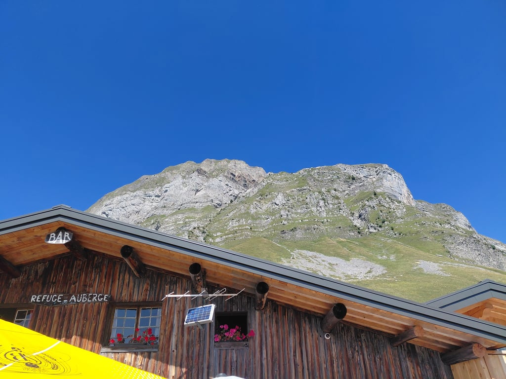
A really tough climb, especially if you do it under a leaden heat, as I did today. The first 5 km there is also no shade at all, the last 3 km again... The road is doable but often a patchwork of small repairs. The climb is particularly irregular with sections up to 15% at times. The graph is therefore very misleading. I must have missed that 3rd kilometre of low gradient, e.g. Now and then you get a view of the valley you come from and then you are amazed at the difference in altitude you can visually determine. That gives courage! And after long pulling and tugging you reach the top where you get a really fantastic panorama (with a view of Mont Blanc) and you can quench your thirst in the Refuge!
Een echt zware klim, zeker als je hem doet onder een loden hitte, zoals ik vandaag deed. De eerste 5 km is er ook helemaal geen schaduw, de laatste 3 km opnieuw niet... De weg is doenbaar maar wel dikwijls een lappendeken van kleine herstellingen. De klim is bijzonder onregelmatig met soms stukken tot 15%. De grafiek is daarom erg misleidend. Die 3de kilometer aan laag stijgingspercentage moet ik bvb blijkbaar gemist hebben. Af en toe krijg je zicht op het dal waar je vandaan komt en dan sta je versteld over het hoogteverschil dat je visueel kan vaststellen. Dat geeft moed! En na lang trekken en sleuren bereik je de top waar je een werkelijk fantastisch panorama krijgt (met zicht op de Mont Blanc) en je in de Refuge je dorst kan lessen !
I'd wanted to do this climb for a long time, I was able to do it on 01/06/2024 and it's without a doubt one of my favourite climbs. No traffic (I passed no more than 2 cars on the road), the state of the road is a little damaged in places but it passes without a problem on a road bike, the first two thirds of the climb are in the forest, sometimes you have a view over the valley, then the last third of the climb is in the mountain pastures, it's really very pretty. Don't be fooled by the profile of the slope, which indicates a strong and regular percentage, because there are certain moments when the road becomes a rollercoaster with occasional small bumps of 10-15m to 15%. I advise you if you want to do the Col de l'Arpettaz to climb up this side and then descend on the south side as the slope is less steep and the road is in better condition.
Je souhaitais faire cette montée depuis longtemps, j'ai put y aller le 01/06/2024 et c'est sans trop de doute que cette montés rentre dans mes ascension favorite. Aucune circulation (j'ai croisé 2 voitures sur la route au maximum), l'état de la route est à certains endroit un peu endommagés mais ca passe sans problème en vélo de route, les deux premiers tiers de la montés se font dans la foret, on a parfois la vue sur la vallée, puis le dernier tiers de l'ascension se fait dans des alpages, c'est vraiment très jolie. Ne pas se faire avoir par le profil de la pente qui indique un pourcentage fort et régulier car, il y a certains moments où la route fait les montagnes russe avec parfois des petites bosses de 10-15m à 15%. Je vous conseille si vous souhaiter faire le Col de l'Arpettaz de monter par ce coté puis de descendre du coté Sud car la pente est moins raide et la route en meilleure état.
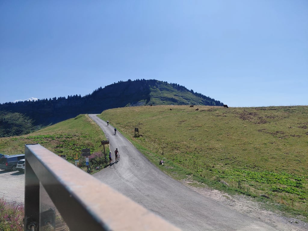
Very nice climb on quiet road where you are only accompanied by cows. You meander from corner to corner up a steep road that constantly stays above 8%. At some stretches you cycle briefly at 7% which feels like recovering but the inside bends can easily get above 10%. Asphalt leaves much to be desired and this side is not recommended for descending. For the descent, I recommend the route via Hauteville where the tarmac is significantly better. The road is still easily accessible by bike, though. The view at the top over the nearby area is more than worth it. This climb is really worthwhile when in the area.
Zeer mooie klim over rustige weg waar je alleen door de koeien vergezelt wordt. Je slingert van bocht naar bocht naar boven op een steile weg die constant boven de 8% blijft. Bij sommige stukken fiets je even op 7% wat als bijkomen voelt maar de binnenbochten kunnen makkelijk boven de 10% geraken. Asfalt laat de wensen over en deze kant is niet aan te raden om af te dalen. Voor de afdaling raad ik de route via Hauteville aan waar het asfalt beduidend beter is. De weg is wel nog goed bereikbaar per fiets. Het uitzicht op de top over de nabije omgeving is meer dan de moeite waard. Deze klim is echt de moeite waard wanneer in de buurt.
| 7 km/h | 02:08:33 |
| 11 km/h | 01:21:48 |
| 15 km/h | 00:59:59 |
| 19 km/h | 00:47:21 |
This page is better in the app