Col d'Ayens from Lacourt is a climb in the region Ariège. It is 6.6 km long and bridges 530 m of vertical ascent with an average gradient of 8%, resulting in a difficulty score of 462. The top of the ascent is located at 958 m above sea level. Climbfinder users shared 1 review/story of this climb and uploaded 2 photos.
Road names: Chemin du Couvent & Route d'Erp
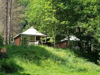
3.0 by Valentino8946This is an automatic translation, the original language is: French.The climb from Lacourt is pretty tough, but be careful! The surprise is that the last kilometre is not asphalted. I had to do some gravel with my road bike... If you have a road bike, do the climb on your side. Magnificent scenery with an orientation table. Water point at the finish.... read more
Welcome! Please activate your account if you would like to share something. Look for the verification email in your inbox.
If you want to upload your photos, you need to create an account. It only takes 1 minute and it's completely free.
The climb from Lacourt is pretty tough, but be careful! The surprise is that the last kilometre is not asphalted.
I had to do some gravel with my road bike...
If you have a road bike, do the climb on your side.
Magnificent scenery with an orientation table.
Water point at the finish.
L'ascension depuis lacourt est assez rude mais attention ! La surprise c'est que le dernier kilomètre n'est pas goudronnée.
J'ai du faire du gravel avec mon vélo route...
Si vous avez un vélo route faire l'ascension de lotre côté.
Paysage magnifique avec table d'orientation.
Point d'eau à l'arrivée.
| 7 km/h | 00:56:38 |
| 11 km/h | 00:36:02 |
| 15 km/h | 00:26:26 |
| 19 km/h | 00:20:52 |
This page is better in the app