| 6 hairpin turns |
| #62 toughest climb of La Maurienne |
| #63 most elevation gain of La Maurienne |
| #63 longest climb of La Maurienne |
| #41 average steepest climb of La Maurienne |
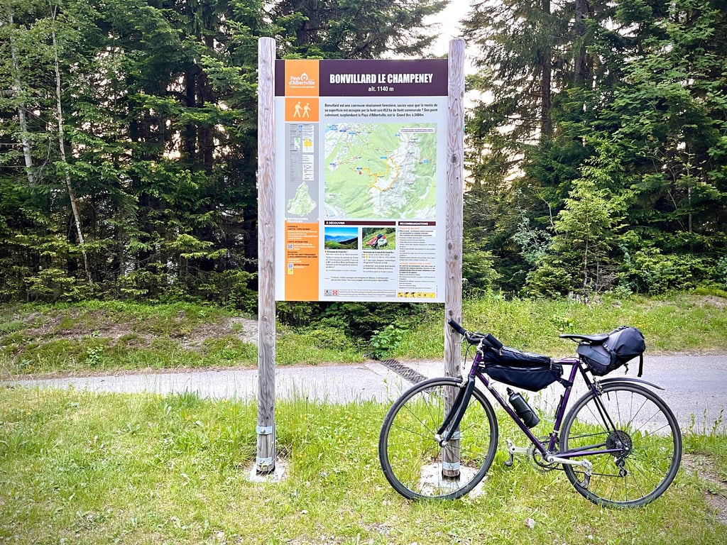
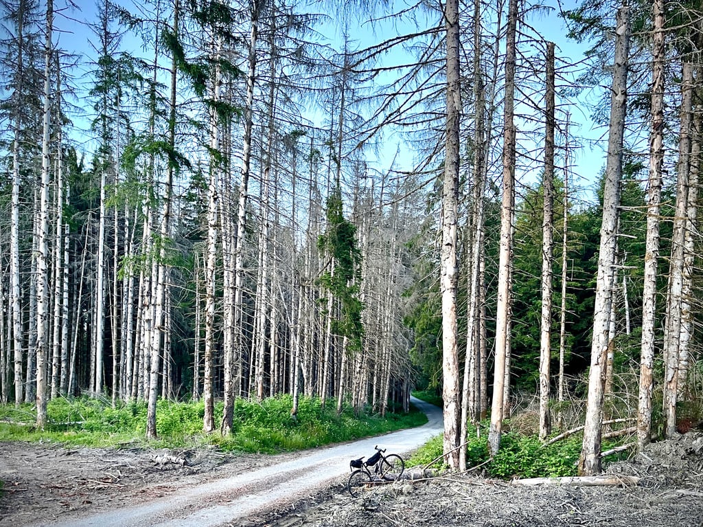
Le Champeney from Bonvillard is a climb in the region La Maurienne. It is 5.3 km long and bridges 398 m of vertical ascent with an average gradient of 7.5%, resulting in a difficulty score of 367. The top of the ascent is located at 1146 m above sea level. Climbfinder users shared 3 reviews of this climb and uploaded 21 photos.
3.0 by sergenavetatThis is an automatic translation, the original language is: French.This is a continuation of the climb to Bonvillard, in total 11km for almost 850M of ascent with an average gradient of about 7.5%. Up to Bonvillard the road is good despite some gravel here and there, after Bonvillard the start is very good up to a crow's feet where you have to take the direction of Champenay, there are then about 4.5km left on a not very good road with many breaks in the slope, alternating recovery and very high percentages. The GPS being discharged at the start, I wil... read more
Welcome! Please activate your account if you would like to share something. Look for the verification email in your inbox.
If you want to upload your photos, you need to create an account. It only takes 1 minute and it's completely free.
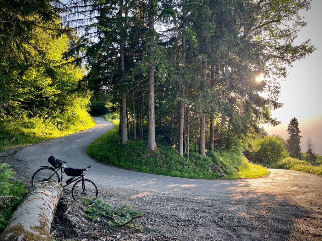
Earthworkers are teasing and facetious! Clearly, they've had some fun here. 12% gradient, flat, 13% gradient, downhill, 10% gradient...
That's the programme! A real leg-breaker!
This "wild" climb is harder than the curve would suggest.
There's even a hundred metres of easy gravel. Lots of gravel. Be careful on the descent.
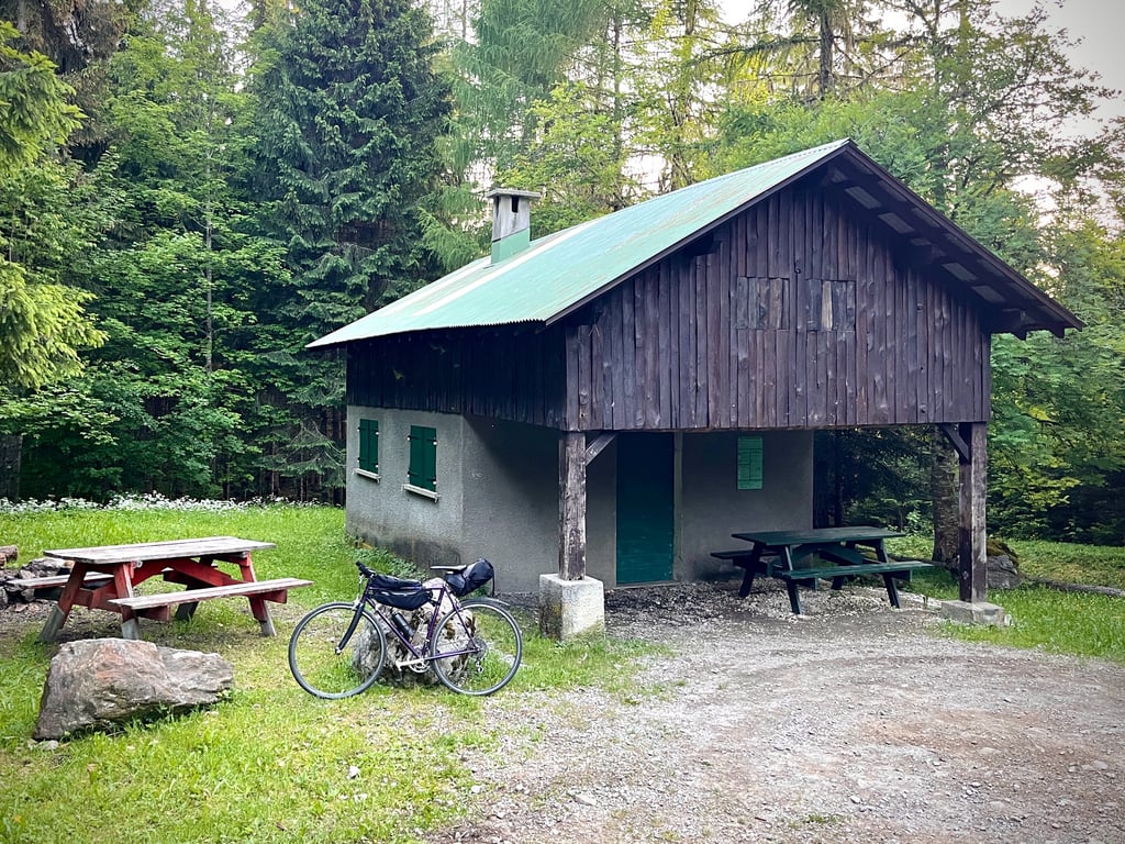
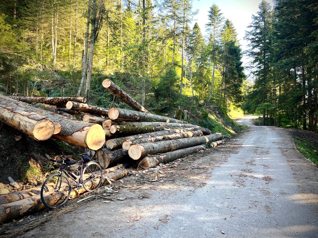
Up there, after the diggers, it's the lumberjacks who are having a field day. There's cutting everywhere. The forest is literally ripped open. At last, however, as far as the Bonvillard protected forest area. The small communal refuge marks the end of the ascent. The climb continues towards the mountain pastures, but more on mountain bikes. A challenging and enjoyable little climb.
Les terrassiers sont taquins et facétieux ! Visiblement, ici, ils se sont amusés. Raidillon à 12%, replat, raidard à 13%, descente, bosse à 10%…
Voilà le programme ! Un vrai casse pattes !
Cette montée « sauvage » est plus difficile que ce que la courbe semble annoncer.
On a même droit à une centaine de mètres de gravel facile. Beaucoup de gravillons. Vigilance dans la descente.
Là-haut, après les terrassiers, ce sont les bûcherons qui s’en donnent à cœur joie. Ça coupe partout. La forêt est littéralement éventrée. Enfin, toutefois jusqu’à la zone de forêt protégée de Bonvillard. Le petit refuge communal signale la fin de l’ascension. La montée se poursuit vers les alpages, mais plutôt en VTT. Exigeante et sympa, cette petite ascension.
As promised, I went back with a fully-charged GPS to measure the slope.
Not much to add to my first comment, the impressions were good because after Bonvillard it's very irregular and difficult.
Alternating gentle slopes 4-5 and even a slight descent, with small walls at 12-13-14%.
It's worth noting that I passed the unsealed section on the bike, it's just 100M long.
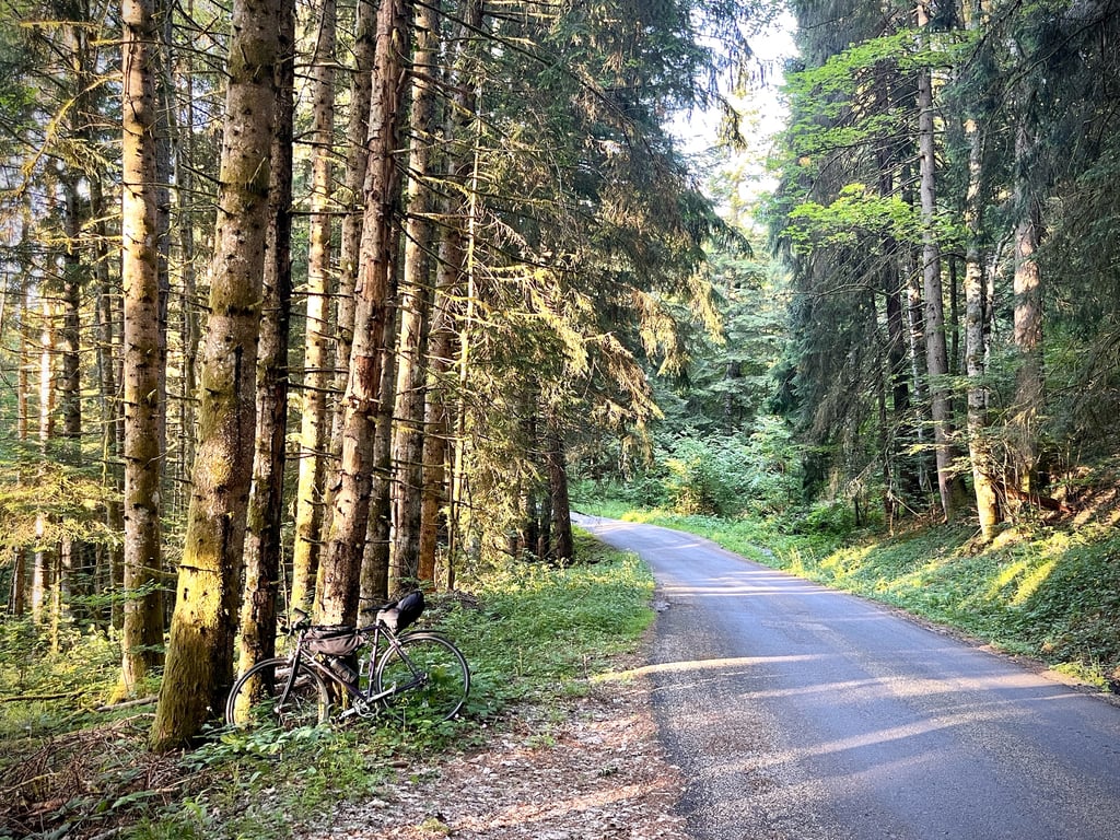
I took a slightly different route, through the small hamlet of La Léchère ( not to be confused with the Thermal Station ) see attached map
Comme promis j'y suis retourné avec un GPS chargé à bloc pour relevé la pente.
Pas grand-chose à ajouter sur mon premier commentaire, les impressions étaient bonnes car après Bonvillard c'est très irrégulier et difficile.
Alternances de pentes faibles 4-5 et même une légère descente, avec des petits murs à 12-13-14%.
À signaler que j'ai passé la partie non goudronnée sur le vélo, elle fait 100M juste.
Je suis passé par un tracé légèrement différent, par le petit hameau de la Léchère ( ne pas confondre avec la Station Thermale )
This is a continuation of the climb to Bonvillard, in total 11km for almost 850M of ascent with an average gradient of about 7.5%.
Up to Bonvillard the road is good despite some gravel here and there, after Bonvillard the start is very good up to a crow's feet where you have to take the direction of Champenay, there are then about 4.5km left on a not very good road with many breaks in the slope, alternating recovery and very high percentages.
The GPS being discharged at the start, I will go back for more precision.
There is an unsealed section for about 100m and you have to walk through it, lots of gravel on the remaining section.
C'est un prolongement de la montée à Bonvillard, au total 11km pour presque 850M de dénivelé avec une pente moyenne de 7,5% environ.
Jusqu'à Bonvillard la route est bonne malgré des gravillons ici et là, après Bonvillard le départ est très bon jusqu'à une patte d'oie où il faut prendre la direction de Champenay , il reste alors environ 4,5km sur une route pas très bonne avec de très nombreuses ruptures de pente, alternants récupération et très forts pourcentages.
Le GPS étant déchargé dès le départ, j'y retournerai pour plus de précision.
Il y a un passage non goudronné sur environ 100M et il faut passer à pieds, beaucoup de gravillons sur la portion restante.
| 7 km/h | 00:45:26 |
| 11 km/h | 00:28:54 |
| 15 km/h | 00:21:12 |
| 19 km/h | 00:16:44 |
This page is better in the app