Tips nearby


| Beautiful scenery |
| Hidden gem |
| 2 hairpin turns |
| #47 toughest climb of Briançon |
| #79 most elevation gain of Hautes Alpes |
| #25 longest climb of Hautes Alpes |
| #97 average steepest climb of Briançon |
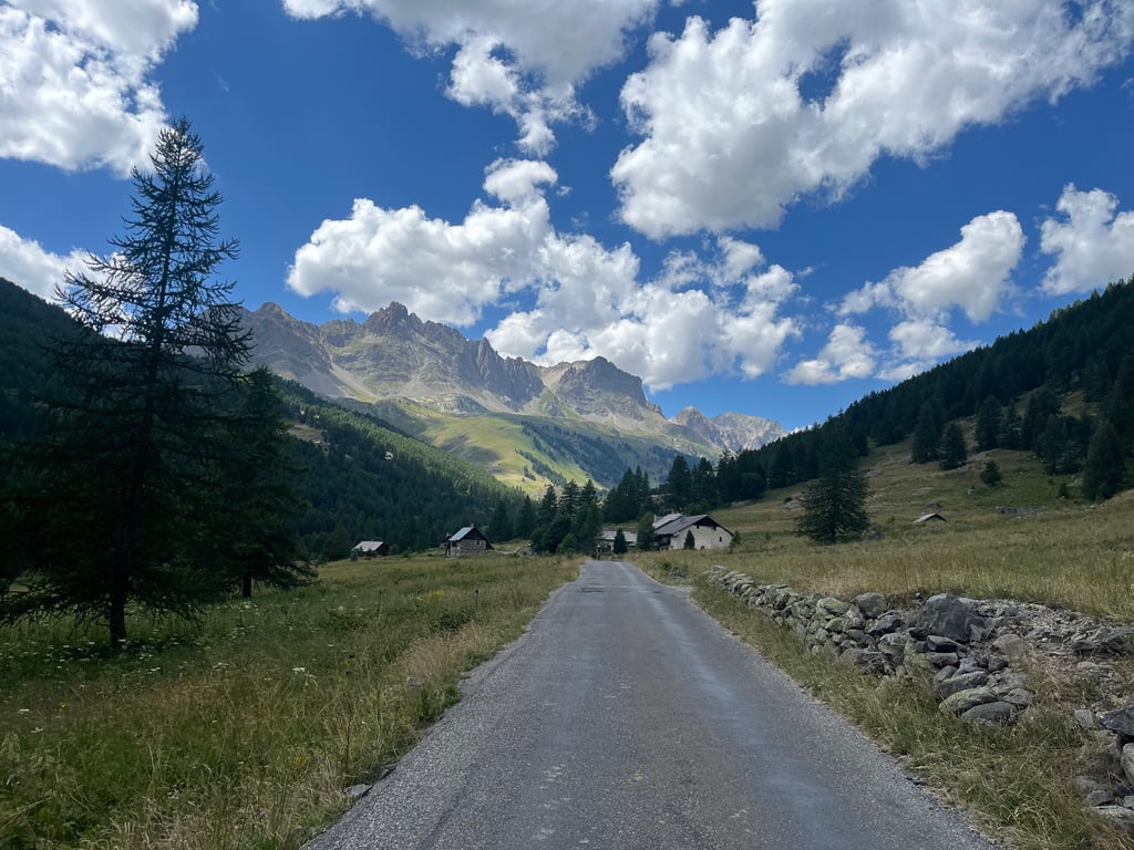
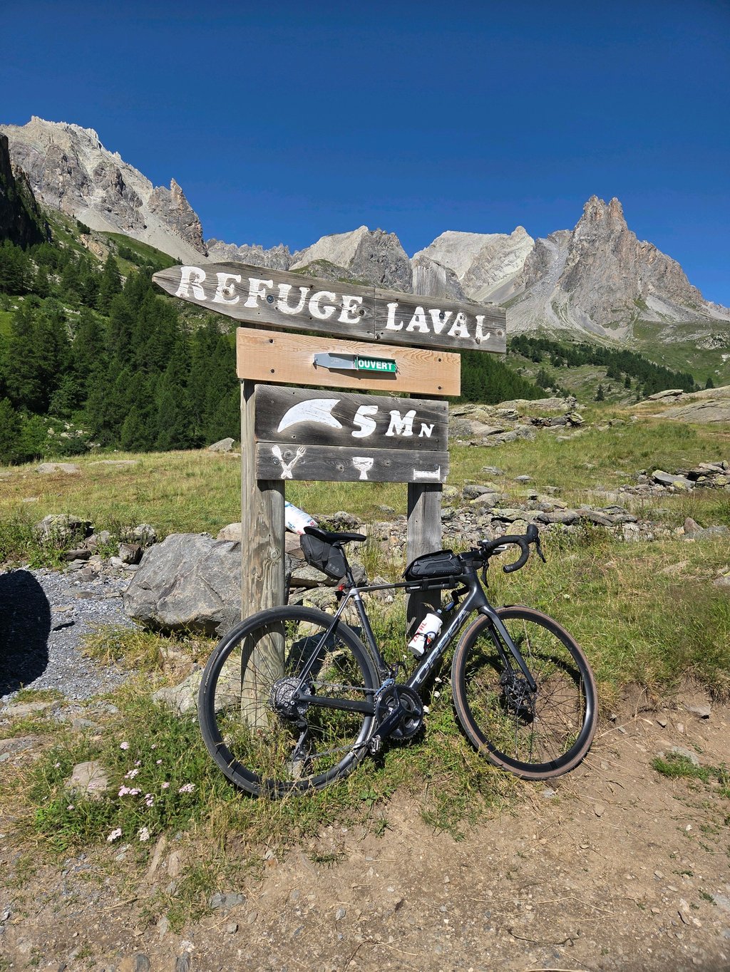
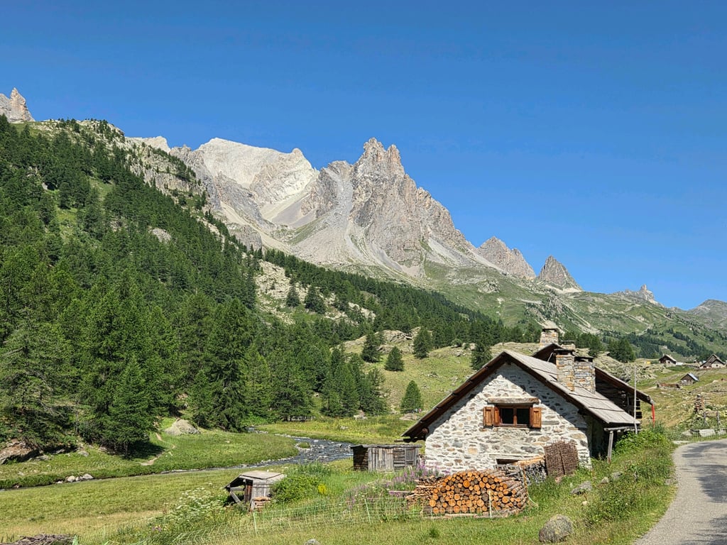
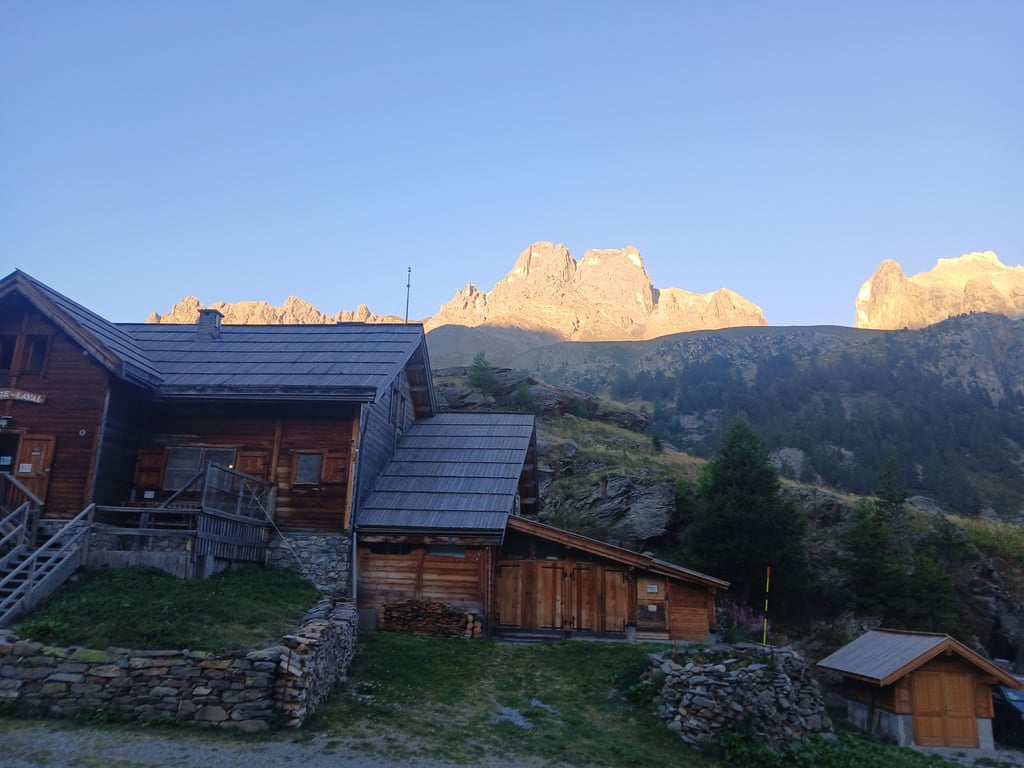
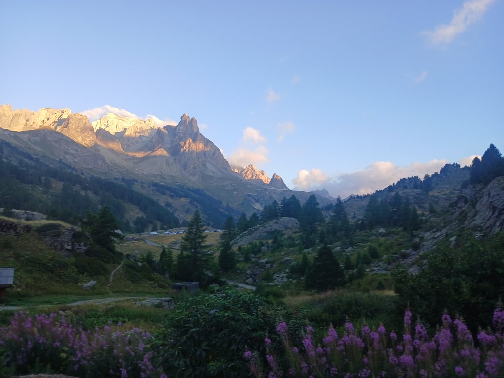
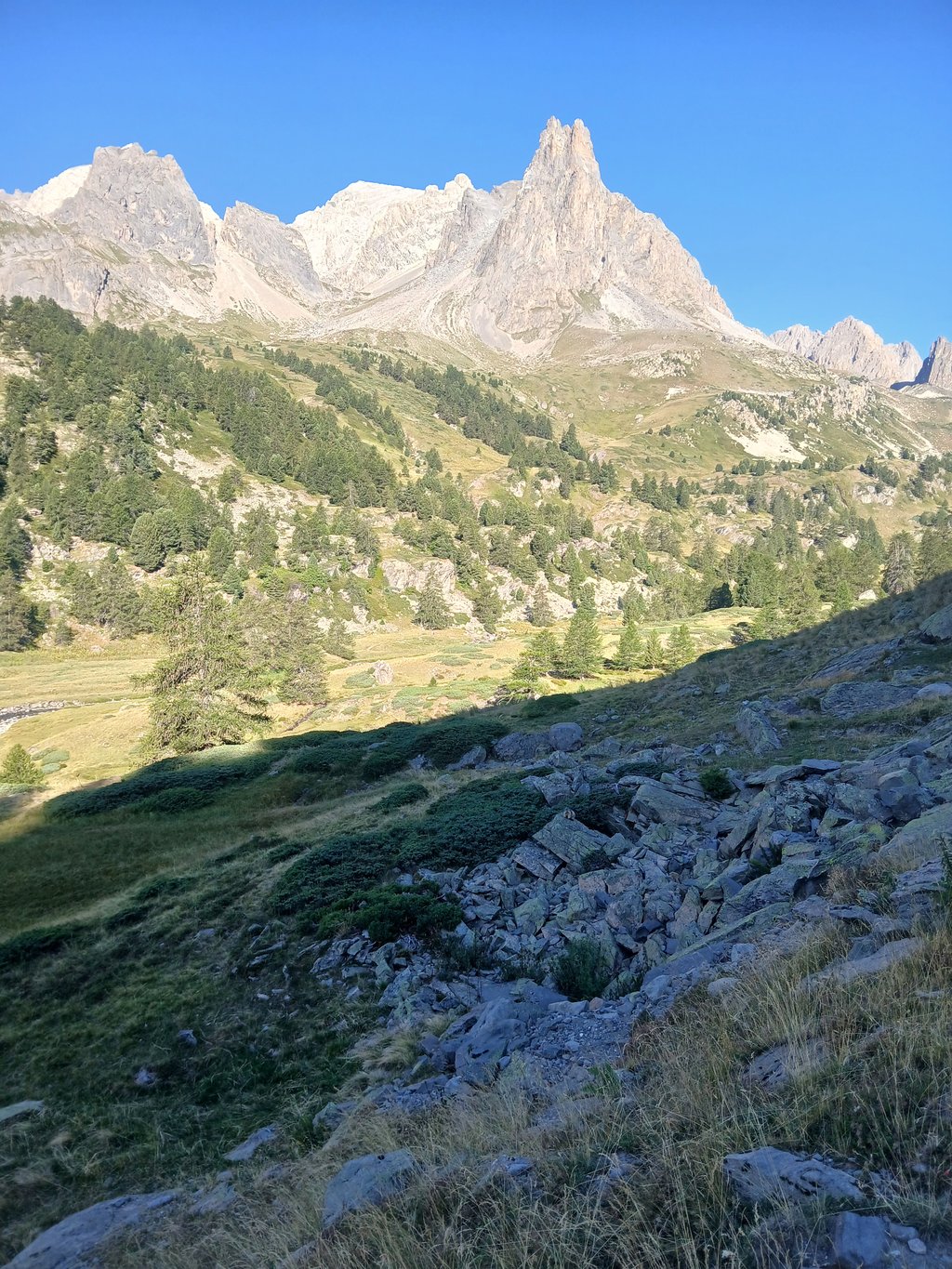
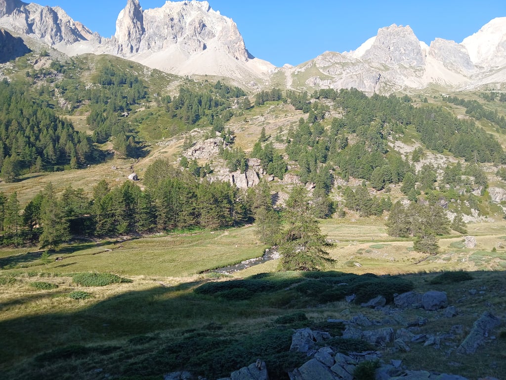
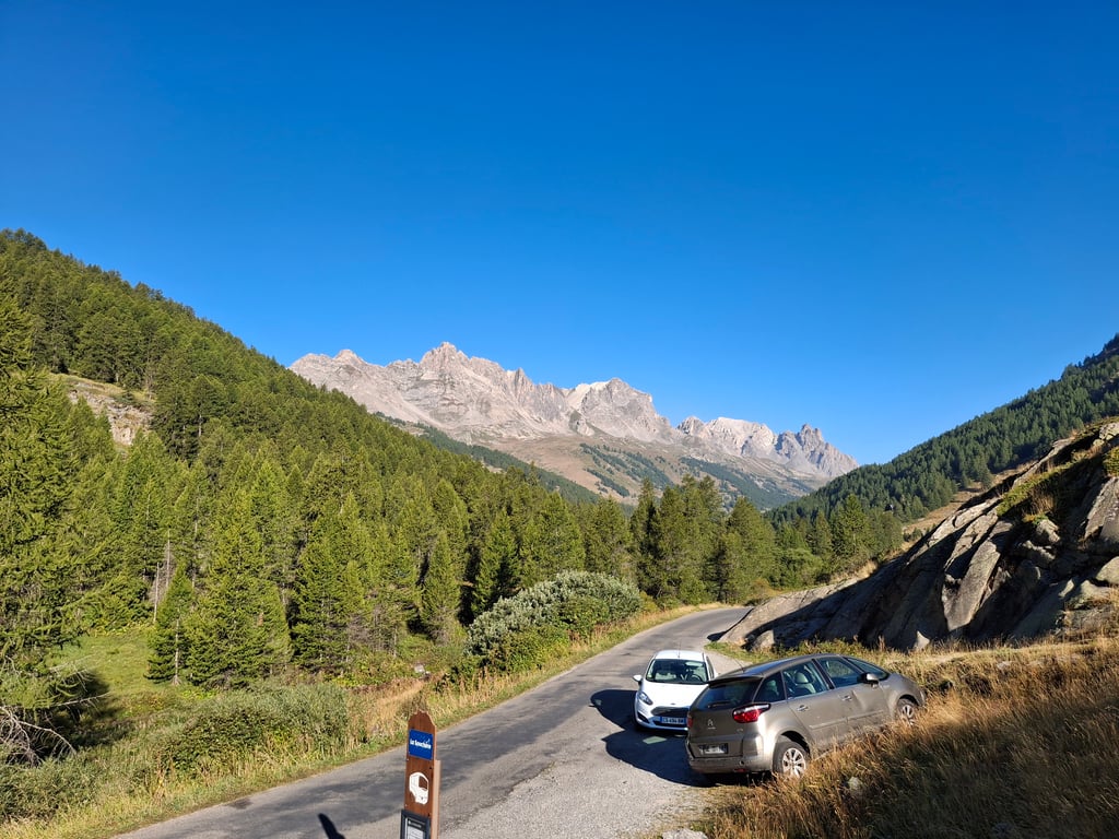
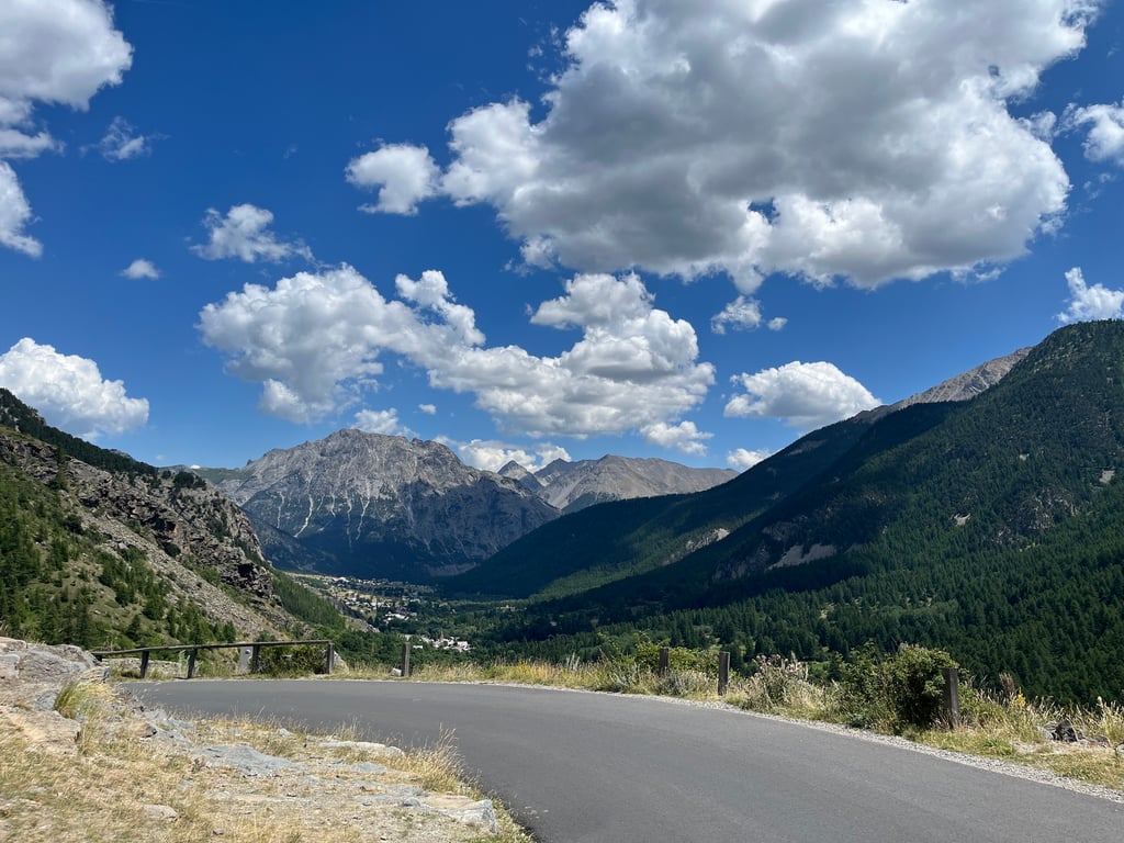
Chalets de Laval from Nevache is a climb in the region Briançon. It is 12 km long and bridges 448 m of vertical ascent with an average gradient of 3.7%, resulting in a difficulty score of 275. The top of the ascent is located at 2022 m above sea level. Climbfinder users shared 9 reviews of this climb and uploaded 19 photos.
Road name: D301T
4.0 by Greg37Superbe vallée de la Clarée. Des paysages magnifiques. La montée n'est pas difficile.... read more
Welcome! Please activate your account if you would like to share something. Look for the verification email in your inbox.
If you want to upload your photos, you need to create an account. It only takes 1 minute and it's completely free.
The stunning Clarée Valley. Magnificent scenery. The climb isn’t difficult.
Superbe vallée de la Clarée. Des paysages magnifiques. La montée n'est pas difficile.
Beautiful route with great panoramic views, but it is not a "real" climb as there are many flat sections. Nevertheless, the scenery makes it fantastically beautiful.
Wunderschöne Strecke mit tollen Pnoramen, ein „echter“ Anstieg ist es jedoch nicht, da es viele Flachpassagen gibt. Trotzdem aufgrund der Landschaft traumhaft schön.
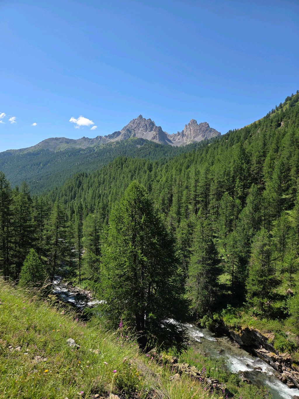
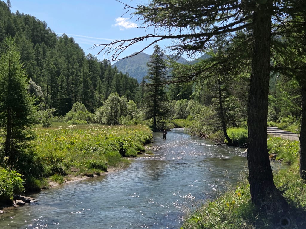
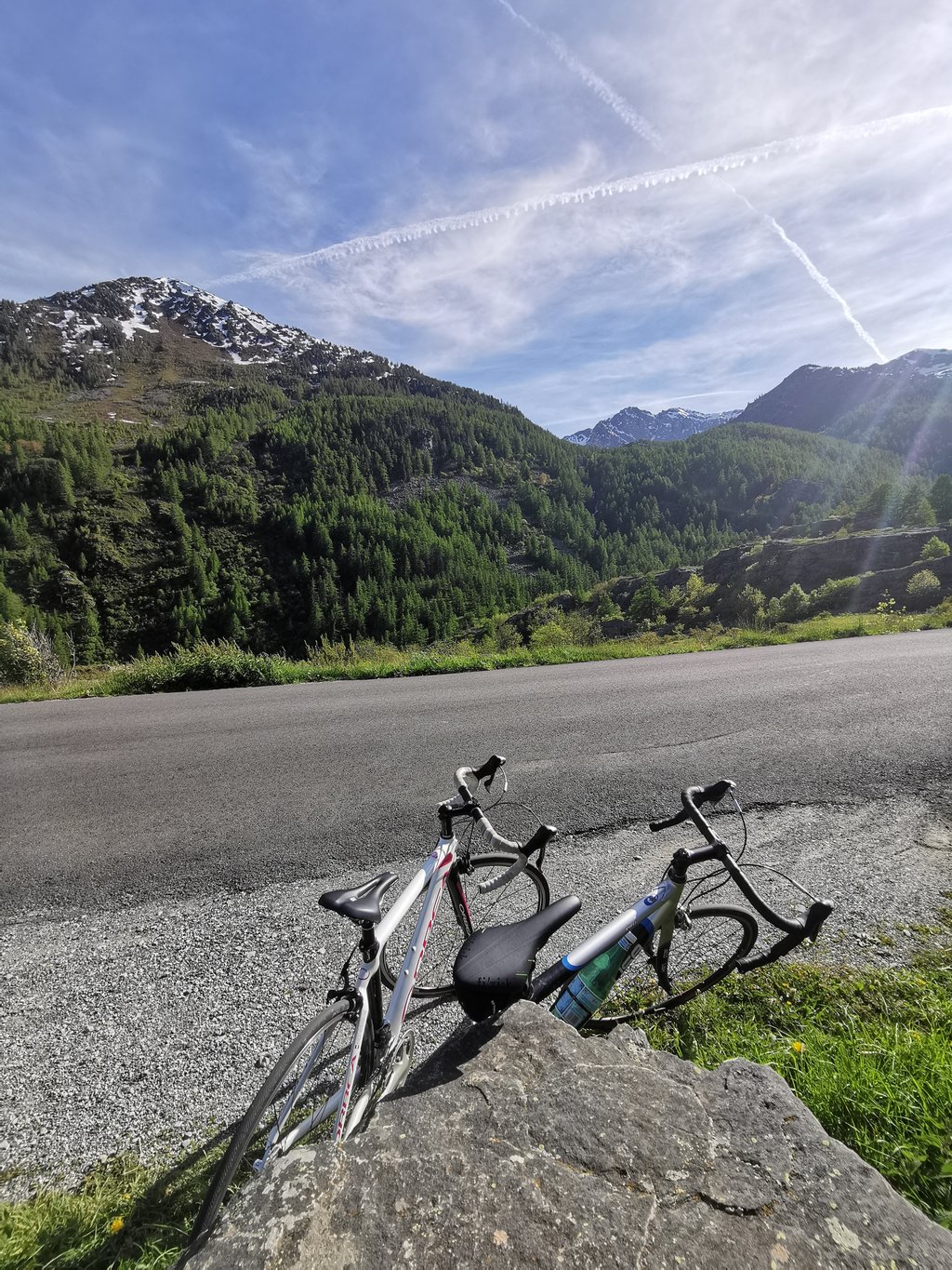
It's a very pleasant climb, and the scenery is superb. In high season (July-August) the road is closed during the day to upward traffic, and replaced by shuttle buses for hikers. The traffic is therefore moderate, which is a good thing given the narrowness of the road and the sometimes blind bends. However, beware of the regular shuttle buses. Breathtaking views from the summit! You do have to get off afterwards, though, as it's a dead end (rotten road bikes at least).
C'est une Ascension très agréable, et les paysages sont superbes. En haute saison (juillet aout) la route est fermée en journée au trafic montant, et remplacé par des navettes pour les randonneurs. Le trafic est donc modéré et c'est rant mieux, étant donné l'étroitesse de la route et les virages parfois à l aveugle. Attention malgré tout aux navettes régulières. Vue à couper le souffle au sommet ! Il faut toutefois en descendre après, car c'est un cul de sac (pourries vélos de route au moins)
A nice side climb. Pretty scenery, and moderate gradients. At busy times the road is closed to traffic, with shuttle buses running to the top. The drivers of these buses can be a little uncompromising, but one bus is better than five cars. The surface is a bit bumpy when descending, especially near the top.
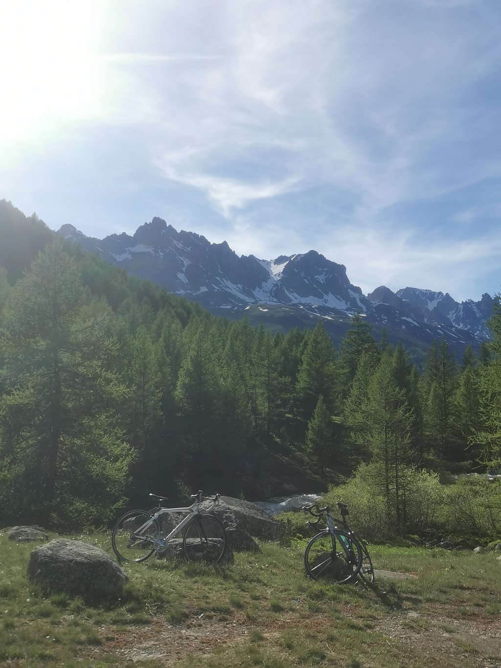
The Haute Clarée is magnificent. We'd like to continue past the Lachat car park :p
Superbe, la haute clarée est magnifique. On aimerait continuer après le parking du Lachat :p
An easy ascent without great difficulty, but well worth doing both for the very little traffic and the beautiful scenery
Salita di per se semplice senza grandi difficoltà, ma vale la pena farla sia per il pochissimo traffico che per il bellissimo paesaggio che si può ammirare
Fairly average road with little traffic, but the scenery is magnificent!
Route assez moyenne et plutôt peu de circulation mais les paysages sont magnifiques !
Coming from Briançon, you never really know where the climb starts: it goes up a few percent all the time, and when you think the climb has then started, you get another flat stretch. Just before the village of Plampinet, an information sign reminds you that you are on the 45th parallel, and therefore as far from the North Pole as you are from the Equator. Past the village of Nevache, it finally gets a bit steeper uphill, but even then you get another long "false flat" strip pushed in front of your wheels. You are then already two kilometres from the summit, before it gets a bit more solid uphill again. For the third time, you think the climb can really start now, and before you know it, there is the car park and the climb is over. It's an easy way to cross the mythical 2,000-metre mark, but those expecting a real climb will still be a bit hungry.
Komende uit Briançon weet je nooit echt waar de klim begint: het gaat de hele tijd enkele percentjes bergop, en als je denkt dat de klim dan begonnen is, krijg je weer een vlakke strook. Net voor het dorpje Plampinet wijst een infobordje je erop dat je je op de 45e breedtegraad bevindt, en dus even ver van de Noordpool als van de Evenaar bent. Voorbij het dorpje Nevache gaat het dan eindelijk wat steiler bergop, maar ook dan krijg je weer een lange "vals platte" strook voor de wielen geschoven. Je bent dan al op twee kilometer van de top, vooraleer het weer wat steviger bergop gaat. Voor de derde keer denk je dat de klim nu echt kan beginnen, en voor je het weet is daar de parking en zit de klim erop. Het is een makkelijke manier om de mythische grens van de 2000 meter te overschrijden, maar wie zich aan een echte klim verwacht zal toch wat op zijn honger blijven zitten.
This climb is the mountain experience at its'n best. From Névache, you cycle into the Vallée de la Clarée and the fun begins. Expect beautiful views, a narrow (and bumpy) road that never really gets steep and a fantastic view at the end of the road. You look straight into the valley and are also treated to an incredible 360-degree panorama. Apart from a few hikers, you will hardly find any sign of life here. Not to be missed!
Deze klim is de bergbeleving op z'n best. Vanaf Névache fiets je de Vallée de la Clarée in en begint de pret. Verwacht prachtige vergezichten, een smal (en hobbelig) weggetje dat nooit echt steil wordt en een fantastisch uitzicht bij het einde van de weg. Je kijkt recht het dal in en wordt bovendien getrakteerd op een ongelooflijk 360 graden panorama. Behalve enkele wandelaars vind je hier nauwelijks een teken van leven. Mag je niet missen!
| 7 km/h | 01:43:12 |
| 11 km/h | 01:05:40 |
| 15 km/h | 00:48:09 |
| 19 km/h | 00:38:01 |
This page is better in the app