View on map
© MapLibre | OpenStreetMap contributors
1%
2%
4%
6%
8%
10%
12%
15%
20%

Chaillol 1600 from Chabottes

4.0
1 review/story | Elevation profile | 3 photos
Tips nearby
Chaillol 1600 from Chabottes
transparant thumb
transparant thumb
transparant thumb
transparant thumb
transparant thumb
Your achievable time
Calculating based on your best performances...
Relaxed
Maximum
W/kg
W/kg
W/kg
Analyse your climbing performance
Detailed insight into your climbing performance & automatically check off climbs
Based on your best performances.
Your best attempt:
Number of attempts:
Elevation profile Chaillol 1600 from Chabottes

Statistics

Difficulty points 404
Length 6.5 km
Average gradient 7.6%
Steepest 100 metres 12.6%
Total ascent 489 m

Short recap

8 hairpin turns
#61 toughest climb of Hautes Alpes
#70 most elevation gain of Hautes Alpes
#97 longest climb of Hautes Alpes
#60 average steepest climb of Hautes Alpes
Feedback about this climb?
Show climbs nearby Export to GPS device

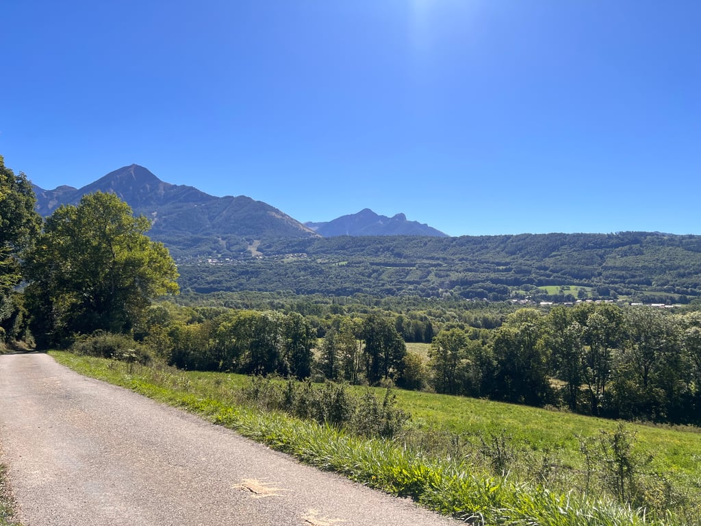
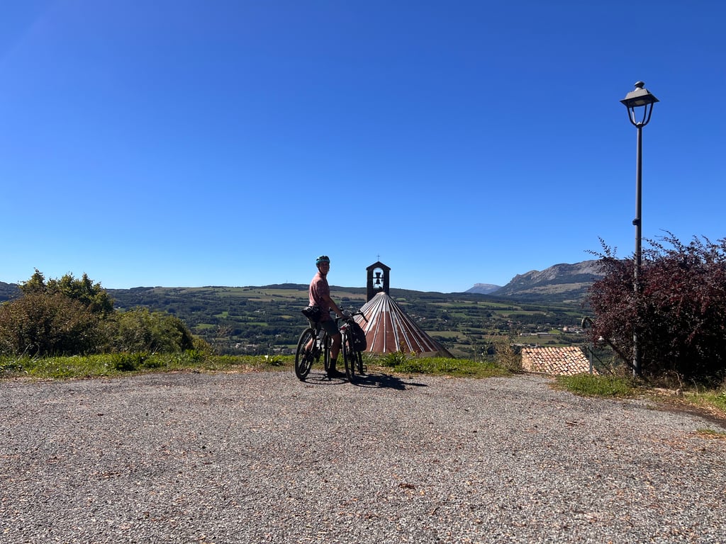
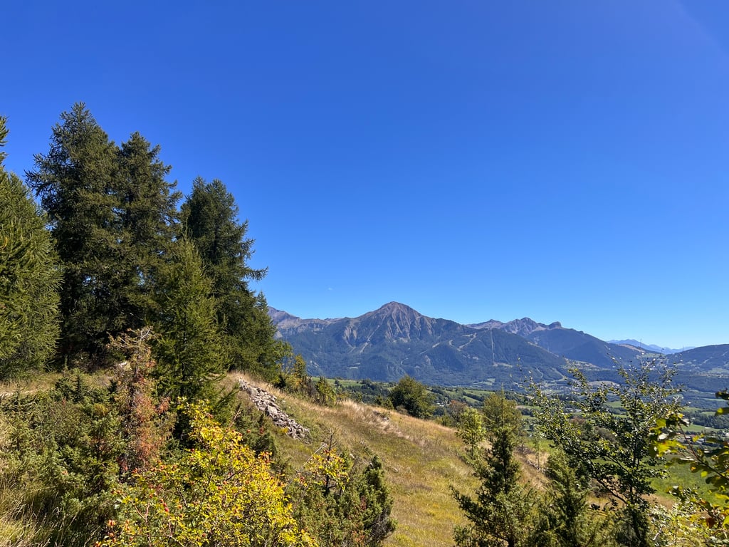
Chaillol 1600 from Chabottes is a climb in the region Serre Ponçon. It is 6.5 km long and bridges 489 m of vertical ascent with an average gradient of 7.6%, resulting in a difficulty score of 404. The top of the ascent is located at 1584 m above sea level. Climbfinder users shared 1 review/story of this climb and uploaded 3 photos.

Road name: D43

4.0 by AntoineR86
This is an automatic translation, the original language is: French.
Today we climbed up from Chabotte via the old Buissard road. We didn't pass anyone and the scenery was breathtaking. The climb up to Chaillol 1600 is steep.... read more

Photos (3)

Chaillol 1600 from Chabottes
transparant thumb
transparant thumb
transparant thumb

Your uploads (max 4)

Welcome! Please activate your account if you would like to share something. Look for the verification email in your inbox.

If you want to upload your photos, you need to create an account. It only takes 1 minute and it's completely free.

  • Receive free climbfinder goodies for your reviews & photos.
  • Create a bucket list and check off conquered climbs.
  • Add missing climbs.
Continue with GoogleContinue with Google Continue with FacebookContinue with Facebook Continue with AppleContinue with Apple Sign up with email
By signing up you agree to our terms of service and confirm that you have read our privacy & content policy.

Reviews (1)

5.0
4.0
3.0
2.0
1.0
AntoineR86
9 Mo 4.0 via the Climbfinder app
This is an automatic translation, the original language is: French. Show original

Today we climbed up from Chabotte via the old Buissard road. We didn't pass anyone and the scenery was breathtaking. The climb up to Chaillol 1600 is steep.

Aujourd’hui nous sommes monté depuis chabotte en passant par l’ancienne route de buissard. Nous n’avons croisé personne et le paysage est à couper le souffle. La monté est raide en arrivant à chaillol 1600.

Chaillol 1600 from Chabottes
Dashboard

Climbing times

7 km/h 00:55:24
11 km/h 00:35:15
15 km/h 00:25:51
19 km/h 00:20:24

Road surface condition

0% 0% 0%
Based on 0 votes
Share your knowledge. What was the road condition during your ascent?

Traffic

0% 0% 0%
Based on 0 votes
Your experience counts. How much traffic did you encounter during the climb?

Frequently Asked Questions

Chaillol 1600 can be cycled from 3 sides. Chaillol 1600 from Saint-Bonnet-en-Champsaur is the most popular side, but the summit can also be reached via Chaillol 1600 from Saint-Julien-en-Champsaur & Chaillol 1600 from Chabottes.

Chaillol 1600 from Chabottes is a challenging ascent. For this type of climbing, we recommend mountain gearing, specifically a compact system. This means a small front chainring of 34 teeth, combined with a rear cassette where, depending on your level, strength, and experience, you choose a sprocket with 30, 32, or even 34 teeth. Remember that a smooth cadence is always more efficient!

Chaillol 1600 from Chabottes is a serious climb and falls into the 2nd category. With a good basic fitness level, even without much cycling experience, you can complete this climb just fine. However, a bike with climbing gears is a must. Without experience or training, it will be really tough – but that’s part of the challenge!

Chaillol 1600 from Chabottes is 6.5 km long.

The average gradient of Chaillol 1600 from Chabottes is 7.6%.

Chaillol 1600 from Chabottes has a steepest segment with an average gradient of 12.6%.

The summit of Chaillol 1600 from Chabottes is at 1584 m.

At a slow pace of 7 km/h, it takes about 00:55:24 to climb Chaillol 1600 from Chabottes. At 11 km/h the time is 00:35:15, and at 15 km/h 00:25:51. For the fastest cyclists, 00:20:24 is an achievable time.

Chaillol 1600 from Chabottes is located in the region Hautes Alpes in France.

This page is better in the app

Climbfinder app
Climbfinder
(Free)
Open