| Hidden gem |
| Cobbles |
| #74 toughest climb of Flanders |
| #71 most elevation gain of Flemish Brabant |
| #50 longest climb of Dijleland |
| #78 average steepest climb of Druivenstreek |
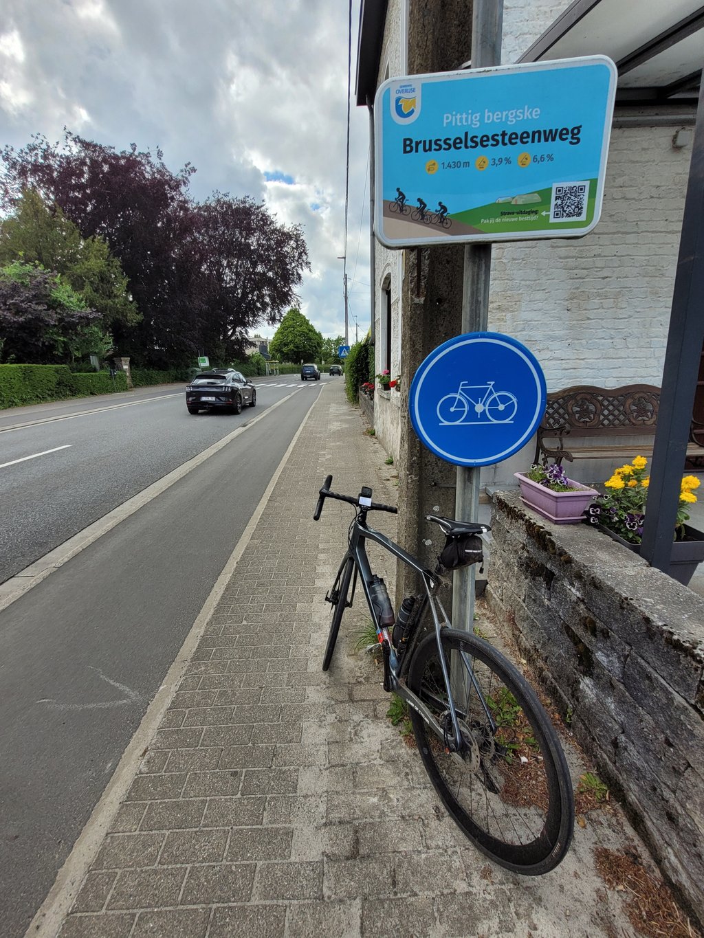
Brusselsesteenweg via Solheide is a climb in the region Druivenstreek. It is 1.3 km long and bridges 58 m of vertical ascent with an average gradient of 4.6%, resulting in a difficulty score of 55. The top of the ascent is located at 107 m above sea level. Climbfinder users shared 4 reviews of this climb and uploaded 8 photos.
Road names: Brusselsesteenweg, Solheide & Brusselsesteenweg
3.0 by Glen_SolanaThis is an automatic translation, the original language is: Dutch.The S-curve in Overijse is well known. Nice to climb via a few hairpins. Too bad it's a busy road with traffic. Suddenly we take a narrow road on our right after the S-curve, the Solheide. Never noticed, but a nice surprise. This path runs between houses and a wall. The cobblestones are not too hard to do and the percentages are not too bad. Afterwards we roll out to the top.... read more

Welcome! Please activate your account if you would like to share something. Look for the verification email in your inbox.
If you want to upload your photos, you need to create an account. It only takes 1 minute and it's completely free.
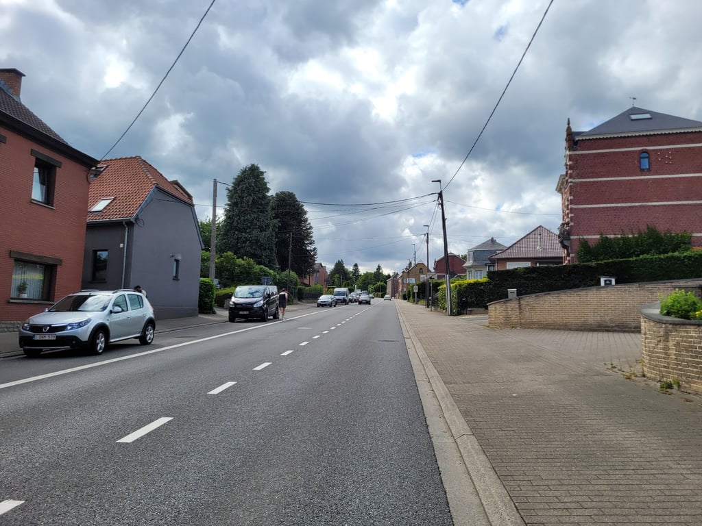
On the permanently signposted "Brabantse Pijl" one takes this descent after the Schavei down towards Overijse. This gives the feeling of a steeper climb. The steepest part is right after the hairpin bends. Furthermore, this climb is not too hard with a long spur on the Brusselsesteenweg. The only disadvantage of this climb is that there is no cycle path up to Kokstraat and you have to cycle on a regional road here. If you are in the area and want to cycle quietly, you are better off going to the Stationsplein and then going up along the Schavei, you end up at the same point.
Op de permanent bewegwijzerde "Brabantse Pijl" neemt men deze afdaling na het Schavei naar beneden richting Overijse. Hierbij geeft dit het gevoel om een stijlere klim te gaan. Het steilste stuk zit hem meteen na de haardspeldbochten. Verder is deze klim niet al te zwaar met een lange uitloper op de Brusselsesteenweg. Enige nadeel aan deze klim is dat er geen fietspad is tot aan de Kokstraat en men hier op een gewestweg moet fietsen. Als je in de buurt bent en rustig wil fietsen ben je beter af even naar het Stationsplein te rijden om vervolgens daar langs het Schavei omhoog te rijden, finaal kom je op hetzelfde punt uit.
Big roads and climbing, that's something that bothers me a bit. I prefer to climb on a narrow road in the fields or in a forest. If you compare the two, even though they may be equally steep, the narrow road feels just a bit heavier. This one is a big wide road, with that famous S-curve from the Brabantse Pijl in it. I choose the Schavei. It is narrower, more legendary (for cycling experts) and no cars try to pass you where they cannot.
Grote wegen en klimmen, da's toch iets wat bij mij wat dwars zit. Ik klim liever op een smalle weg in de velden of in een bos. Als je die twee vergelijkt, ook al zijn ze misschien even steil, dan voelt de smalle weg toch net iets zwaarder. Deze is een grote brede weg, met die beroemde S-bocht uit de Brabantse Pijl erin. Ik kies het Schavei. Dat is smaller, legendarischer (voor wielerkenners) en er proberen geen auto's je voorbij te rijden waar het niet kan.
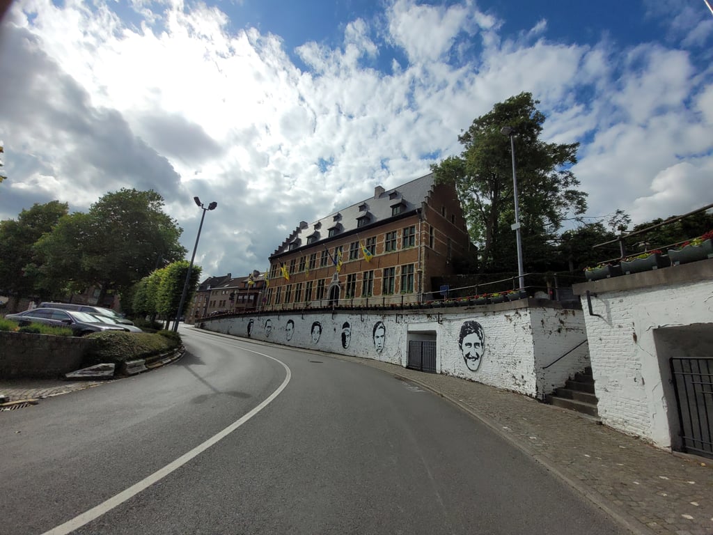
The S-curve in Overijse is well known. Nice to climb via a few hairpins. Too bad it's a busy road with traffic.
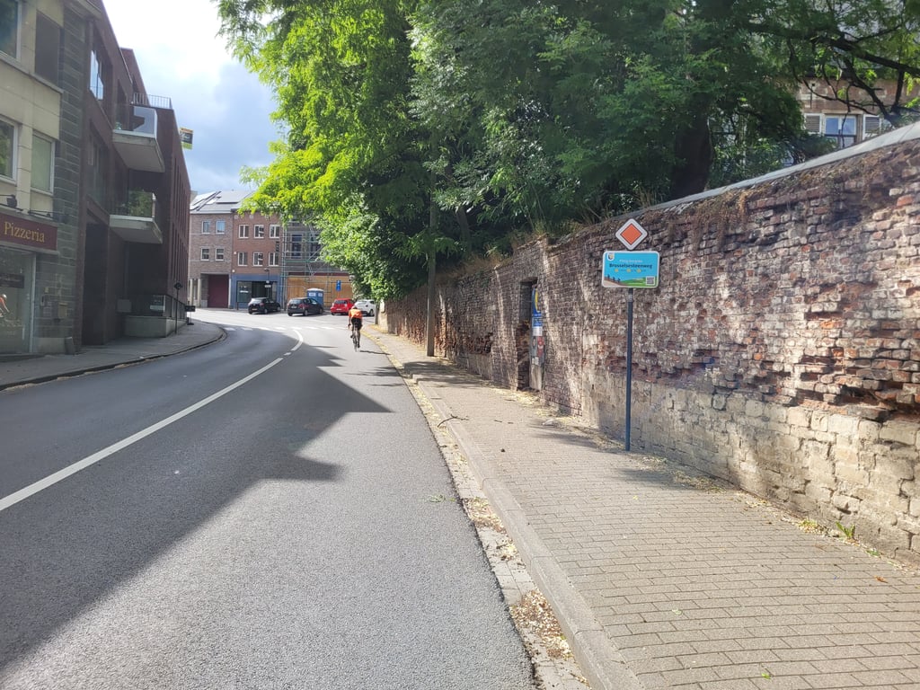
Suddenly we take a narrow road on our right after the S-curve, the Solheide. Never noticed, but a nice surprise.
This path runs between houses and a wall. The cobblestones are not too hard to do and the percentages are not too bad. Afterwards we roll out to the top.
De S-bocht in Overijse is gekend. Eens leuk om via een paar haarspeldbochten te klimmen. Alleen spijtig dat het een drukke gewestweg is met verkeer.
Opeens rechts een smal wegje nemen na de S-bocht, de Solheide. Nog nooit opgemerkt, maar een leuke verrassing.
Dit padje loopt tussen huizen en een muur. De kasseien die er liggen zijn redelijk te doen en de percentages vallen ook nog goed mee. Nadien "uitbollen" tot de top.
| 7 km/h | 00:10:45 |
| 11 km/h | 00:06:51 |
| 15 km/h | 00:05:01 |
| 19 km/h | 00:03:57 |
This page is better in the app