Bousée from Sartiau is a climb in the region Pays des Collines. It is 1.1 km long and bridges 67 m of vertical ascent with an average gradient of 5.8%, resulting in a difficulty score of 55. The top of the ascent is located at 113 m above sea level. Climbfinder users shared 8 reviews of this climb and uploaded 1 photo.
This is an automatic translation, the original language is: Dutch.
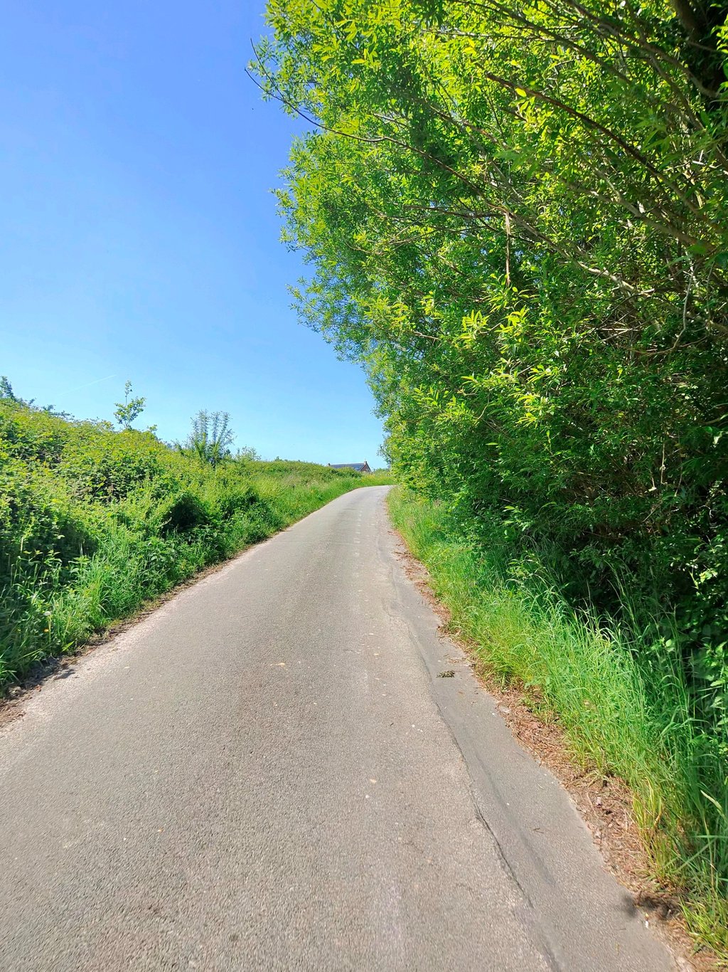
This really is a hidden gem! Swings gently upwards at first. When you think you are almost off, however, there comes another steep end note. You arrive at the top puffing, but are rewarded with beautiful views....read more
Photos (1)
Welcome! Please activate your account if you would like to share something. Look for the verification email in your inbox.
This is an automatic translation, the original language is: Dutch.
Show original
This really is a hidden gem! Swings gently upwards at first. When you think you are almost off, however, there comes another steep end note. You arrive at the top puffing, but are rewarded with beautiful views.
Dit is echt een verborgen juweeltje! Slingert in het begin rustig omhoog. Wanneer je denkt dat je er bijna vanaf bent, komt er echter nog een steile eindnoot. Je komt puffend boven, maar wordt beloond met mooie uitzichten.
This is an automatic translation, the original language is: Dutch.
Show original
Blessed climb! Especially in the last turns, it is really hard work to get to the top. First between the houses on a moderate road surface. As soon as you turn right you ride between the trees. Hidden gem!
Zalige klim! Zeker in de laatste bochten is het echt hard werken om boven te geraken. Eerst tussen de huizen over een matig wegdek. Vanaf je naar rechts afdraait rijd je tussen de bomen. Verborgen pareltje!
This is an automatic translation, the original language is: French.
Show original
Incredibly difficult climb for my size (1m95, 100kg) but it went through all the same. It was nice even if I really couldn't concentrate on it 👀
Ascension incroyablement difficile pour mon gabarit (1m95, 100kg) mais c'est tout de même passé. C'était joli même si je n'ai vraiment pas pu me concentrer dessus 👀
This is an automatic translation, the original language is: Dutch.
Show original
Very nice climb: it gets trickier and steeper as you progress. Last stretch is quite disappointing. Very nice and quiet surroundings. Only some pebbles and some mud on the track at the beginning of the climb. Highly recommended.
Heel leuke klim: het wordt steeds lastiger en steiler naarmate je de klim vordert. Laatste stuk valt best wel tegen. Zeer mooie en rustige omgeving. Enkel wat steentjes en wat modder op de baan in het begin van de klim. Een echte aanrader.
This is an automatic translation, the original language is: Dutch.
Show original
Nice climb to do. You cycle through beautiful agricultural surroundings. First it's false flat, then it gets really climbing when you get close to the trees. Save some for the end because the last 100m are steep.
Leuke klim om te doen. Je fietst door een prachtige landbouwomgeving. Eerst gaat het nog vals plat, daarna wordt het echt klimmen wanneer je in de buurt van de bomen komt. Houdt wat over voor het einde want de laaste 100m zijn steil.
This is an automatic translation, the original language is: French.
Show original
A very pretty, fairly quiet climb in a bucolic setting, but the end is quite steep and you have to know how to manage your effort because the finish is strong. The view from the summit is very pleasant. A must do!
très jolie ascensions assez calme dans un cadre bucolique mais la fin est assez pentue et il faut savoir gérer son effort car le finish est costaud . La vue au sommet est très agréable. A faire absolument!
This is an automatic translation, the original language is: French.
Show original
"In cauda venenum": in the tail the venom, as the Latin saying goes. This particularly illustrates this hill, a compulsory part of the Grinta Challenges in which I participated. Very quiet, narrow, you feel a bit cut off from the world, but the final stretch brings you back to reality. It can easily be followed by the climb to the nearby hamlet of Papins, which will finish off the tired cyclist.
« In cauda venenum » : dans la queue le venin, dit-on en latin. Cela illustre particulièrement cette côte, un passage obligé des Grinta Challenges auxquels j'ai participé. Très tranquille, étroite, on s'y sent un peu coupé du monde, mais le final ramène à la réalité. On peut aisément la faire suivre par la côte du hameau des Papins, toute proche, qui finira d'achever le cycliste fatigué.
You don't need special gearing for Bousée from Sartiau. The slope isn't long or steep enough to require much shifting down. You can conquer this climb on power alone. However, a compact gearing system with a smallest front chainring of 34 and largest rear sprocket of 28 or 30 is always nice if you enjoy cycling uphill. This helps maintain a smooth cadence.
Bousée from Sartiau falls into the 5th category. With good fitness, you can ride it up with speed and power. If you have less training, shift down and climb smoothly.
Bousée from Sartiau is 1.1 km long.
The average gradient of Bousée from Sartiau is 5.8%.
Bousée from Sartiau has a steepest segment with an average gradient of 14.7%.
The summit of Bousée from Sartiau is at 113 m.
At a slow pace of 7 km/h, it takes about 00:09:49 to climb Bousée from Sartiau. At 11 km/h the time is 00:06:15, and at 15 km/h 00:04:35. For the fastest cyclists, 00:03:37 is an achievable time.