Tips nearby


| 6 hairpin turns |
| #68 toughest climb of La Maurienne |
| #68 most elevation gain of La Maurienne |
| #70 longest climb of La Maurienne |
| #43 average steepest climb of La Maurienne |
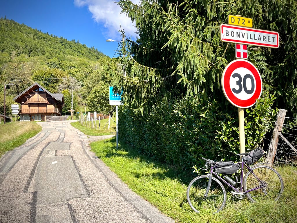
Bonvillaret from Val d'Arc is a climb in the region La Maurienne. It is 4.6 km long and bridges 340 m of vertical ascent with an average gradient of 7.4%, resulting in a difficulty score of 289. The top of the ascent is located at 680 m above sea level. Climbfinder users shared 3 reviews of this climb and uploaded 4 photos.
Road name: Route de Bonvillaret
3.0 by Cordoba110This is an automatic translation, the original language is: Dutch.Not too tough climb, ideal as training. In the second half, gradients of 7% - 11% alternate with recovery sections of 4-6%. Didn't encounter a single car throughout the climb and descent. You could also call it the route de châitaigniers, I did this climb in autumn and it is constantly slaloming between the fallen tame castagnes.... read more
Welcome! Please activate your account if you would like to share something. Look for the verification email in your inbox.
If you want to upload your photos, you need to create an account. It only takes 1 minute and it's completely free.
Not too tough climb, ideal as training. In the second half, gradients of 7% - 11% alternate with recovery sections of 4-6%. Didn't encounter a single car throughout the climb and descent. You could also call it the route de châitaigniers, I did this climb in autumn and it is constantly slaloming between the fallen tame castagnes.
Niet te zware klim, ideaal als training. In de tweede helft wisselen percentages van 7% - 11% zich in trappen af met recuperatiestukken van 4-6%. Heel de klim én afdaling geen enkele auto tegen gekomen. Je kan het ook de route de châitaigniers kunnen noemen, ik deed deze klim in de herfst en het is constant slalommen tussen de afgevallen tamme castagnes.
The first 2 kilometres are tough. Then, the further you climb, the gentler the gradients become.
I didn't meet anyone. It has to be said that there's nothing very exciting on this road.
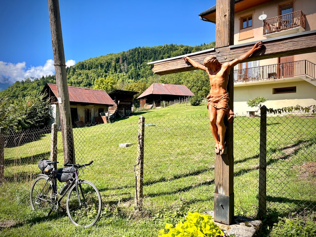
Except for a sunbathing Christ.
The village of Bonvillaret isn't very special either.
A short climb that will leave few moving memories.
Les 2 premiers kilomètres sont costauds. Et puis, plus l’on grimpe, plus les pourcentages s’adoucissent.
Je n’ai croisé personne. Il faut dire qu’il n’y a rien de très palpitant sur cette route.
Ah si ! J’ai rencontré un Christ qui bronzait.
Le village de Bonvillaret n’est pas non plus exceptionnel.
Une petite ascension qui ne laissera que peu de souvenirs émus.
Made on the 8th of May 2023,
Short but with a fairly muscular section at the start as the fairly accurate profile shows, after that it's quieter... so to speak.
Mostly in the shade, this climb is nice if you are on holiday in the area.
It is possible to descend to Aiton on the other side, on a narrow but good road.
This can be combined with the other side for the more experienced.
Fait le 8 mai 2023,
Court mais avec une partie assez musclée au début comme le montre le profil assez fidèle, ensuite c'est plus tranquille... si on peut dire.
En grande partie à l'ombre, cette ascension est sympa si vous êtes en vacances dans le secteur.
Possibilité de descendre sur Aiton par l'autre versant, sur une petite route étroite mais en bon état.
A combiner avec l'autre versant pour les plus entrainés.
| 7 km/h | 00:39:12 |
| 11 km/h | 00:24:57 |
| 15 km/h | 00:18:18 |
| 19 km/h | 00:14:26 |
This page is better in the app