Bois des Milleris from Hamanxard is a climb in the region Vosges. It is 5.1 km long and bridges 309 m of vertical ascent with an average gradient of 6%, resulting in a difficulty score of 215. The top of the ascent is located at 738 m above sea level. Climbfinder users shared 2 reviews of this climb and uploaded 2 photos.
Road names: D 20 & D 136E
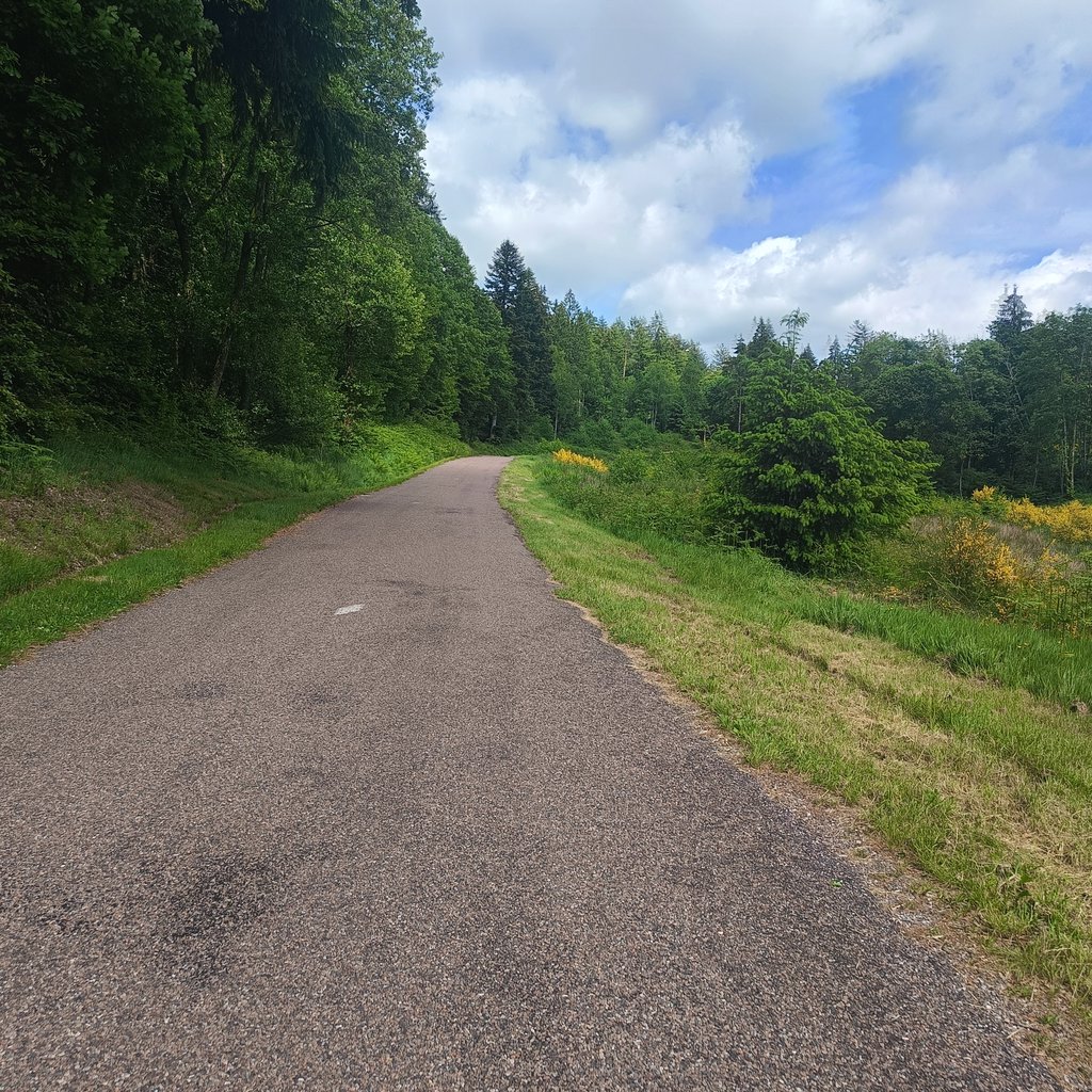
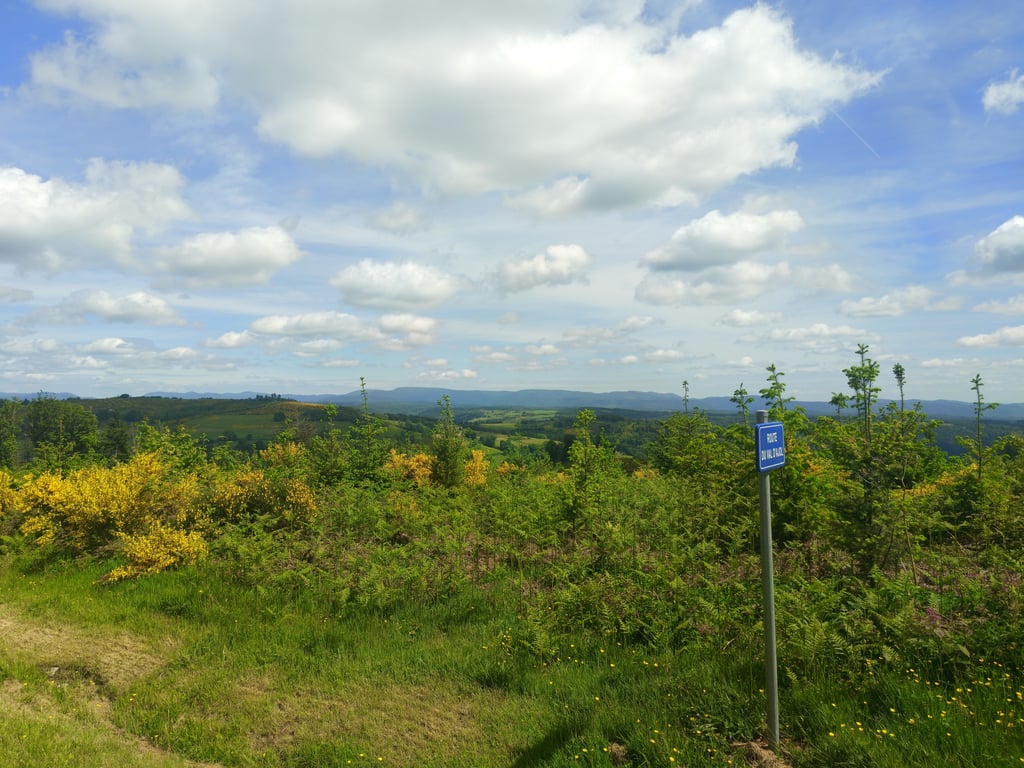
5.0 by MatteoDe klim start in een mooie vallei en kronkelt door de bossen omhoog. Op de top is er een prachtig ver uitzicht.... read more
Welcome! Please activate your account if you would like to share something. Look for the verification email in your inbox.
If you want to upload your photos, you need to create an account. It only takes 1 minute and it's completely free.
The climb starts in a beautiful valley and winds up through the forests. At the top, there is a beautiful distant view.
De klim start in een mooie vallei en kronkelt door de bossen omhoog. Op de top is er een prachtig ver uitzicht.
Don't be fooled by the profile. Halfway up, the gradient runs into the double digits for at least half a kilometre and that bolts anything but. What this map also fails to mention is that you are already climbing slightly from LeVal d'Ajol (=2 to 3 km). Mostly 2-3%, but just before Hamanxard also a bit of 5%. And then there is this whole climb, which all in all is surprisingly long for these parts. Mostly forest, so few views. And almost always a lot of wind here, so depending on how it is, the steep part will be easier or more challenging.
Laat je niet foppen door het profiel. Halverwege loopt het stijgingspercentage minstens een halve kilometer in de dubbele cijfers en dat bolt allesbehalve. Wat deze kaart er ook niet bij vermeld is dat je al vanaf LeVal d'Ajol (=2 à 3 km) licht aan het klimmen bent. Veelal 2-3%, maar vlak voor Hamanxard ook een stukje 5%. En daarna volgt dus nog deze hele klim, die al met al verrassend lang is voor deze contreien. Vooral bos, dus weinig uitzicht. En vrijwel altijd veel wind hier, afhankelijk van hoe die staat is het steile gedeelte wat makkelijker of juist beuken.
| 7 km/h | 00:43:54 |
| 11 km/h | 00:27:56 |
| 15 km/h | 00:20:29 |
| 19 km/h | 00:16:10 |
This page is better in the app