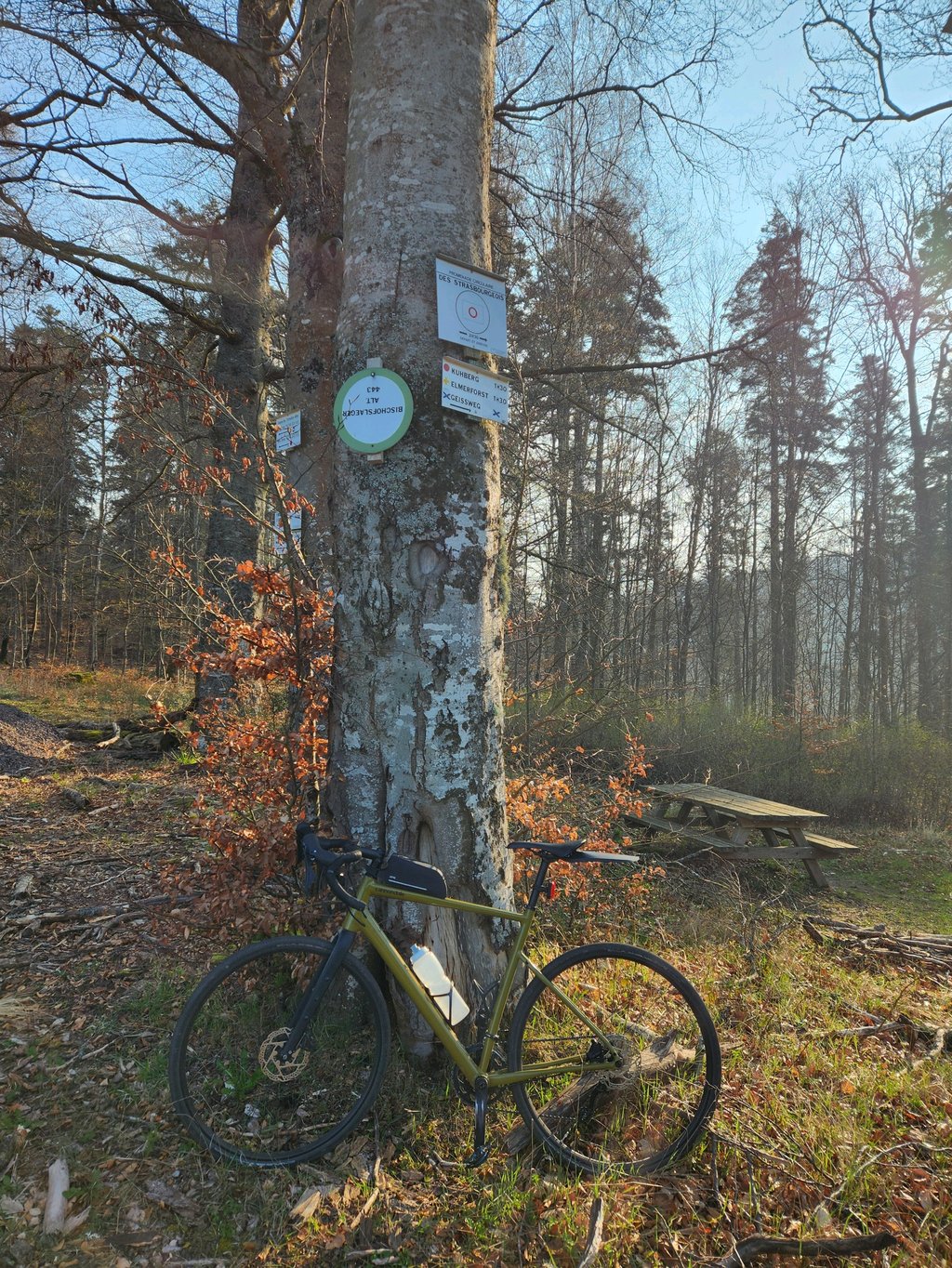
Bischofslaeger is a climb in the region Lower Rhine. It is 3.8 km long and bridges 177 m of vertical ascent with an average gradient of 4.7%, resulting in a difficulty score of 96. The top of the ascent is located at 443 m above sea level. Climbfinder users shared 1 review/story of this climb and uploaded 3 photos.
This is an automatic translation, the original language is: French.
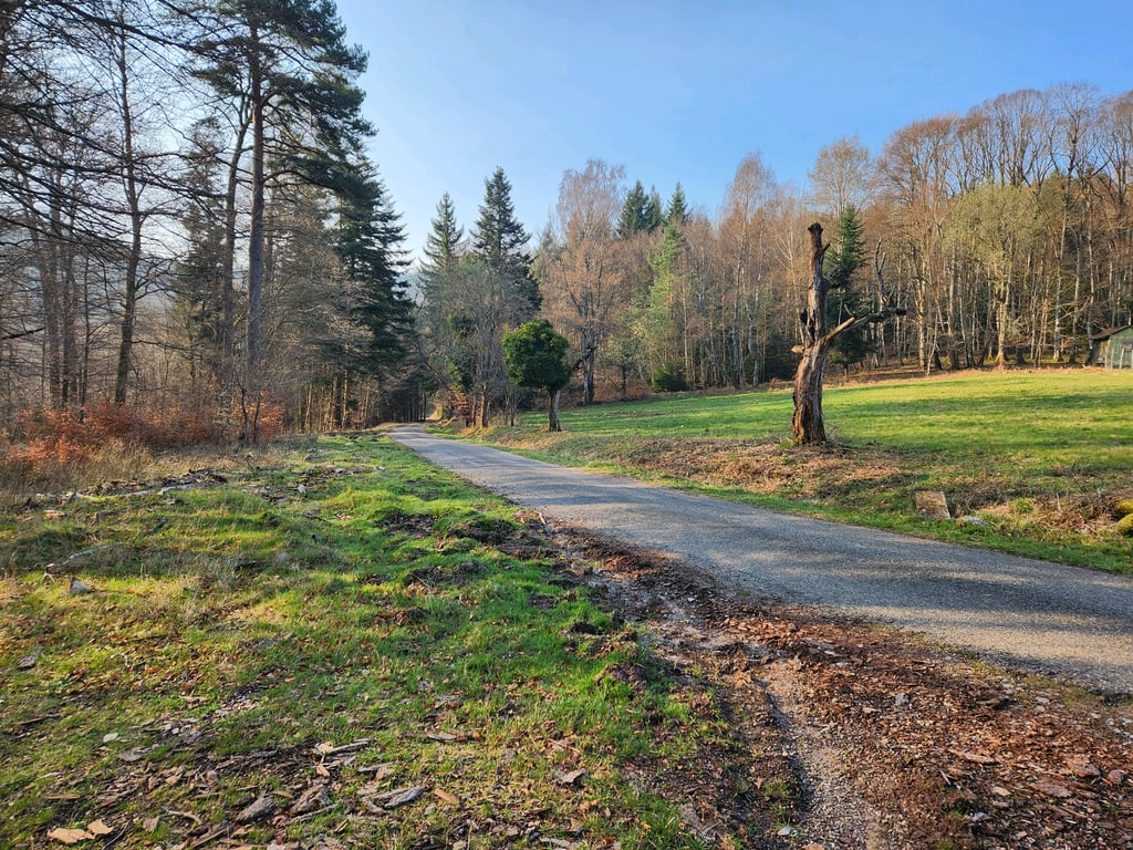
The road isn't necessarily in good condition, but it does go uphill.
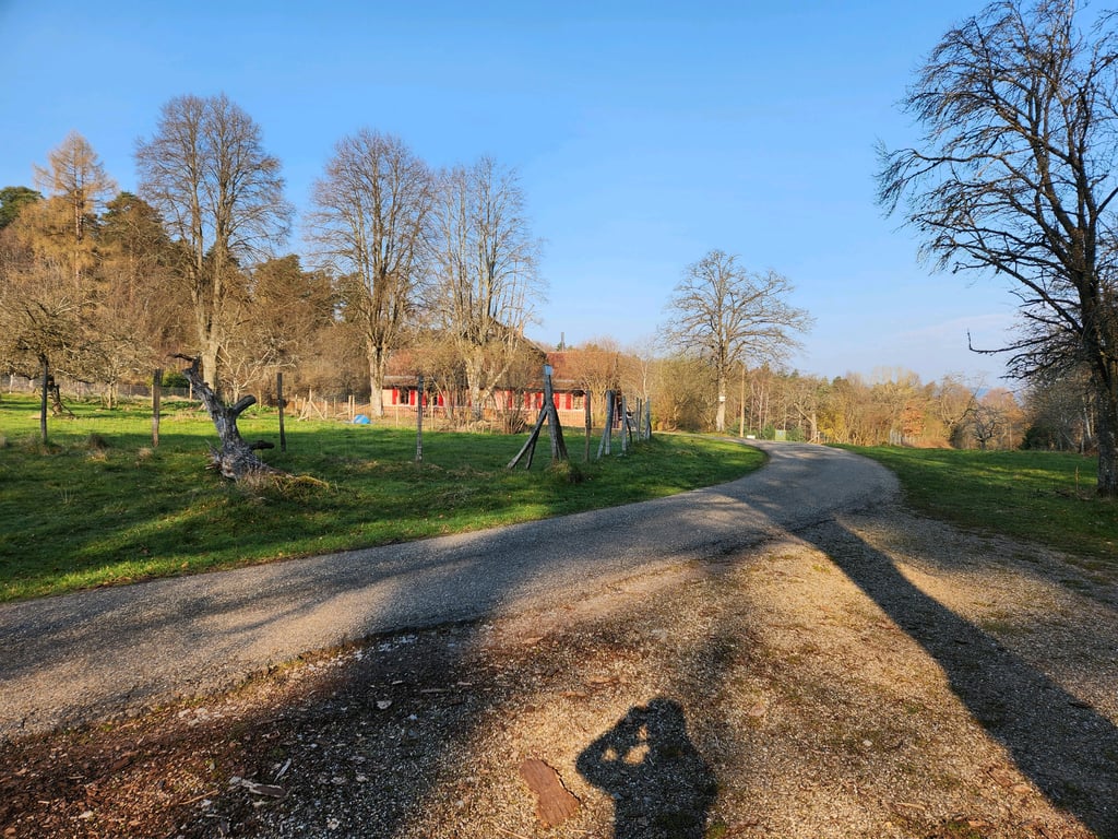
The ascent through the forest is pleasant, passing by fishing ponds, then arriving at the Bischofslaeger forest house located in a beautiful clearing at the crossroads of numerous hiking trails after a final hairpin bend.
From here, you can descend to Freudeneck or reach Wangenbourg on gravelly but rolling forest paths....read more
Photos (3)
Welcome! Please activate your account if you would like to share something. Look for the verification email in your inbox.
This is an automatic translation, the original language is: French.
Show original
The road isn't necessarily in good condition, but it does go uphill.
The ascent through the forest is pleasant, passing by fishing ponds, then arriving at the Bischofslaeger forest house located in a beautiful clearing at the crossroads of numerous hiking trails after a final hairpin bend.
From here, you can descend to Freudeneck or reach Wangenbourg on gravelly but rolling forest paths.
La route n'est pas forcément en bon état mais ça passe en montée.
L'ascension en forêt est agréable ,on passe à proximité d'étangs de pêche,puis arrivée à la maison forestière du Bischofslaeger situé dans une belle clairière carrefour de nombreux chemins de randonnée après une dernière épingle.
De là possibilité de redescendre sur Freudeneck ou de rejoindre Wangenbourg par des chemins forestiers gravel mais roulant.
Share your knowledge. What was the road condition during your ascent?
Traffic
100% 0% 0%
Based on 1 vote
Your experience counts. How much traffic did you encounter during the climb?
Frequently Asked Questions
You don't need special gearing for Bischofslaeger. The slope isn't long or steep enough to require much shifting down. You can conquer this climb on power alone. However, a compact gearing system with a smallest front chainring of 34 and largest rear sprocket of 28 or 30 is always nice if you enjoy cycling uphill. This helps maintain a smooth cadence.
Bischofslaeger is a 4th-category climb. A sprint to the top is usually not an option, and untrained riders will definitely feel it in their legs. For trained cyclists, it is a great training climb.
Bischofslaeger is 3.8 km long.
The average gradient of Bischofslaeger is 4.7%.
Bischofslaeger has a steepest segment with an average gradient of 8.5%.
The summit of Bischofslaeger is at 443 m.
At a slow pace of 7 km/h, it takes about 00:32:27 to climb Bischofslaeger. At 11 km/h the time is 00:20:39, and at 15 km/h 00:15:08. For the fastest cyclists, 00:11:57 is an achievable time.