| 20 hairpin turns |
| #78 toughest climb of Trentino-South Tyrol |
| #62 most elevation gain of Bolzano |
| #70 longest climb of Dolomites |
| #71 average steepest climb of Bolzano |
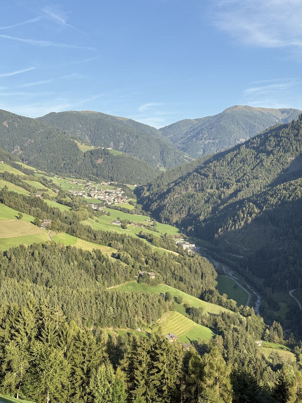
Alpe di Rodengo from Kreuzplon is a climb in the region Dolomites. It is 9.6 km long and bridges 946 m of vertical ascent with an average gradient of 9.9%, resulting in a difficulty score of 1062. The top of the ascent is located at 1727 m above sea level. Climbfinder users shared 1 review/story of this climb and uploaded 1 photo.
Road names: Via Kreuz, Kreuznerberg & Via Berg
3.0 by cv93This is an automatic translation, the original language is: Italian.a climb that is not reminiscent of the neighbouring Dolomites, but which has a charm all its own. It is tackled on a narrow mountain road (single-track), with rough but well-maintained asphalt. The presence of small stones, gravel or dry grass dragged from the surrounding meadows should be noted: nothing that creates problems on the ascent, but on the descent it is better to avoid it, since there are safer and more comfortable alternatives. The gradient is almost always above 10%, with only a... read more
Welcome! Please activate your account if you would like to share something. Look for the verification email in your inbox.
If you want to upload your photos, you need to create an account. It only takes 1 minute and it's completely free.
a climb that is not reminiscent of the neighbouring Dolomites, but which has a charm all its own. It is tackled on a narrow mountain road (single-track), with rough but well-maintained asphalt. The presence of small stones, gravel or dry grass dragged from the surrounding meadows should be noted: nothing that creates problems on the ascent, but on the descent it is better to avoid it, since there are safer and more comfortable alternatives.
The gradient is almost always above 10%, with only a couple of short sections that are really more severe. For a good part you pedal through the woods, but the best moments come when they open up, offering glimpses of green pastures and the valley below.
If you find yourself in the area, it is definitely worth a try: on a hunch, this is the best side to climb, while to descend you should choose another route.
una salita che non ricorda le vicine Dolomitiche, ma che ha un fascino tutto suo. Si affronta su una stretta stradina di montagna (a carreggiata unica), con asfalto ruvido ma ben tenuto. Va segnalata la presenza di piccole pietre, ghiaietta o erba secca trascinata dai prati circostanti: nulla che crei problemi in salita, ma in discesa è meglio evitarla, visto che ci sono alternative più sicure e comode.
La pendenza si mantiene quasi sempre sopra il 10%, con solo un paio di brevi tratti davvero più severi. Per buona parte si pedala immersi nei boschi, ma i momenti più belli arrivano quando questi si aprono, regalando scorci sui pascoli verdi e sulla vallata sottostante.
Se ci si trova in zona, merita sicuramente un tentativo: a sensazione questo è il versante migliore per salire, mentre per scendere conviene scegliere un’altra strada.
| 7 km/h | 01:22:12 |
| 11 km/h | 00:52:18 |
| 15 km/h | 00:38:21 |
| 19 km/h | 00:30:17 |
This page is better in the app