View on map
© MapLibre | OpenStreetMap contributors
1%
2%
4%
6%
8%
10%
12%
15%
20%

Aachener Wald via Lütticher Strasse

3.3
3 reviews | Elevation profile | 6 photos
Tips nearby
Aachener Wald via Lütticher Strasse
transparant thumb
transparant thumb
Your achievable time
Calculating based on your best performances...
Relaxed
Maximum
W/kg
W/kg
W/kg
Analyse your climbing performance
Detailed insight into your climbing performance & automatically check off climbs
Based on your best performances.
Your best attempt:
Number of attempts:
Elevation profile Aachener Wald via Lütticher Strasse

Statistics

Difficulty points 32
Length 1.7 km
Average gradient 3.7%
Steepest 100 metres 7%
Total ascent 63 m
Feedback about this climb?
Show climbs nearby Export to GPS device

Aachener Wald via Lütticher Strasse is a climb in the region Cologne. It is 1.7 km long and bridges 63 m of vertical ascent with an average gradient of 3.7%, resulting in a difficulty score of 32. The top of the ascent is located at 355 m above sea level. Climbfinder users shared 3 reviews of this climb and uploaded 6 photos.

Road names: Entenpfuhler Weg, Osterweg & Revierweg

4.0 by Jarin
This is an automatic translation, the original language is: Dutch.
Nice climb that slows down a bit in incline after a run-up, after which you have reached the summit immediately after the last effort at the local version of a Seven's jump (Sieberg). A gem!... read more

Photos (6)

Aachener Wald via Lütticher Strasse

Your uploads (max 4)

Welcome! Please activate your account if you would like to share something. Look for the verification email in your inbox.

If you want to upload your photos, you need to create an account. It only takes 1 minute and it's completely free.

  • Receive free climbfinder goodies for your reviews & photos.
  • Create a bucket list and check off conquered climbs.
  • Add missing climbs.
Continue with GoogleContinue with Google Continue with FacebookContinue with Facebook Continue with AppleContinue with Apple Sign up with email
By signing up you agree to our terms of service and confirm that you have read our privacy & content policy.

Reviews (3)

5.0
4.0
3.0
2.0
1.0
Jarin
1 y 4.0 via the Climbfinder app
This is an automatic translation, the original language is: Dutch. Show original

Nice climb that slows down a bit in incline after a run-up, after which you have reached the summit immediately after the last effort at the local version of a Seven's jump (Sieberg). A gem!

Mooie klim die na een aanloopje wat in stijging afneemt, waarna je meteen laatste inspanning bij de lokale versie van een Zevensprong (Sieberg) de top heb bereikt. Een juweeltje!

Aachener Wald via Lütticher Strasse
Dashboard
Fedor
1 y 3.0
This is an automatic translation, the original language is: Dutch. Show original

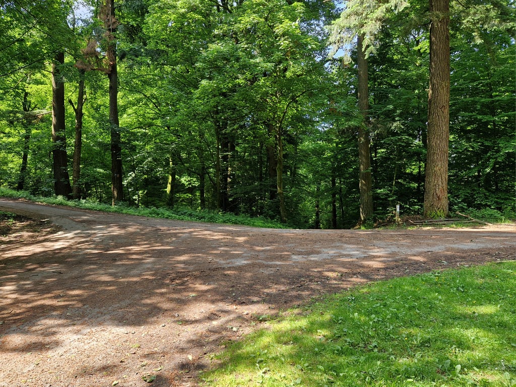
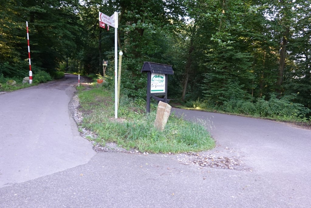
A climb completely in the forest. Pretty uphill at first where it cycles further uphill on the left at the highest point. Here the tarmac is moderate but there is a good track while a flatter section follows. Further on, the road gets better and steeper again which continues to the highest point (in the left turn).

Een klim volledig in het bos. In het begin aardig oplopend waarbij het op het hoogste punt linksaf verder omhoog fietst. Hier is het asfalt matig maar er is wel een goed spoor terwijl er een vlakker stuk volgt. Verderop wordt de weg weer beter en steiler wat doorloopt tot het hoogste punt (in de bocht naar links).

Aachener Wald via Lütticher Strasse
Dashboard
BikerJohan
1 y 3.0
This is an automatic translation, the original language is: Dutch. Show original

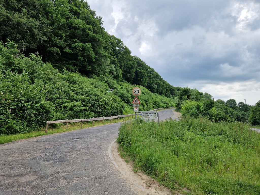
Not too difficult climb in the Aachenerwald. Froma the Lütticherstrasse you turn onto the Enthenpfuhlerweg. At the first junction, keep left and go up the Osterweg. Hardest parts are at the beginning and end. The middle section can be described as false flat.

Niet te moeilijke klim in het Aachenerwald. Vana de Lütticherstrasse ga je de Enthenpfuhlerweg op. Op de eerste splitsing hou je links aan en ga je de Osterweg op. Zwaarste stukken zitten aan het begin en einde. Middendeel is te bestempelen als vals plat.

Dashboard

Climbing times

7 km/h 00:14:43
11 km/h 00:09:21
15 km/h 00:06:52
19 km/h 00:05:25

Road surface condition

0% 0% 0%
Based on 0 votes
Share your knowledge. What was the road condition during your ascent?

Traffic

0% 0% 0%
Based on 0 votes
Your experience counts. How much traffic did you encounter during the climb?

Frequently Asked Questions

You don't need special gearing for Aachener Wald via Lütticher Strasse. The slope isn't long or steep enough to require much shifting down. You can conquer this climb on power alone. However, a compact gearing system with a smallest front chainring of 34 and largest rear sprocket of 28 or 30 is always nice if you enjoy cycling uphill. This helps maintain a smooth cadence.

Aachener Wald via Lütticher Strasse falls into the 5th category. With good fitness, you can ride it up with speed and power. If you have less training, shift down and climb smoothly.

Aachener Wald via Lütticher Strasse is 1.7 km long.

The average gradient of Aachener Wald via Lütticher Strasse is 3.7%.

Aachener Wald via Lütticher Strasse has a steepest segment with an average gradient of 7%.

The summit of Aachener Wald via Lütticher Strasse is at 355 m.

At a slow pace of 7 km/h, it takes about 00:14:43 to climb Aachener Wald via Lütticher Strasse. At 11 km/h the time is 00:09:21, and at 15 km/h 00:06:52. For the fastest cyclists, 00:05:25 is an achievable time.

Aachener Wald via Lütticher Strasse is located in the region Cologne in Germany.

This page is better in the app

Climbfinder app
Climbfinder
(Free)
Open