100k+ climbers track their ascents in the Climbfinder App
Discover
Map
Regions
Ranking
Analytics
Premium
Climbs
No results found
Regions
No results found
Places
No results found
US
English
English (US units)
Nederlands
Français
Deutsch
Italiano
Español
Polski
Dashboard
My routes
My climbs
Climbfinder goodies
Settings
Log out
Continue with Google
Continue with Facebook
Continue with Apple
or
Log in
Sign up
Home
Ranking
Most popular climbs - Germany
The ultimate climbing rankings
Most popular
Most popular
Toughest
Steepest
Longest
Elevation gain
Highest
Hairpins
Best rated
Germany
Regions
No results found
Places
No results found
My location
Retrieving location...
Browser location not shared
Remove current selection
All
Bucket list
17.291
climbs
0.0
% ridden
Previous
Next
Loading...
No climbs found
11326
Your best attempt:
Climbed
Bucket list climb
Not yet climbed
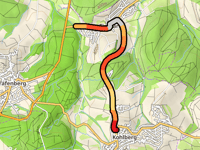
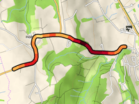
Kohlberg via Tischardt
2 mi
4.4%
84
459 ft
1575 ft
4
11327
Your best attempt:
Climbed
Bucket list climb
Not yet climbed
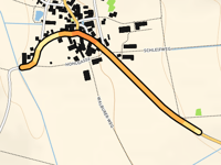
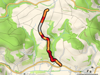
Ottenberg via Grummetsgrund
0.5 mi
2.5%
7
72 ft
1519 ft
11328
Your best attempt:
Climbed
Bucket list climb
Not yet climbed
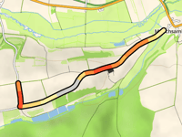
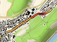
Büchelberg from Mönchsambach
1.3 mi
3.2%
34
217 ft
1096 ft
5
11329
Your best attempt:
Climbed
Bucket list climb
Not yet climbed
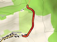
Mönchsberg / Winterleite
0.4 mi
7.7%
43
184 ft
1991 ft
5
11330
Your best attempt:
Climbed
Bucket list climb
Not yet climbed
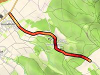
Alter Staffelberg from Grundfeld
1.7 mi
7.0%
153
627 ft
1526 ft
3
11331
Your best attempt:
Climbed
Bucket list climb
Not yet climbed
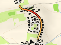
Hintsberg from Steinhöring
0.3 mi
4.1%
10
66 ft
1732 ft
11332
Your best attempt:
Climbed
Bucket list climb
Not yet climbed
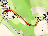
Etzenberg from Abersdorf
0.6 mi
5.2%
34
164 ft
1877 ft
5
11333
Your best attempt:
Climbed
Bucket list climb
Not yet climbed
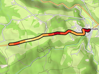
Haushamer Strasse from Wörnsmühl
1.8 mi
5.3%
112
512 ft
2779 ft
1
4
11334
Your best attempt:
Climbed
Bucket list climb
Not yet climbed
Quarzsandgrube via Lessingstrasse
1.4 mi
5.0%
83
364 ft
522 ft
4
11335
Your best attempt:
Climbed
Bucket list climb
Not yet climbed
Konatsried from Hundhagermühle
2 mi
4.2%
74
433 ft
2005 ft
5
11336
Your best attempt:
Climbed
Bucket list climb
Not yet climbed
Pfaffenberg from Dürnersdorf
0.8 mi
4.3%
31
174 ft
1690 ft
5
11337
Your best attempt:
Climbed
Bucket list climb
Not yet climbed
Eichenberg from Döllnitzbach
0.4 mi
6.9%
37
138 ft
1706 ft
5
11338
Your best attempt:
Climbed
Bucket list climb
Not yet climbed
Engratshofen from Weldermühle
0.4 mi
6.0%
26
115 ft
2395 ft
5
11339
Your best attempt:
Climbed
Bucket list climb
Not yet climbed
Illchberg from Wildsteig
1.1 mi
6.7%
91
387 ft
3140 ft
4
11340
Your best attempt:
Climbed
Bucket list climb
Not yet climbed
Lendrass from Hettisried
1.9 mi
4.6%
83
456 ft
2848 ft
4
11341
Your best attempt:
Climbed
Bucket list climb
Not yet climbed
Wiedenberg from Haselbach
1.1 mi
2.9%
22
164 ft
1906 ft
11342
Your best attempt:
Climbed
Bucket list climb
Not yet climbed
Henrichsknübel from Eichholz
0.9 mi
4.8%
43
223 ft
797 ft
5
11343
Your best attempt:
Climbed
Bucket list climb
Not yet climbed
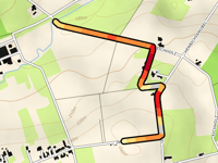
Eichelsberg from Nesselröden via Holzhausen
3.5 mi
3.7%
103
696 ft
1430 ft
4
4
11344
Your best attempt:
Climbed
Bucket list climb
Not yet climbed
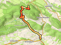
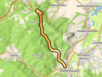
Jagdhaus Bodesruh from Wölfershausen
4.2 mi
2.9%
75
643 ft
1371 ft
4
11345
Your best attempt:
Climbed
Bucket list climb
Not yet climbed
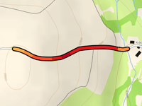
Krätlemühle from Higgenhof
0.4 mi
7.6%
37
151 ft
2277 ft
5
11346
Your best attempt:
Climbed
Bucket list climb
Not yet climbed
Höhreute berg from Zussdorf
1.4 mi
7.5%
165
561 ft
2546 ft
3
11347
Your best attempt:
Climbed
Bucket list climb
Not yet climbed
Lellwangen via Sinnenberg
1.3 mi
6.0%
108
427 ft
1969 ft
4
11348
Your best attempt:
Climbed
Bucket list climb
Not yet climbed
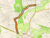
Berg from Thuir via Tontenbach
1.2 mi
3.6%
31
230 ft
1024 ft
5
11349
Your best attempt:
Climbed
Bucket list climb
Not yet climbed
Rainberg via Tannenstrasse
0.8 mi
4.7%
39
197 ft
676 ft
5
11350
Your best attempt:
Climbed
Bucket list climb
Not yet climbed
Ansteig von Oberoberndorf
2.5 mi
3.0%
54
384 ft
1171 ft
5
Previous
Next
Your best attempt:
Climbed
Bucket list climb
Not yet climbed
a
This page is better in the app
Climbfinder
(Free)
Open