Analyze your climb times with the Climbfinder App
Discover
Map
Regions
Ranking
Analytics
Premium
Climbs
No results found
Regions
No results found
Places
No results found
US
English
English (US units)
Nederlands
Français
Deutsch
Italiano
Español
Polski
Dashboard
My routes
My climbs
Climbfinder goodies
Settings
Log out
Continue with Google
Continue with Facebook
Continue with Apple
or
Log in
Sign up
Home
Ranking
Most popular climbs - Germany
The ultimate climbing rankings
Most popular
Most popular
Toughest
Steepest
Longest
Elevation gain
Highest
Hairpins
Best rated
Germany
Regions
No results found
Places
No results found
My location
Retrieving location...
Browser location not shared
Remove current selection
All
Bucket list
17.291
climbs
0.0
% ridden
Previous
Next
Loading...
No climbs found
8376
Your best attempt:
Climbed
Bucket list climb
Not yet climbed
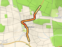
Rudolphshaner Höhe from Rudolphshan
1.1 mi
3.8%
30
223 ft
1335 ft
5
8377
Your best attempt:
Climbed
Bucket list climb
Not yet climbed
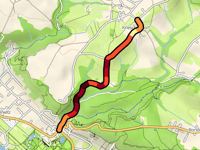
Malschendorf via Pillnitzberg
1.2 mi
9.0%
186
548 ft
991 ft
3
8378
Your best attempt:
Climbed
Bucket list climb
Not yet climbed
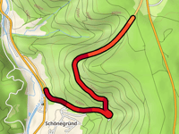
Besenfelder Strasse from Schönegründ
2.1 mi
8.8%
265
948 ft
2612 ft
1
3
8379
Your best attempt:
Climbed
Bucket list climb
Not yet climbed
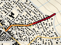
Kapellensteige from Eibelstädt
0.5 mi
8.0%
60
194 ft
784 ft
5
8380
Your best attempt:
Climbed
Bucket list climb
Not yet climbed
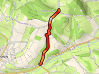
Haimberg / Giebelrain from Altenmühle
1.3 mi
7.0%
111
472 ft
1726 ft
1
4
8381
Your best attempt:
Climbed
Bucket list climb
Not yet climbed
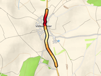
Völkersleier from Wartmannsroth
1 mi
3.8%
41
197 ft
1263 ft
5
8382
Your best attempt:
Climbed
Bucket list climb
Not yet climbed
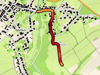
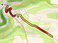
Am Rothsiefen from Nöthen
0.5 mi
9.2%
67
220 ft
1316 ft
5
8383
Your best attempt:
Climbed
Bucket list climb
Not yet climbed
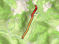
Wiessenberg via Kirchilpe
1.1 mi
4.7%
49
262 ft
1460 ft
5
8384
Your best attempt:
Climbed
Bucket list climb
Not yet climbed
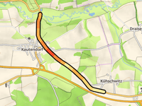
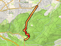
Geiersberg from Kautendorf
1.5 mi
3.2%
33
246 ft
1870 ft
5
8385
Your best attempt:
Climbed
Bucket list climb
Not yet climbed
Grubenholz from Oberndorf
0.3 mi
4.5%
10
66 ft
1581 ft
8386
Your best attempt:
Climbed
Bucket list climb
Not yet climbed
Reuther Strasse from Harmating
0.8 mi
4.8%
41
203 ft
2405 ft
5
8387
Your best attempt:
Climbed
Bucket list climb
Not yet climbed
Görwangs from Aitrang
1.1 mi
3.3%
32
194 ft
2628 ft
5
8388
Your best attempt:
Climbed
Bucket list climb
Not yet climbed
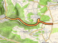
Rosenberg from Kyllburg
1.5 mi
6.5%
142
531 ft
1437 ft
2
4
8389
Your best attempt:
Climbed
Bucket list climb
Not yet climbed
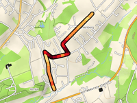
Ahlenberg via Unterer Ahlenbergweg
0.9 mi
6.6%
87
315 ft
810 ft
4
8390
Your best attempt:
Climbed
Bucket list climb
Not yet climbed
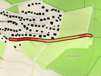
Falkensteinstrasse from Elmshagen
0.4 mi
5.7%
20
108 ft
1453 ft
8391
Your best attempt:
Climbed
Bucket list climb
Not yet climbed
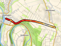
Albshausen from Guxhagen
1.6 mi
5.5%
104
472 ft
968 ft
4
8392
Your best attempt:
Climbed
Bucket list climb
Not yet climbed
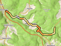
Pommer from Völkershain
5.3 mi
2.4%
81
679 ft
1614 ft
4
8393
Your best attempt:
Climbed
Bucket list climb
Not yet climbed
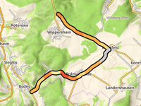
Wippershainer Höhe from Bodes
5.4 mi
2.7%
108
784 ft
1483 ft
4
8394
Your best attempt:
Climbed
Bucket list climb
Not yet climbed
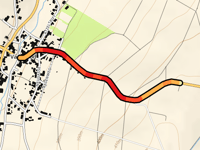
Wallenröder Strasse from Vadenrod
0.7 mi
6.4%
50
233 ft
1365 ft
5
8395
Your best attempt:
Climbed
Bucket list climb
Not yet climbed
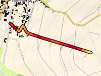
Kugelberg from Vadenrod via Rasenweg
0.6 mi
7.5%
62
246 ft
1388 ft
5
8396
Your best attempt:
Climbed
Bucket list climb
Not yet climbed
Bergheimer Steige from Wolfbusch
1.8 mi
5.0%
85
476 ft
1585 ft
4
8397
Your best attempt:
Climbed
Bucket list climb
Not yet climbed
Im Aischfeld from Alpirsbach
3.3 mi
4.2%
108
732 ft
2182 ft
4
8398
Your best attempt:
Climbed
Bucket list climb
Not yet climbed
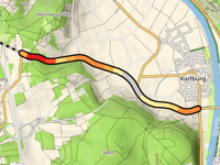
Mausberg from Karlburg
2.4 mi
3.3%
76
423 ft
948 ft
4
8399
Your best attempt:
Climbed
Bucket list climb
Not yet climbed
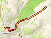
Hohe Hardt from Grünsfeld via Laistrasse
1.6 mi
5.3%
86
436 ft
1148 ft
4
8400
Your best attempt:
Climbed
Bucket list climb
Not yet climbed
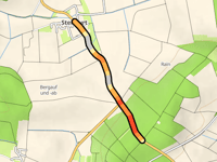
Gitzberg from Steinfurt
0.9 mi
3.4%
26
167 ft
1368 ft
5
Previous
Next
Your best attempt:
Climbed
Bucket list climb
Not yet climbed
a
This page is better in the app
Climbfinder
(Free)
Open