View on map
© MapLibre | OpenStreetMap contributors
1%
2%
4%
6%
8%
10%
12%
15%
20%

Weidestraat via Constant Bauneweg

3.0
2 reviews | Elevation profile | 1 photo
Tips nearby
Weidestraat via Constant Bauneweg
transparant thumb
transparant thumb
transparant thumb
transparant thumb
transparant thumb
transparant thumb
transparant thumb
Your achievable time
Calculating based on your best performances...
Relaxed
Maximum
W/kg
W/kg
W/kg
Analyze your climbing performance
Detailed insight into your climbing performance & automatically check off climbs
Based on your best performances.
Your best attempt:
Number of attempts:
Elevation profile Weidestraat via Constant Bauneweg
paved
cobbles
paved

Statistics

Difficulty points 37
Length 1.3 mi
Average gradient 2.8%
Steepest segment 9.8%
Total ascent 187 ft

Short recap

Beautiful scenery
#83 toughest climb of Flemish Brabant
#83 most elevation gain of Flemish Brabant
#79 longest climb of Flemish Brabant
Feedback about this climb?
Show climbs nearby Export to GPS device

Weidestraat via Constant Bauneweg is a climb in the region Pajottenland. It is 1.3 mi long and bridges 187 ft of vertical ascent with an average gradient of 2.8%, resulting in a difficulty score of 37. The top of the ascent is located at 262 ft above sea level. Climbfinder users shared 2 reviews of this climb and uploaded 1 photo.

Road names: Nieuwstraat - Rue Neuve, Dachelenbergstraat, Constant Bauneweg & Weidestraat
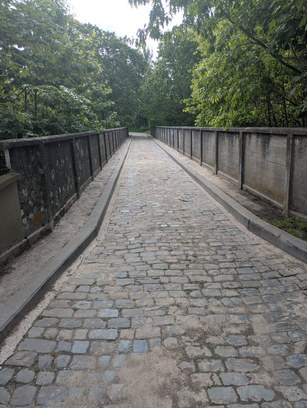
3.0 by macamelb
This is an automatic translation, the original language is: French.
Nice little climb away from the traffic (as soon as you leave the main road). Initially in a residential area, then along the railroad. A steeper section, but preceded by a short descent, so not too difficult. The narrow bridge after this harder section makes this side all the more enjoyable.... read more

Photos (1)

Weidestraat via Constant Bauneweg
transparant thumb
transparant thumb
transparant thumb
transparant thumb
transparant thumb

Your uploads (max 4)

Welcome! Please activate your account if you would like to share something. Look for the verification email in your inbox.

If you want to upload your photos, you need to create an account. It only takes 1 minute and it's completely free.

  • Receive free climbfinder goodies for your reviews & photos.
  • Create a bucket list and check off conquered climbs.
  • Add missing climbs.
Continue with GoogleContinue with Google Continue with FacebookContinue with Facebook Continue with AppleContinue with Apple Sign up with email
By signing up you agree to our terms of service and confirm that you have read our privacy & content policy.

Reviews (2)

5.0
4.0
3.0
2.0
1.0
macamelb
3 w 3.0
This is an automatic translation, the original language is: French. Show original

Nice little climb away from the traffic (as soon as you leave the main road). Initially in a residential area, then along the railroad. A steeper section, but preceded by a short descent, so not too difficult. The narrow bridge after this harder section makes this side all the more enjoyable.

Chouette petite montée à l'écart de la circulation (à partir du moment où l'on quitte la route principale). Au début en zone résidentielle puis le long du chemin de fer. Un passage plus raide mais qui est précédé d'une petite descente, ce qui le rend pas trop difficile. Le petit pont étroit après cette portion plus dure rend cette côté d'autant plus sympa.

Dashboard
Franck_Pastor
8 Mo 3.0
This is an automatic translation, the original language is: French. Show original

Unlike its neighbour, the Dochelenberg, this double climb has a more varied setting: after the city section common to both variants, the narrow cobbled section at the end of the route gives it a much more picturesque air.

À la différence de son voisin, le « Dochelenberg », cette double ascension bénéficie d'un cadre plus varié : après la partie citadine commune aux deux variantes, la portion pavée et étroite en fin de parcours lui donne un air bien plus pittoresque.

Dashboard

Climbing times

5 mph 00:15:12
7 mph 00:10:45
9 mph 00:08:23
12 mph 00:06:18

Road surface condition

0% 100% 0%
Based on 1 vote
Share your knowledge. What was the road condition during your ascent?

Traffic

0% 100% 0%
Based on 1 vote
Your experience counts. How much traffic did you encounter during the climb?

Frequently Asked Questions

You don't need special gearing for Weidestraat via Constant Bauneweg. The slope isn't long or steep enough to require much shifting down. You can conquer this climb on power alone. However, a compact gearing system with a smallest front chainring of 34 and largest rear sprocket of 28 or 30 is always nice if you enjoy cycling uphill. This helps maintain a smooth cadence.

Weidestraat via Constant Bauneweg falls into the 5th category. With good fitness, you can ride it up with speed and power. If you have less training, shift down and climb smoothly.

Weidestraat via Constant Bauneweg is 1.3 mi long.

The average gradient of Weidestraat via Constant Bauneweg is 2.8%.

Weidestraat via Constant Bauneweg has a steepest segment with an average gradient of 9.8%.

The summit of Weidestraat via Constant Bauneweg is at 262 ft.

At a slow pace of 5 mph, it takes about 00:15:12 to climb Weidestraat via Constant Bauneweg. At 7 mph the time is 00:10:45, and at 9 mph 00:08:23. For the fastest cyclists, 00:06:18 is an achievable time.

Weidestraat via Constant Bauneweg is located in the region Flemish Brabant in Belgium.

This page is better in the app

Climbfinder app
Climbfinder
(Free)
Open