View on map
© MapLibre | OpenStreetMap contributors
1%
2%
4%
6%
8%
10%
12%
15%
20%

Weg naar As from Genk

3.0
1 review/story | Elevation profile | 2 photos
Tips nearby
Weg naar As from Genk
transparant thumb
transparant thumb
transparant thumb
transparant thumb
transparant thumb
transparant thumb
Your achievable time
Calculating based on your best performances...
Relaxed
Maximum
W/kg
W/kg
W/kg
Analyze your climbing performance
Detailed insight into your climbing performance & automatically check off climbs
Based on your best performances.
Your best attempt:
Number of attempts:
Elevation profile Weg naar As from Genk

Statistics

Difficulty points 5
Length 0.3 mi
Average gradient 2.9%
Steepest segment 5.2%
Total ascent 46 ft

Short recap

1 hairpin turn
#95 longest climb of Kempens Plateau
#85 average steepest climb of Kempens Plateau
Feedback about this climb?
Show climbs nearby Export to GPS device

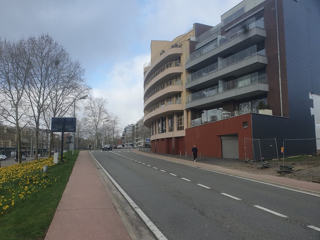
Weg naar As from Genk is a climb in the region Kempens Plateau. It is 0.3 mi long and bridges 46 ft of vertical ascent with an average gradient of 2.9%, resulting in a difficulty score of 5. The top of the ascent is located at 262 ft above sea level. Climbfinder users shared 1 review/story of this climb and uploaded 2 photos.

Road name: Weg naar As

3.0 by depolle
This is an automatic translation, the original language is: Dutch.
Departing from Europalaan, the ascent is gentle with a sort of hairpin bend, after which you can see the summit looming in the distance.This slope has quite a bit of cycling history attached to it.For example, it has been the setting for a few arrivals in the EnecoTour, the worldtour race currently known as the Renewitour.This Genk climb will probably also be included as a transit route in a cycling route rather than being a goal in itself.... read more

Photos (2)

Weg naar As from Genk
transparant thumb
transparant thumb
transparant thumb
transparant thumb

Your uploads (max 4)

Welcome! Please activate your account if you would like to share something. Look for the verification email in your inbox.

If you want to upload your photos, you need to create an account. It only takes 1 minute and it's completely free.

  • Receive free climbfinder goodies for your reviews & photos.
  • Create a bucket list and check off conquered climbs.
  • Add missing climbs.
Continue with GoogleContinue with Google Continue with FacebookContinue with Facebook Continue with AppleContinue with Apple Sign up with email
By signing up you agree to our terms of service and confirm that you have read our privacy & content policy.

Reviews (1)

5.0
4.0
3.0
2.0
1.0
depolle
1 y 3.0
This is an automatic translation, the original language is: Dutch. Show original

Departing from Europalaan, the ascent is gentle with a sort of hairpin bend, after which you can see the summit looming in the distance.This slope has quite a bit of cycling history attached to it.For example, it has been the setting for a few arrivals in the EnecoTour, the worldtour race currently known as the Renewitour.This Genk climb will probably also be included as a transit route in a cycling route rather than being a goal in itself.

Vertrekkend vanuit de Europalaan gaat het met een soort haarspeldbocht meteen gezapig naar boven.Hierna ziet men de top in de verte al vrij snel voor zich opdoemen.Aan deze helling kleeft behoorlijk wat wielergeschiedenis.Zo was ze o.a. een paar maal het decor van een aankomst in de EnecoTour, de worldtourwedstrijd die momenteel onder de naam RenewiTour door het leven gaat.Ook deze Genkse klim zal wellicht vooral eerder als een doorgangsweg in een fietstraject opgenomen worden dan een doel op zich zijn.

Dashboard

Climbing times

5 mph 00:03:34
7 mph 00:02:31
9 mph 00:01:58
12 mph 00:01:28

Road surface condition

100% 0% 0%
Based on 1 vote
Share your knowledge. What was the road condition during your ascent?

Traffic

50% 50% 0%
Based on 2 votes
Your experience counts. How much traffic did you encounter during the climb?

Frequently Asked Questions

You don't need special gearing for Weg naar As from Genk. The slope isn't long or steep enough to require much shifting down. You can conquer this climb on power alone. However, a compact gearing system with a smallest front chainring of 34 and largest rear sprocket of 28 or 30 is always nice if you enjoy cycling uphill. This helps maintain a smooth cadence.

Weg naar As from Genk is not tough enough to be assigned a mountain category. This means that even untrained cyclists can reach the top without any problems on this climb.

Weg naar As from Genk is 0.3 mi long.

The average gradient of Weg naar As from Genk is 2.9%.

Weg naar As from Genk has a steepest segment with an average gradient of 5.2%.

The summit of Weg naar As from Genk is at 262 ft.

At a slow pace of 5 mph, it takes about 00:03:34 to climb Weg naar As from Genk. At 7 mph the time is 00:02:31, and at 9 mph 00:01:58. For the fastest cyclists, 00:01:28 is an achievable time.

Weg naar As from Genk is located in the region Belgium Limburg in Belgium.

This page is better in the app

Climbfinder app
Climbfinder
(Free)
Open