View on map
© MapLibre | OpenStreetMap contributors
1%
2%
4%
6%
8%
10%
12%
15%
20%

Wahlwiller from Partij

1.4
5 reviews | Elevation profile | 1 photo
Tips nearby
Wahlwiller from Partij
transparant thumb
transparant thumb
transparant thumb
transparant thumb
transparant thumb
transparant thumb
transparant thumb
Your achievable time
Calculating based on your best performances...
Relaxed
Maximum
W/kg
W/kg
W/kg
Analyze your climbing performance
Detailed insight into your climbing performance & automatically check off climbs
Based on your best performances.
Your best attempt:
Number of attempts:
Elevation profile Wahlwiller from Partij

Statistics

Difficulty points 7
Length 0.9 mi
Average gradient 2.1%
Steepest segment 3.7%
Total ascent 98 ft
Feedback about this climb?
Show climbs nearby Export to GPS device

Wahlwiller from Partij is a climb in the region South Limburg. It is 0.9 mi long and bridges 98 ft of vertical ascent with an average gradient of 2.1%, resulting in a difficulty score of 7. The top of the ascent is located at 430 ft above sea level. Climbfinder users shared 5 reviews of this climb and uploaded 1 photo.
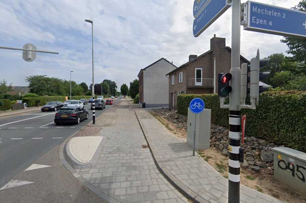
Road name: Rijksweg

2.0 by ScOgLiO
This is an automatic translation, the original language is: English.
Just a loooong, boring drag to get to the Drielandenpunt climb's start. Busy road and negligible gradients (it's a false flat), I took it as easy and slow as I could bea to save energy for the main course, so it seemed to last an eternity... read more

Photos (1)

Wahlwiller from Partij
transparant thumb
transparant thumb
transparant thumb
transparant thumb
transparant thumb

Your uploads (max 4)

Welcome! Please activate your account if you would like to share something. Look for the verification email in your inbox.

If you want to upload your photos, you need to create an account. It only takes 1 minute and it's completely free.

  • Receive free climbfinder goodies for your reviews & photos.
  • Create a bucket list and check off conquered climbs.
  • Add missing climbs.
Continue with GoogleContinue with Google Continue with FacebookContinue with Facebook Continue with AppleContinue with Apple Sign up with email
By signing up you agree to our terms of service and confirm that you have read our privacy & content policy.

Reviews (5)

5.0
4.0
3.0
2.0
1.0
ScOgLiO
2 Mo 2.0

Just a loooong, boring drag to get to the Drielandenpunt climb's start. Busy road and negligible gradients (it's a false flat), I took it as easy and slow as I could bea to save energy for the main course, so it seemed to last an eternity

Dashboard
ErikdeKlerk
1 y 1.0
This is an automatic translation, the original language is: Dutch. Show original

next time, take the parallel road; turn left at the crossroads in Wahlwiller and right between the pub and the church, and straight on to Nijswiller. This road is also called 'the tramway' after the tramway that was there many years ago.

neem volgende keer de parallelweg; bij het kruispunt in Wahlwiller linksaf en tussen de kroeg en de kerk rechtsaf, en rechtdoor naar Nijswiller. Deze weg heet ook wel 'de trambaan', naar de tramlijn die er vele jaren terug was.

Dashboard
DennisColijn
1 y 1.0
This is an automatic translation, the original language is: Dutch. Show original

The ugliest variant you can take. It goes straight on in 1 line, traffic lights halfway, along the busiest road in the hill country and also stretches with concrete slabs. Did 'm to tick off but that's really the only reason.

De meest lelijke variant die je kunt nemen. Het gaat in 1 streep rechtdoor, stoplichten halverwege, langs de drukste weg van het heuvelland en ook nog stukken met betonplaten. Heb 'm gedaan om af te kunnen vinken maar dat is ook echt de enige reden.

Dashboard
Fedor
1 y 1.0
This is an automatic translation, the original language is: Dutch. Show original

Boring climb along busy through road where you also encounter traffic lights halfway. Moreover, you cycle partly on a tiled path. Fortunately, there are much nicer alternatives,

Saaie klim langs de drukke doorgaande weg waarbij je halverwege ook nog verkeerslichten tegenkomt. Bovendien fiets je deels over een tegelpad. Gelukkig zijn er veel mooiere alternatieven,

Dashboard
BikerJohan
1 y 2.0
This is an automatic translation, the original language is: Dutch. Show original

Even and not too difficult climb along the clear cycle path of the N-278 from Partij to Nijswiller. Summit lies between Wahlwiller and Nijswiller.

Gelijkmatige en niet te moeilijke klim over het vrijliggende fietspad van de N-278 vanaf Partij naar Nijswiller. Top ligt tussen Wahlwiller en Nijswiller.

Dashboard

Climbing times

5 mph 00:10:41
7 mph 00:07:33
9 mph 00:05:53
12 mph 00:04:25

Road surface condition

0% 100% 0%
Based on 1 vote
Share your knowledge. What was the road condition during your ascent?

Traffic

0% 0% 100%
Based on 1 vote
Your experience counts. How much traffic did you encounter during the climb?

Frequently Asked Questions

You don't need special gearing for Wahlwiller from Partij. The slope isn't long or steep enough to require much shifting down. You can conquer this climb on power alone. However, a compact gearing system with a smallest front chainring of 34 and largest rear sprocket of 28 or 30 is always nice if you enjoy cycling uphill. This helps maintain a smooth cadence.

Wahlwiller from Partij is not tough enough to be assigned a mountain category. This means that even untrained cyclists can reach the top without any problems on this climb.

Wahlwiller from Partij is 0.9 mi long.

The average gradient of Wahlwiller from Partij is 2.1%.

Wahlwiller from Partij has a steepest segment with an average gradient of 3.7%.

The summit of Wahlwiller from Partij is at 430 ft.

At a slow pace of 5 mph, it takes about 00:10:41 to climb Wahlwiller from Partij. At 7 mph the time is 00:07:33, and at 9 mph 00:05:53. For the fastest cyclists, 00:04:25 is an achievable time.

Wahlwiller from Partij is located in the region Limburg in Netherlands.

This page is better in the app

Climbfinder app
Climbfinder
(Free)
Open