View on map
© MapLibre | OpenStreetMap contributors
1%
2%
4%
6%
8%
10%
12%
15%
20%

Waalbroekerweg from Waalbroek

3.0
2 reviews | Elevation profile | 5 photos
Tips nearby
Waalbroekerweg from Waalbroek
transparant thumb
transparant thumb
transparant thumb
Your achievable time
Calculating based on your best performances...
Relaxed
Maximum
W/kg
W/kg
W/kg
Analyze your climbing performance
Detailed insight into your climbing performance & automatically check off climbs
Based on your best performances.
Your best attempt:
Number of attempts:
Elevation profile Waalbroekerweg from Waalbroek

Statistics

Difficulty points 15
Length 0.5 mi
Average gradient 4.2%
Steepest segment 6.9%
Total ascent 102 ft
Feedback about this climb?
Show climbs nearby Export to GPS device

Waalbroekerweg from Waalbroek is a climb in the region South Limburg. It is 0.5 mi long and bridges 102 ft of vertical ascent with an average gradient of 4.2%, resulting in a difficulty score of 15. The top of the ascent is located at 581 ft above sea level. Climbfinder users shared 2 reviews of this climb and uploaded 5 photos.

Road names: Waalbroek & Waalbroekerweg
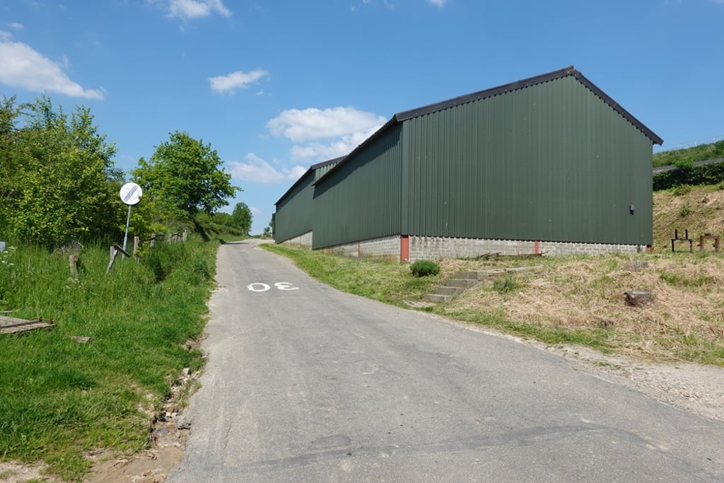
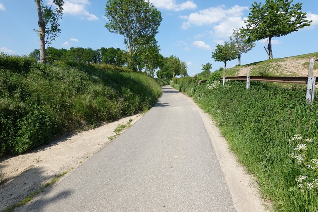
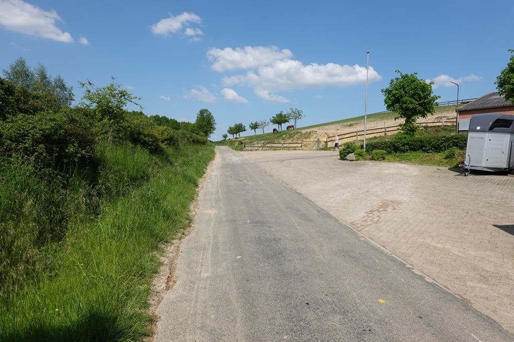
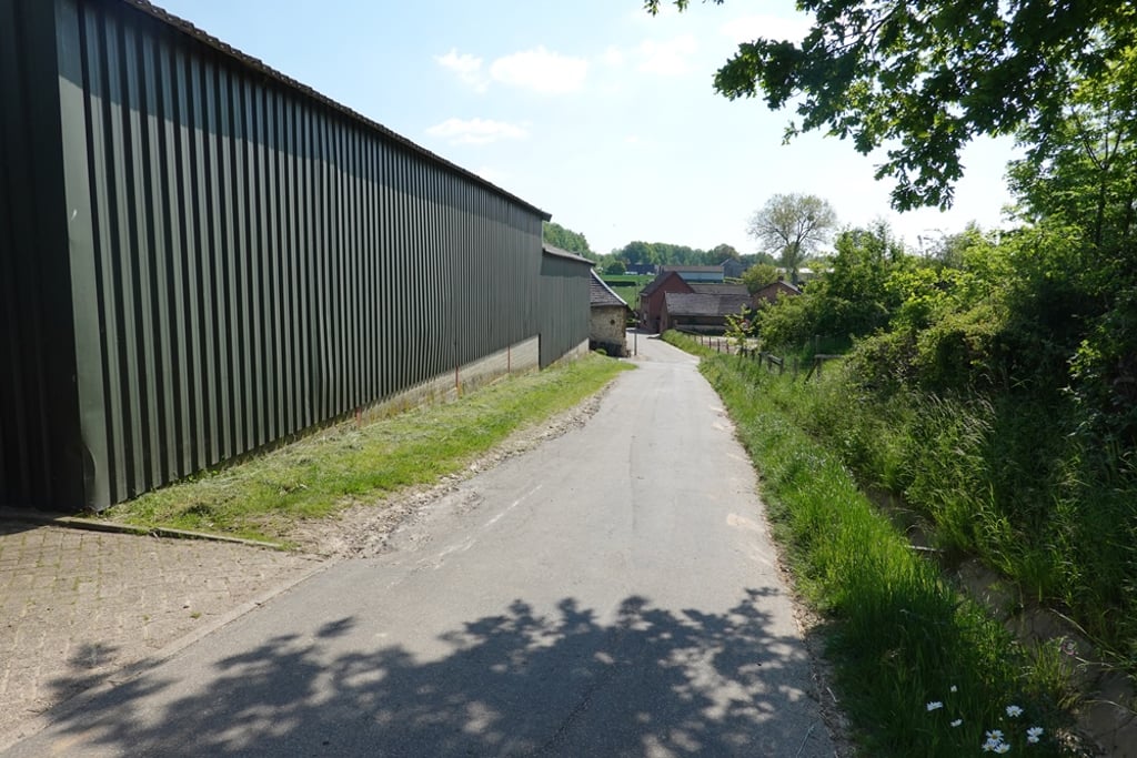
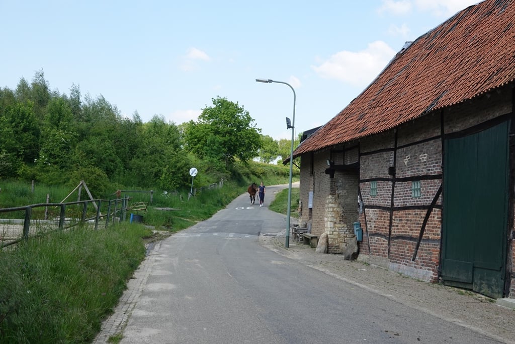
3.0 by Fedor
This is an automatic translation, the original language is: Dutch.
Used to ride regularly when the road turned into a gravel path after the climb. Now a cycle path has been constructed so you can cycle on asphalt to Kerkrade. Rises well visible at the beginning near the buildings after which you continue cycling up in a quiet agricultural setting.... read more

Photos (5)

Waalbroekerweg from Waalbroek
transparant thumb

Your uploads (max 4)

Welcome! Please activate your account if you would like to share something. Look for the verification email in your inbox.

If you want to upload your photos, you need to create an account. It only takes 1 minute and it's completely free.

  • Receive free climbfinder goodies for your reviews & photos.
  • Create a bucket list and check off conquered climbs.
  • Add missing climbs.
Continue with GoogleContinue with Google Continue with FacebookContinue with Facebook Continue with AppleContinue with Apple Sign up with email
By signing up you agree to our terms of service and confirm that you have read our privacy & content policy.

Reviews (2)

5.0
4.0
3.0
2.0
1.0
Fedor
10 Mo 3.0
This is an automatic translation, the original language is: Dutch. Show original

Used to ride regularly when the road turned into a gravel path after the climb. Now a cycle path has been constructed so you can cycle on asphalt to Kerkrade. Rises well visible at the beginning near the buildings after which you continue cycling up in a quiet agricultural setting.

Vroeger al regelmatig gereden toen de weg na de klim nog overging in een gravelpad. Nu is er een fietspad aangelegd zodat je verhard tot aan Kerkrade door kan fietsen. Loopt in het begin bij de gebouwen goed zichtbaar op waarna je in een rustige agrarische omgeving verder omhoog fietst.

Waalbroekerweg from Waalbroek
Dashboard
BikerJohan
10 Mo 3.0
This is an automatic translation, the original language is: Dutch. Show original

The climb starts in Waalbroek at the same point as the climb Rodeputserveldweg. Where until recently you had to turn left towards Simpelveld, you can now go straight ahead on a new cycle path for this climb. You ride under the A-76 towards Kerkrade after the summit.

De klim begint in Waalbroek op hetzelfde punt als de klim Rodeputserveldweg. Waar je tot onlangs linksaf moest richting Simpelveld kan je voor deze klim nu rechtdoor over een nieuw fietspad. Je rijdt na de top onder de A-76 door richting Kerkrade.

Dashboard

Climbing times

5 mph 00:05:37
7 mph 00:03:58
9 mph 00:03:06
12 mph 00:02:19

Road surface condition

0% 0% 0%
Based on 0 votes
Share your knowledge. What was the road condition during your ascent?

Traffic

0% 0% 0%
Based on 0 votes
Your experience counts. How much traffic did you encounter during the climb?

Frequently Asked Questions

You don't need special gearing for Waalbroekerweg from Waalbroek. The slope isn't long or steep enough to require much shifting down. You can conquer this climb on power alone. However, a compact gearing system with a smallest front chainring of 34 and largest rear sprocket of 28 or 30 is always nice if you enjoy cycling uphill. This helps maintain a smooth cadence.

Waalbroekerweg from Waalbroek is not tough enough to be assigned a mountain category. This means that even untrained cyclists can reach the top without any problems on this climb.

Waalbroekerweg from Waalbroek is 0.5 mi long.

The average gradient of Waalbroekerweg from Waalbroek is 4.2%.

Waalbroekerweg from Waalbroek has a steepest segment with an average gradient of 6.9%.

The summit of Waalbroekerweg from Waalbroek is at 581 ft.

At a slow pace of 5 mph, it takes about 00:05:37 to climb Waalbroekerweg from Waalbroek. At 7 mph the time is 00:03:58, and at 9 mph 00:03:06. For the fastest cyclists, 00:02:19 is an achievable time.

Waalbroekerweg from Waalbroek is located in the region Limburg in Netherlands.

This page is better in the app

Climbfinder app
Climbfinder
(Free)
Open