View on map
© MapLibre | OpenStreetMap contributors
1%
2%
4%
6%
8%
10%
12%
15%
20%

Vliegenberg from Martenslinde

4.0
2 reviews | Elevation profile | 13 photos
Tips nearby
Vliegenberg from Martenslinde
Your achievable time
Calculating based on your best performances...
Relaxed
Maximum
W/kg
W/kg
W/kg
Analyze your climbing performance
Detailed insight into your climbing performance & automatically check off climbs
Based on your best performances.
Your best attempt:
Number of attempts:
Elevation profile Vliegenberg from Martenslinde

Statistics

Difficulty points 23
Length 0.6 mi
Average gradient 4.1%
Steepest segment 8.4%
Total ascent 121 ft

Short recap

Hidden gem
#39 toughest climb of Belgium Limburg
Feedback about this climb?
Show climbs nearby Export to GPS device

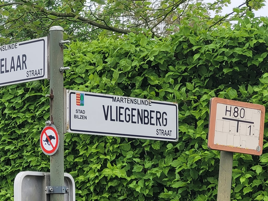
Vliegenberg from Martenslinde is a climb in the region Haspengouw. It is 0.6 mi long and bridges 121 ft of vertical ascent with an average gradient of 4.1%, resulting in a difficulty score of 23. The top of the ascent is located at 341 ft above sea level. Climbfinder users shared 2 reviews of this climb and uploaded 13 photos.

Road names: Vliegenbergstraat & Watergat

4.0 by Jarin
This is an automatic translation, the original language is: Dutch.
Typical climb for the region. Climb starts nicely through a hollow road, after which you are treated to nice views at the first summit. Then, after a short descent, the climb pulls on nicely.... read more

Photos (13)

Vliegenberg from Martenslinde
transparant thumb
transparant thumb
transparant thumb
transparant thumb
transparant thumb

Your uploads (max 4)

Welcome! Please activate your account if you would like to share something. Look for the verification email in your inbox.

If you want to upload your photos, you need to create an account. It only takes 1 minute and it's completely free.

  • Receive free climbfinder goodies for your reviews & photos.
  • Create a bucket list and check off conquered climbs.
  • Add missing climbs.
Continue with GoogleContinue with Google Continue with FacebookContinue with Facebook Continue with AppleContinue with Apple Sign up with email
By signing up you agree to our terms of service and confirm that you have read our privacy & content policy.

Reviews (2)

5.0
4.0
3.0
2.0
1.0
Jarin
1 y 4.0 via the Climbfinder app
This is an automatic translation, the original language is: Dutch. Show original

Typical climb for the region. Climb starts nicely through a hollow road, after which you are treated to nice views at the first summit. Then, after a short descent, the climb pulls on nicely.

Typische klim voor de streek. Klim begint mooi door een holleweg, waarna je op de eerste top op een mooi uitzicht wordt getrakteerd. Daarna trekt de klim na een korte afdaling nog even lekker door.

Vliegenberg from Martenslinde
Dashboard
Fedor
3 y 4.0
This is an automatic translation, the original language is: Dutch. Show original

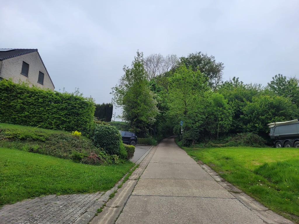
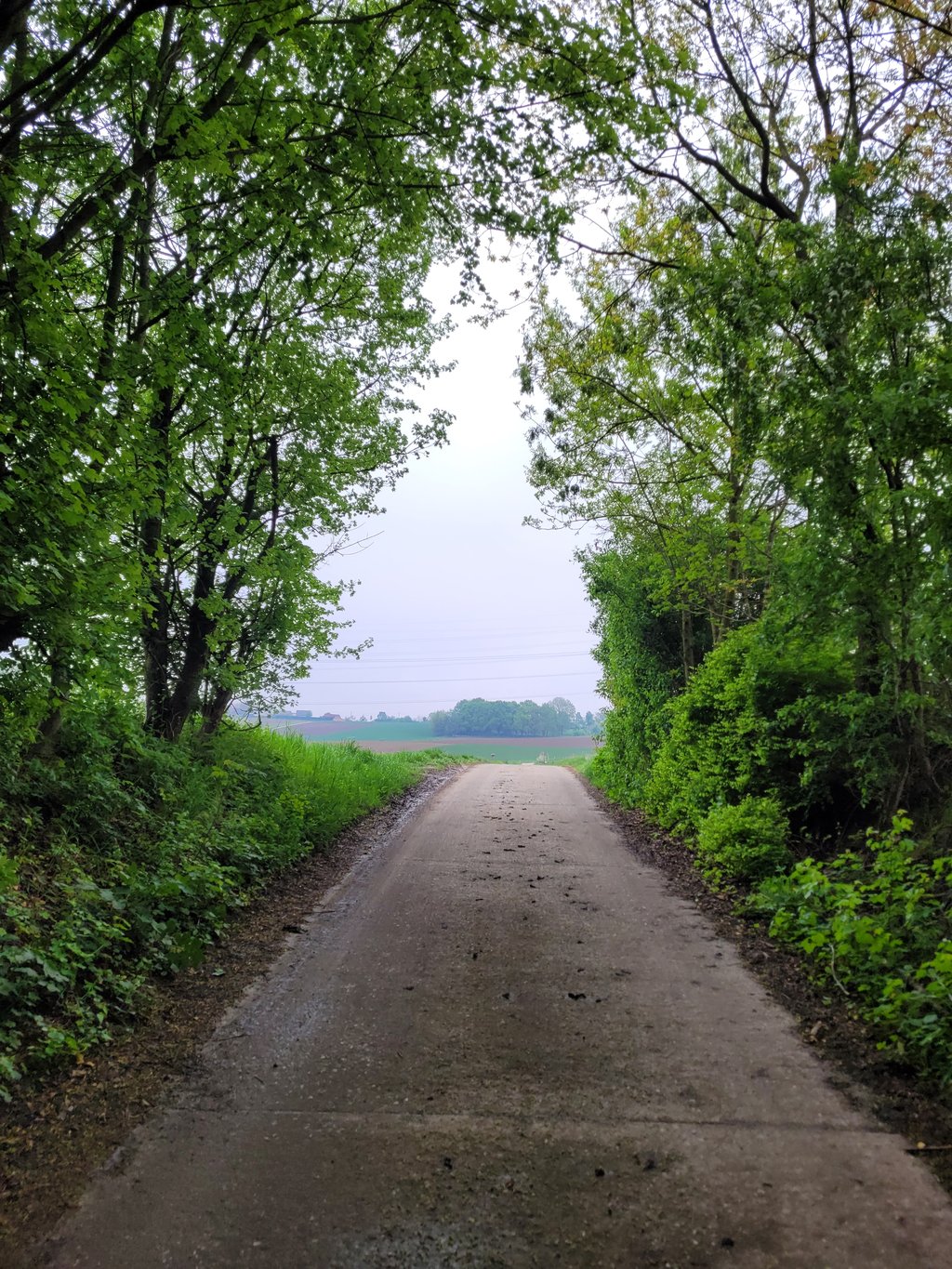
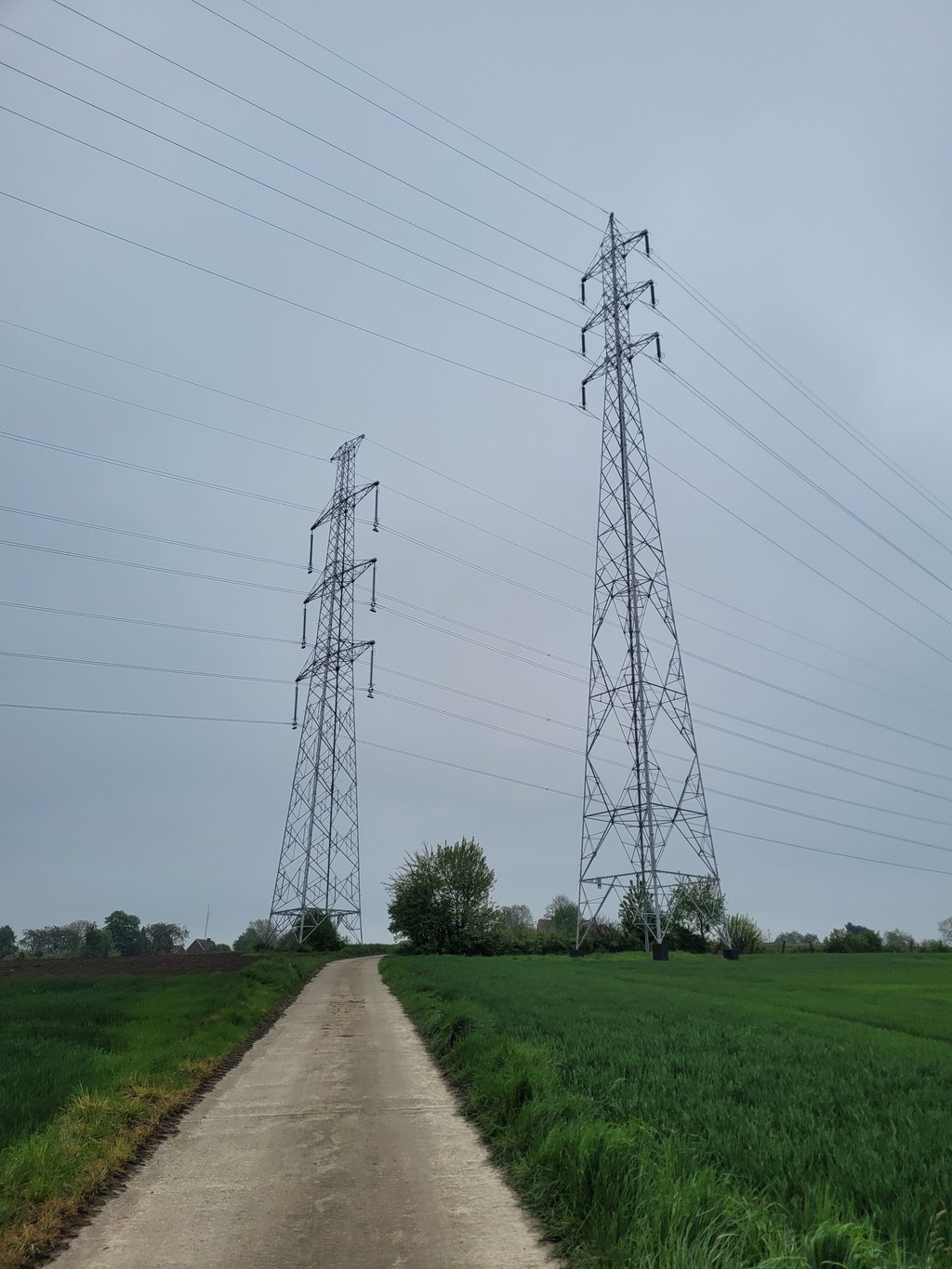
A climb in two parts (with a slight descent in between) that both run nicely and each has its own character. The first climb runs along a hollow road and after the clear summit you can see the ridge, which you have to climb up on the second climb, nicely in front of you. This second section runs through agricultural land with clear views. You drive along a concrete road where cars's and motorbikes are prohibited.

Een klim in twee delen (met een lichte afdaling tussendoor) die allebei lekker lopen en elk een eigen karakter hebben. De eerste klim loopt over een holle weg en na de duidelijke top zie je de heuvelrug, waar je bij de tweede klim tegenop moet, mooi voor je liggen. Dit tweede deel loopt door agrarisch gebied met vrij uitzicht. Je rijdt over een betonweggetje waar auto's en motoren verboden zijn.

Vliegenberg from Martenslinde
Dashboard

Climbing times

5 mph 00:06:42
7 mph 00:04:45
9 mph 00:03:42
12 mph 00:02:46

Road surface condition

0% 0% 0%
Based on 0 votes
Share your knowledge. What was the road condition during your ascent?

Traffic

0% 0% 0%
Based on 0 votes
Your experience counts. How much traffic did you encounter during the climb?

Frequently Asked Questions

You don't need special gearing for Vliegenberg from Martenslinde. The slope isn't long or steep enough to require much shifting down. You can conquer this climb on power alone. However, a compact gearing system with a smallest front chainring of 34 and largest rear sprocket of 28 or 30 is always nice if you enjoy cycling uphill. This helps maintain a smooth cadence.

Vliegenberg from Martenslinde is not tough enough to be assigned a mountain category. This means that even untrained cyclists can reach the top without any problems on this climb.

Vliegenberg from Martenslinde is 0.6 mi long.

The average gradient of Vliegenberg from Martenslinde is 4.1%.

Vliegenberg from Martenslinde has a steepest segment with an average gradient of 8.4%.

The summit of Vliegenberg from Martenslinde is at 341 ft.

At a slow pace of 5 mph, it takes about 00:06:42 to climb Vliegenberg from Martenslinde. At 7 mph the time is 00:04:45, and at 9 mph 00:03:42. For the fastest cyclists, 00:02:46 is an achievable time.

Vliegenberg from Martenslinde is located in the region Belgium Limburg in Belgium.

This page is better in the app

Climbfinder app
Climbfinder
(Free)
Open