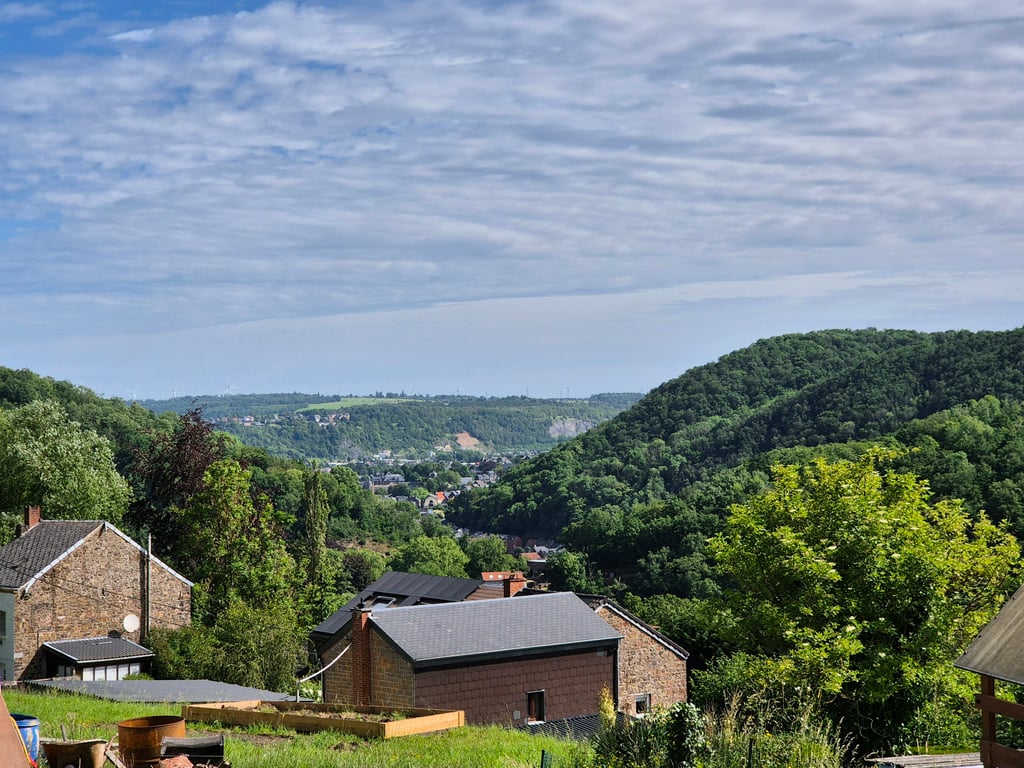
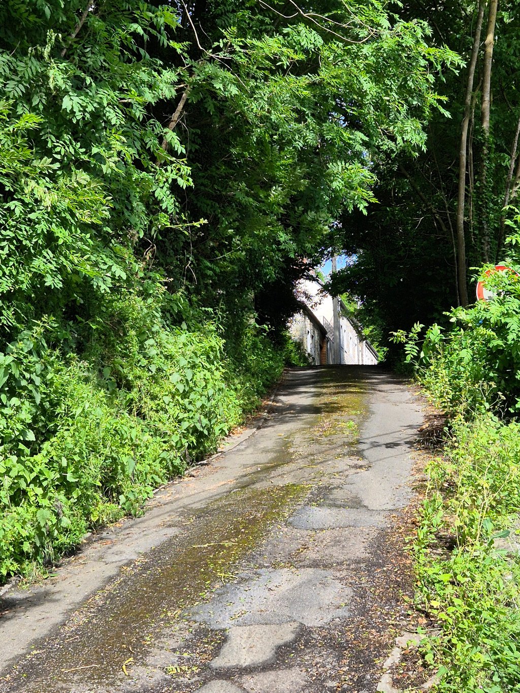
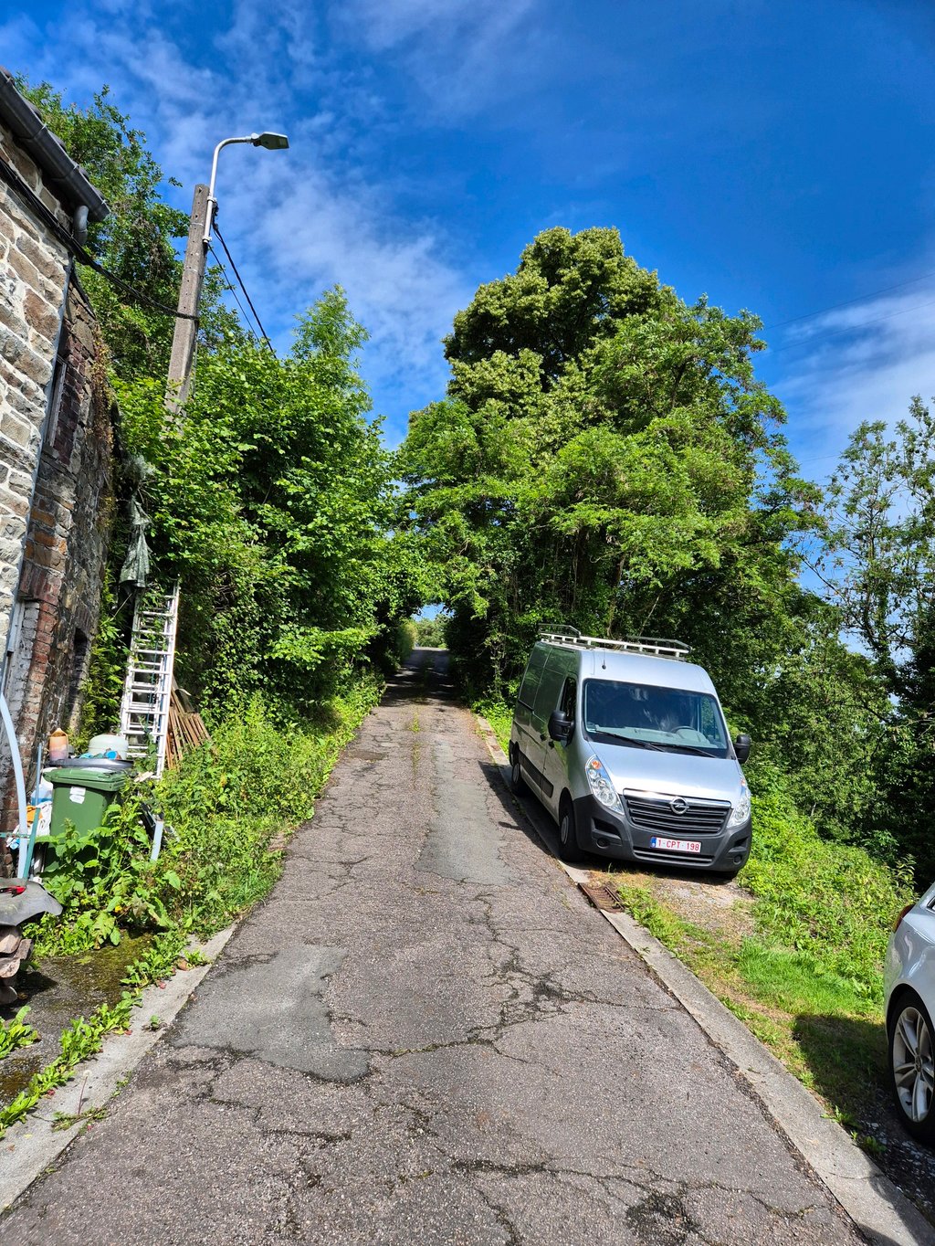
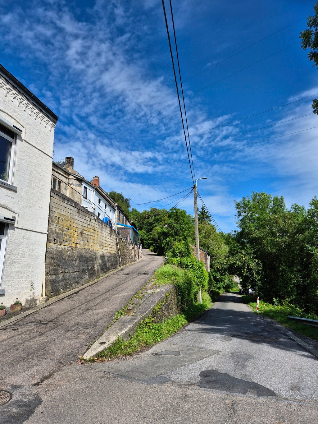
Vieux Thier de Huy is a climb in the region Valleys of the Meuse, Sambre and Orneau. It is 0.4 mi long and bridges 230 ft of vertical ascent with an average gradient of 11.4%, resulting in a difficulty score of 82. The top of the ascent is located at 561 ft above sea level. Climbfinder users shared 3 reviews of this climb and uploaded 7 photos.
This is an automatic translation, the original language is: Dutch.
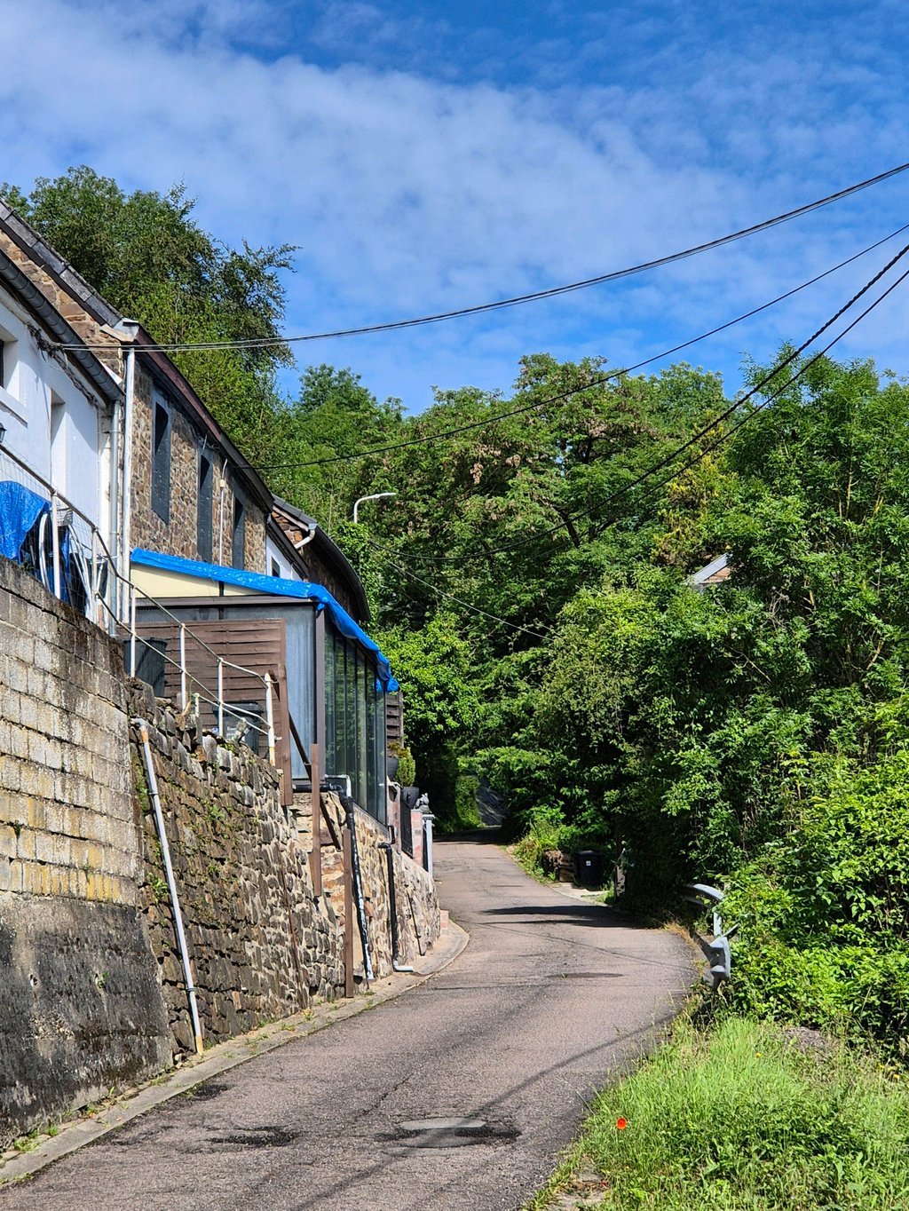
Nice version that I like better than the Thier de Huy. Be careful if you want to descend to the main road afterwards, for example to take the Thier de Huy: I made the mistake to keep to the right at the top of this climb and descend via the Vieux Thier as well, but this road has a very bad road surface and is really steep at the end (more than 20% downhill) so especially with damp road surface DANGEROUS! It is better and safer to turn LEFT at the top of the climb and descend on the gradually des...read more
Photos (7)
Welcome! Please activate your account if you would like to share something. Look for the verification email in your inbox.
This is an automatic translation, the original language is: Dutch.
Show original
Nice version that I like better than the Thier de Huy. Be careful if you want to descend to the main road afterwards, for example to take the Thier de Huy: I made the mistake to keep to the right at the top of this climb and descend via the Vieux Thier as well, but this road has a very bad road surface and is really steep at the end (more than 20% downhill) so especially with damp road surface DANGEROUS! It is better and safer to turn LEFT at the top of the climb and descend on the gradually descending Rte du Comte.
Mooie versie die ik beter vindt lopen dan de Thier de Huy. Pas overigens wel op als je nadien weer naar de grote weg wilt afdalen, bijvoorbeeld om de Thier de Huy te pakken: ik maakte de fout om bovenaan deze klim rechts aan te houden en via de Vieux Thier ook af te dalen, maar deze weg heeft heel slecht wegdek en is op het laatst echt loeisteil (meer dan 20% naar beneden) dus zeker met vochtig wegdek LEVENSGEVAARLIJK! Beter en veiliger is het op bovenaan de klim LINKSAF te slaan en via de geleidelijk dalende Rte du Comte weer af te dalen.
This is an automatic translation, the original language is: French.
Show original
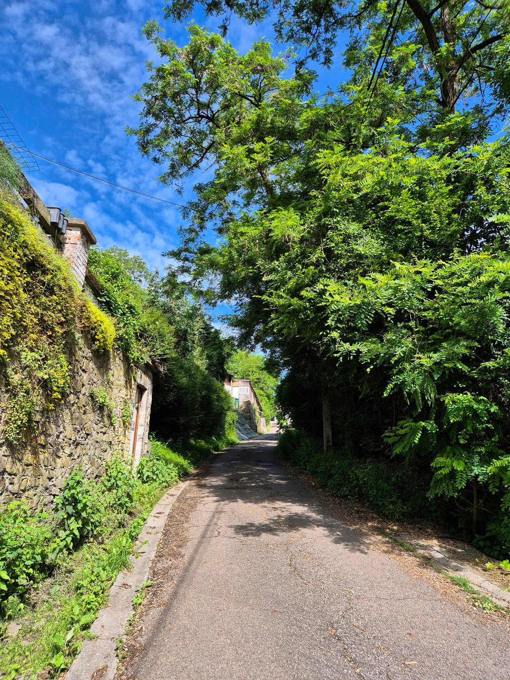
A very steep climb but not a very long one, and fortunately it's really difficult. The initial part is the steepest, and you don't have any momentum at all, no matter where you arrive.
Montée très raide mais pas très longue, et heureusement car c'est vraiment difficile. La partie initiale est la plus raide, et on l'entame sans élan quel que soit l'endroit dont on arrive
This is an automatic translation, the original language is: Dutch.
Show original
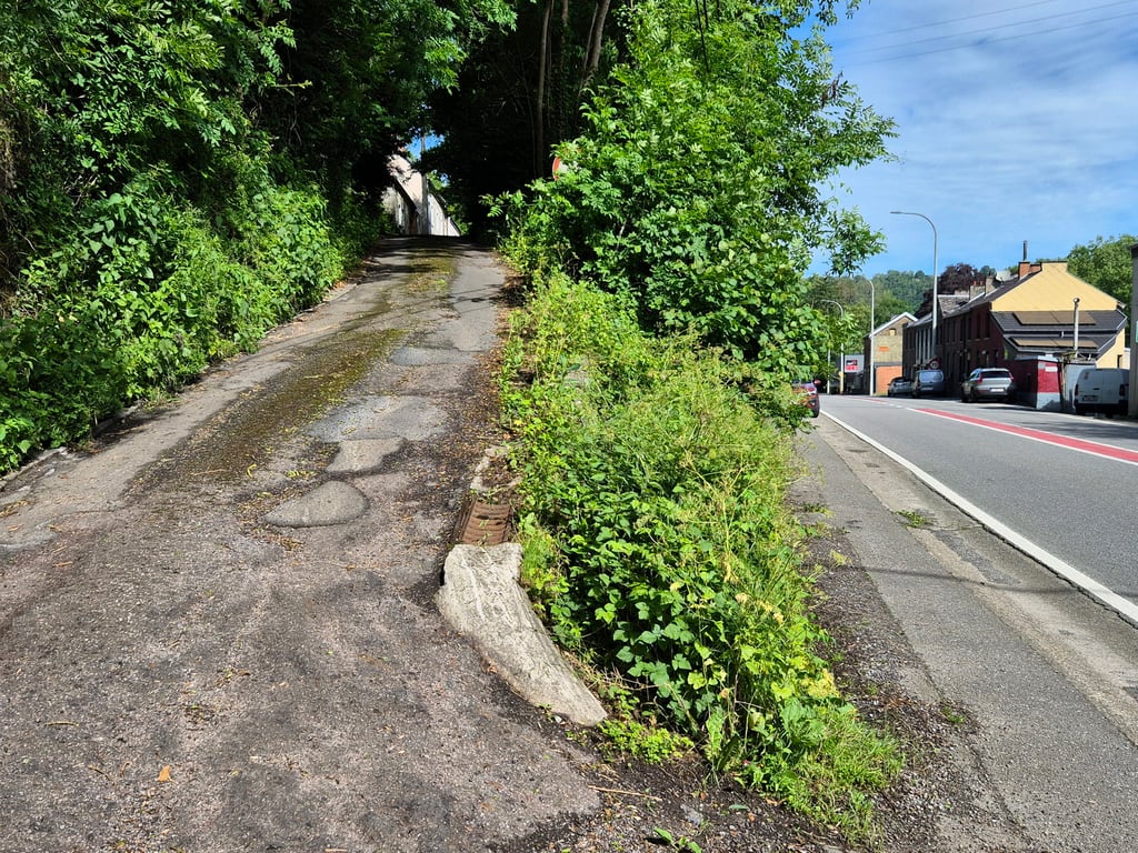
A climb with 3 punctures that in many lists is nevertheless extremely heavy and that is certainly not a lie. Fortunately it is not too long and if you survive the first two bumps the worst is already over. The road surface leaves something to be desired here and there and with wet weather you can certainly slide away on the gravel sections, but the col is certainly doable. If you turn right at the top, you can descend again to start the next climbs, but for me that was rather with the brakes on the terrible road surface. Anyway, I don't think there's really an alternative, especially if you want to go up the Thier de Huy or Montagne Corroy afterwards, both highly recommended.
Een beklimming met 3 prikjes die in menig lijstje toch als uiterst zwaar wordt bestippeld en dat is zeker niet gelogen. Hij is gelukkig niet al te lang en als je de eerste twee bultjes overleefd is het ergste al wel voorbij. Het wegdek laat hier en daar de wensen over en met nat weer kun je zeker wegschuiven op de stukken met grind, maar haalbaar is de col zeker wel. Als je boven rechts afdraait kan je opnieuw dalen om de volgende beklimmingen aan te vatten, maar dat ging bij mij op het erbarmelijke wegdek eerder toch met de remmen toe. Enfin, ik denk niet dat er echt een alternatief is, zeker als je erna graag de Thier de Huy of Montagne Corroy opwilt, allebei ook aanraders.
Share your knowledge. What was the road condition during your ascent?
Traffic
0% 0% 0%
Based on 0 votes
Your experience counts. How much traffic did you encounter during the climb?
Frequently Asked Questions
You don't need special gearing for Vieux Thier de Huy. The slope isn't long or steep enough to require much shifting down. You can conquer this climb on power alone. However, a compact gearing system with a smallest front chainring of 34 and largest rear sprocket of 28 or 30 is always nice if you enjoy cycling uphill. This helps maintain a smooth cadence.
Vieux Thier de Huy is a 4th-category climb. A sprint to the top is usually not an option, and untrained riders will definitely feel it in their legs. For trained cyclists, it is a great training climb.
Vieux Thier de Huy is 0.4 mi long.
The average gradient of Vieux Thier de Huy is 11.4%.
Vieux Thier de Huy has a steepest segment with an average gradient of 14.5%.
The summit of Vieux Thier de Huy is at 561 ft.
At a slow pace of 5 mph, it takes about 00:04:35 to climb Vieux Thier de Huy. At 7 mph the time is 00:03:15, and at 9 mph 00:02:32. For the fastest cyclists, 00:01:54 is an achievable time.