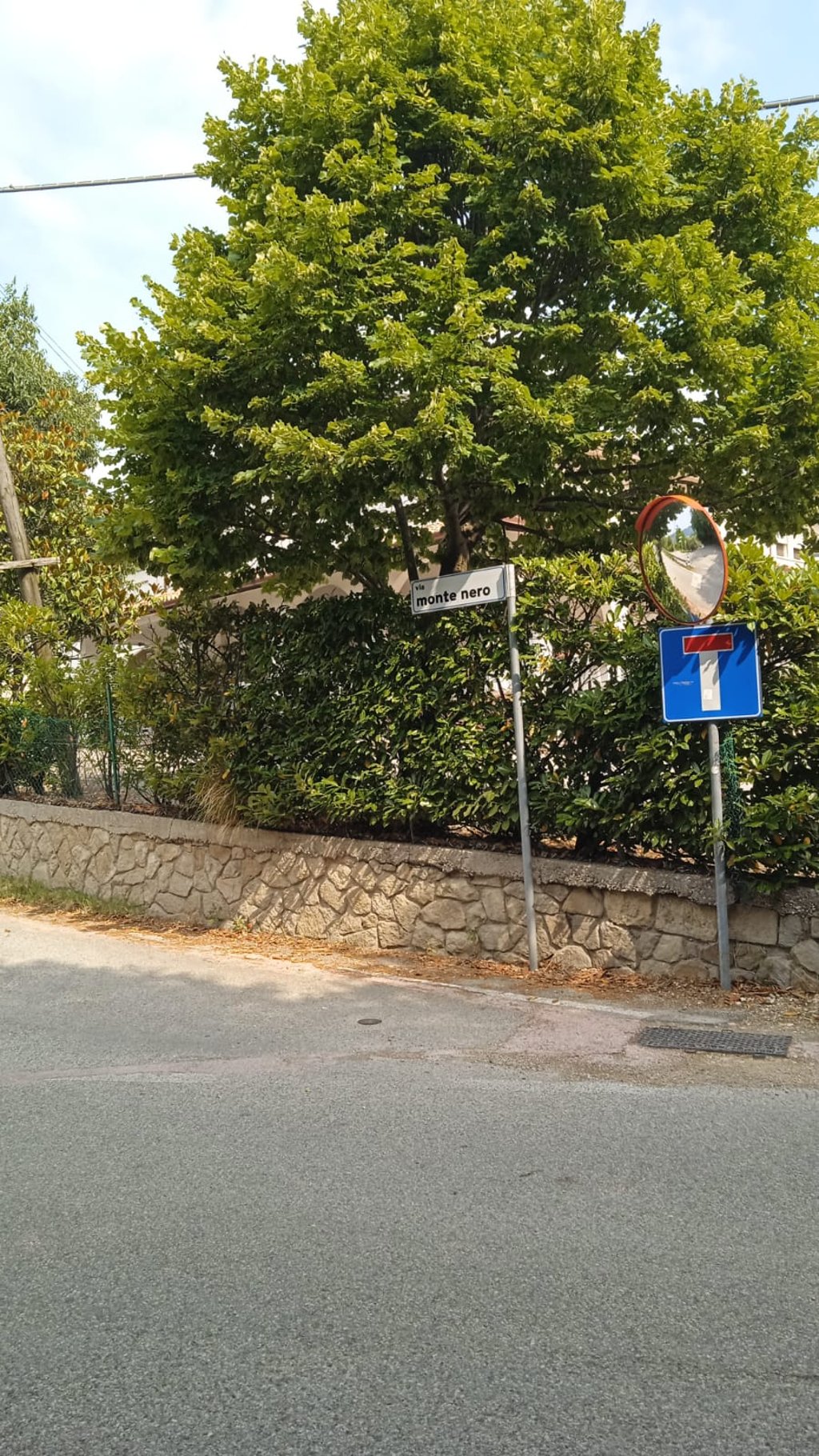
Via Montenero is a climb in the region Padua. It is 0.2 mi long and bridges 148 ft of vertical ascent with an average gradient of 13%, resulting in a difficulty score of 62. The top of the ascent is located at 509 ft above sea level. Climbfinder users shared 1 review/story of this climb and uploaded 4 photos.
This is an automatic translation, the original language is: Italian.
For those who are not exhausted by the gradients of the climb from Turri or (especially) from Regazzoni bassa via Scagliara, there is the possibility of treating yourself to another fairly tough 400 metres by turning into via Monterero right at the top of the hill. It is worth the effort. It takes a little strength to overcome other ramps with gradients of more than 15%, but the effort is short. The reward is a nice little road through the forest and a beautiful view of the eastern hills. The ...read more
Photos (4)
Welcome! Please activate your account if you would like to share something. Look for the verification email in your inbox.
This is an automatic translation, the original language is: Italian.
Show original
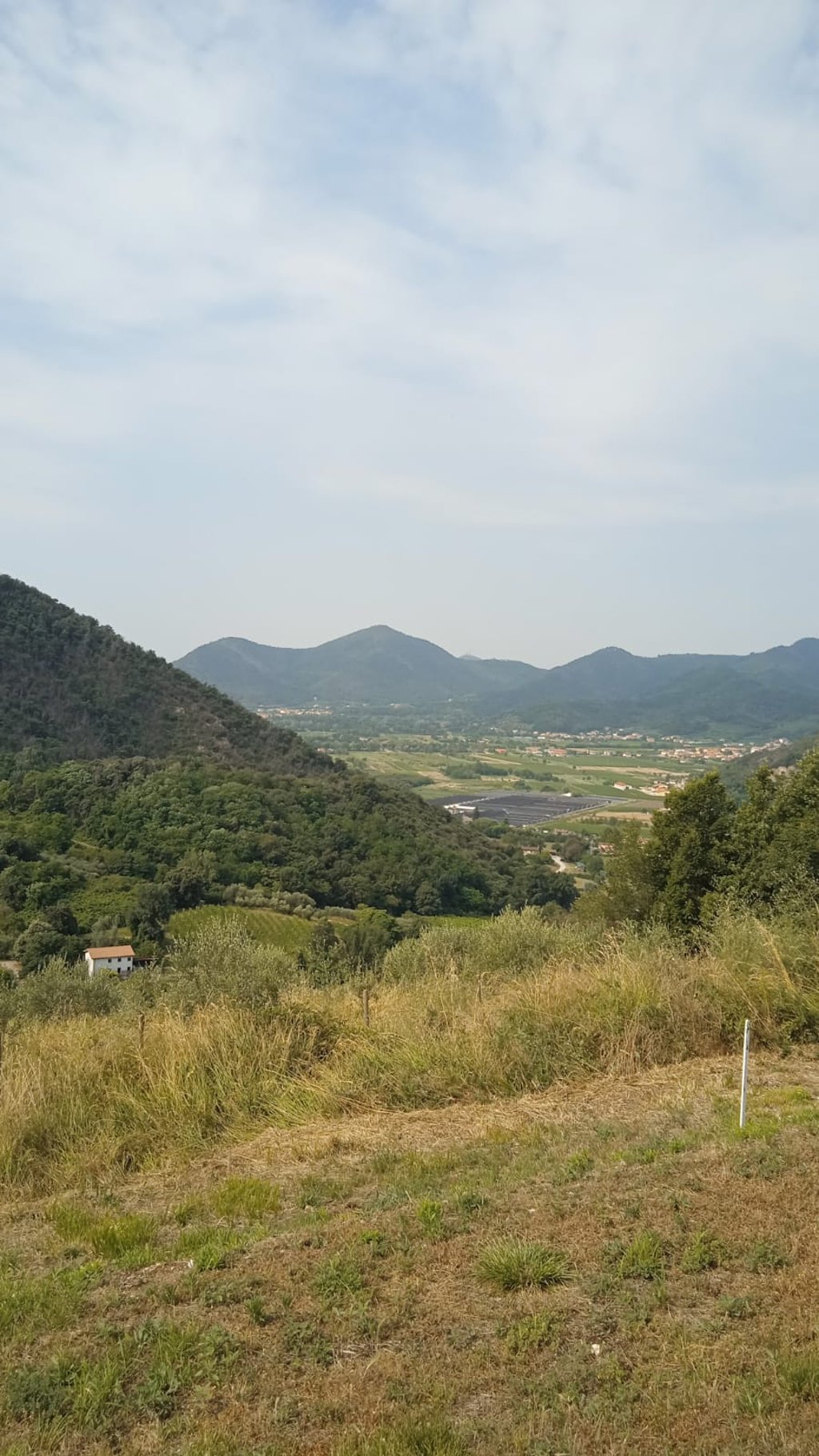
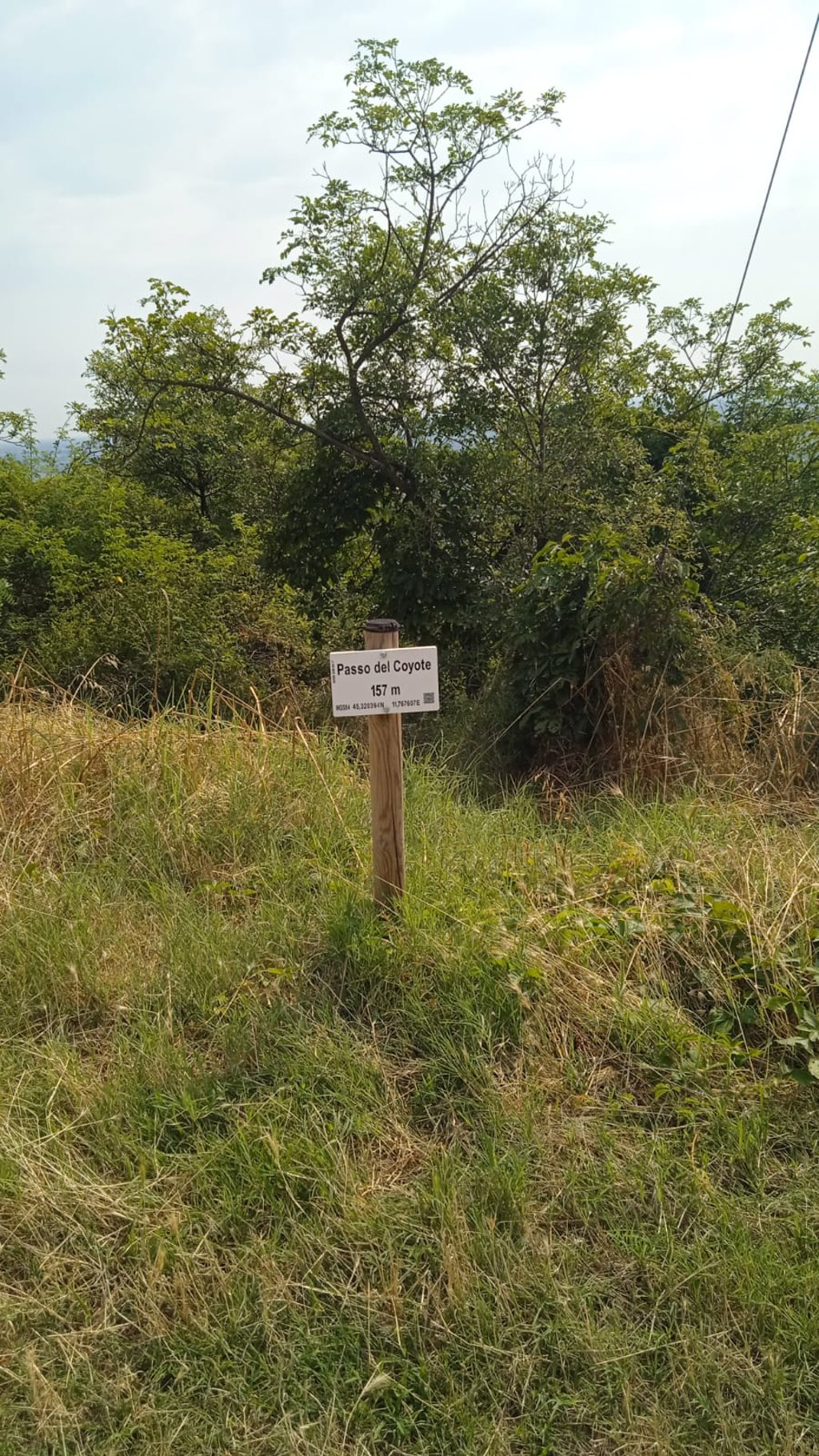
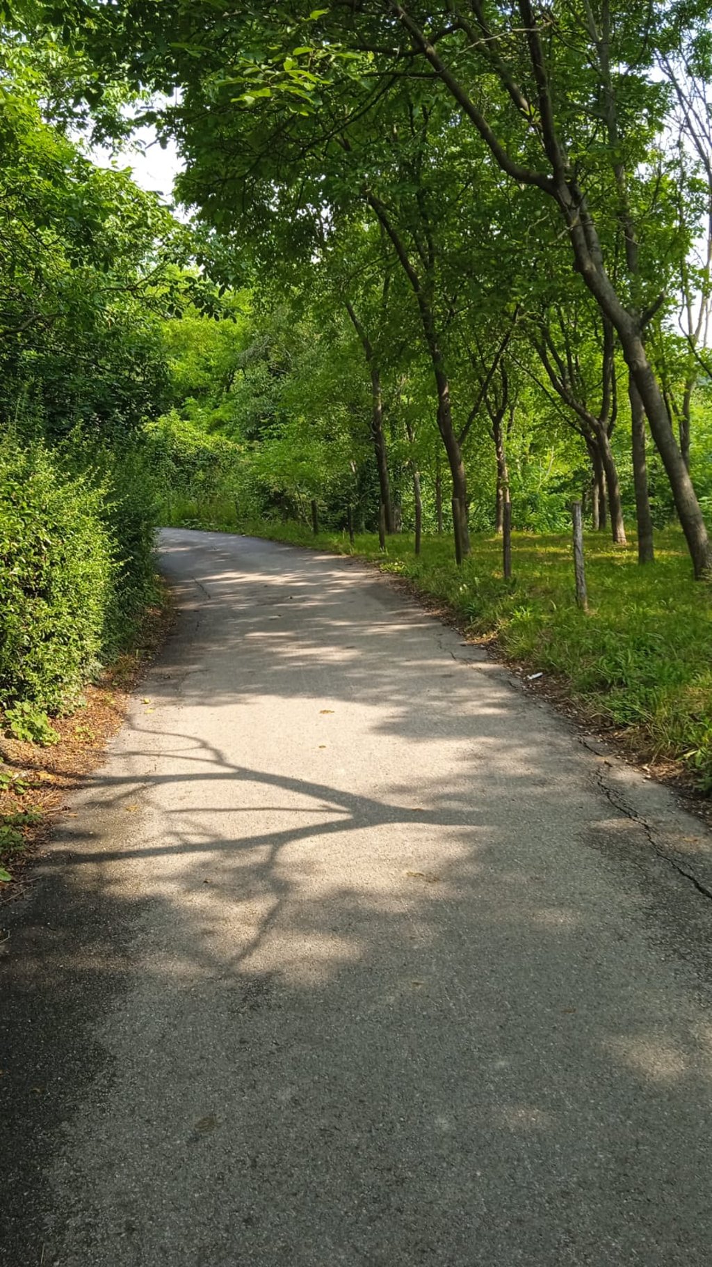
For those who are not exhausted by the gradients of the climb from Turri or (especially) from Regazzoni bassa via Scagliara, there is the possibility of treating yourself to another fairly tough 400 metres by turning into via Monterero right at the top of the hill. It is worth the effort. It takes a little strength to overcome other ramps with gradients of more than 15%, but the effort is short. The reward is a nice little road through the forest and a beautiful view of the eastern hills. The end of the climb is at the signpost indicating the "Coyote Pass" a somewhat bombastic name for an ascent that only reaches 157 metres above sea level.
The asphalt is good but the road is narrow and steep. So the descent must be travelled carefully. Traffic is practically inexistent.
Per chi non fosse fiaccato dalle pendenze della salita da Turri o (soprattutto) da Regazzoni bassa tramite via Scagliara esiste la possibilità di regalarsi altri 400 metri abbastanza duri voltando in via Monterero proprio in corrispondenza dello scollinamento. Vale la pena. Ci vuole un po' di forza per superare altre rampette con pendenza superiore al 15%, ma l'impegno è breve. Il premio è una bella stradina nel bosco e un bel panorama che si apre sui colli orientali. La fine della salita si trova in corrispondenza del cartello che indica il "Passo del Coyote", un nome un po' altisonante per un'ascesa che raggiunge solo 157 m sul livello del mare.
L'asfalto è buono ma la strada è stretta e ripida. Quindi la discesa va percorsa con attenzione. Il traffico è praticamente inestistente.
Share your knowledge. What was the road condition during your ascent?
Traffic
0% 0% 0%
Based on 0 votes
Your experience counts. How much traffic did you encounter during the climb?
Frequently Asked Questions
You don't need special gearing for Via Montenero. The slope isn't long or steep enough to require much shifting down. You can conquer this climb on power alone. However, a compact gearing system with a smallest front chainring of 34 and largest rear sprocket of 28 or 30 is always nice if you enjoy cycling uphill. This helps maintain a smooth cadence.
Via Montenero falls into the 5th category. With good fitness, you can ride it up with speed and power. If you have less training, shift down and climb smoothly.
Via Montenero is 0.2 mi long.
The average gradient of Via Montenero is 13%.
Via Montenero has a steepest segment with an average gradient of 16.6%.
The summit of Via Montenero is at 509 ft.
At a slow pace of 5 mph, it takes about 00:02:35 to climb Via Montenero. At 7 mph the time is 00:01:50, and at 9 mph 00:01:25. For the fastest cyclists, 00:01:04 is an achievable time.
Via Montenero is located in the region Padua in Italy.