View on map
© MapLibre | OpenStreetMap contributors
1%
2%
4%
6%
8%
10%
12%
15%
20%

Verlorenkostweg from Landsrade

3.0
1 review/story | Elevation profile | 7 photos
Tips nearby
Verlorenkostweg from Landsrade
transparant thumb
Your achievable time
Calculating based on your best performances...
Relaxed
Maximum
W/kg
W/kg
W/kg
Analyze your climbing performance
Detailed insight into your climbing performance & automatically check off climbs
Based on your best performances.
Your best attempt:
Number of attempts:
Elevation profile Verlorenkostweg from Landsrade

Statistics

Difficulty points 30
Length 0.4 mi
Average gradient 6.6%
Steepest segment 13.9%
Total ascent 128 ft

Short recap

Hidden gem
#88 average steepest climb of Netherlands
Feedback about this climb?
Show climbs nearby Export to GPS device

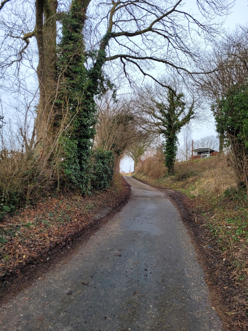
Verlorenkostweg from Landsrade is a climb in the region South Limburg. It is 0.4 mi long and bridges 128 ft of vertical ascent with an average gradient of 6.6%, resulting in a difficulty score of 30. The top of the ascent is located at 525 ft above sea level. Climbfinder users shared 1 review/story of this climb and uploaded 7 photos.

Road name: Verlorenkostweg

3.0 by Fedor
This is an automatic translation, the original language is: Dutch.
Quite irregular climb with the steepest part (and then quite steep) in the hollow road next to the campsite. Beautiful surroundings, you would think very quiet but that was against: still some cars and da's difficult i.c.m. the narrow road. You have to descend to get to the beginning. When descending pay attention: after the "dangerous turn " (with sign) is much gravel on the road.... read more

Photos (7)

Verlorenkostweg from Landsrade
transparant thumb
transparant thumb
transparant thumb
transparant thumb
transparant thumb

Your uploads (max 4)

Welcome! Please activate your account if you would like to share something. Look for the verification email in your inbox.

If you want to upload your photos, you need to create an account. It only takes 1 minute and it's completely free.

  • Receive free climbfinder goodies for your reviews & photos.
  • Create a bucket list and check off conquered climbs.
  • Add missing climbs.
Continue with GoogleContinue with Google Continue with FacebookContinue with Facebook Continue with AppleContinue with Apple Sign up with email
By signing up you agree to our terms of service and confirm that you have read our privacy & content policy.

Reviews (1)

5.0
4.0
3.0
2.0
1.0
Fedor
4 y 3.0
This is an automatic translation, the original language is: Dutch. Show original

Quite irregular climb with the steepest part (and then quite steep) in the hollow road next to the campsite. Beautiful surroundings, you would think very quiet but that was against: still some cars and da's difficult i.c.m. the narrow road.

You have to descend to get to the beginning. When descending pay attention: after the "dangerous turn " (with sign) is much gravel on the road.

Nogal onregelmatige klim waarbij het steilste stuk (en dan ook behoorlijk steil) in de holle weg naast de camping zit. Mooie omgeving, je zou denken erg rustig maar dat viel tegen: toch enkele auto's en da's lastig i.c.m. de smalle weg.

Je moet afdalen om bij het begin te komen. Bij het afdalen goed opletten: na de "gevaarlijke bocht" (met bord) ligt veel grind op de weg.

Verlorenkostweg from Landsrade
Dashboard

Climbing times

5 mph 00:04:25
7 mph 00:03:08
9 mph 00:02:26
12 mph 00:01:50

Road surface condition

100% 0% 0%
Based on 1 vote
Share your knowledge. What was the road condition during your ascent?

Traffic

100% 0% 0%
Based on 1 vote
Your experience counts. How much traffic did you encounter during the climb?

Frequently Asked Questions

You don't need special gearing for Verlorenkostweg from Landsrade. The slope isn't long or steep enough to require much shifting down. You can conquer this climb on power alone. However, a compact gearing system with a smallest front chainring of 34 and largest rear sprocket of 28 or 30 is always nice if you enjoy cycling uphill. This helps maintain a smooth cadence.

Verlorenkostweg from Landsrade falls into the 5th category. With good fitness, you can ride it up with speed and power. If you have less training, shift down and climb smoothly.

Verlorenkostweg from Landsrade is 0.4 mi long.

The average gradient of Verlorenkostweg from Landsrade is 6.6%.

Verlorenkostweg from Landsrade has a steepest segment with an average gradient of 13.9%.

The summit of Verlorenkostweg from Landsrade is at 525 ft.

At a slow pace of 5 mph, it takes about 00:04:25 to climb Verlorenkostweg from Landsrade. At 7 mph the time is 00:03:08, and at 9 mph 00:02:26. For the fastest cyclists, 00:01:50 is an achievable time.

Verlorenkostweg from Landsrade is located in the region Limburg in Netherlands.

This page is better in the app

Climbfinder app
Climbfinder
(Free)
Open