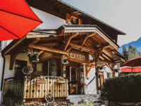
| Beautiful scenery |
| 5 hairpin turns |
| #75 toughest climb of Aosta Valley |
| #73 most elevation gain of Aosta Valley |
| #62 longest climb of Aosta Valley |
| #71 average steepest climb of Aosta Valley |
Val Veny from Courmayeur is a climb in the region Aosta Valley. It is 4.7 mi long and bridges 1496 ft of vertical ascent with an average gradient of 6.1%, resulting in a difficulty score of 412. The top of the ascent is located at 5479 ft above sea level. Climbfinder users shared 4 reviews of this climb and uploaded 3 photos.
4.0 by FedebiciThis is an automatic translation, the original language is: Italian.This valley is always stunning. Pass Courmayeur and turn left, facing Mont Blanc. The climb gets steep right after you cross the bridge. The gradients are around 8–10% all the way to the little church of Notre Dame. Then the road levels off, and you’ll catch your breath near the campground. The final stretch begins after a small bridge. Keep in mind that there are two barriers to pass. After the first one, the gradients increase significantly again, making for a very uneven climb that’s mu... read more
Welcome! Please activate your account if you would like to share something. Look for the verification email in your inbox.
If you want to upload your photos, you need to create an account. It only takes 1 minute and it's completely free.
This valley is always stunning. Pass Courmayeur and turn left, facing Mont Blanc. The climb gets steep right after you cross the bridge. The gradients are around 8–10% all the way to the little church of Notre Dame. Then the road levels off, and you’ll catch your breath near the campground. The final stretch begins after a small bridge. Keep in mind that there are two barriers to pass. After the first one, the gradients increase significantly again, making for a very uneven climb that’s much tougher than you might think based on the average gradient.
Sempre stupenda questa valle. Si sorpassa Courmayeur per deviare a sinistra guardando il monte bianco. Si sale subito in maniera dura appena sorpassato il ponte. Le pendenze sono attorno al 8-10% fino alla chiesetta di Notre Dame. Poi la strada spiana e si recupera all’altezza del campeggio. L’ultimo tratto inizia dopo un ponticello. Contate che ci sono due sbarre da passare. Dopo la prima le pendenze salgono nuovamente in maniera importante dunque salita molto irregolare e ben più tosta rispetto a quel che si possa pensare vedendo la pendenza media
An averagely demanding climb that can ideally be divided into three sectors: the first goes from the bridge over the Dora to the junction for Pré-de-Pascal, challenging with gradients of even more than 10%, the second on a falsopiano that allows you to fully enjoy the marvel of the Mont Blanc glacier and the luxuriant nature of the valley, characterised by forests of tall fir trees, the third upstream of the pin-nic area: The third upstream of the pin-nic area: you regain altitude with a couple of hairpin bends, the gradients become steep again, and you arrive at the barrier that prevents cars from continuing, from there, on a road with fairly steep gradients, you arrive at a first dirt track (practicable on a road bike without too much trouble), passing it, you return to asphalt and proceed to the final end of the road, the Combal Lake
Salita mediamente impegnativa divisibile idealmente in tre settori: il primo va dal ponte sulla Dora al bivio per Pré-de-Pascal, impegnativo con pendenze anche superiori al 10%, il secondo su un falsopiano che permette di godersi pienamente la meraviglia del ghiacciaio del Monte Bianco e la rigogliosa natura della valle, caratterizzata da boschi di alti abeti, il terzo a monte dell'area pin-nic: si riprende quota con una coppia di tornanti, le pendenze tornano aspre, si arriva alla sbarra che impedisce alle automobili da proseguire, da lì, su una strada con pendenze abbastanza elevate si arriva a un primo tratto sterrato (percorribile su bici da strada senza troppi patemi), superandolo, si torna su asfalto e si procede fino alla fine definitiva della strada, il Lago Combal
It is worth it more for the beauty of the views than for the climb itself, although there are some exciting sections.
Merita più per la bellezza dei panorami che per la salita in se, pur con alcuni tratti entusiasmanti.
| 5 mph | 00:56:20 |
| 7 mph | 00:39:53 |
| 9 mph | 00:31:05 |
| 12 mph | 00:23:21 |
This page is better in the app