Val Sumvitg from Surrein is a climb in the region Grisons. It is 3.7 mi long and bridges 1266 ft of vertical ascent with an average gradient of 6.5%, resulting in a difficulty score of 328. The top of the ascent is located at 4295 ft above sea level. Climbfinder users shared 2 reviews of this climb and uploaded 16 photos.
This is an automatic translation, the original language is: Dutch.
Show original
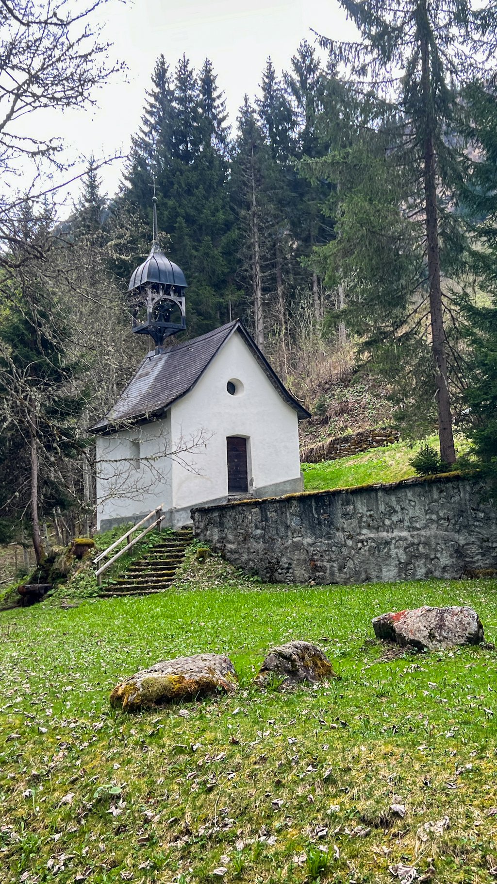
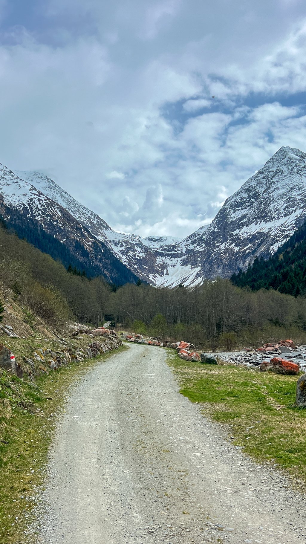
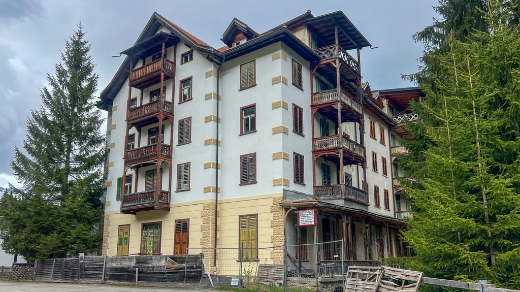
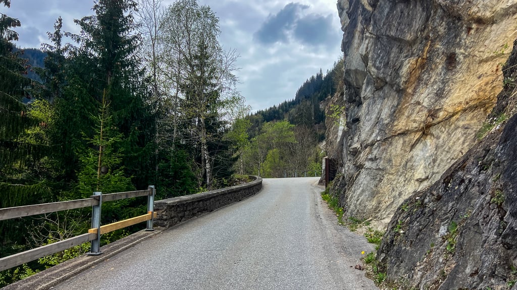
Ideal for a 'coffee ride'. There is so much packed into this little climb that I can recommend it to anyone. Reading along? Never too steep, a cool tunnel, a narrow bridge, an abandoned ghost hotel, a mini-mini village with inn and chapel, a modest crackling blue-green reservoir, alpine meadows, forest and views of beautiful high mountains both there and back.
So be sure to cycle on until the reservoir and tarmac ends. If you have a gravel bike, you can enjoy the peace and natural beauty even longer
Ideaal voor een ‘koffieritje’. In deze kleine klim zit zoveel ingepakt, dat ik ‘m iedereen kan aanraden. Leest u even mee? Nooit te steil, een koele tunnel, een nauwe brug, een verlaten spookhotel, een mini-mini-dorp met herberg en kapel, een bescheiden knetterblauwgroen stuwmeer, alpenweides, bos en uitzicht op prachtige hoge bergen, zowel heen als terug.
Fiets daarom zeker door tot het stuwmeer en het asfalt ophoudt. Heb je een gravelfiets dan kun je nog langer genieten van de rust en het natuurschoon
Share your knowledge. What was the road condition during your ascent?
Traffic
100% 0% 0%
Based on 1 vote
Your experience counts. How much traffic did you encounter during the climb?
Frequently Asked Questions
Val Sumvitg from Surrein is a challenging ascent. For this type of climbing, we recommend mountain gearing, specifically a compact system. This means a small front chainring of 34 teeth, combined with a rear cassette where, depending on your level, strength, and experience, you choose a sprocket with 30, 32, or even 34 teeth. Remember that a smooth cadence is always more efficient!
Val Sumvitg from Surrein is a serious climb and falls into the 2nd category. With a good basic fitness level, even without much cycling experience, you can complete this climb just fine. However, a bike with climbing gears is a must. Without experience or training, it will be really tough – but that’s part of the challenge!
Val Sumvitg from Surrein is 3.7 mi long.
The average gradient of Val Sumvitg from Surrein is 6.5%.
Val Sumvitg from Surrein has a steepest segment with an average gradient of 14.1%.
The summit of Val Sumvitg from Surrein is at 4295 ft.
At a slow pace of 5 mph, it takes about 00:44:46 to climb Val Sumvitg from Surrein. At 7 mph the time is 00:31:42, and at 9 mph 00:24:42. For the fastest cyclists, 00:18:33 is an achievable time.
Val Sumvitg from Surrein is located in the region Grisons in Switzerland.