Tips nearby


| Hidden gem |
| 18 hairpin turns |
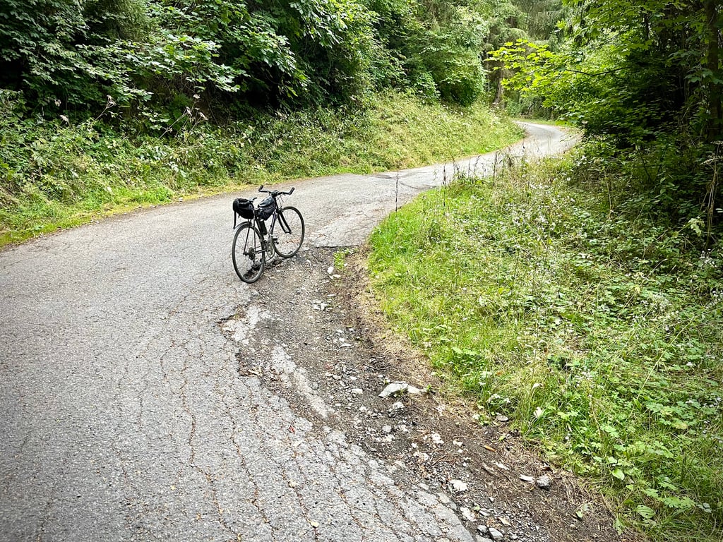
| Gravel |
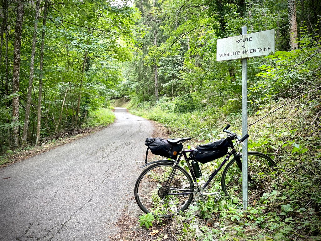
| Bad road |
| #27 toughest climb of La Maurienne |
| #33 most elevation gain of La Maurienne |
| #42 longest climb of La Maurienne |
| #74 average steepest climb of Savoie |
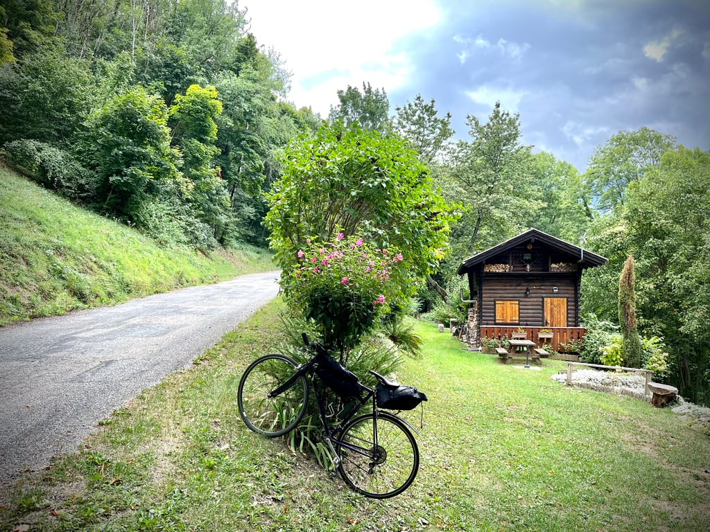
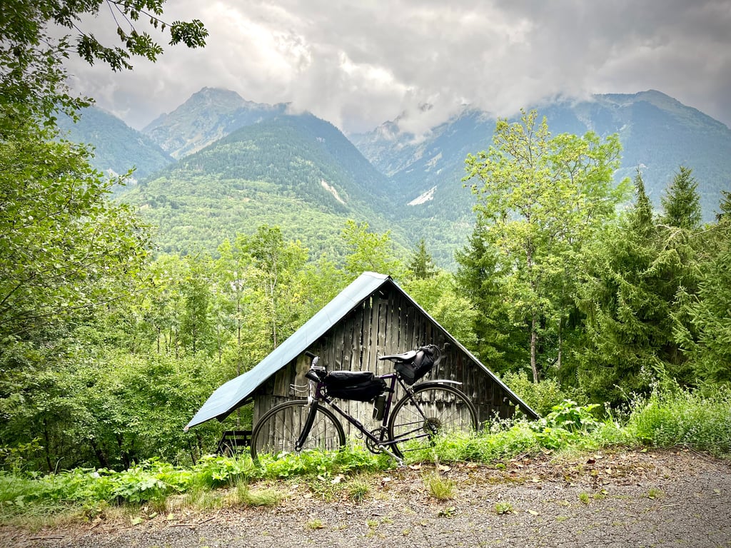
Teppes Rouges from Sainte-Marie-de-Cuines is a climb in the region La Maurienne. It is 6.4 mi long and bridges 2822 ft of vertical ascent with an average gradient of 8.3%, resulting in a difficulty score of 763. The top of the ascent is located at 4337 ft above sea level. Climbfinder users shared 2 reviews of this climb and uploaded 10 photos.
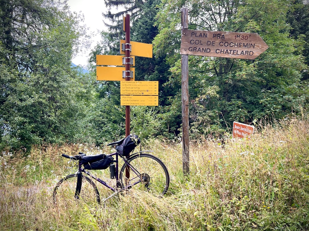
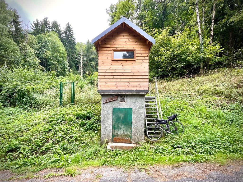
Road name: Route du Mont
3.0 by CromagnonThis is an automatic translation, the original language is: French.Admittedly, this tiny road isn't exactly a bowling alley, but it's absolutely and resolutely rideable, and that's with a road bike and 23mm tyres. OK, the descent requires attention, but personally, I found it fun to ride. The curves are beautiful. The forest is wild. The gradients are quite serious and irregular. This climb is well worth its 723 points. It's worth doing if you like peace and quiet and undergrowth climbs. There's not much at the top. There are two ... read more

Welcome! Please activate your account if you would like to share something. Look for the verification email in your inbox.
If you want to upload your photos, you need to create an account. It only takes 1 minute and it's completely free.
Admittedly, this tiny road isn't exactly a bowling alley, but it's absolutely and resolutely rideable, and that's with a road bike and 23mm tyres.
OK, the descent requires attention, but personally, I found it fun to ride.
The curves are beautiful. The forest is wild.
The gradients are quite serious and irregular.
This climb is well worth its 723 points.
It's worth doing if you like peace and quiet and undergrowth climbs.
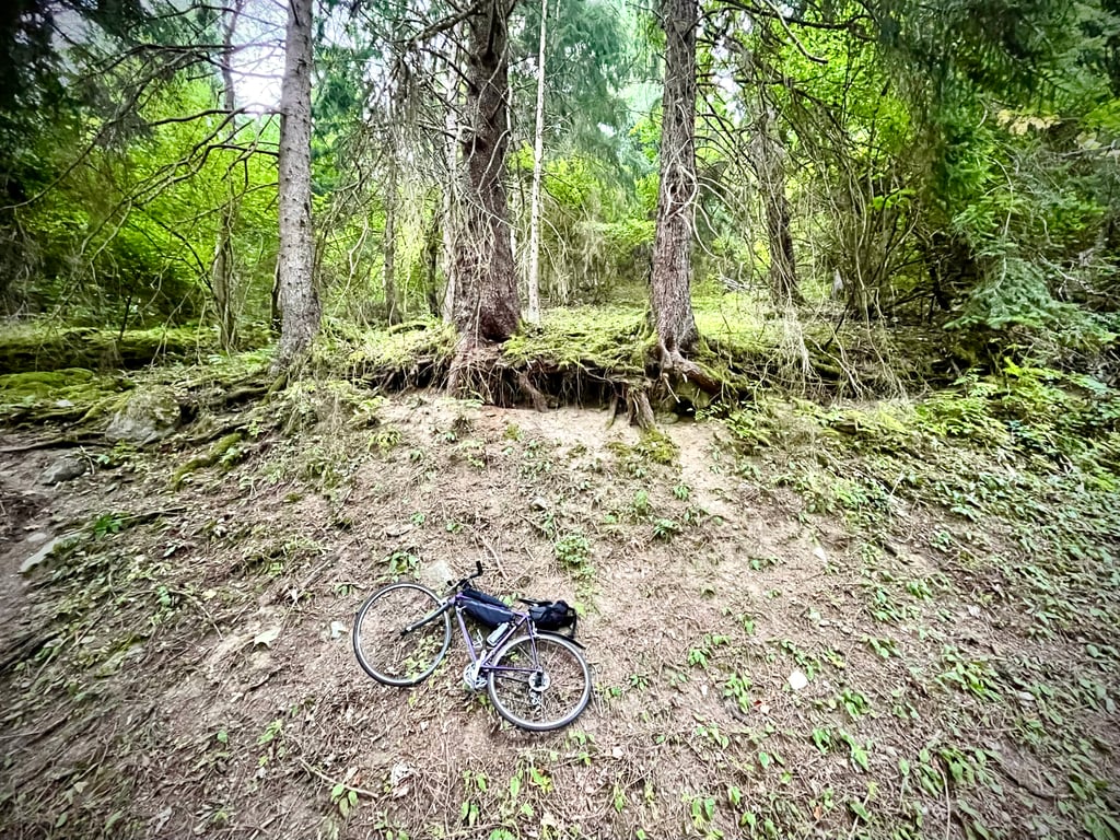
There's not much at the top. There are two forest tracks that climb higher, and this time mountain biking is more suitable.
There are fountains all along the route. The water at the last two is not controlled, but it can be useful.
Alors, certes, cette minuscule route n’est pas exactement une piste de bowling, mais, elle est absolument et résolument praticable et ce, avec un vélo de route et des pneus de 23.
OK, la descente demande de l’attention, mais, personnellement, je l’ai trouvée sympa à faire.
Les courbes sont belles. La forêt est sauvage.
Les pourcentages sont assez sérieux et irréguliers.
Cette montée mérite bien ses 723 points.
A faire si vous aimez le calme et les ascensions en sous-bois.
En haut, pas grand chose. Deux chemins forestiers qui grimpent plus haut et là, cette fois, le VTT sera effectivement plus indiqué.
A noter : des fontaines un peu partout sur le parcours. L’eau des deux dernières n’est pas contrôlée, mais, ça peut rendre service.
Interesting climb for a workout, after that it's 95% forest so nothing to see apart from one spot where you have a nice clear view.
The road is really bad, the descent is just horrible, I did it because I live next door to see what it was like but I certainly won't do it again.
Montée intéressante pour un entraînement, après c’est 95% de forêt donc rien à voir à part un endroit ou on a un belle vue dégagée.
La route est vraiment mauvaise, la descente est juste horrible, je l’ai fait car j’habite à coté pour voir ce que ça donnait mais je ne la referai sûrement pas.
| 5 mph | 01:17:43 |
| 7 mph | 00:55:01 |
| 9 mph | 00:42:52 |
| 12 mph | 00:32:12 |
This page is better in the app