Tips nearby


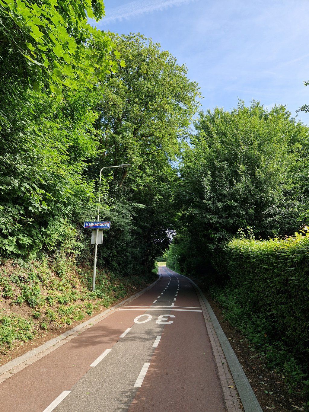
Stoepert is a climb in the region South Limburg. It is 1.6 mi long and bridges 200 ft of vertical ascent with an average gradient of 2.4%, resulting in a difficulty score of 19. The top of the ascent is located at 443 ft above sea level. Climbfinder users shared 7 reviews of this climb and uploaded 9 photos.
Road names: Nieuweweg, Kloosterweg, Stoepertweg & Kampstraat
4.0 by JarinThis is an automatic translation, the original language is: Dutch.Beautiful traffic-free hidden climb to Arensgenhout, which is a perfect alternative to the much busier and less beautiful Emmaberg climb that runs more or less parallel to it. Highly recommended!!! .... read more

Welcome! Please activate your account if you would like to share something. Look for the verification email in your inbox.
If you want to upload your photos, you need to create an account. It only takes 1 minute and it's completely free.
Beautiful traffic-free hidden climb to Arensgenhout, which is a perfect alternative to the much busier and less beautiful Emmaberg climb that runs more or less parallel to it. Highly recommended!!! .
Prachtige verkeersluwe verborgen klim naar Arensgenhout, die een perfect alternatief is voor de veel drukkere en minder mooie Emmaberg klim die min of meer parallel aan deze klim loopt. Aanrader!! .
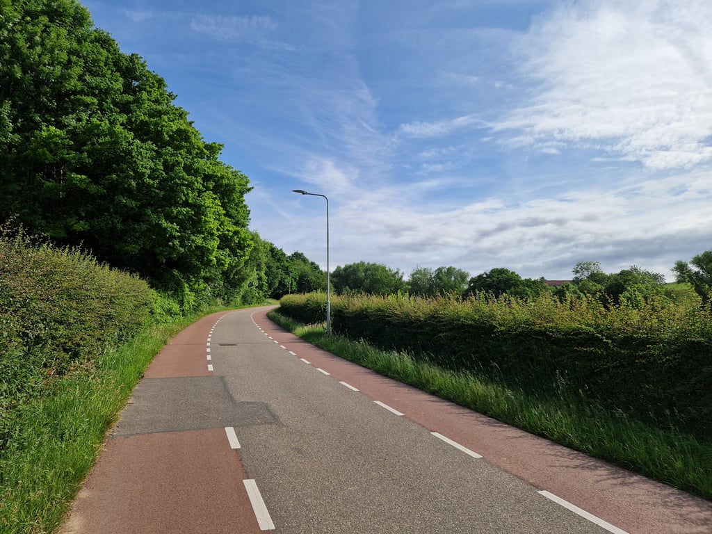
Not too difficult climb from the centre of Valkenburg to Arensgenhout. The climb starts right as you enter Nieuweweg. After the level crossing, take care to turn left onto Parallelweg. Then take the first right onto Kloosterweg/Stoepertweg. After the small tunnel under the A-79 motorway, continue straight on. It is a fine running false flat climb that you can ride up on the big slab.
Niet te moeilijke klim vanuit het centrum van Valkenburg naar Arensgenhout. De klim begint gelijk als je de Nieuweweg opgaat. Na de spoorwegovergang even opletten om linksaf de Parallelweg op te gaan. Hierna de eerste weg rechtsaf Kloosterweg/Stoepertweg. Na het tunneltje onder de A-79 rij je rechtdoor. Het is een prima lopende vals plat klim die je op de grote plaat omhoog kan rijden.
Lovely climb where most of it is and nice runner over a nice winding road with beautiful asphalt. The first part is equal to the Emmaberg and is not nice cycling because of the traffic and the narrow lane. After the railroad you have to turn left but you have to make a very strange turn (behind the median) to get to the side street. Anyway, it is often very busy there (especially when the barriers have been closed) so pay attention. Then a short descent and up along the monastery after which the road changes into a sort of "bicycle street" (but not an official one). Great cycling until under the highway. There the asphalt is slightly less (but still OK) and you ride along a hollow road to the end. Definitely recommended above the Emmaberg.
Heerlijke klim waar het het grootste deel een lekkere loper is over een mooi slingerende weg met prachtig asfalt. Het eerste stukje is gelijk aan de Emmaberg en is niet fijn fietsen vanwege het verkeer en de krappe rijstrook. Na het spoor moet je linksaf maar je moet een erg vreemde bocht maken (achter de middenberm om) om in de zijstraat te komen. Sowieso is het vaak erg druk daar (helemaal als de spoorbomen dicht zijn geweest) dus goed opletten. Daarna een stukje dalen en langs het klooster weer omhoog waarna de weg verandert in een soort "fietsstraat" (maar dan geen officiële). Heerlijk fietsen tot onder de snelweg door. Daar wordt het asfalt iets minder (maar nog steeds OK) en rijd je via een holle weg naar het eindpunt. Zeker aan te raden boven de Emmaberg.
Great climb. Runs like a train on that smooth asphalt road. Much better than the "tiled path" of the Emmaberg. Be careful in the descent when you pass the sign "Valkenburg" before the house with number 2. There is sometimes traffic from the right of the Casimir Ubaghslaan. The situation there is somewhat unclear. With a bit of bad luck a car suddenly appears in front of you.
Heerlijke klim. Loopt als een trein over die strakke asfaltweg. Vele malen beter dan het "tegelpad" van de Emmaberg. Pas in de afdaling wel op als je voor de woning met nummer 2 het bord "Valkenburg" passeert. Er komt nog weleens verkeer van rechts van de Casimir Ubaghslaan. Situatie is daar enigszins onoverzichtelijk. Met een beetje pech doemt er ineens een auto voor je op.
Nice climb with wonderful and newly renewed asphalt. This climb is not steep and goes up gradually. In the descent you don't have to watch out for side roads, so you can go full throttle into Valkenburg.
Fijne klim met heerlijk en pas vernieuwd asfalt. Deze klim is ook niet steil en loopt geleidelijk omhoog. In de afdaling hoef je ook niet op te letten op zijstraten, dus je kunt volle gas Valkenburg binnen denderen.
nice alternative to the emma mountain.
mooi alternatief voor de emmaberg.
Beautiful climb! Best way to go from cycling heart of Valkenburg to the north through the countryside. Asphalt has been completely renewed only in July 2019, so both uphill and downhill goes like sunshine.
Prachtige beklimming! Beste manier om van wielerhart Valkenburg naar het noorden te gaan middendoor de natuur. Asfalt is pas in juli 2019 geheel vernieuwd, dus zowel bergop als bergaf gaat als een zonnetje.
| 5 mph | 00:19:00 |
| 7 mph | 00:13:27 |
| 9 mph | 00:10:29 |
| 12 mph | 00:07:52 |
This page is better in the app