View on map
© MapLibre | OpenStreetMap contributors
1%
2%
4%
6%
8%
10%
12%
15%
20%

Sousberg from Schin op Geul

1.0
2 reviews | Elevation profile | 9 photos
Tips nearby
Sousberg from Schin op Geul
Your achievable time
Calculating based on your best performances...
Relaxed
Maximum
W/kg
W/kg
W/kg
Analyze your climbing performance
Detailed insight into your climbing performance & automatically check off climbs
Based on your best performances.
Your best attempt:
Number of attempts:
Elevation profile Sousberg from Schin op Geul

Statistics

Difficulty points 9
Length 0.3 mi
Average gradient 4.3%
Steepest segment 6.6%
Total ascent 59 ft

Short recap

Hidden gem
Feedback about this climb?
Show climbs nearby Export to GPS device

Sousberg from Schin op Geul is a climb in the region South Limburg. It is 0.3 mi long and bridges 59 ft of vertical ascent with an average gradient of 4.3%, resulting in a difficulty score of 9. The top of the ascent is located at 341 ft above sea level. Climbfinder users shared 2 reviews of this climb and uploaded 9 photos.

Road names: Grachtstraat & Sousberg
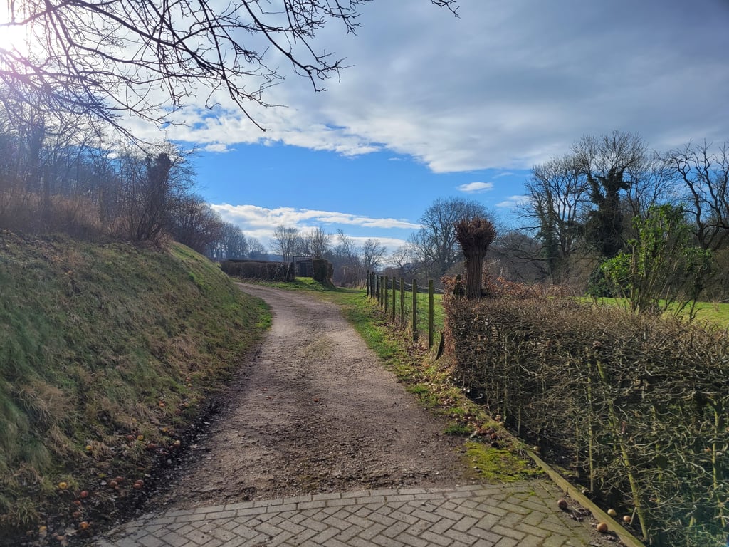
1.0 by Jarin
This is an automatic translation, the original language is: Dutch.
Indeed not recommended. Before you have even rounded the bend you are faced with a dirt road. You can continue left to a car park but after 30 metres the fun is also over. For nice uutIcht you will really have to take the footpath after that. Not worth a diversion.... read more

Photos (9)

Sousberg from Schin op Geul
transparant thumb
transparant thumb
transparant thumb

Your uploads (max 4)

Welcome! Please activate your account if you would like to share something. Look for the verification email in your inbox.

If you want to upload your photos, you need to create an account. It only takes 1 minute and it's completely free.

  • Receive free climbfinder goodies for your reviews & photos.
  • Create a bucket list and check off conquered climbs.
  • Add missing climbs.
Continue with GoogleContinue with Google Continue with FacebookContinue with Facebook Continue with AppleContinue with Apple Sign up with email
By signing up you agree to our terms of service and confirm that you have read our privacy & content policy.

Reviews (2)

5.0
4.0
3.0
2.0
1.0
Jarin
1 y 1.0
This is an automatic translation, the original language is: Dutch. Show original

Indeed not recommended. Before you have even rounded the bend you are faced with a dirt road. You can continue left to a car park but after 30 metres the fun is also over. For nice uutIcht you will really have to take the footpath after that. Not worth a diversion.

Inderdaad geen aanrader. Voordat je goed en wel de bocht om bent sta je al voor een onverharde weg. Je kunt links nog even door tot een parkeerplaats maar na 30 meter is de pret ook uit. Voor mooi uutIcht zul je daarna toch echt nog even de benenwagen moeten nemen. Geen omweg waard.

Dashboard
Fedor
4 y 1.0
This is an automatic translation, the original language is: Dutch. Show original

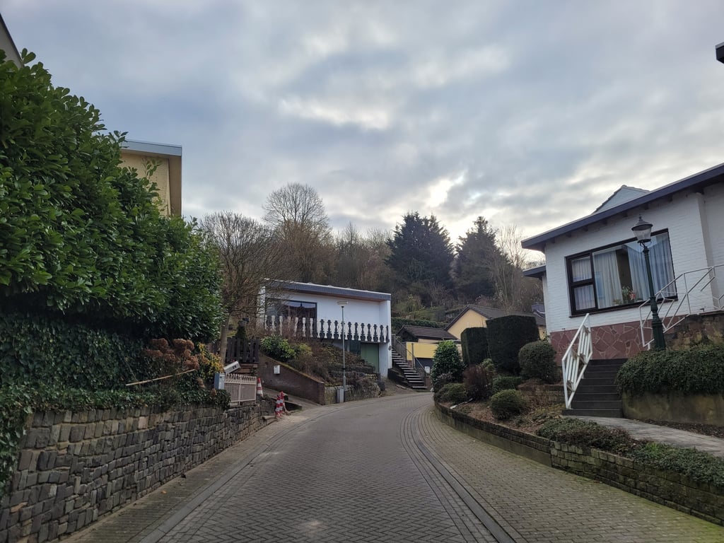
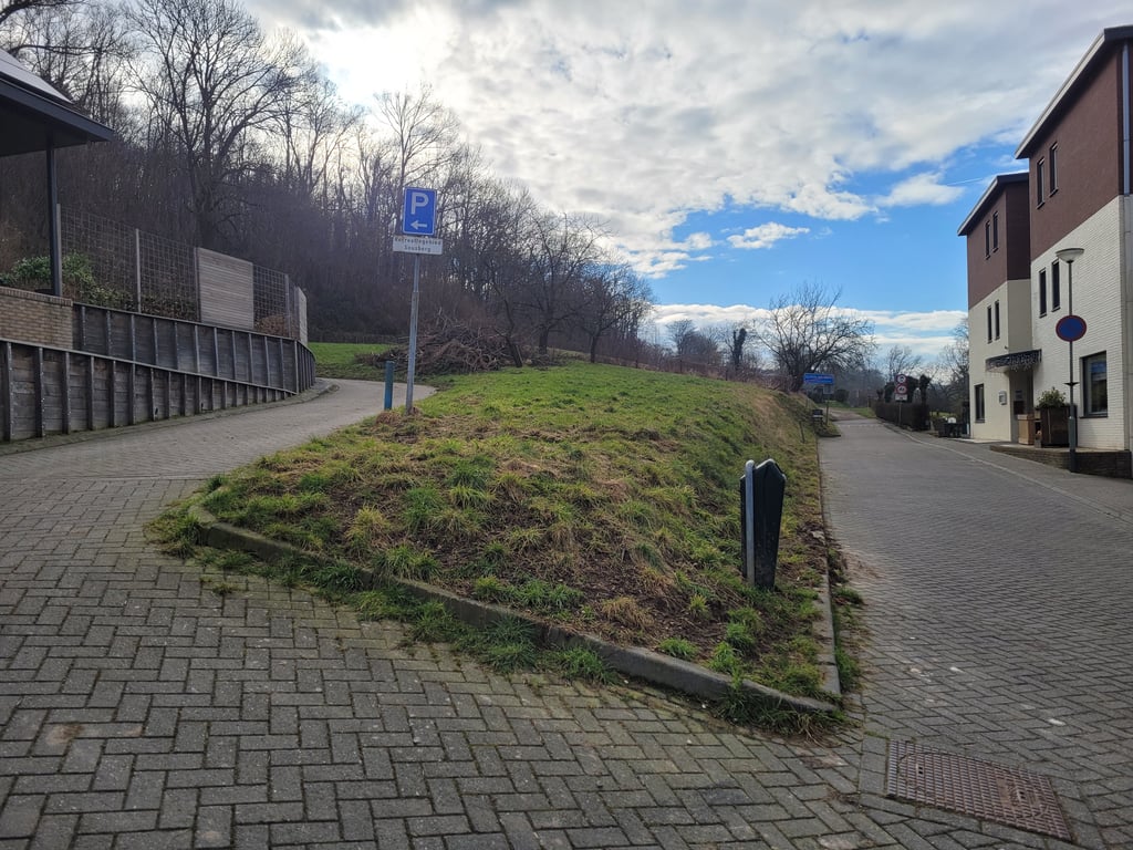
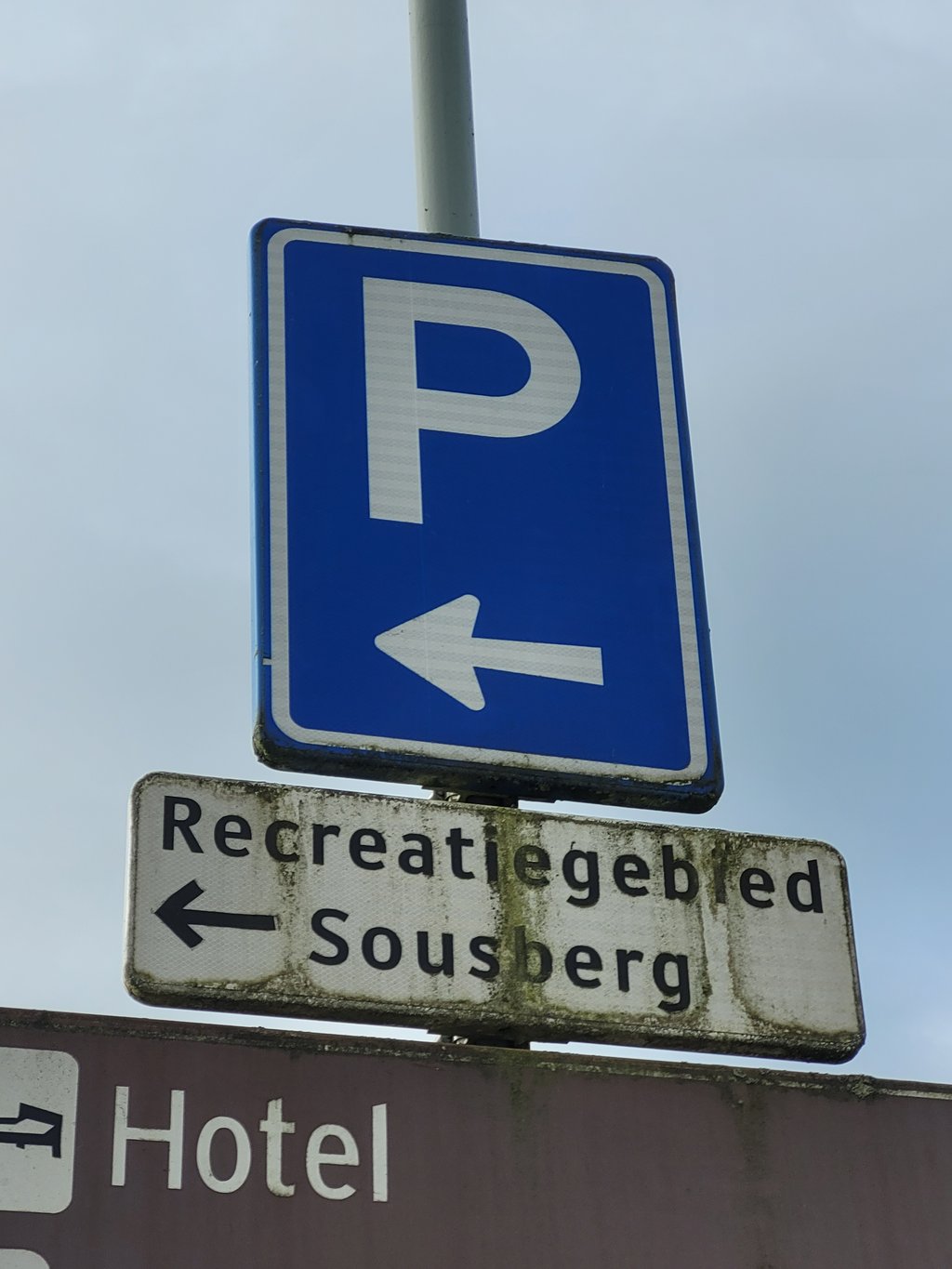
A disappointment. I had hoped for a nice view from the end point (dead end at the parking lot) but for that you have to enter a cart track from the parking lot (on the other side than from where you enter the parking lot). The parking lot has a high hedge so you don't see much from there. The road has a few steeper parts (the profile is right) and runs between the houses. Not much to see either.

Elsewhere this would be a nice climb, but not between the beautiful climbing violence in the immediate vicinity.

Een tegenvallertje. Ik had gehoopt op mooi uitzicht vanaf het eindpunt (doodlopend op parkeerplaats) maar daarvoor moet je vanaf de parkeerplaats even een karrespoor in (aan de andere kant dan vanwaar je de parkeerplaats op rijdt). De parkeerplaats heeft een hoge heg dus daarvandaan zie je niet veel. De weg ter naar toe heeft een paar steilere stukjes (het profiel klopt) en loopt verder tussen de huizen door. Onderweg ook niet veel te zien dus.

Elders zou dit best een aardige klim zijn, maar niet tussen het fraaie klimgeweld in de directe omgeving.

Sousberg from Schin op Geul
Dashboard

Climbing times

5 mph 00:03:08
7 mph 00:02:13
9 mph 00:01:44
12 mph 00:01:18

Road surface condition

0% 0% 0%
Based on 0 votes
Share your knowledge. What was the road condition during your ascent?

Traffic

0% 0% 0%
Based on 0 votes
Your experience counts. How much traffic did you encounter during the climb?

Frequently Asked Questions

You don't need special gearing for Sousberg from Schin op Geul. The slope isn't long or steep enough to require much shifting down. You can conquer this climb on power alone. However, a compact gearing system with a smallest front chainring of 34 and largest rear sprocket of 28 or 30 is always nice if you enjoy cycling uphill. This helps maintain a smooth cadence.

Sousberg from Schin op Geul is not tough enough to be assigned a mountain category. This means that even untrained cyclists can reach the top without any problems on this climb.

Sousberg from Schin op Geul is 0.3 mi long.

The average gradient of Sousberg from Schin op Geul is 4.3%.

Sousberg from Schin op Geul has a steepest segment with an average gradient of 6.6%.

The summit of Sousberg from Schin op Geul is at 341 ft.

At a slow pace of 5 mph, it takes about 00:03:08 to climb Sousberg from Schin op Geul. At 7 mph the time is 00:02:13, and at 9 mph 00:01:44. For the fastest cyclists, 00:01:18 is an achievable time.

Sousberg from Schin op Geul is located in the region Limburg in Netherlands.

This page is better in the app

Climbfinder app
Climbfinder
(Free)
Open