| Gravel |
| #50 toughest climb of Flanders |
| #63 most elevation gain of Flanders |
| #64 longest climb of Belgium Limburg |
| #26 average steepest climb of Voer-Region |
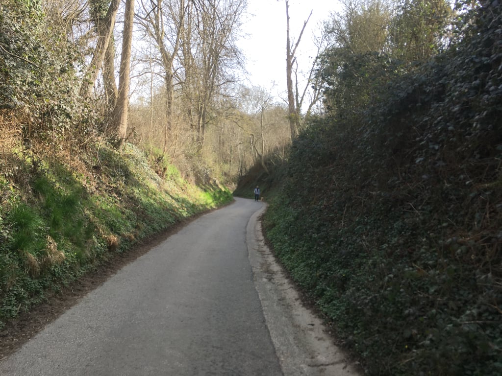
Snauwenberg from ’s-Gravenvoeren is a climb in the region Voer-Region. It is 1.2 mi long and bridges 266 ft of vertical ascent with an average gradient of 4.3%, resulting in a difficulty score of 66. The top of the ascent is located at 551 ft above sea level. Climbfinder users shared 3 reviews of this climb and uploaded 14 photos.
Road names: Kinkenberg, Koetsweg & Snauwenberg
1.0 by JarinThis is an automatic translation, the original language is: Dutch.I agree with my fellow reviewer that this climb does not belong on Climbfinder, at least not as a climb for a road bike. I've climbed it several times on MTB rides and I've also climbed it on an MTB, but this is no place for a cyclist! Beautiful views indeed, but you have to bring or rent a gravel bike or MTB!... read more

Welcome! Please activate your account if you would like to share something. Look for the verification email in your inbox.
If you want to upload your photos, you need to create an account. It only takes 1 minute and it's completely free.
I agree with my fellow reviewer that this climb does not belong on Climbfinder, at least not as a climb for a road bike. I've climbed it several times on MTB rides and I've also climbed it on an MTB, but this is no place for a cyclist! Beautiful views indeed, but you have to bring or rent a gravel bike or MTB!
Ik ben het met mij collega-recensent eens dst deze klim niet op Climbfinder thuishoort, althans niet als beklimming voor een racefiets. Ik had 'm al meermaals afgedaald tijdens een MTB-rit en heb 'm ook met een MTB opgefietst, maar een wielrenner heeft hier niks te zoeken! Inderdaad prachtige uitzichten, maar dan moet je dus wel een gravelbike of MTB meebrengen of huren!
In my opinion, this does not belong on climbfinder. This is a pure gravel climb. And call me a purist, but for gravel climbs you should be elsewhere. You can't do this on a road bike and so it's not a climb.
In my personal opinion, delete climbfinder. I have seen people hiking with a tow bike.
Tip: Ride around it. Don't tick these off! And anyone suggesting these climbs. Not good at it as we say in Antwerp ;-)
Volgens mij hoort dit niet thuis op climbfinder. Dit is een zuivere gravelklim. En noem me een purist, maar voor gravelklimmetjes moet je elders zijn. Dit kan je niet doen met een racebike en is dus geen klim.
In mijn persoonlijke mening, deleten van climbfinder. Ik heb mensen met een trekfiets zien wandelen.
Tip: RIJ ER ROND. Deze moet je niet afvinken! En wie deze klims suggereert. Niet goed bezig zoals we in Antwerpen zeggen ;-)
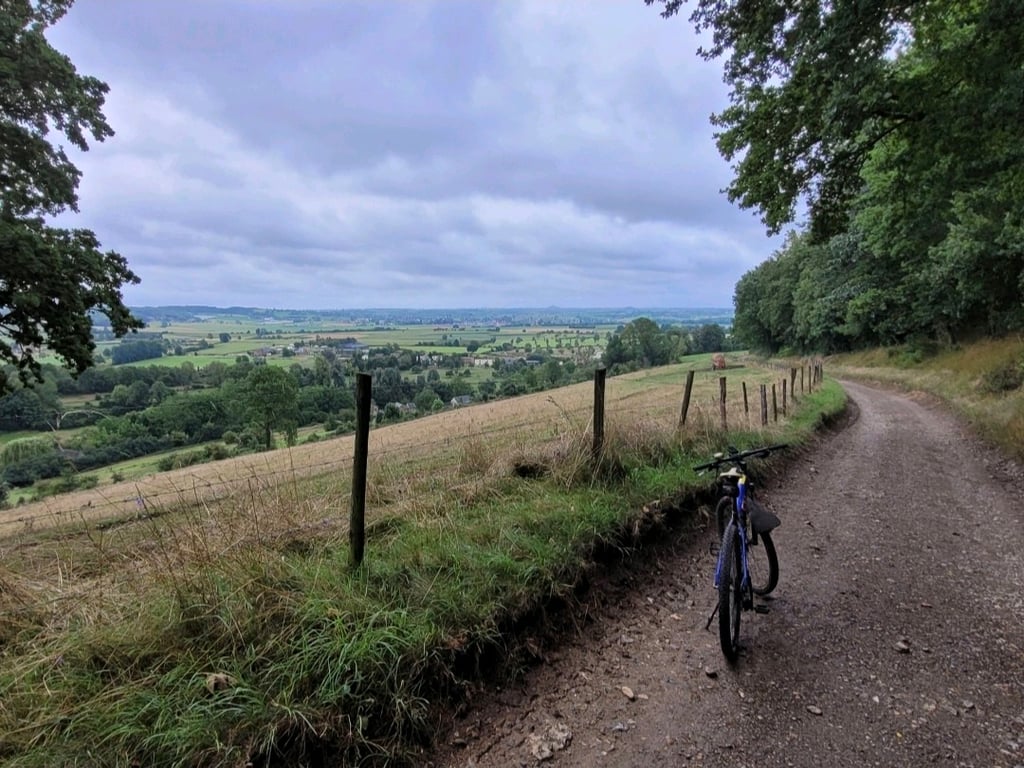
The first part is a nice winding and hollow road leading from the village into the green with a nice percentage. When the road surface changes to gravel the road becomes a bit less steep but it doesn't get any easier. There's gravel and gravel and the gravel here consists mainly of round gravel which makes pedalling pretty tough. Fortunately, the scenery is inspiring because once you leave the forest, this is perhaps the most beautiful road in the Voerstreek. Then I gladly take the heavy gravel for granted. Anyway, everyone's choices.
Het eerste deel is een mooi slingerend en hol weggetje wat vanuit het dorp het groen in loopt met een lekker percentage. Als het wegdek overgaat in gravel wordt de weg wat minder steil... maar makkelijker wordt het niet. Je hebt gravel en gravel en de gravel hier bestaat vooral uit rond grind wat het trappen behoorlijk zwaar maakt. Gelukkig is de omgeving (en het prachtige uitzicht) wel inspirerend want zodra je het bos uit komt is dit misschien wel het mooiste weggetje in de Voerstreek. Dan neem ik de zware gravel graag voor lief. Maar goed, ieder zijn/haar keuzes.
| 5 mph | 00:14:12 |
| 7 mph | 00:10:03 |
| 9 mph | 00:07:50 |
| 12 mph | 00:05:53 |
This page is better in the app