Serra di Pigno is a climb in the region Corsica. It is 2.6 mi long and bridges 1306 ft of vertical ascent with an average gradient of 9.5%, resulting in a difficulty score of 393. The top of the ascent is located at 3100 ft above sea level. Climbfinder users shared 1 review/story of this climb and uploaded 4 photos.
This is an automatic translation, the original language is: Dutch.
This climb has everything that makes a climb great: good steepness, (virtually) no traffic, hairpin turns and beautiful views. Nice touch were the unflappable cows staring at me from the side of the road. The only serious drawback is the really bad road surface at the beginning and at the end. Still, no reason to ignore this climb. I combined it with the Col de Teghime from Bastia (you can also do it from Saint Florent). You then turn two second category climbs into a serious first category clim...read more
Photos (4)
Welcome! Please activate your account if you would like to share something. Look for the verification email in your inbox.
This is an automatic translation, the original language is: Dutch.
Show original
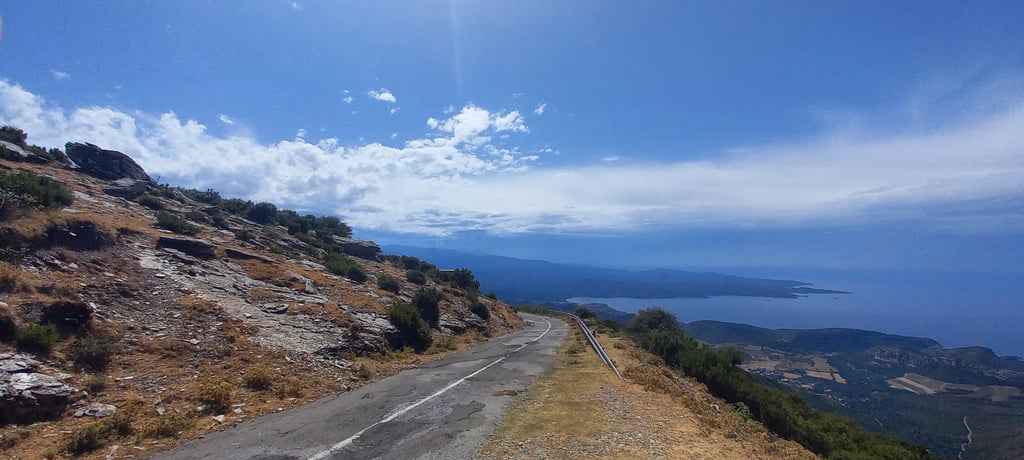
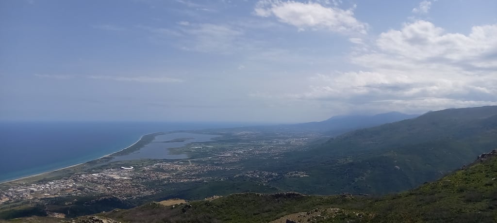
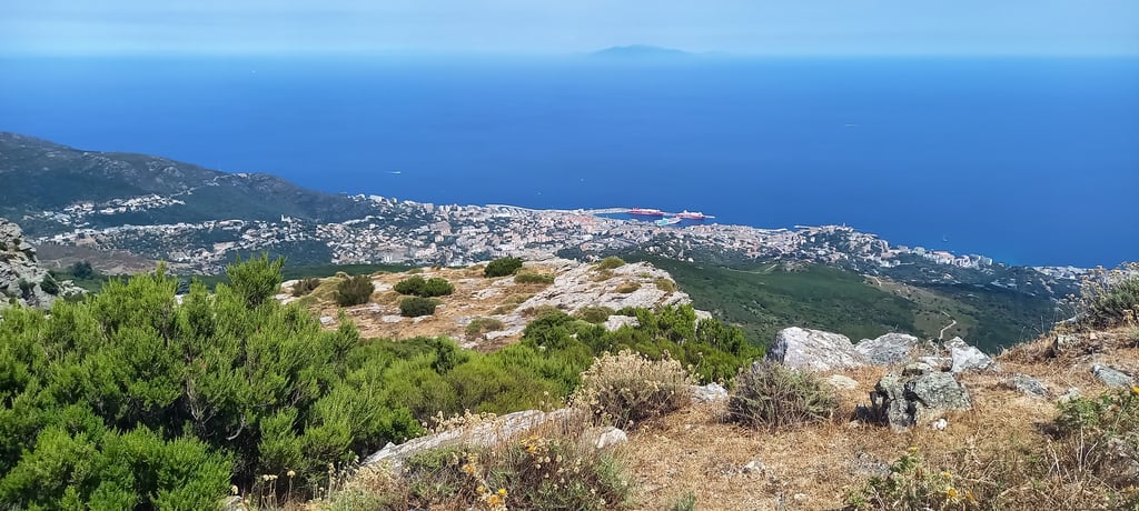
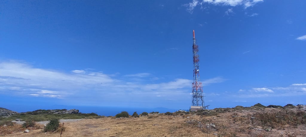
This climb has everything that makes a climb great: good steepness, (virtually) no traffic, hairpin turns and beautiful views. Nice touch were the unflappable cows staring at me from the side of the road. The only serious drawback is the really bad road surface at the beginning and at the end. Still, no reason to ignore this climb. I combined it with the Col de Teghime from Bastia (you can also do it from Saint Florent). You then turn two second category climbs into a serious first category climb of 14.2 km with an average percentage of 6.3 per cent of which the last 4 km average 9.5 per cent. Views at the summit are not pretty: you only see the radio towers. However, just below the summit it is stunning. You can see Bastia and Cap Corse.
Deze beklimming heeft alles wat een beklimming geweldig maakt: goed steil, (vrijwel) geen verkeer, haarspeldbochten en prachtige uitzichten. Leuk detail waren de onverstoorbare koeien die mij vanaf de zijkant van de weg aanstaarden. Enige serieuze nadeel is het werkelijk zeer slechte wegdek aan het begin en an het einde. Toch geen reden om deze klim links te laten liggen. Ik heb hem gecombineerd met de Col de Teghime vanuit Bastia (Kun je ook vanaf Saint Florent doen). Je maakt dan van twee tweede categorie klimmen een serieuze eerste categorieklim van 14.2 km met een gemiddeld percentage van 6.3 procent waarvan de laatste 4 km gemiddeld 9.5 procent. Uitzicht op de top is niet mooi: je ziet enkel de radiotorens. Maar vlak onder de top is het wel schitterend. Je ziet Bastia en Cap Corse.
Share your knowledge. What was the road condition during your ascent?
Traffic
75% 0% 25%
Based on 4 votes
Your experience counts. How much traffic did you encounter during the climb?
Frequently Asked Questions
Serra di Pigno is a challenging ascent. For this type of climbing, we recommend mountain gearing, specifically a compact system. This means a small front chainring of 34 teeth, combined with a rear cassette where, depending on your level, strength, and experience, you choose a sprocket with 30, 32, or even 34 teeth. Remember that a smooth cadence is always more efficient!
Serra di Pigno is a serious climb and falls into the 2nd category. With a good basic fitness level, even without much cycling experience, you can complete this climb just fine. However, a bike with climbing gears is a must. Without experience or training, it will be really tough – but that’s part of the challenge!
Serra di Pigno is 2.6 mi long.
The average gradient of Serra di Pigno is 9.5%.
Serra di Pigno has a steepest segment with an average gradient of 13.9%.
The summit of Serra di Pigno is at 3100 ft.
At a slow pace of 5 mph, it takes about 00:31:21 to climb Serra di Pigno. At 7 mph the time is 00:22:12, and at 9 mph 00:17:18. For the fastest cyclists, 00:12:59 is an achievable time.
Serra di Pigno is located in the region Corsica in France.