View on map
© MapLibre | OpenStreetMap contributors
1%
2%
4%
6%
8%
10%
12%
15%
20%

Schurzelter Strasse from Seffent

2.3
3 reviews | Elevation profile | 10 photos
Tips nearby
Schurzelter Strasse from Seffent
Your achievable time
Calculating based on your best performances...
Relaxed
Maximum
W/kg
W/kg
W/kg
Analyze your climbing performance
Detailed insight into your climbing performance & automatically check off climbs
Based on your best performances.
Your best attempt:
Number of attempts:
Elevation profile Schurzelter Strasse from Seffent

Statistics

Difficulty points 7
Length 0.5 mi
Average gradient 2.7%
Steepest segment 4.6%
Total ascent 75 ft
Feedback about this climb?
Show climbs nearby Export to GPS device

Schurzelter Strasse from Seffent is a climb in the region Cologne. It is 0.5 mi long and bridges 75 ft of vertical ascent with an average gradient of 2.7%, resulting in a difficulty score of 7. The top of the ascent is located at 689 ft above sea level. Climbfinder users shared 3 reviews of this climb and uploaded 10 photos.

Road name: Schurzelter Strasse
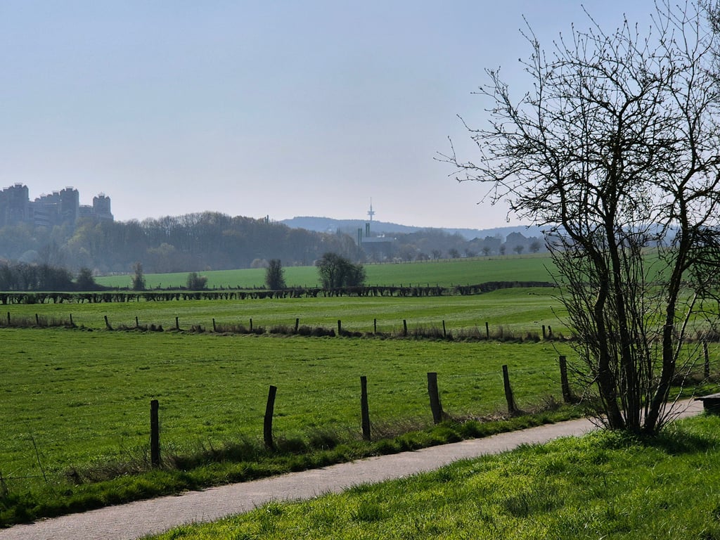
2.0 by BikerJohan
This is an automatic translation, the original language is: Dutch.
Some false flat with some bits where you have to push a bit more along the cycle path of the main road from Seffent to Vaalserquartier. Climb starts at Schlangenweg. View of the Klinikum Aachen on the left.... read more

Photos (10)

Schurzelter Strasse from Seffent
transparant thumb
transparant thumb

Your uploads (max 4)

Welcome! Please activate your account if you would like to share something. Look for the verification email in your inbox.

If you want to upload your photos, you need to create an account. It only takes 1 minute and it's completely free.

  • Receive free climbfinder goodies for your reviews & photos.
  • Create a bucket list and check off conquered climbs.
  • Add missing climbs.
Continue with GoogleContinue with Google Continue with FacebookContinue with Facebook Continue with AppleContinue with Apple Sign up with email
By signing up you agree to our terms of service and confirm that you have read our privacy & content policy.

Reviews (3)

5.0
4.0
3.0
2.0
1.0
BikerJohan
1 y 2.0
This is an automatic translation, the original language is: Dutch. Show original

Some false flat with some bits where you have to push a bit more along the cycle path of the main road from Seffent to Vaalserquartier. Climb starts at Schlangenweg. View of the Klinikum Aachen on the left.

Wat vals plat met enkele stukjes waar je even wat meer moet aanzetten over het fietspad van de doorgaande weg van Seffent naar Vaalserquartier. Klim begint t.h.v. de Schlangenweg. Links uitzicht op het Klinikum Aachen.

Dashboard
XaviElSchwalbo
2 y 2.0
This is an automatic translation, the original language is: German. Show original

A mixture of a false flat and a slight climb that is quite long. If the wind is blowing from the SW, you should only take this route in a northerly direction as it is quite susceptible to wind.

Eine Mischung aus falscher Ebene und leichtem Anstieg der sich ziemlich zieht. Falls es Wind aus SW gibt, sollte man diese Strecke nur in Richtung Norden befahren, da die Strecke ziemlich windanfällig ist.
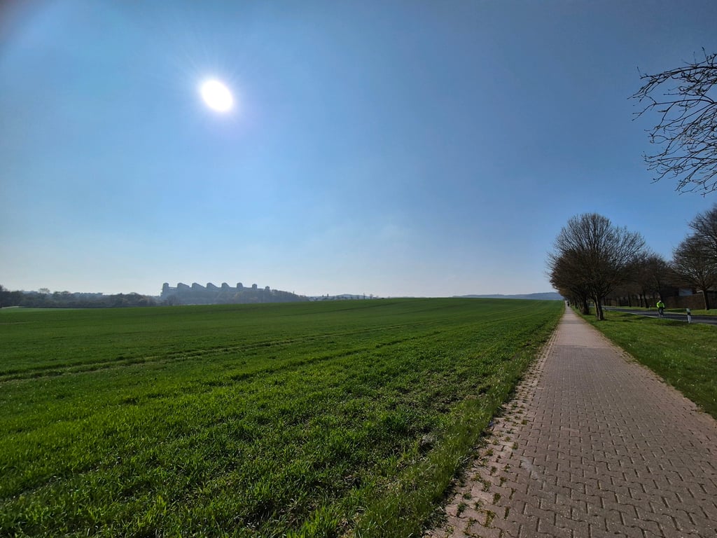
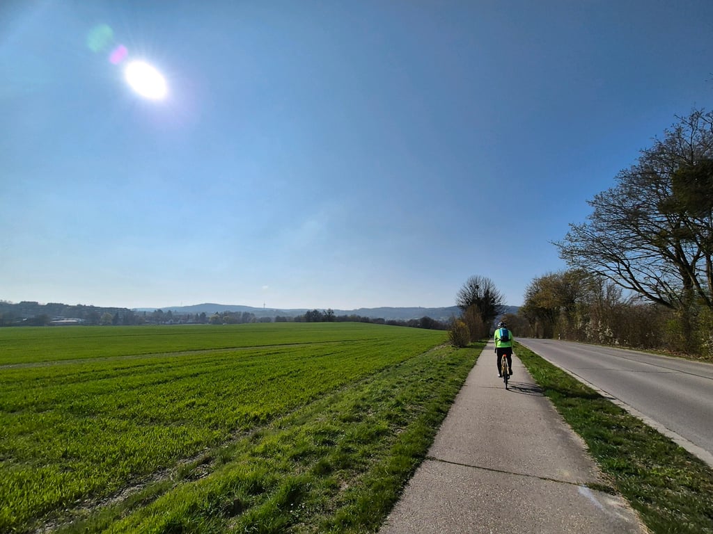
Dashboard
Fedor
4 y 3.0
This is an automatic translation, the original language is: Dutch. Show original

Relaxed climb with one slightly steeper section (reasonable in the beginning). From the nice village of Seffent you slowly ascend between the golf course and agricultural area. On the left hand side you have a view on the Klinikum. After the top beautiful view over Vaals and the Vaalserberg.
The bike path is good to ride but not super comfortable. Riding on the road, however, can have the effect that some motorists clearly show that you do not belong there.

Relaxed klimmetje met één iets steiler gedeelte (redelijk in het begin). Vanuit het leuke dorpje Seffent stijg je langzaam tussen de golfbaan en landbouwgebied omhoog. Links uitzicht op o.a. het Klinikum. Na de top mooi uitzicht over Vaals en de Vaalserberg.
het fietspad is goed te rijden maar niet super comfortabel. Rijden op de weg kan echter als gevolg hebben dat sommige automobilisten duidelijk laten merken dat je daar niet hoort.

Schurzelter Strasse from Seffent
Dashboard

Climbing times

5 mph 00:06:20
7 mph 00:04:29
9 mph 00:03:30
12 mph 00:02:37

Road surface condition

0% 0% 0%
Based on 0 votes
Share your knowledge. What was the road condition during your ascent?

Traffic

0% 0% 0%
Based on 0 votes
Your experience counts. How much traffic did you encounter during the climb?

Frequently Asked Questions

Schurzelter Strasse can be cycled from 5 sides. Schneeberg from Lemiers is the most popular side, but the summit can also be reached via Senserbachweg from Lemiers, Schneeberg from Aachen, Schurzelter Strasse from Seffent & Seffenterstraat via Sneeuwberglaan.

You don't need special gearing for Schurzelter Strasse from Seffent. The slope isn't long or steep enough to require much shifting down. You can conquer this climb on power alone. However, a compact gearing system with a smallest front chainring of 34 and largest rear sprocket of 28 or 30 is always nice if you enjoy cycling uphill. This helps maintain a smooth cadence.

Schurzelter Strasse from Seffent is not tough enough to be assigned a mountain category. This means that even untrained cyclists can reach the top without any problems on this climb.

Schurzelter Strasse from Seffent is 0.5 mi long.

The average gradient of Schurzelter Strasse from Seffent is 2.7%.

Schurzelter Strasse from Seffent has a steepest segment with an average gradient of 4.6%.

The summit of Schurzelter Strasse from Seffent is at 689 ft.

At a slow pace of 5 mph, it takes about 00:06:20 to climb Schurzelter Strasse from Seffent. At 7 mph the time is 00:04:29, and at 9 mph 00:03:30. For the fastest cyclists, 00:02:37 is an achievable time.

Schurzelter Strasse from Seffent is located in the region Cologne in Germany.

This page is better in the app

Climbfinder app
Climbfinder
(Free)
Open