Schurenbachhalde is a climb in the region Düsseldorf. It is 0.4 mi long and bridges 144 ft of vertical ascent with an average gradient of 6.6%, resulting in a difficulty score of 43. The top of the ascent is located at 262 ft above sea level. Climbfinder users shared 1 review/story of this climb and uploaded 2 photos.
This is an automatic translation, the original language is: German.
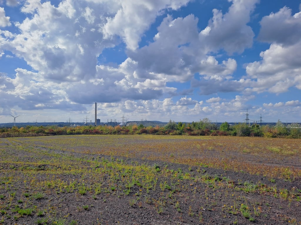
The Schurenbachhalde is not a classic climb in the sense of long serpentines or steep ramps, but it does have its charm - especially for those who want to combine urban scenery with sporting activity in the Ruhr region.
The ascent usually starts from the northern foot of the slag heap, either via the official main path or one of the smaller, unpaved alternative routes. There is no tarmac here, as the path is mostly gravelled or consists of packed earth. In dry conditions it can be ridden on w...read more
Photos (2)
Welcome! Please activate your account if you would like to share something. Look for the verification email in your inbox.
This is an automatic translation, the original language is: German.
Show original
The Schurenbachhalde is not a classic climb in the sense of long serpentines or steep ramps, but it does have its charm - especially for those who want to combine urban scenery with sporting activity in the Ruhr region.
The ascent usually starts from the northern foot of the slag heap, either via the official main path or one of the smaller, unpaved alternative routes. There is no tarmac here, as the path is mostly gravelled or consists of packed earth. In dry conditions it can be ridden on without any problems, but in wet conditions it quickly becomes slippery. A gravel bike or MTB is the better choice here.
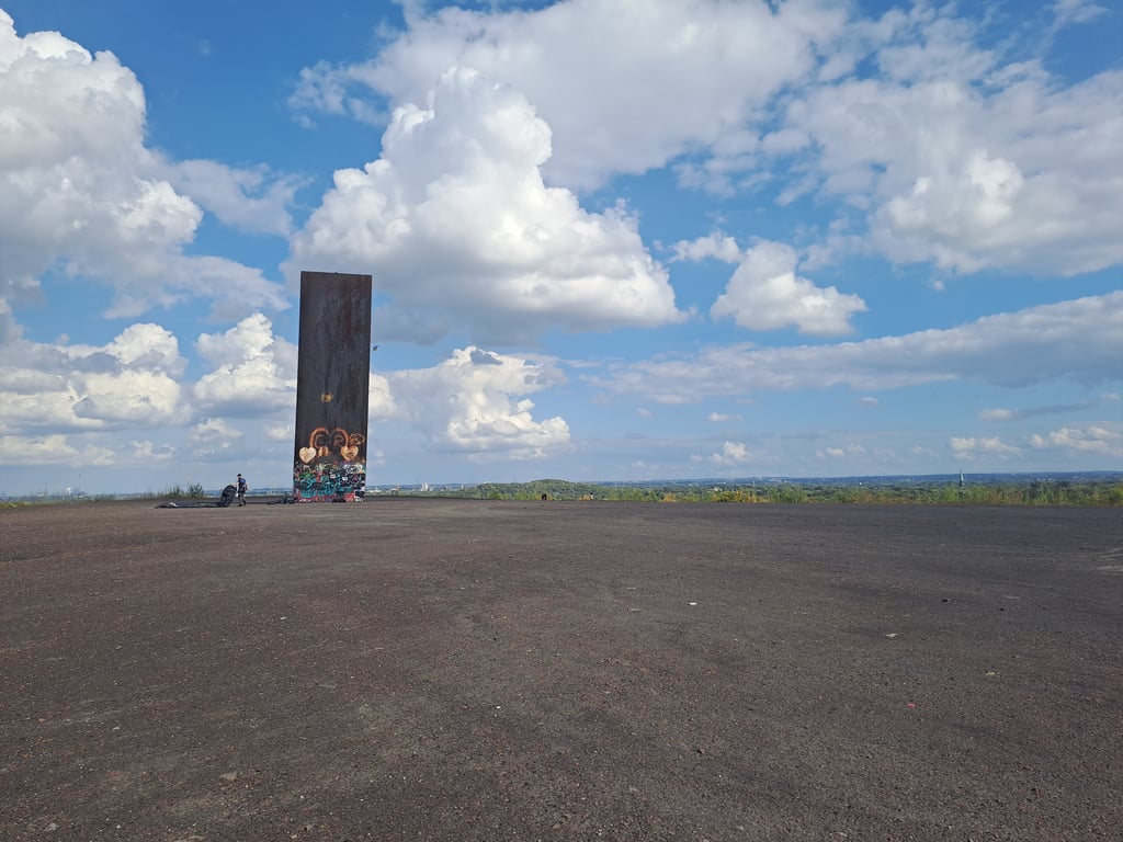
Once you reach the top, you are rewarded with an impressive view over the Ruhr region. The huge steel sculpture "Bramme für das Ruhrgebiet" marks the highest point and provides a magnificent panorama.
Die Schurenbachhalde ist kein klassischer Anstieg im Sinne langer Serpentinen oder steiler Rampen, aber sie hat ihren Reiz – besonders für alle, die im Ruhrgebiet urbane Landschaft mit sportlicher Aktivität verbinden wollen.
Der Aufstieg beginnt meist vom nördlichen Fuß der Halde, entweder über den offiziellen Hauptweg oder eine der kleineren, unbefestigten Alternativrouten. Asphalt findet man hier nicht, der Weg ist größtenteils geschottert oder besteht aus festgefahrenem Erdweg. Bei trockenen Bedingungen problemlos befahrbar, aber bei Nässe wird es schnell rutschig. Ein Gravel- oder MTB ist hier die bessere Wahl.
Oben angekommen wird man mit einem beeindruckenden Blick über das Ruhrgebiet belohnt. Die riesige Stahlskulptur "Bramme für das Ruhrgebiet" markiert den höchsten Punkt und sorgt für ein großartiges Panorama.
Share your knowledge. What was the road condition during your ascent?
Traffic
0% 0% 0%
Based on 0 votes
Your experience counts. How much traffic did you encounter during the climb?
Frequently Asked Questions
You don't need special gearing for Schurenbachhalde. The slope isn't long or steep enough to require much shifting down. You can conquer this climb on power alone. However, a compact gearing system with a smallest front chainring of 34 and largest rear sprocket of 28 or 30 is always nice if you enjoy cycling uphill. This helps maintain a smooth cadence.
Schurenbachhalde falls into the 5th category. With good fitness, you can ride it up with speed and power. If you have less training, shift down and climb smoothly.
Schurenbachhalde is 0.4 mi long.
The average gradient of Schurenbachhalde is 6.6%.
Schurenbachhalde has a steepest segment with an average gradient of 10.1%.
The summit of Schurenbachhalde is at 262 ft.
At a slow pace of 5 mph, it takes about 00:04:56 to climb Schurenbachhalde. At 7 mph the time is 00:03:29, and at 9 mph 00:02:43. For the fastest cyclists, 00:02:02 is an achievable time.